

Happy Monday, Central Coast!
As we dove into a new work week, skies were clear and temps were on the rise. Monday's high temperatures warmed a few degrees from the cooler weekend, but that is just the appetizer of a massive warm-up on the way across the region. Let's dive right in!
A massive ridge of high pressure is in place across the country. For the East Coast, it means that Hurricane Erin will stay offshore, for the south, it means hot and muggy air is in place, and for us... a heat wave and gusty winds.

The gusts are already in place. Here is the winds across the region at 5:30 p.m.

Overnight, those winds will focus in on the south coast, bringing gusts up to 45 mph. Because of that, there is a wind advisory in place for the south coast through Tuesday morning.

Into Tuesday temps will start to rise. This will start slow and mean that for Tuesday at least highs will be right around normal for this time of year.
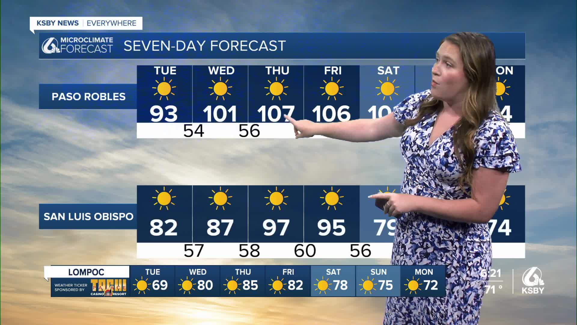
Into the middle of the week, the high pressure will strengthen and perpetuate the warming trend. The combination of limited marine influence, gusty offshore winds and uninterrupted sunshine will skyrocket the temps. The heat peaks Thursday and will take a few days to ramp down. Here is a look at the 7-day-forecast.
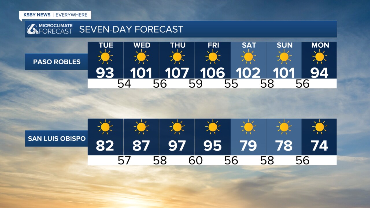

Those high temps have prompted an Extreme Heat Watch for the interiors of San Luis Obispo and Santa Barbara counties through Saturday evening. Be sure to stay hydrated, limit exposure to heat during the warmest hours, and check in on vulnerable people in our communities.

The heat will combine with low humidity and the aforementioned winds to increase fire weather concerns. There is a Fire Weather Watch in place for the interiors of Santa Barbara County and the southern interiors of San Luis Obispo County through Sunday night. This does include the Gifford Fire burn zone. I will keep a close eye on this concern.

Late next week, the temps will start to cool as the pattern is broken up. The good news is cooler temps, the bad news is thunderstorm chances bring risk of dry lightning to the region Friday through Sunday. This thunderstorm risk isn't close enough for much detail, but we will stay on the far NW side of the storms. I'll bring you updates as they become available.

Beyond the weekend, I am tracking a continued pattern of cooler and possibly more active weather. Here is a look at the 8-14 day outlooks from the Climate Prediction Center.


Have a wonderful week!
-Vivian
