

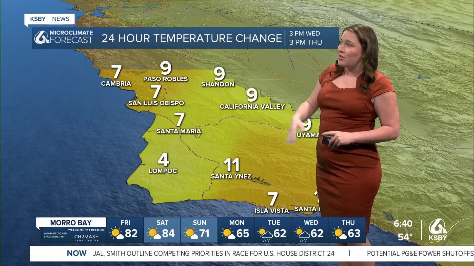


Good morning, Central Coast, and happy Friday!
Heat has been the story for the last few days as a combination of a high-pressure system to our north and a low-pressure system to our south fuels a strong offshore wind event.
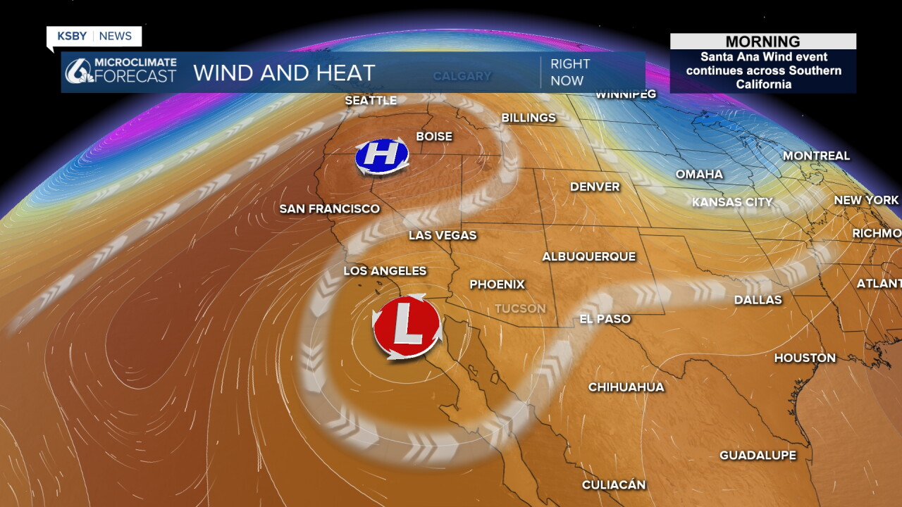
That will drive temperatures back into the 90s along with significant fire weather danger.
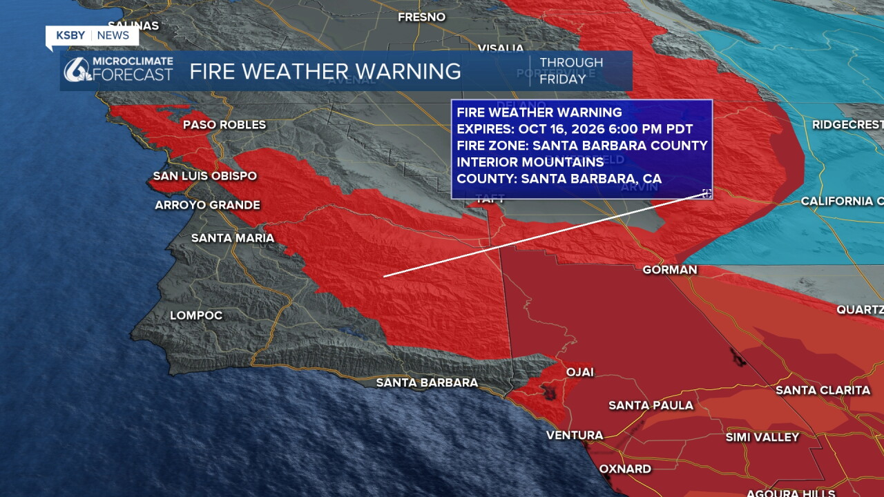
A Fire Weather Warning is co-located with a Red Flag Warning for our highest elevations across the Central Coast. This is in place through 6 p.m. Friday night.
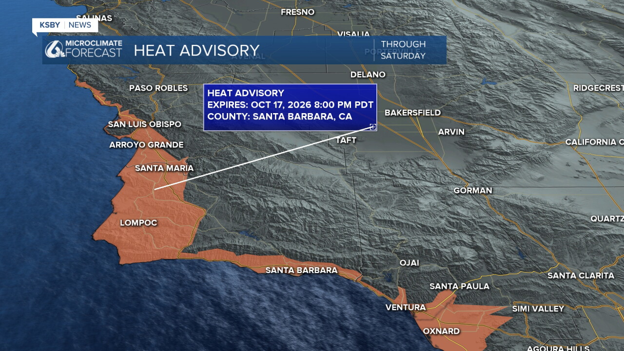
There is also a high heat advisory in place for the beaches and coastal valleys through 8 p.m. Saturday.
Here is a look at the temperatures we can expect this afternoon.
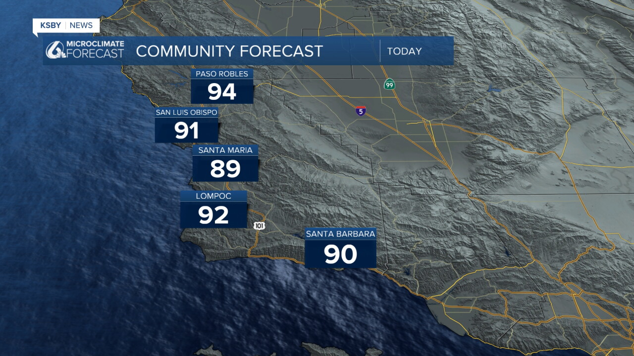
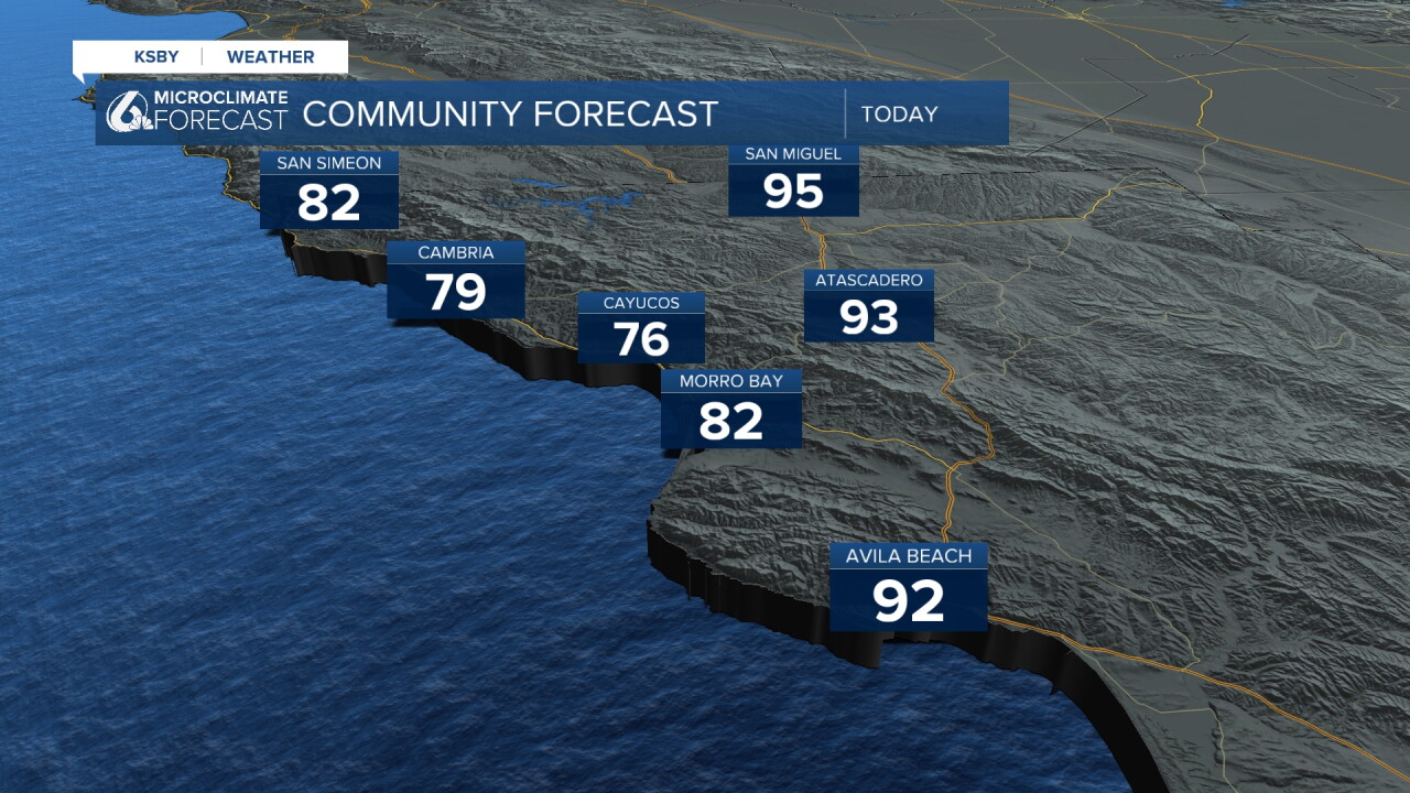
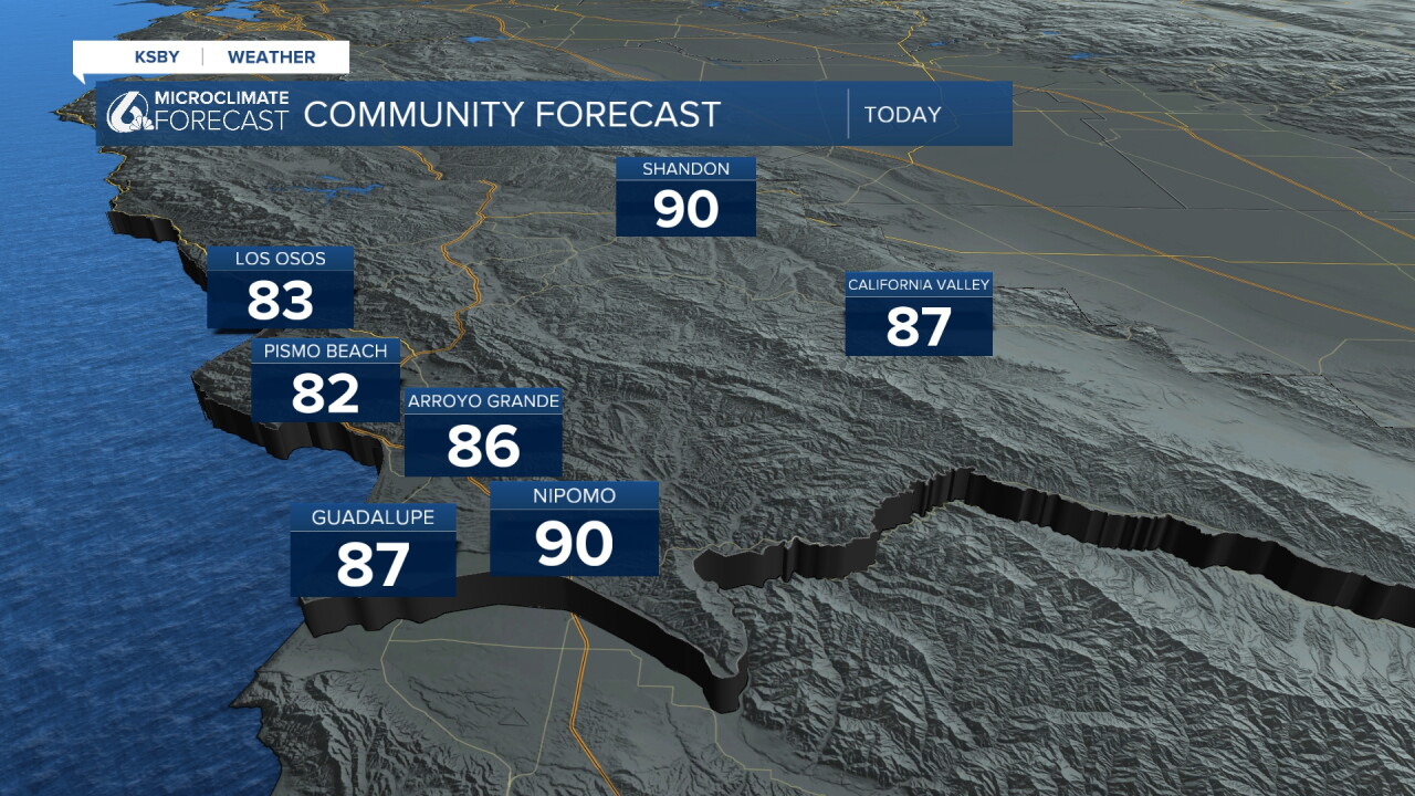
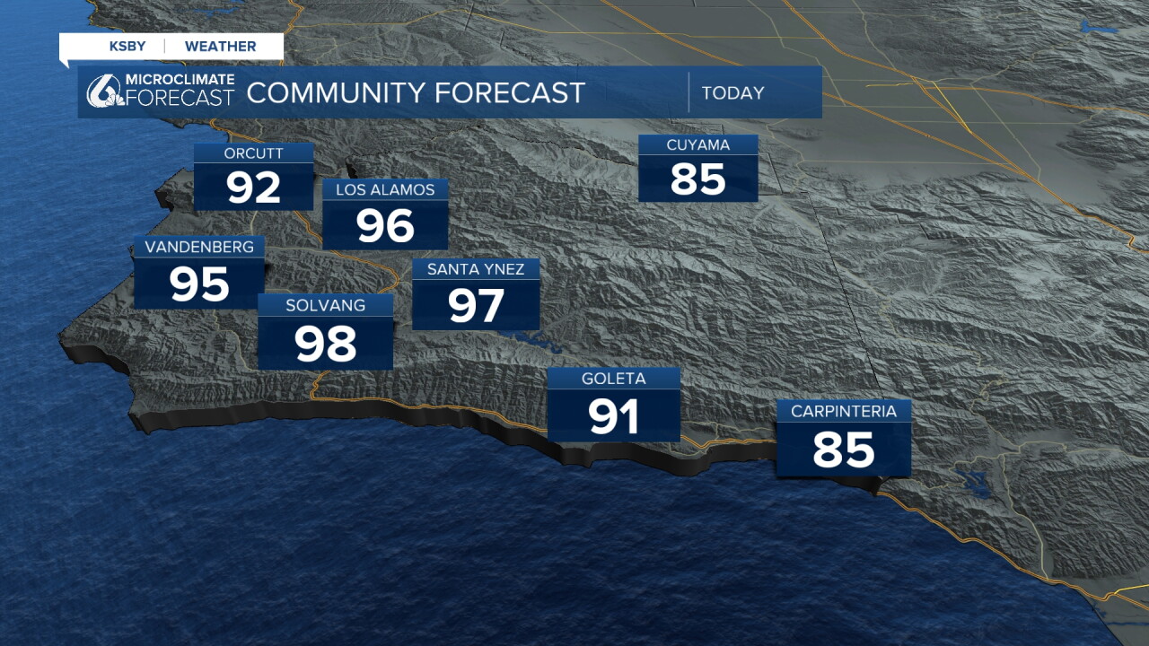
Over the weekend, the offshore winds will start to fade, and with it the fire weather danger and temperatures will fade.
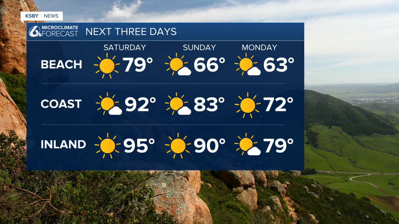
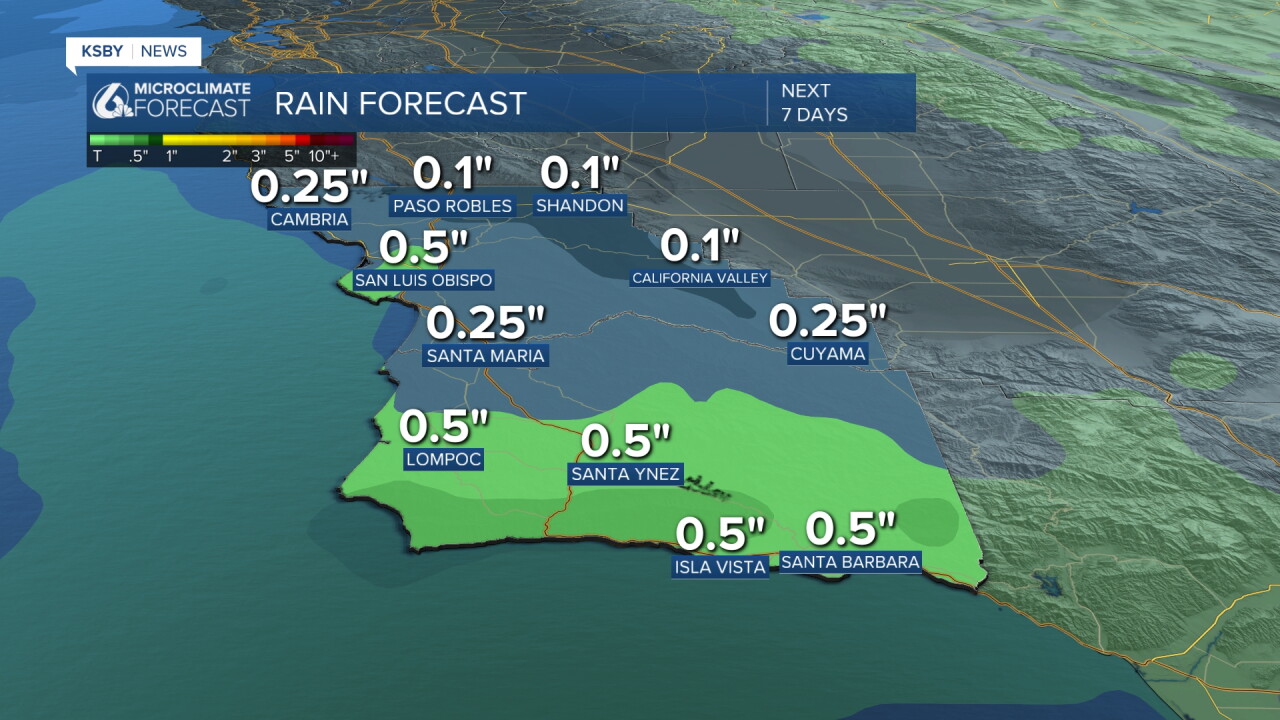
Early next week, a low-pressure system originating in the Aleutian Islands in Alaska will push south. It will drop temperatures significantly and bring a chance of rain Tuesday and Wednesday. This is a little ways out still, but most models have us looking at around a half inch of rain.
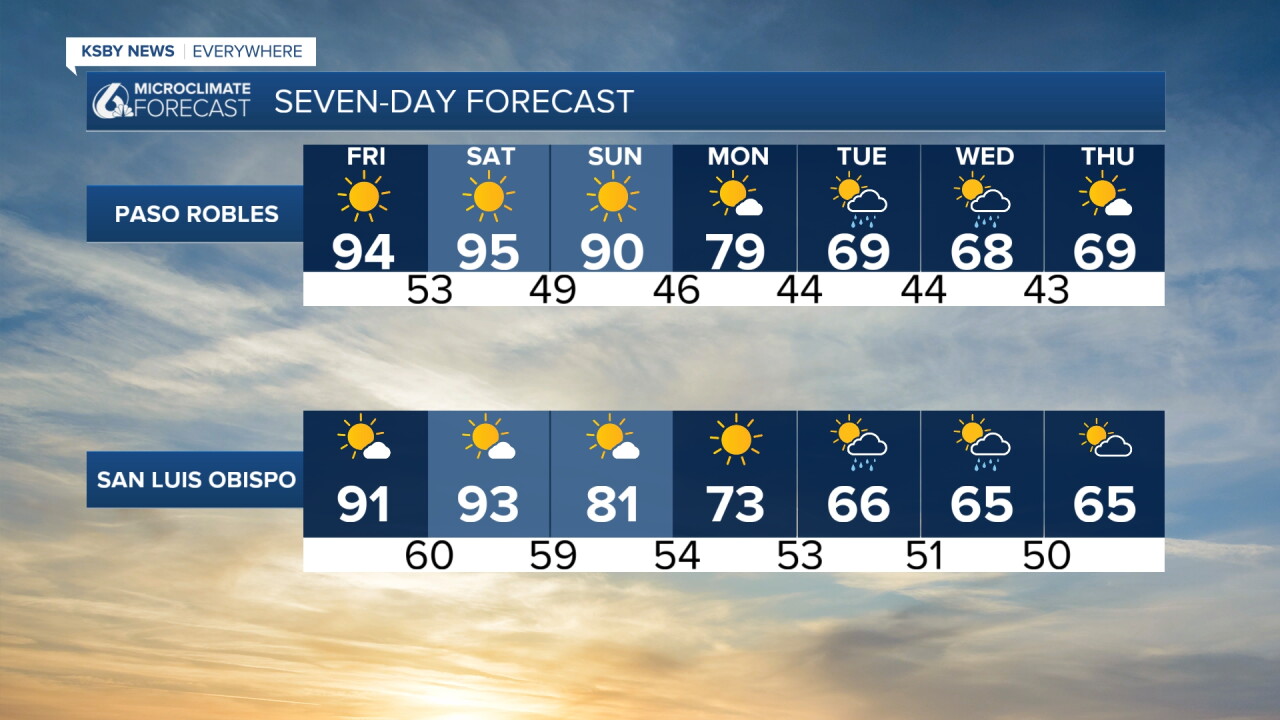
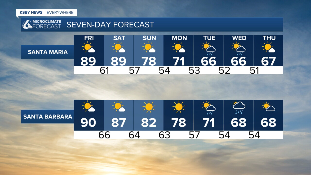
Here is a look at all of that on the 7-day forecast!
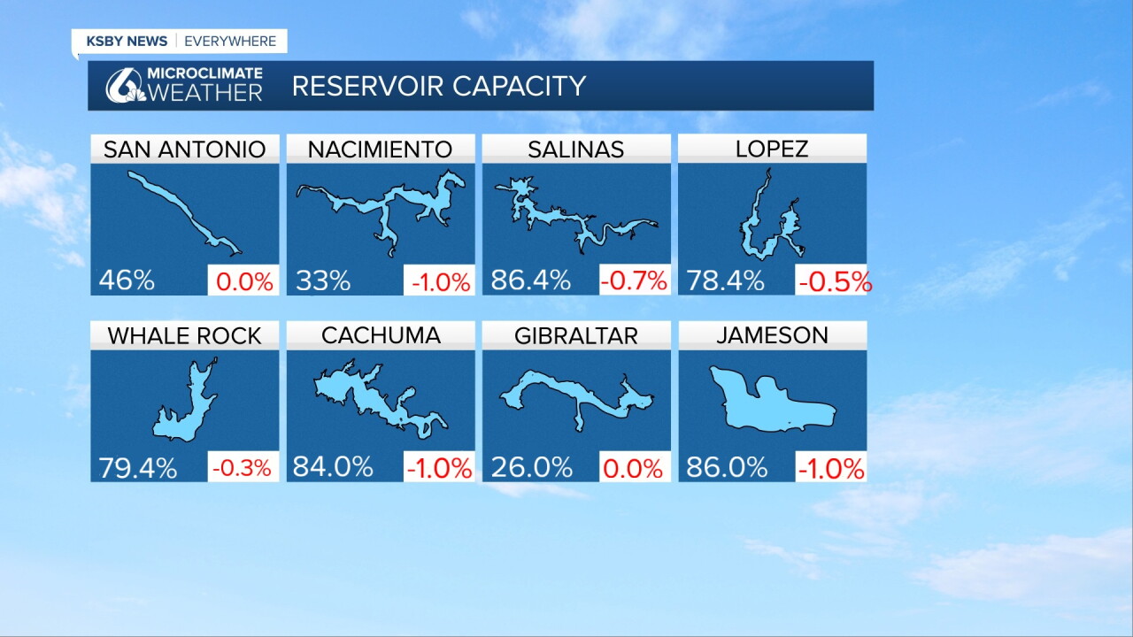
One more note before the weekend. Here is a look at the current lake levels across the Central Coast. The week-over-week change is listed in red at the bottom.
Have a wonderful weekend, Central Coast! Stay weather aware!
-Vivian
