


Good morning, Central Coast!
As we kick off our Tuesday morning, we have two very different forecasts. This morning, the coasts are facing dense fog, but by the afternoon, high heat and fire weather will take over. Lets start with the fog.
Temps in the upper 50s are in place with the marine layer dramatically limiting visibility on our roads.

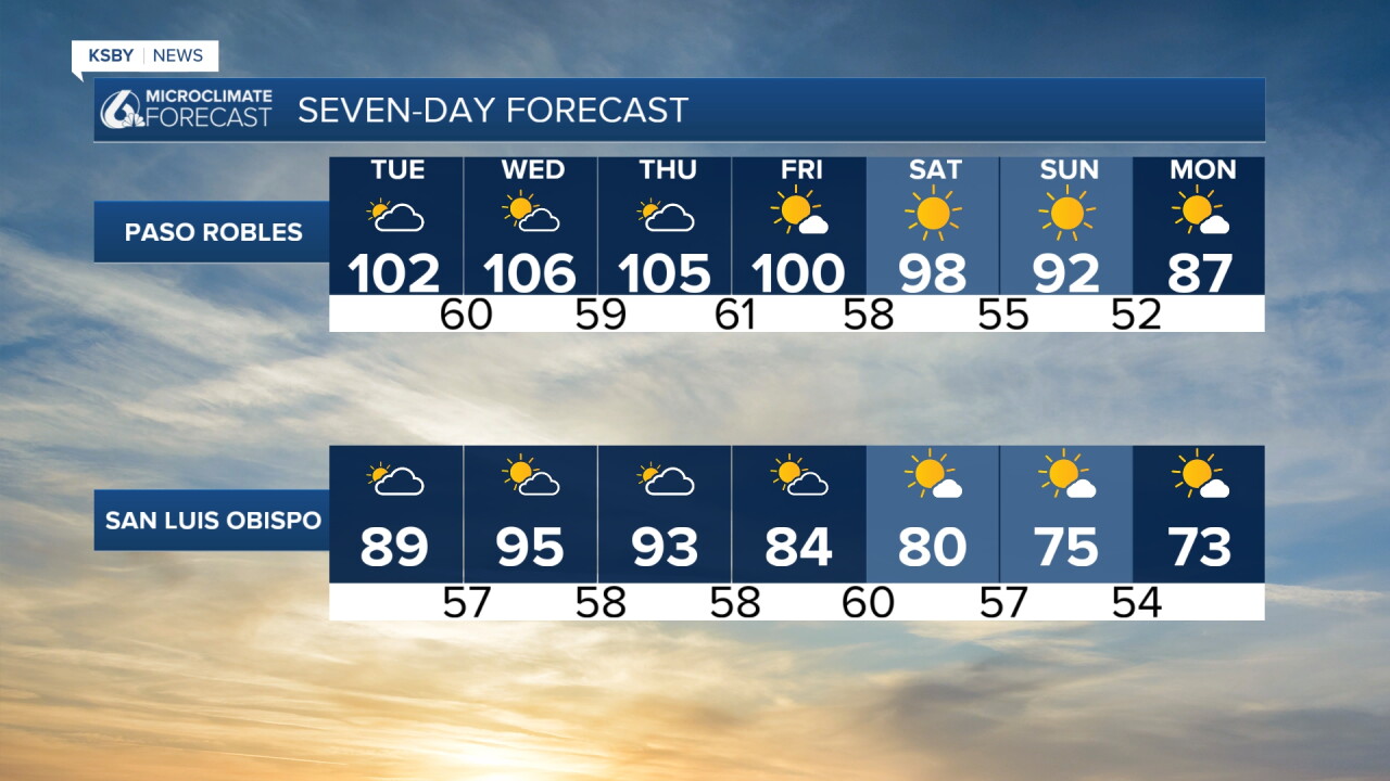
That will clear out quickly and sunshine will be the story with heat into the afternoon. High temps will reach into the triple digits for interiors, 90s along the south coast and 80s for coastal valleys.

The temps will increase even more as the high pressure pushes closer to the west coast over the next few days. Wednesday will be the peak of temps with a slow cooling trend beginning Thursday.

All of the heat has prompted alerts. They are layered over each other, so here is the gist.
- A heat advisory is in place for all but our farthest western beach communities through Thursday night at 8 p.m.
- A high heat warning is in place for the south coast and SB county interiors through Friday evening
- A fire weather and red flag warning is in place for the highest interiors through Friday evening.

Into the weekend, some cooling is in store. More mild weather for the extended forecast.
Here is what that all looks like on the 7-day forecast!

Have a wonderful day ahead, Central Coast!
-Vivian
