

Good morning, Central Coast!
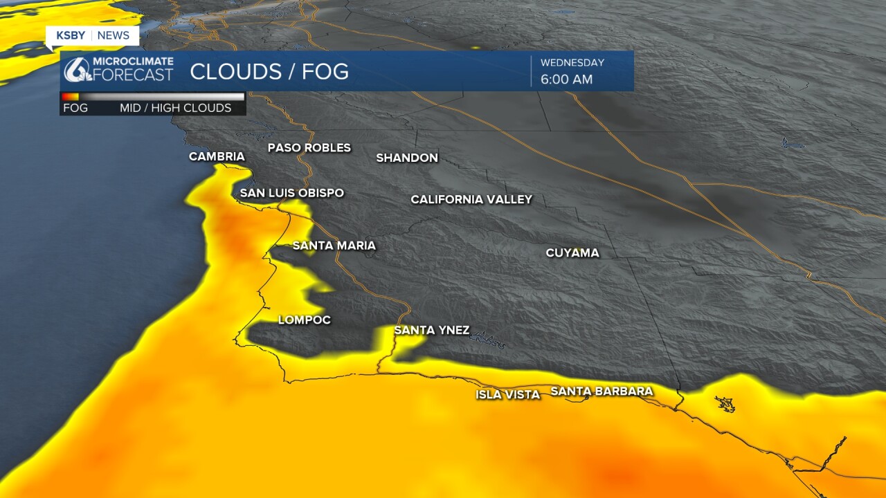
As we kick off the morning fog is back for many of our coastal valley and beach communities. For all but the south coast (that has had fog for the past few mornings) this is the first foggy start for quite a while. Take it slow on the roads where visibility falls.
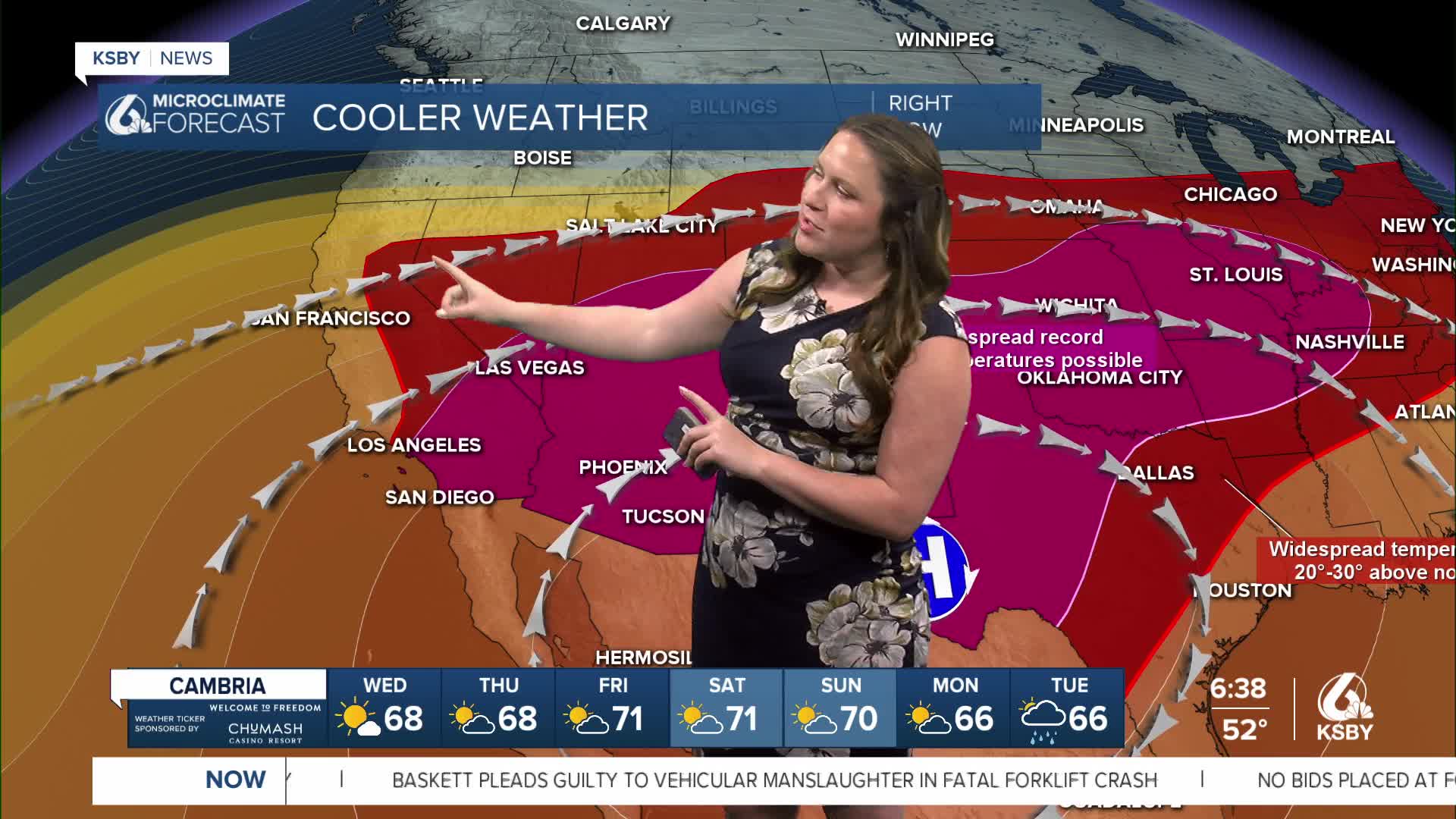
The ridge of high pressure is still very much in place across the region, but as it pushes east, better weather moves in for each day.

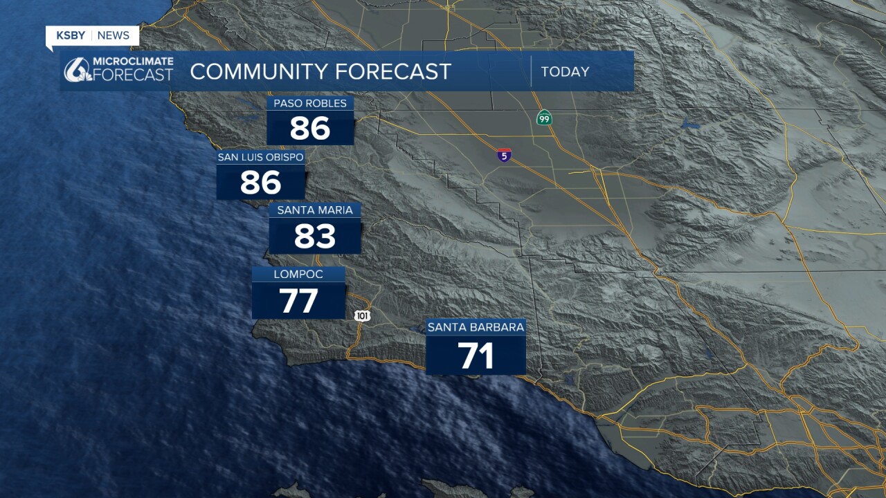
High temps today will still be much warmer than normal, but will be cooler than recent days.
As we go through the rest of the week temps will fall by a few degrees each day. By the weekend, highs will be in the 70s.
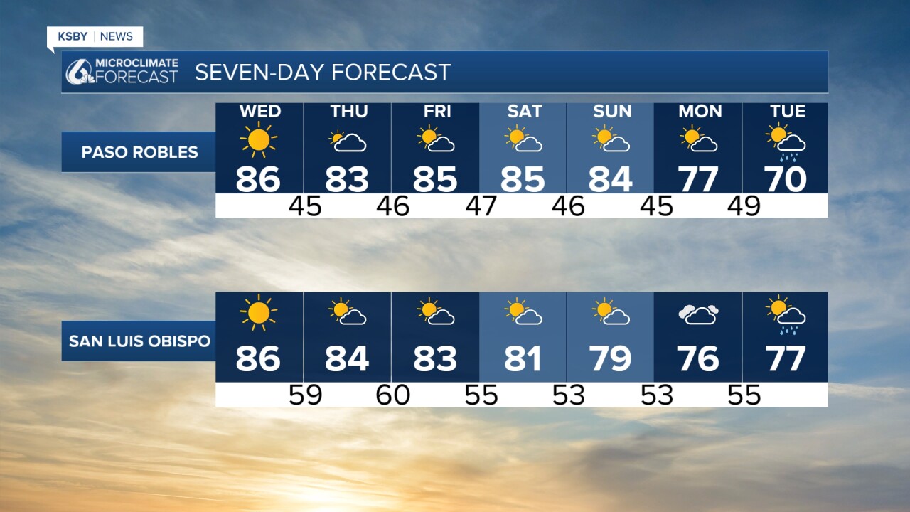
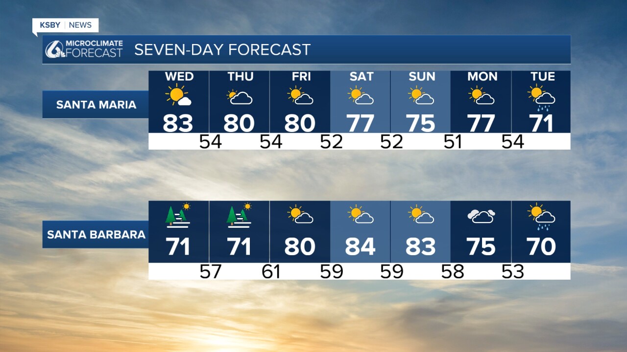
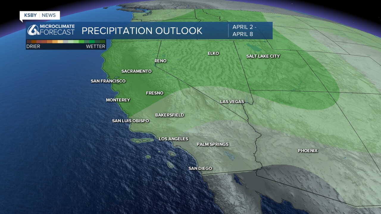
Next week, we have a larger pattern change as we welcome a chance for rain. Current models show a system moving into California on Tuesday morning and bringing lingering rain chances through Wednesday. While it doesn't look like a large system it will bring needed rain after the heat we have seen recently.
Have a wonderful day, Central Coast!
-Vivian
