

Good morning, Central Coast!
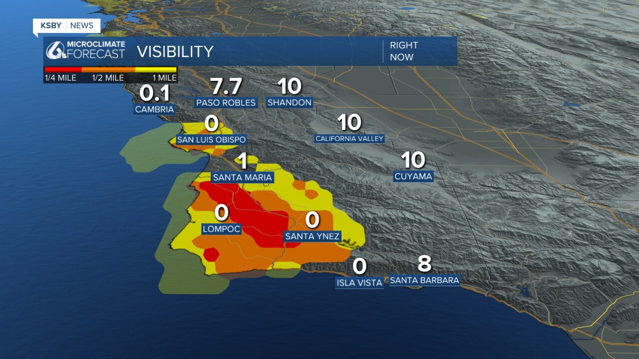
As we kick off the morning, fog is the story. Many communities have limited visibility for the morning commute. Take it slow on the roads.
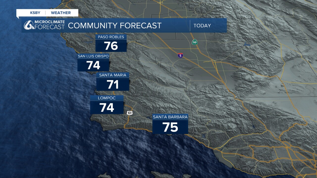
The fog will clear out by mid-morning to be replaced with a few hours of sunshine. Don't get too comfortable, though. This afternoon, clouds will move in and start our next system by Friday morning.
High temps today will fall a few degrees from Wednesday as we transition to a cooler pattern.
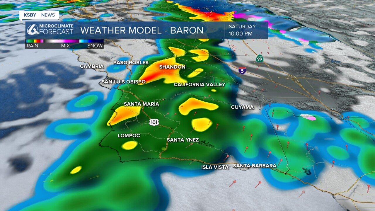
By midnight tonight, the first few very light showers will begin and become more widespread into the morning. Most of the storms will be off and on, but there is the potential for a few stronger cells to move through.

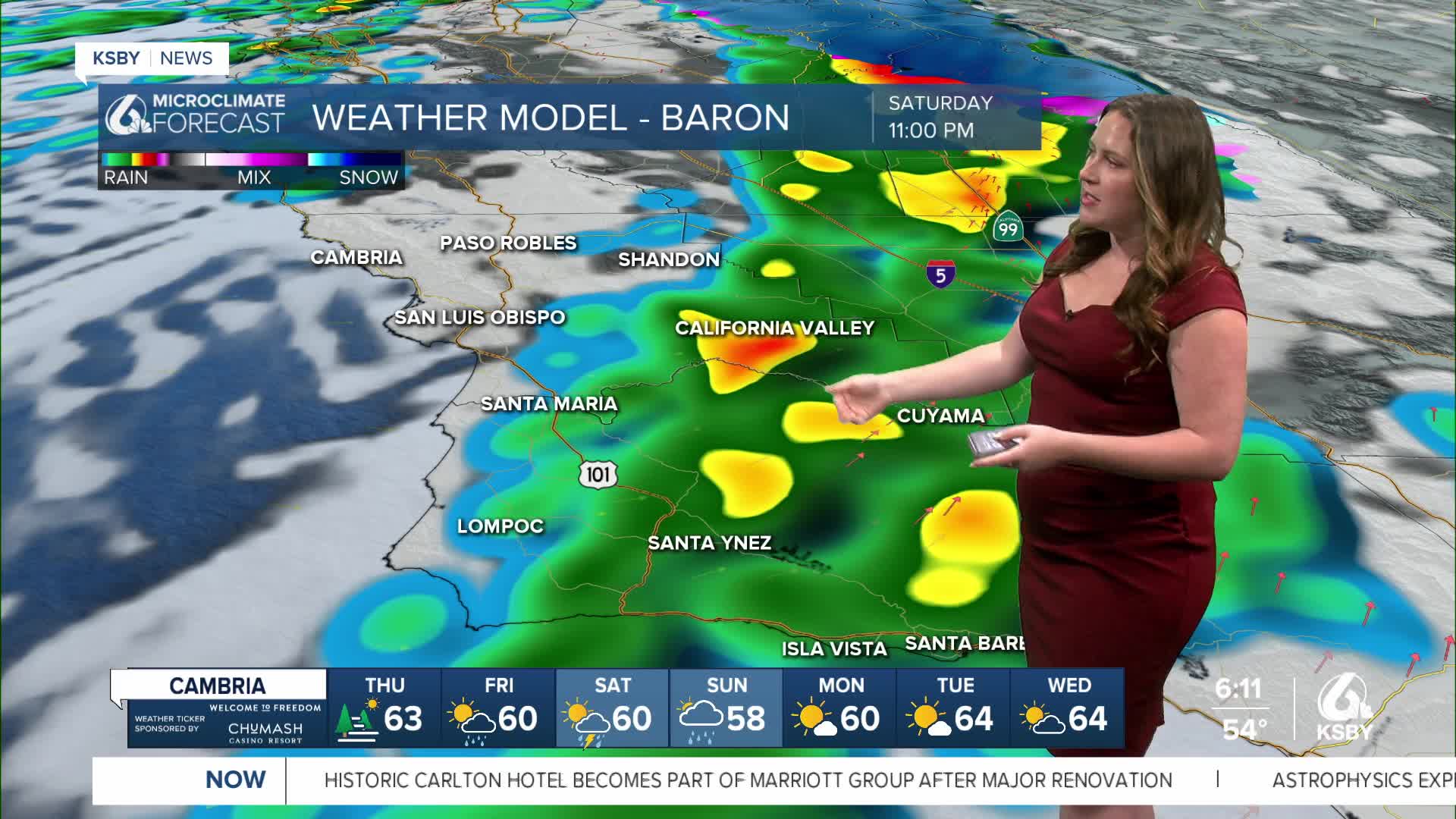
Saturday night, a secondary cold front will move in and bring a band of heavier rain and our best chance for a few stronger storms. Within this band, hail is a possibility along with the heavier rain and strong winds.
Sunday, we will start to clear out, and by Monday morning, just some cloud cover will remain.
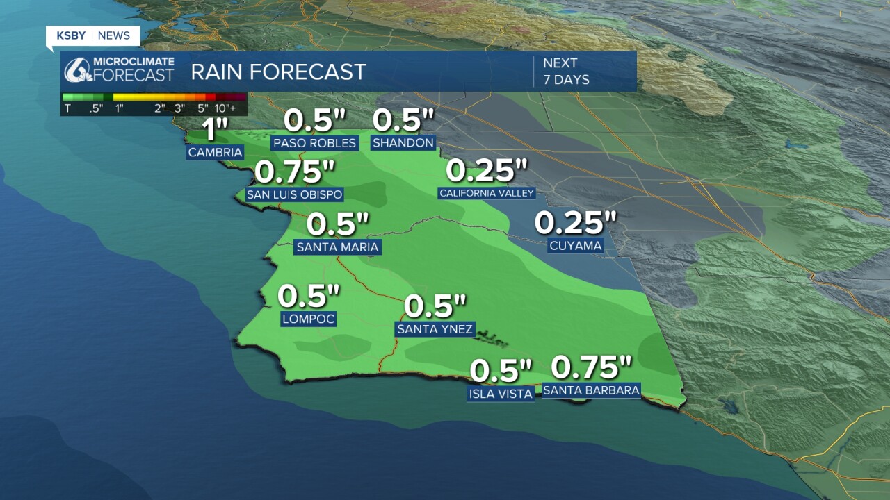
All said and done, rain totals will be around 3/4" with less in the interiors. Heavier totals are expected at the highest elevations and where the thunderstorms pass overhead.
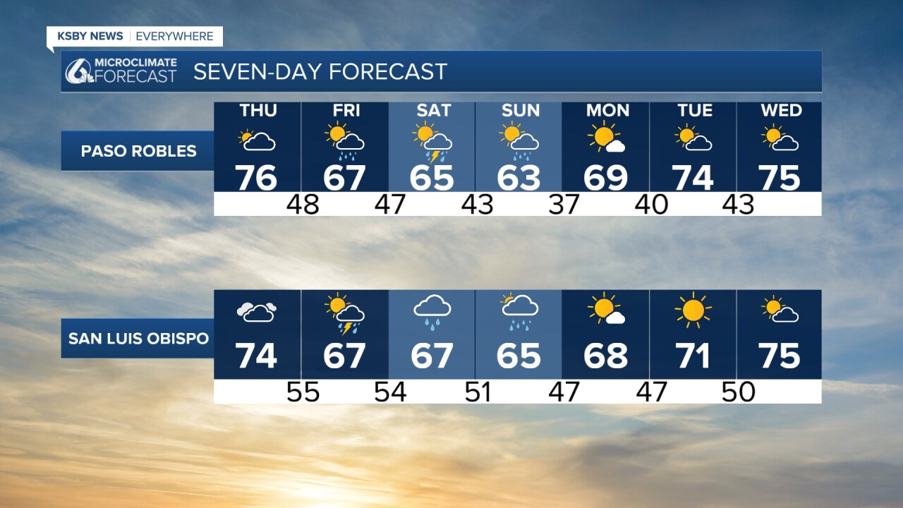
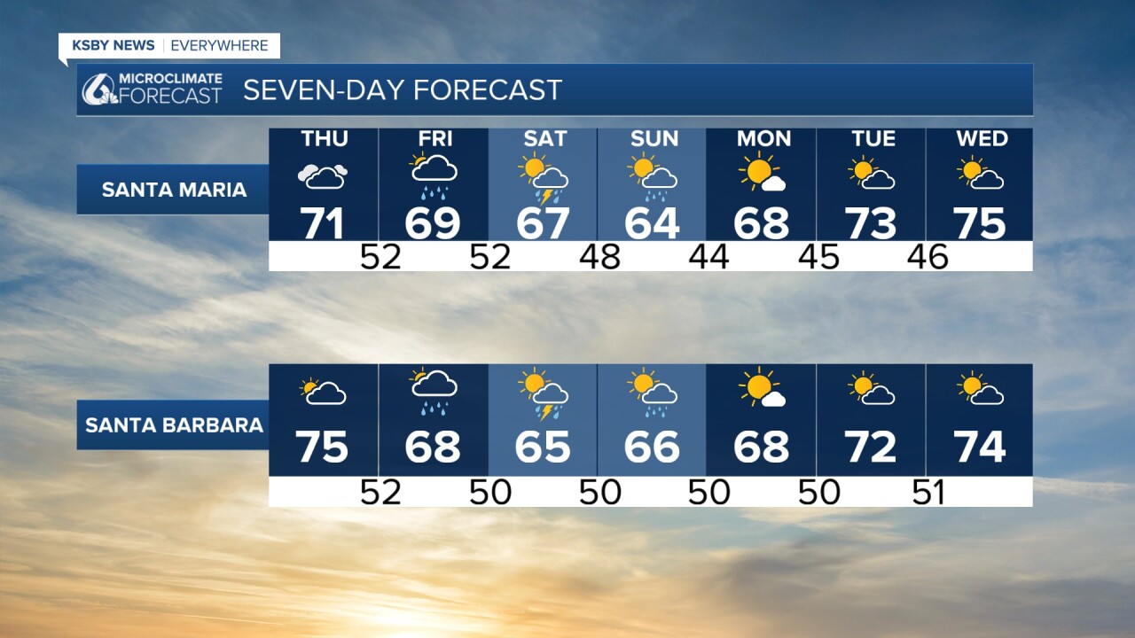
Here is what that all looks like wrapped up in the 7-day forecast!
Have a great day, Central Coast!
-Vivian
