



Good morning, Central Coast!
Big changes are in store for this week with cooler temps, rain chances, and stronger winds. Let's dive right in!
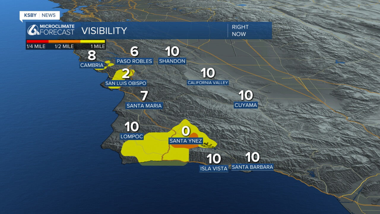
Starting off this morning, there is some fog across the region thanks to the winds shifting onshore. On the whole, no major concern is expected due to limited visibility. The densest fog is in the Santa Ynez Valley and will clear out by mid-morning.
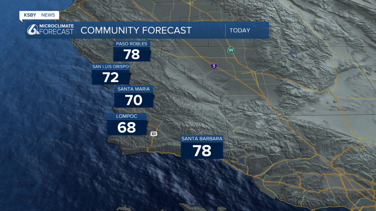
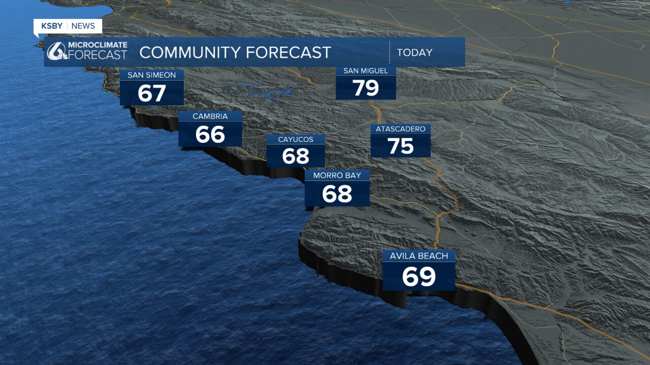
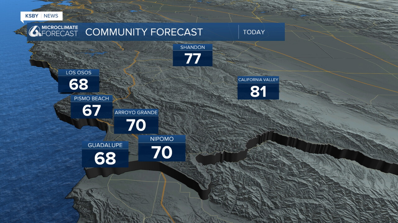
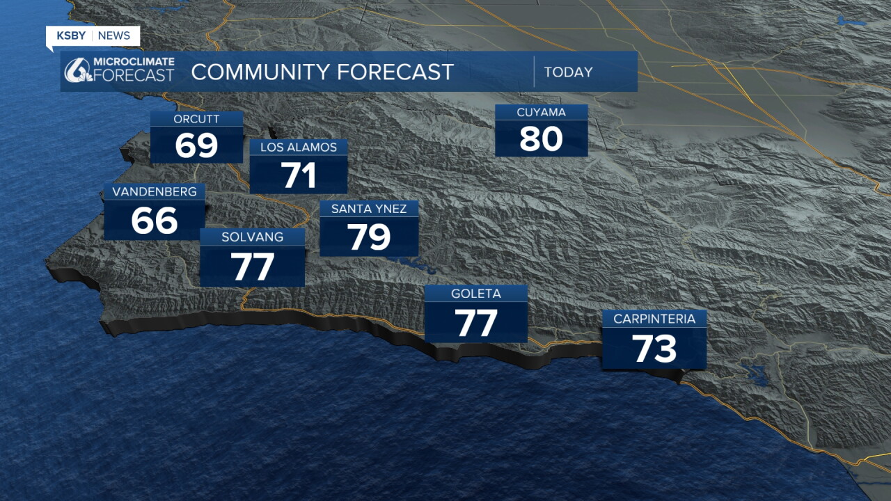
Temps will cool down significantly as compared to last week, when near-record highs were widespread. Today highs will fall into the 70s and 60s for many spots. That is a thirty-degree drop for some of our communities.
Here is a look at today's high temperatures across the region.
Okay, now onto the big story... rain!
A low-pressure system that originated near the Aleutian Islands in Alaska is moving south and will cross Northern California later this week. As the core low presses east, the cold front trailing the system will cross the Central Coast.
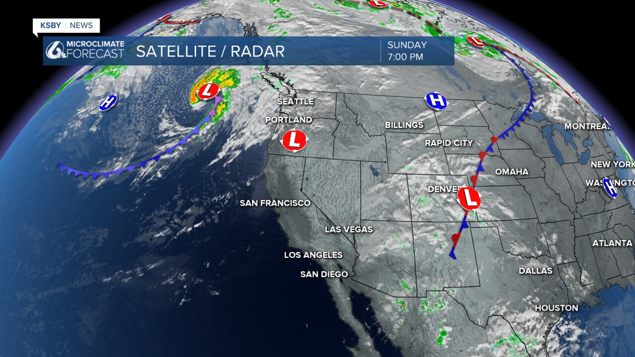
For us that means rain Wednesday and Thursday.
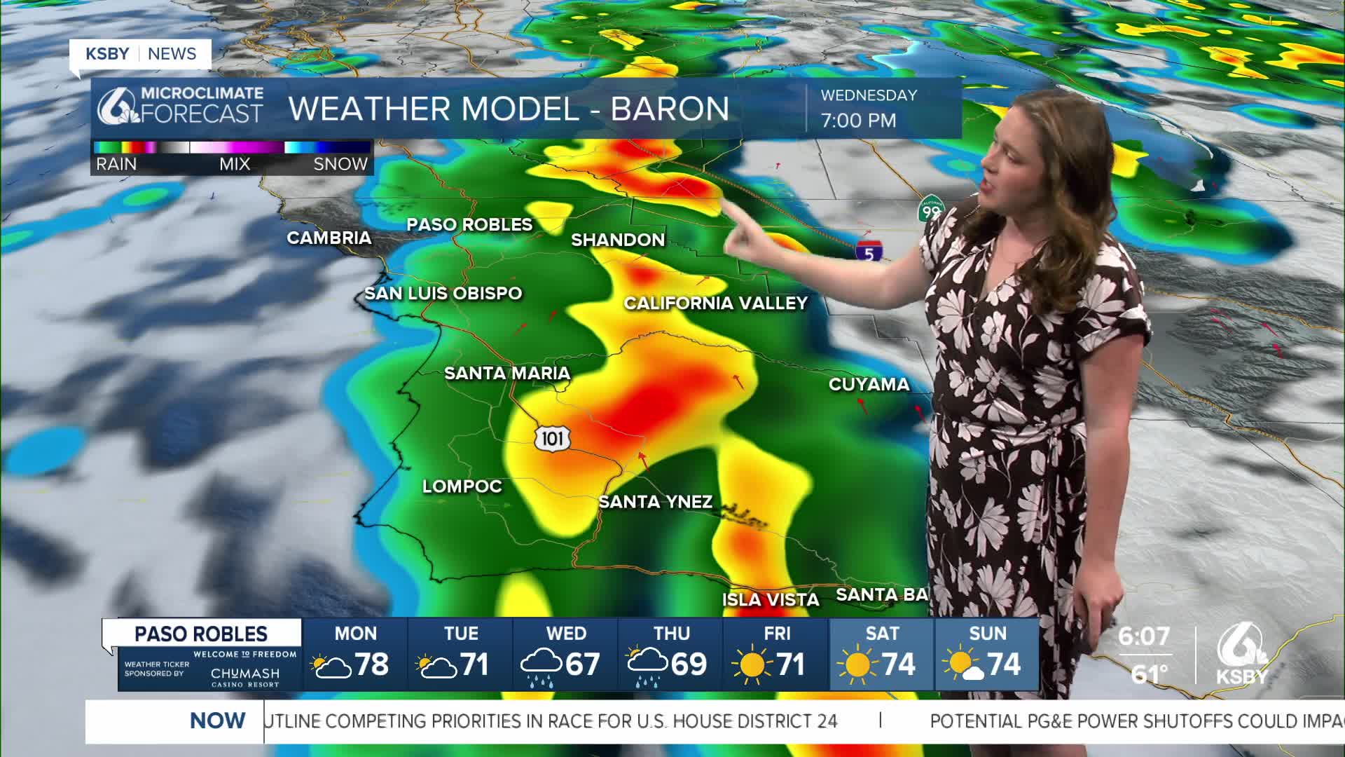
Starting very early Wednesday morning, a cold front will arrive and bring us the first band of rain. Through the day, we can expect more showers, although they will be spotty at best.
By Wednesday evening the core low pressure will push through and bring us the heaviest band of rain. Higher accumulations and the chance for some thunderstorms are expected.
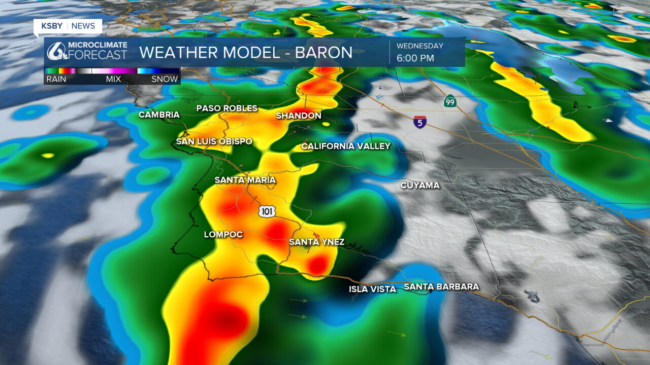
By Thursday morning, the worst will have passed, but still some showers are possible into the afternoon.
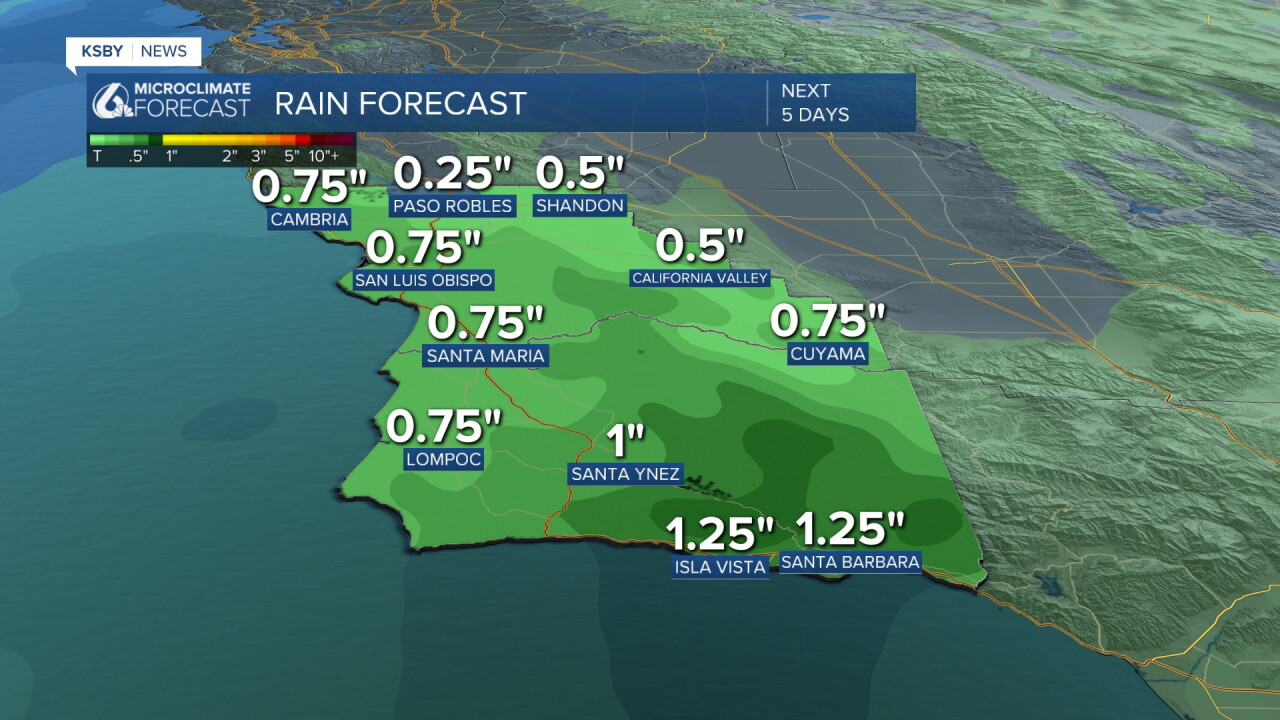
All said and done this will be our largest system of the season so far (that being said, the new rain year started on Oct. 1st). Accumulations could be up to an inch in some spots. Here is the forecast.
Here is all of that on your 7-day forecast!
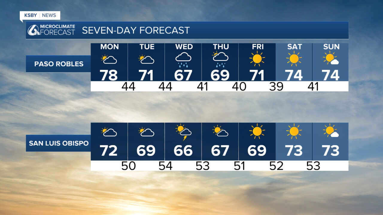
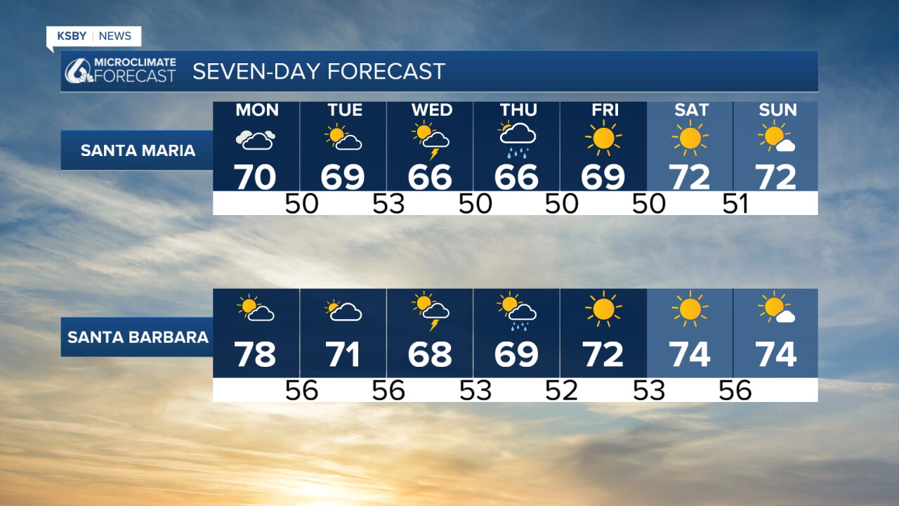
I will keep you updated as this storm system arrives throughout the week. Have a wonderful day, Central Coast!
-Vivian
