

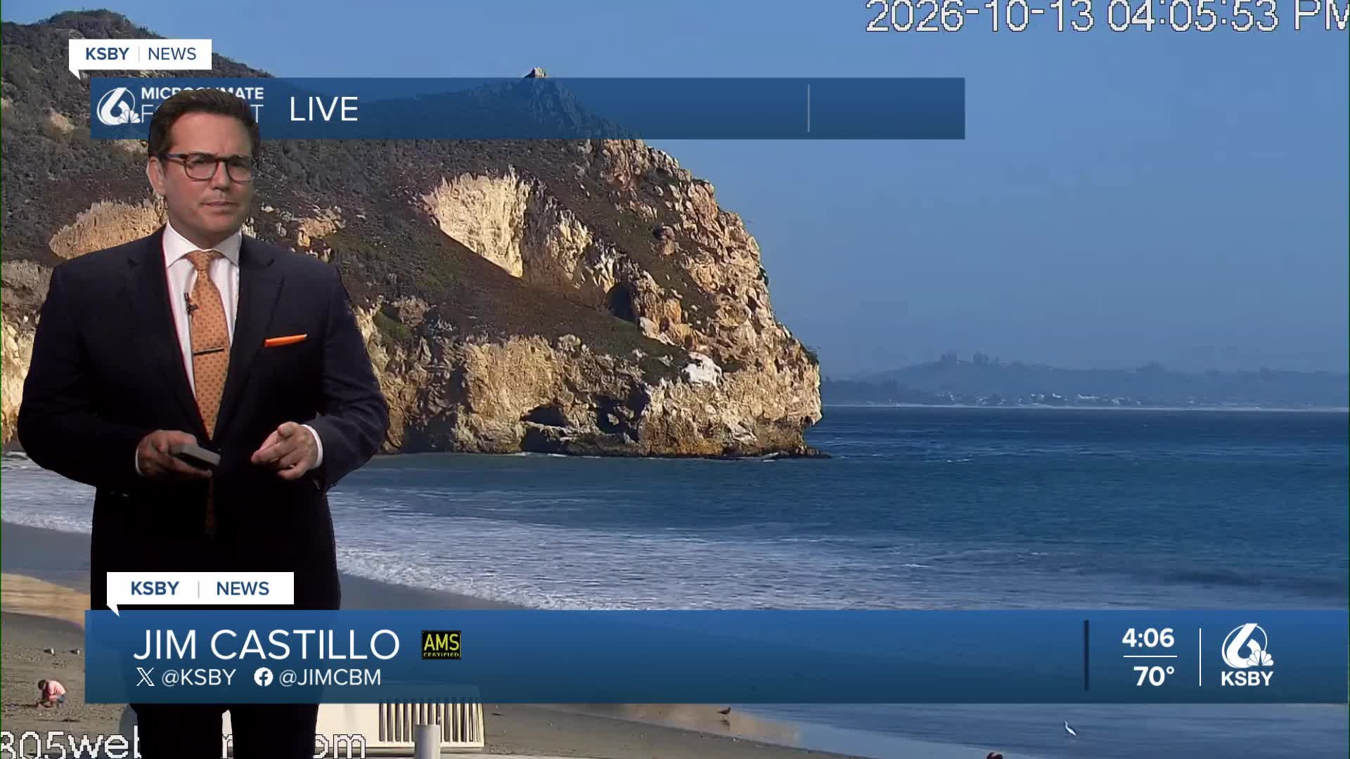


Good Tuesday evening from Meteorologist Jim Castillo
Here is your Central Coast weather breakdown for San Luis Obispo County, Santa Barbara County, and our local mountain and forest areas.
Offshore Pressure Trends: A mild offshore wind is keeping the skies clear and driving a localized drying trend across the region at night and in the mornings.
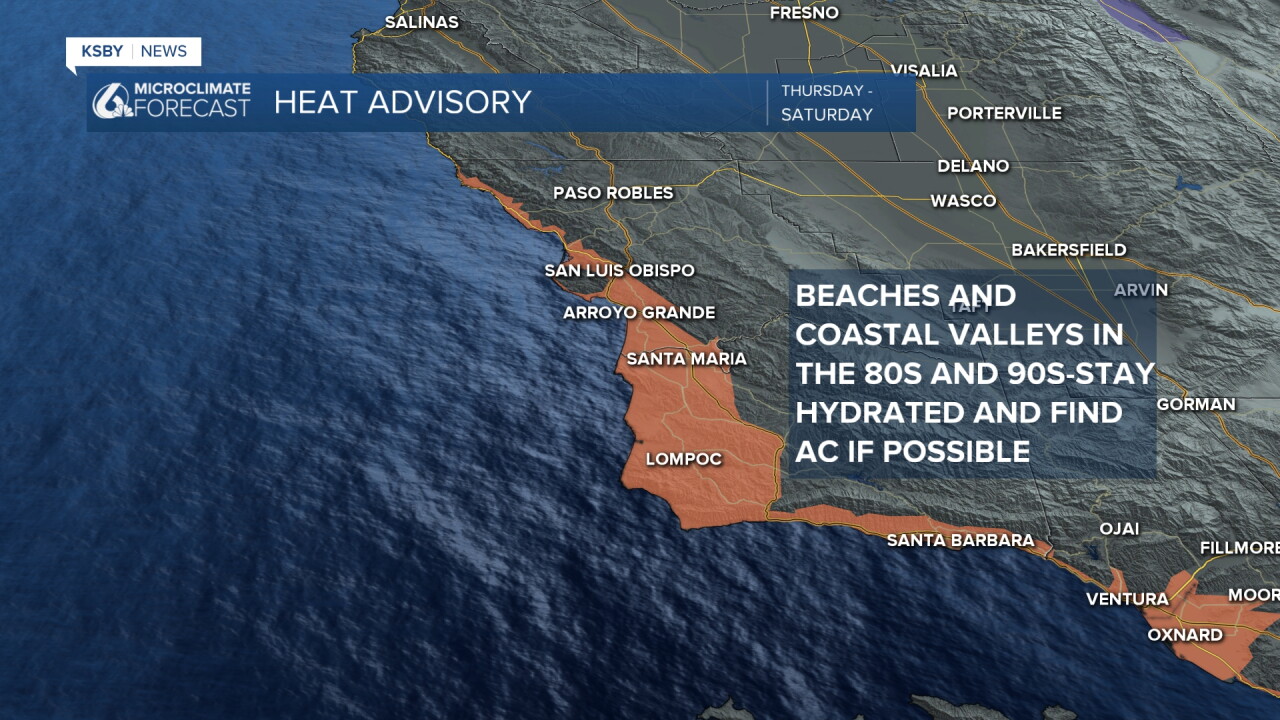
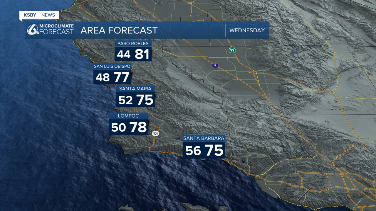
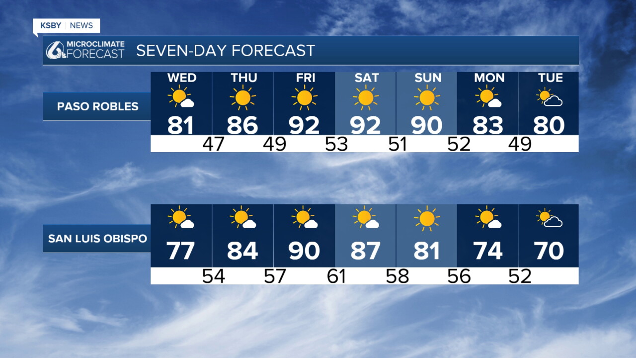
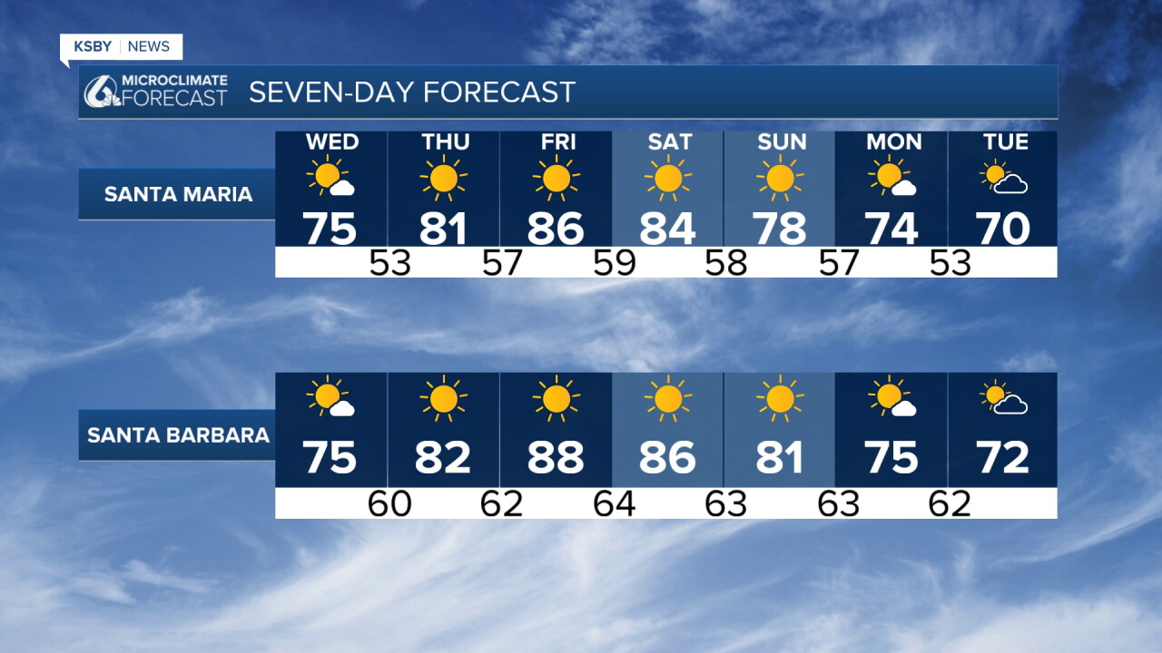
A steady warming trend expands into Wednesday and a Heat Advisory begins Thursday and goes through Saturday for the Coastal Valleys and Beach areas with 80s and 90s in the forecast.
Expect full sunshine across both counties as atmospheric moisture stays low.
Regional Wind & Fire Weather Alert Highlights
Ventura & Los Angeles Counties: A major Santa Ana Wind event is forecast to peak Thursday into Friday with wind gusts reaching 50 to 70 mph in exposed high terrain. Fire Weather Warnings and Wind Advisories and High Wind Watches are in effect for Southern California.
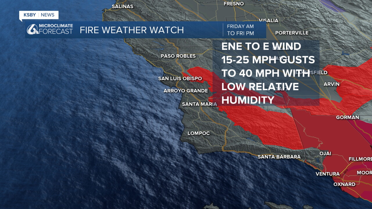
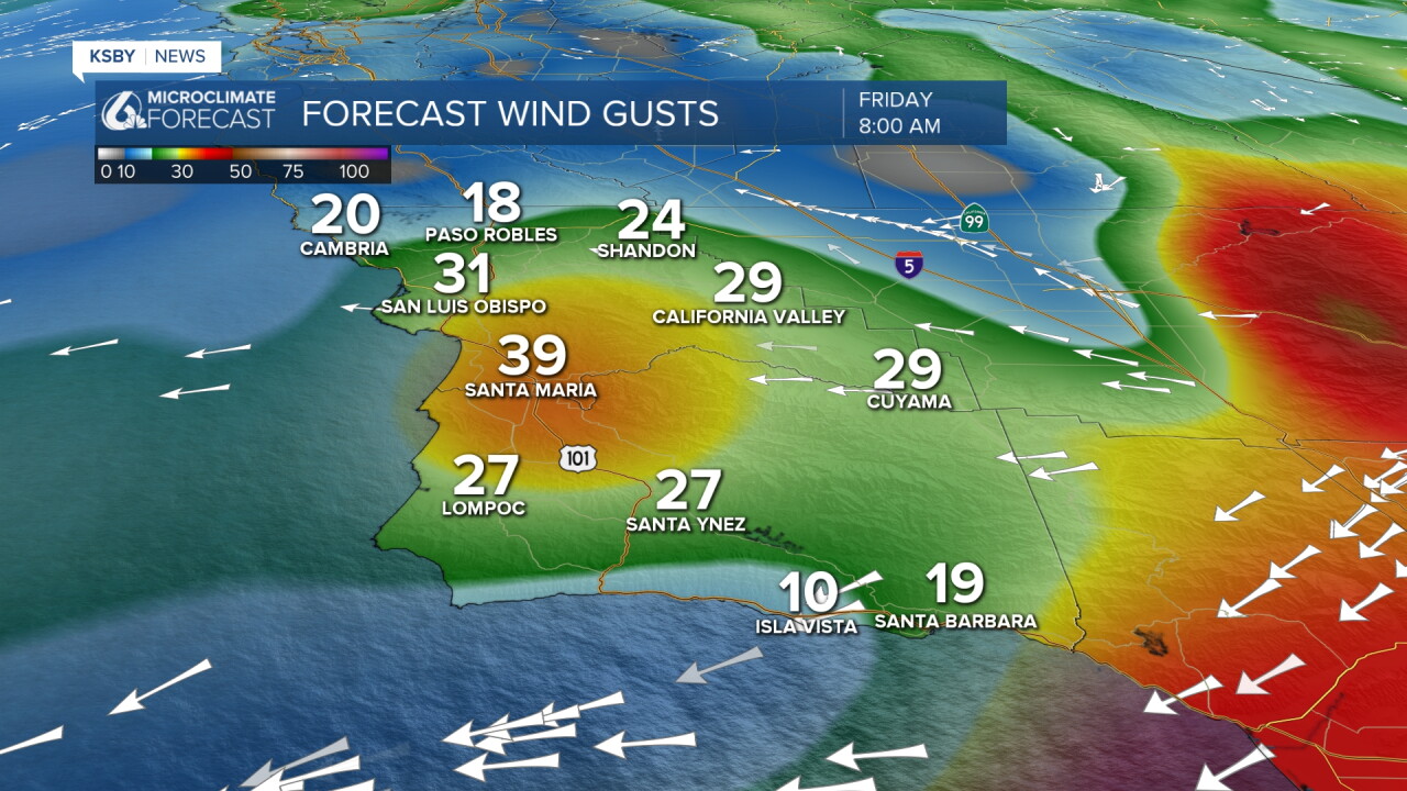
San Luis Obispo & Santa Barbara Counties: The offshore wind event ramps up Friday morning, and a Fire Weather Watch is in effect Friday from parts of the Santa Lucia County mountiains into the Santa Barbara County mountains. Gusts up to 40 mph are expected Friday morning and early afternoon.
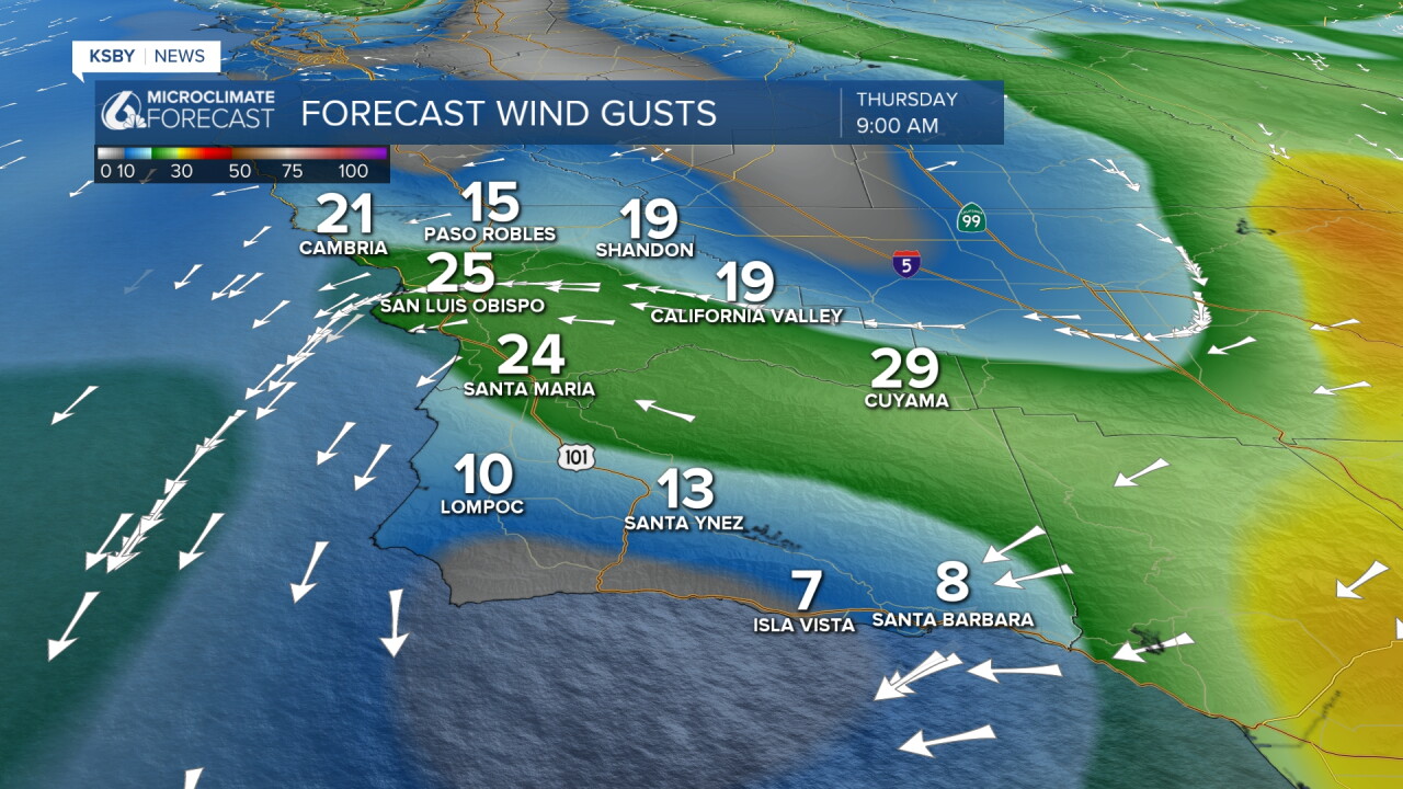
Local Central Coast Wind Conditions: The primary offshore wind core will remain south, but many areas along the Central Coast will see gusty conditions.
Mountain & Forest Conditions
Santa Lucia Mountains: Expect localized gusty northeast winds through the ridges and canyons. No official wind advisories are in effect for the Santa Lucias at this time, but it will get gusty especially Thursday and Friday morning.
Santa Ynez Mountains: Gusty offshore winds will accelerate down the passes and canyons, aiding in the localized warming and drying process.
Los Padres National Forest (San Luis Obispo & Santa Barbara Sections): Air accelerating over the higher elevations into the coastal valleys will undergo compressional heating, significantly reducing relative humidity across the forest terrain.
Temperature Trend & Peak Heat Details
Heat Advisories: Heat Advisories have been issued for coastal sections of San Luis Obispo County and Santa Barbara County, lasting Thursday through Saturday.
Peak Heat Window: Highs will rise steadily day by day, reaching their peak on Friday.
Expected Highs: Peak temperatures will reach the 80s to low 90s across the beaches and coastal valley zones in both counties.
Extended Heat: Above-normal temperatures are expected to hold steady through Sunday before a very gradual cooling pattern begins early next week.
Extended Forecast & Next Week's Pattern Shift
Early Next Week: Slow cooling trend back toward seasonal norms.
Mid-Week System: High model confidence points to a cold upper-level low-pressure system dropping into the region by the middle of next week.
Expected Impact: This will bring a sharp drop in temperatures and a dramatic change in weather conditions. While currently modeled as a predominantly dry system, any slight shift in its track offshore could introduce a chance of coastal and mountain rain showers.
Have a great night, Central Coast!
-Jim
