



Good morning, Central Coast!
Our beloved marine layer is back this Monday morning, bringing those familiar cloudy skies to most of the region with some fog at the highest elevation spots along the Cuesta Ridge. No major worries, but something to be aware of for the morning commute.
Today will bring some slight warming (especially for the interior valleys) with highs climbing into the upper 90s. Coastal valleys may get a few degrees of warming too but it won't be too much of a concern.
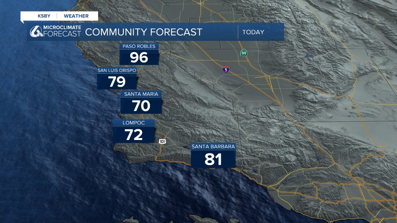
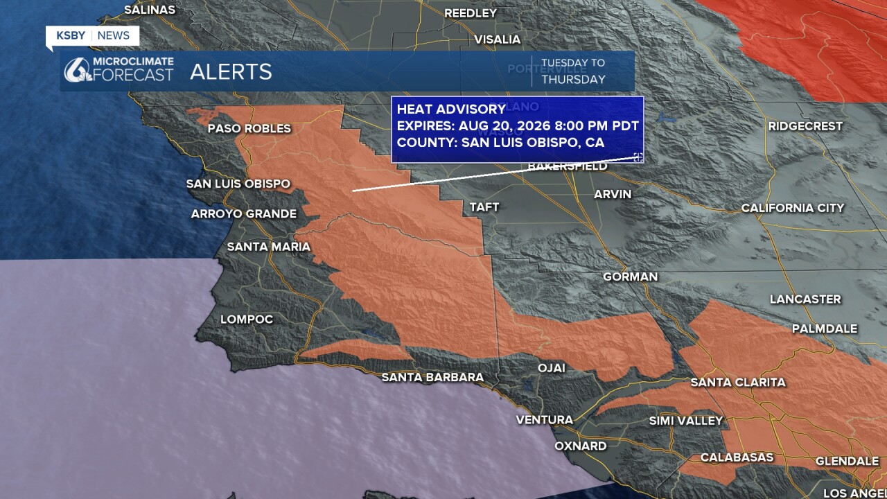
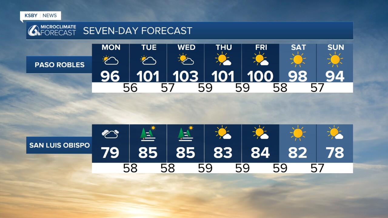
The high heat continues through the week, with the worst of it Tuesday through Thursday as interior valleys reach into the triple digits. Those soaring temps have prompted a high heat advisory for our interior valleys from 10 a.m. Tuesday through Thursday night.
Into the weekend, we will see some cooling as marine influence reaches into the interior valleys. This will cut a few degrees off of daytime highs but on the whole, will make for a perfect weekend. Morning clouds and afternoon sunshine.
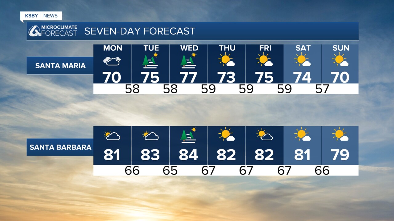
Here is what that all looks like on our 7-day forecast!
Have a wonderful day, Central Coast!
-Vivian
