

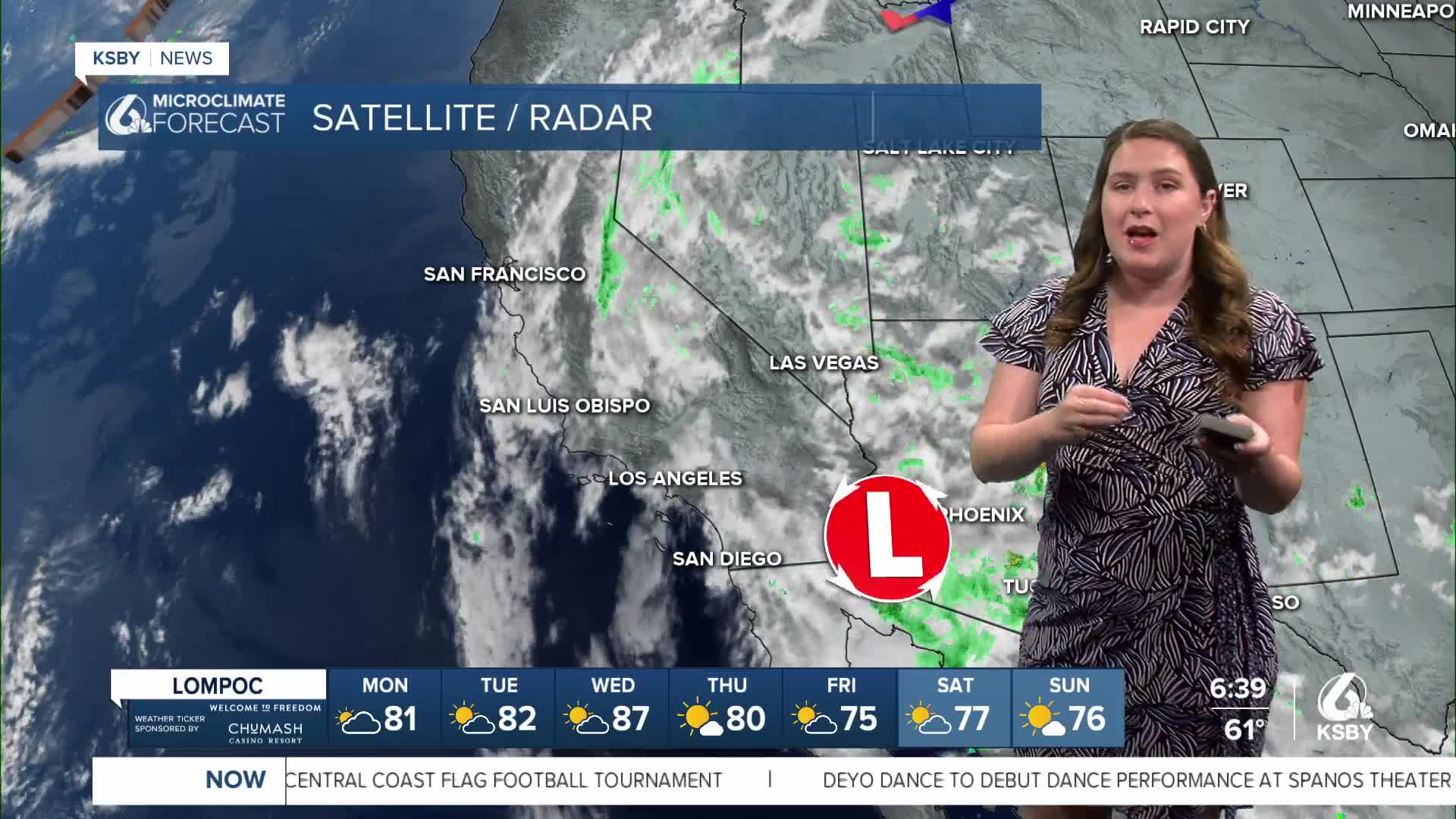


Good morning, Central Coast!
It has been a hot set of days across the Central Coast with highs soaring each day. With the addition of humidity (from the Arizona Monsoon showers we saw on Sunday), it will be another hot and honestly damp day.
The highs on Sunday were kept a little lower thanks to the showers but that won't be the case today. Highs will soar into the triple digits in the interior valleys; coasts will be in the 80s.
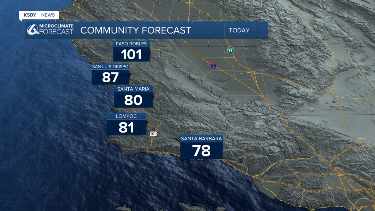
Thanks to the heat, there are a few alerts in place.
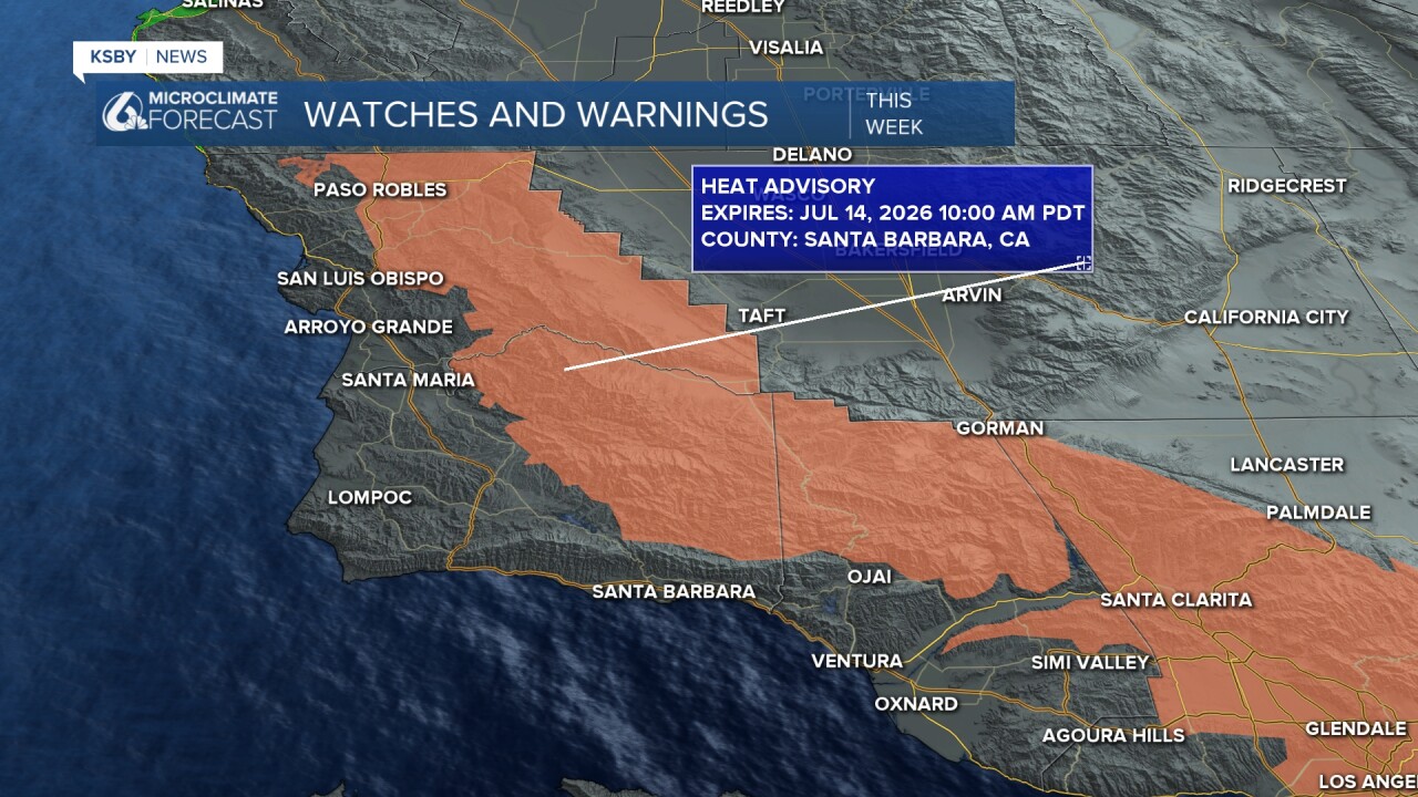
Starting off with the heat advisory that is still in place from last week. This indicates triple-digit heat continuing into this week. The advisory will expire at 10 a.m. Tuesday.
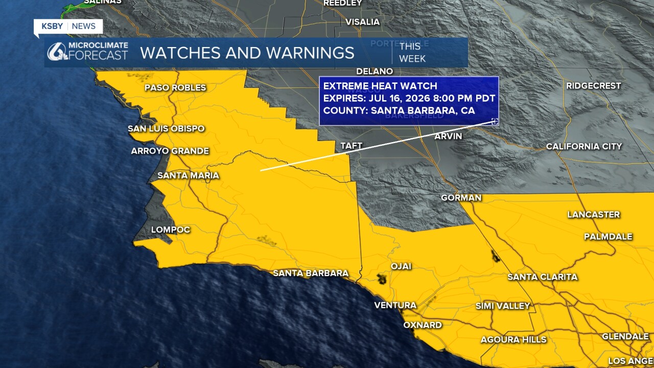
At that point, temps will soar more and have prompted an extreme heat watch (that is an upgrade of both scale and intensity). That will last through Thursday night and encompass the hottest temps on Wednesday afternoon.
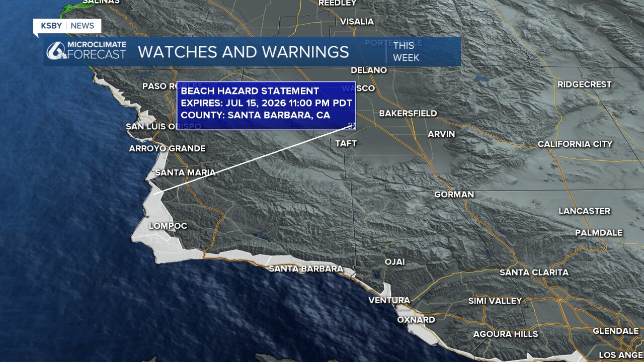
If you are looking to escape the heat by the beaches, a word of warning. A beach hazard statement is in place for all of our beaches through Wednesday night thanks to added wave energy and rip current risk.
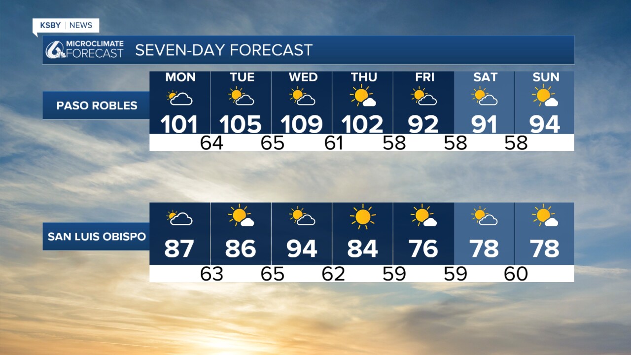
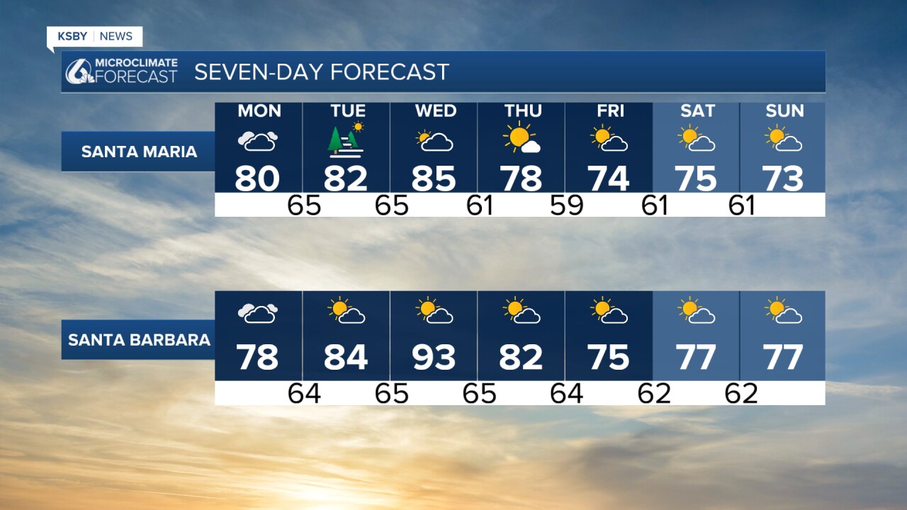
Wednesday will be the hottest day of the forecast by far, with temps up to 110 degrees for the Paso Robles Area with 90s in most of our coastal communities.
Thankfully temps will cool as we head into the weekend.
Have a wonderful day, Central Coast!
-Vivian
