

Good morning, Central Coast!
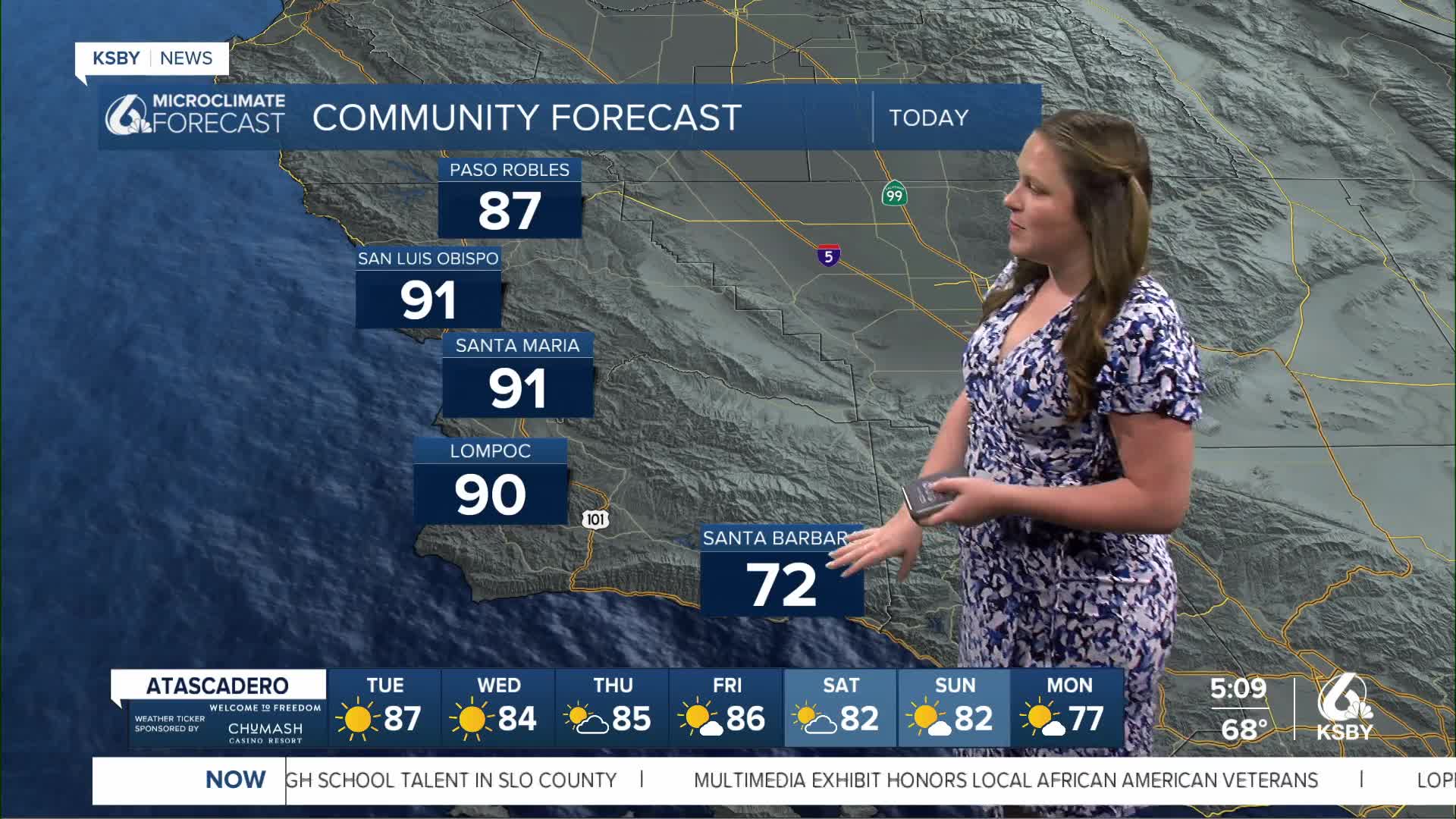
Another day of heat is headed our way. Offshore winds are increasing temps signifciantly in the San Luis Obispo area (70 around 6 a.m.). On the other side of the coin is the south coast, where some fog is limiting visibility as well as keeping temps cooler.

We still have a heat advisory in place for all of our western beaches as well as coastal valleys through 8 p.m. Tuesday.

An interesting fact about yesterday's temperatures. On Monday, the Santa Maria airport reached an official temperature of 93 degrees. That smashed the old record of 89 set in 1926 (exactly 100 years ago). Additionally, Lompoc, San Luis Obispo, and Santa Ynez all broke records.
High temps today will be nearly identical to Monday with highs in the 80s and 90s in most spots, with cooler weather along the south coast (thanks to the marine layer).
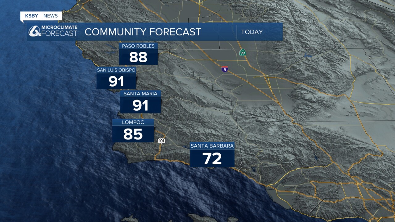
Those highs will once again set widespread records.
Starting Wendesday the high pressure that is driving this whole pattern will weaken and allow temps to start falling. The cooling trend will be very slow but still will be noticable and bring cooler temps by the weekend. That being said, even the temps in the upper 70s are still well above normal for this time of the year.
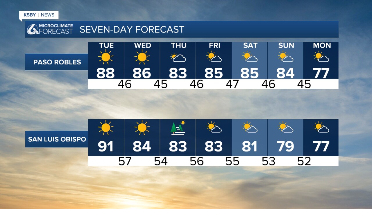

Looking past the 7-day forecast temps will still be a little above normal for this time of the year, but will be much closer to those typical temperatures. I am following a small low-pressure system that looks to form early next week and bring us small chances for rain. This is a long way out, and even now it is a long shot, but there is a chance!
I'll bring you the latest on that chance as it gets closer.
Have a wonderful Tuesday, Central Coast!
-Vivian
