

——— 8 p.m. Update from Meteorologist Vivian Rennie———
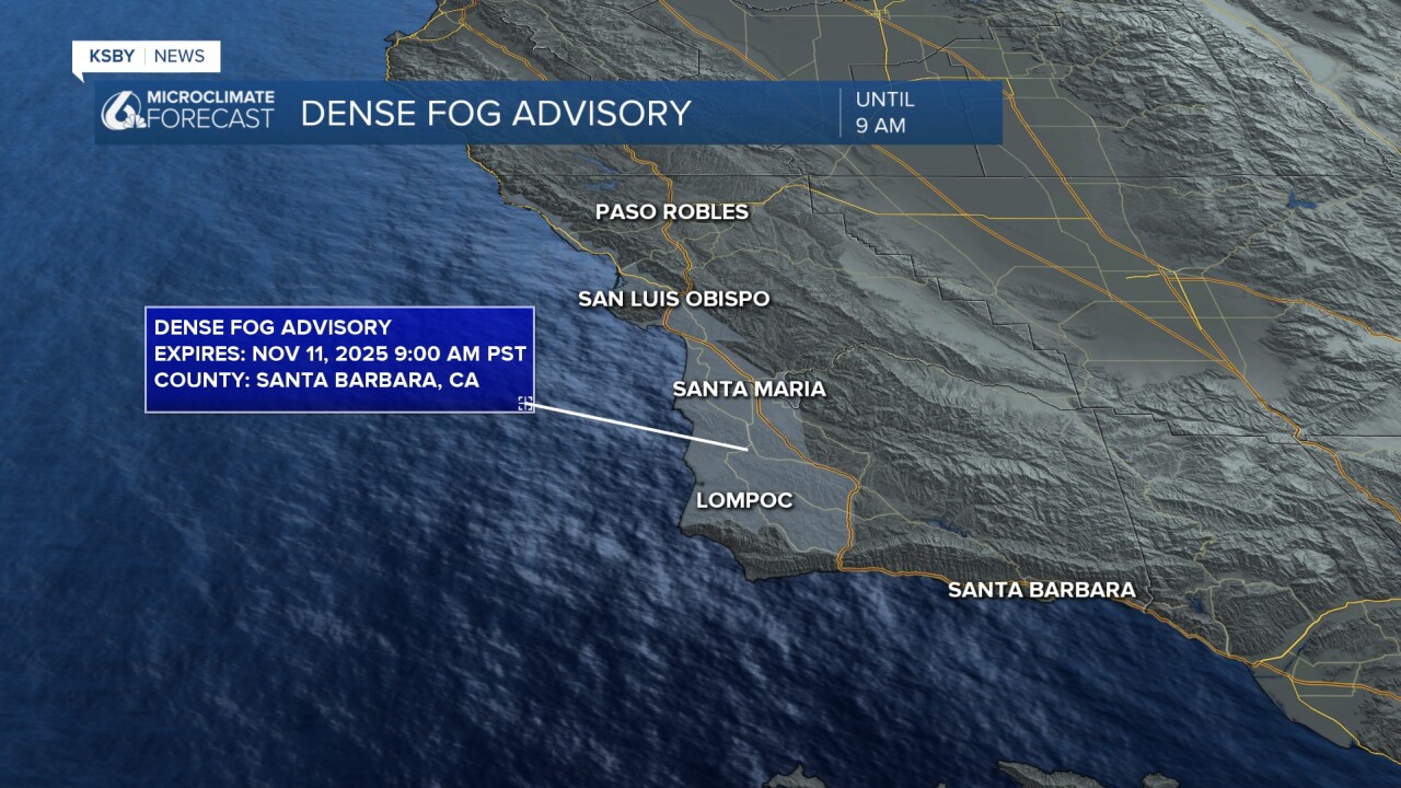
It's a foggy one out there tonight! There is a dense fog advisory in place through 9 a.m. Tuesday morning for our coastal valleys, western beaches, and the south coast. Take caution on the roads tonight and tomorrow morning during the commute.

——— Original Article ———
Happy Monday, Central Coast! As we kick off a new workweek, big changes are on the way in our forecast. Let's dive right in.
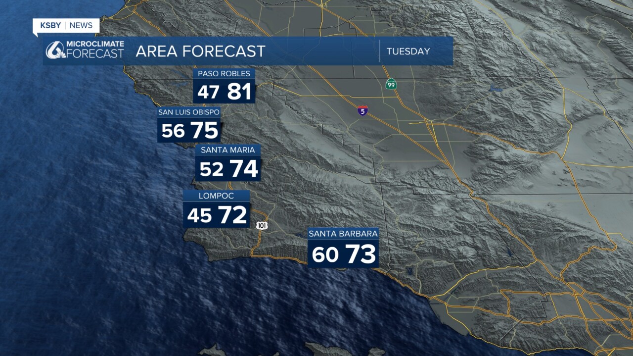
The weekend (and start of the week) were 10-15 degrees above normal for this time of the year. Here are the high temps we got up to on Monday across the region.

Into the afternoon hours, marine influence pushed in and will drop visibility into tomorrow morning. Take it slow on roads where fog is present.
That fog will clear out for many spots by mid-morning, but will leave cooler, dense marine air at the surface. Translation: temps will be substantially cooler on Tuesday.
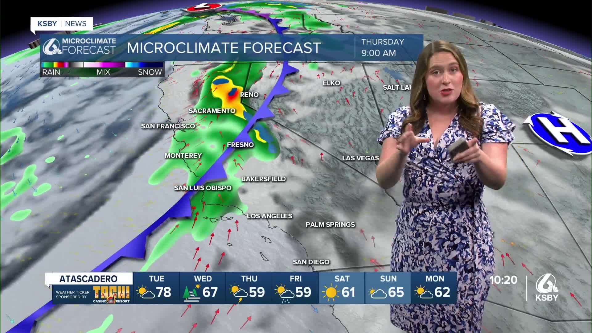
Wednesday will start off with another round of fog and mild afternoon temps. Into the evening, a cold front will push in and bring our rain chances. As that initial cold front moves through, heavy rain will come in, and there is even the chance for some isolated thunderstorms.
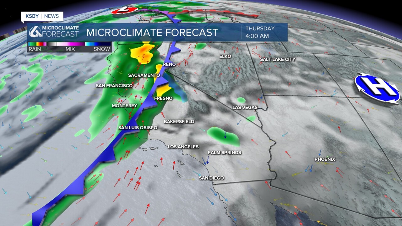
The heaviest rain is expected Thursday morning into the mid-afternoon. From there, lingering rain will continue through the day and even into Friday. At that point, a secondary front will move in and bring us another round of rain. That one will be less intense but will still bring us some more accumulations.
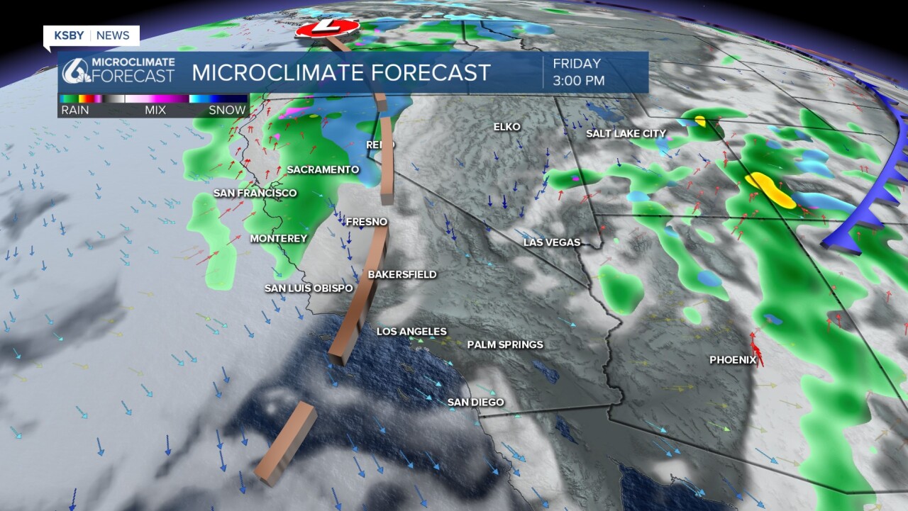
I think it is a little too early to talk about rain totals, but this storm has the potential to be quite large. A little extra warning is worth it.
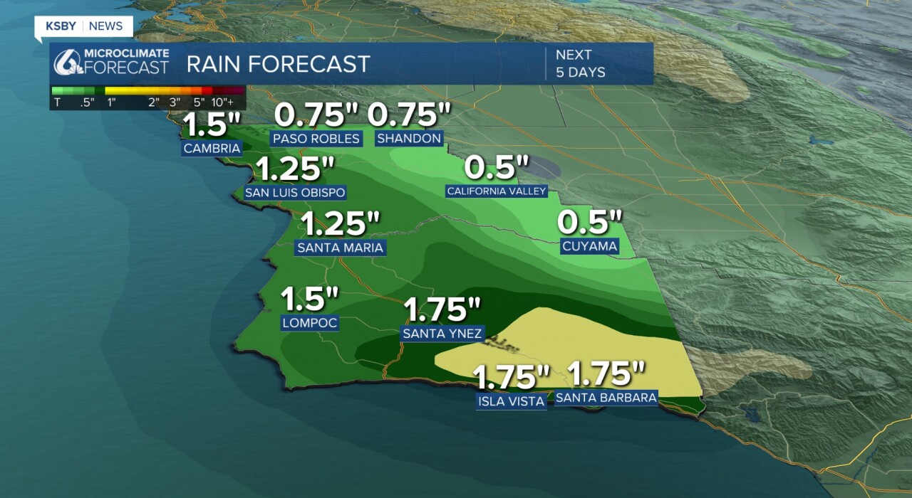
Higher elevations will pick up more rain, with the ridge tops picking up double the valleys. On the whole, most spots will see 1.25" to 1.5" of rain. Interior valleys will be closer to a half inch. As a quick disclaimer, this is likely to change slightly as the storm gets closer.
As I have shown in this article already, this storm will span several days and bring significant rain. I really like how it is explained in this graphic from the National Weather Service.

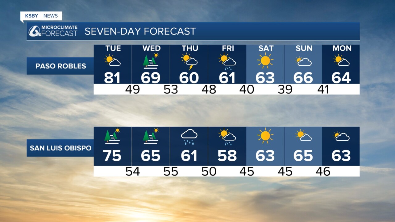
Here is what all of that looks like in a 7-day forecast.

Have a wonderful week, Central Coast! I will bring you the latest on our coming storm, on air and online throughout the week.
-Vivian
