

It was a hot one across the region on Tuesday, and there is a lot more heat to come. Let's dive right in!
Tuesday, a high-pressure system that has been sitting in the desert southwest slowly started to push west. This means skyrocketing temps are on the way, plus some fire weather concern.

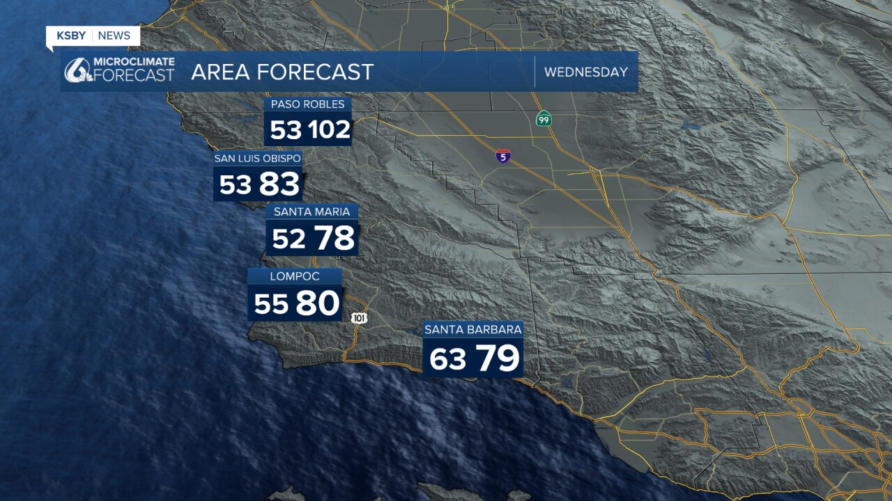
Here is a look at the high temperatures that Tuesday brought us.

Gusty winds were also a big part of our story on Tuesday. As we move towards sunset, those winds will focus in on the south coast, bringing gusts up to 45 mph. Because of that, there is a wind advisory in place for the south coast through early Wednesday morning.

Wednesday will kick off clear once again as the marine layer stays banished offshore. That will kick off a warm day where highs will soar to 10 degrees warmer than normal for this time of the year.
Into the latter half of the week, the high pressure will strengthen and perpetuate the warming trend. The combination of limited marine influence, gusty offshore winds, and uninterrupted sunshine will skyrocket the temps. The heat peaks on Thursday and will take a few days to ramp down. Here is a look at the 7-day forecast.


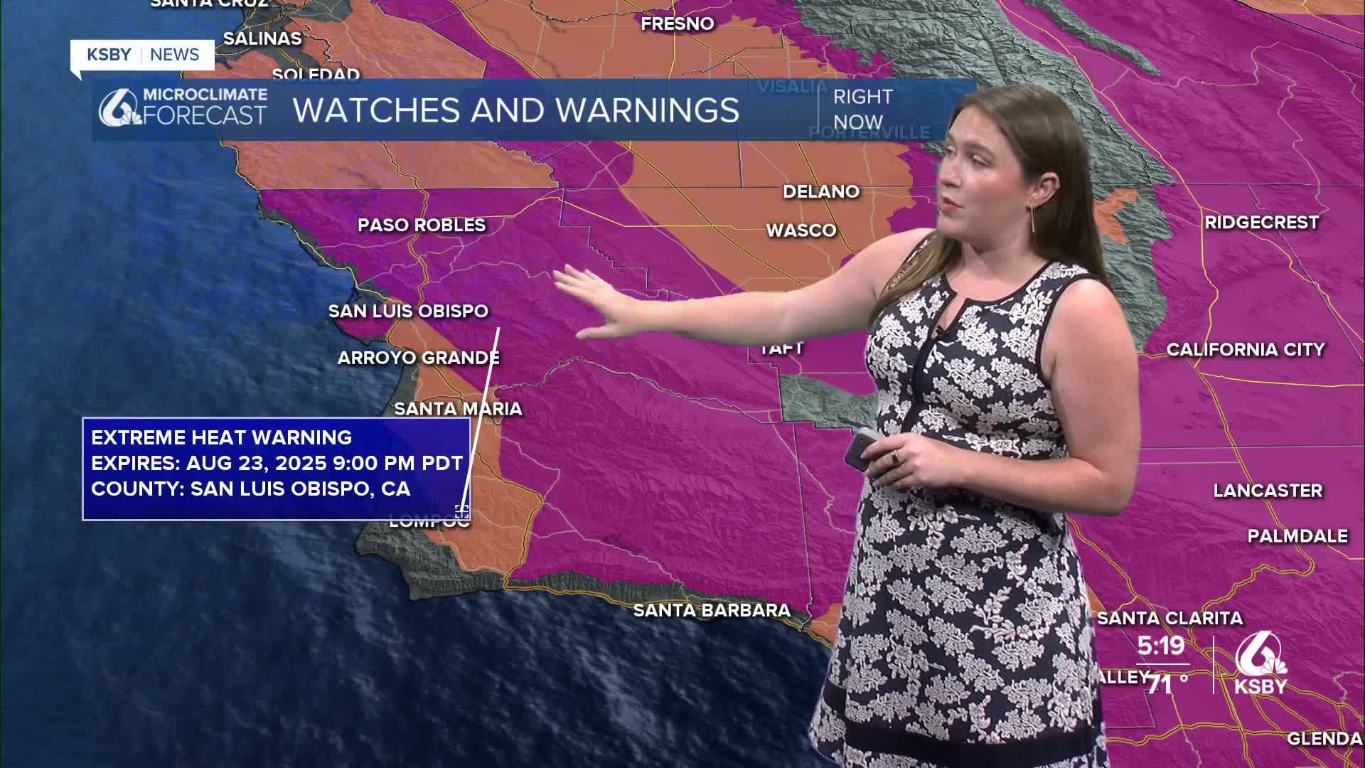
Those high temperatures have prompted an Extreme Heat Warning for the interiors of San Luis Obispo and Santa Barbara counties through Saturday evening. That is an upgrade from the watch that was in place on Monday. Temps upwards of 105° are expected for that area. Additionally, a high heat advisory has been issued for the coastal valleys through Friday night. Temps upwards of 90° are expected in this region.

Be sure to stay hydrated, limit exposure to heat during the warmest hours, and check in on vulnerable people in our communities.
The heat will combine with low humidity and the aforementioned winds to increase fire weather concerns. There is a Fire Weather Watch in place for the interiors of Santa Barbara County and the southern interiors of San Luis Obispo County through Sunday night. This does include the Gifford Fire burn zone. I will keep a close eye on this concern.

Late next week, the temps will start to cool as the pattern is broken up. The good news is cooler temps, the bad news is thunderstorm chances bring risk of dry lightning to the region Friday through Sunday. This thunderstorm risk isn't close enough for much detail, but we will stay on the far NW side of the storms. I'll bring you updates as they become available.
Have a wonderful week!
-Vivian
