

Good morning, Central Coast, and happy St. Patrick's Day!

As we head into another day of record warmth, we have some (thankfully) cooler morning temps. Open those windows, let the cooler air in before the heat of the day causes concern.
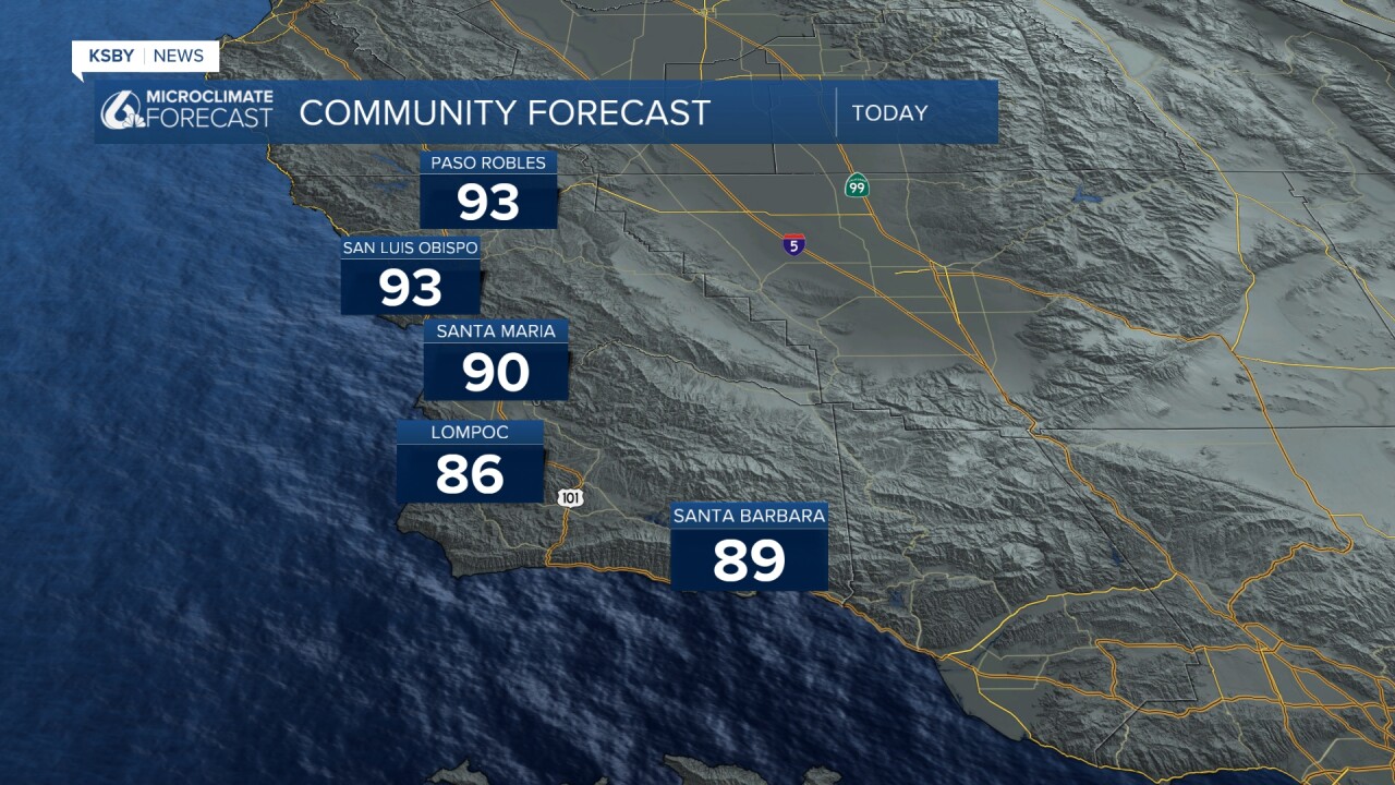
Here are the temps as of 6:45 a.m.

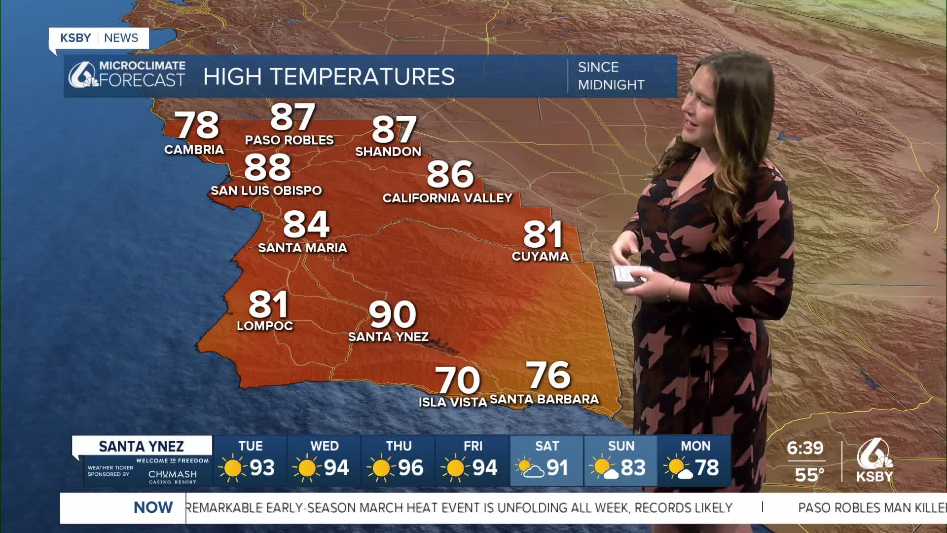
Highs today will soar into the low 90s across much of the region. Here is a look at the high temperatures we can expect for today.
For a little context, daytime highs in mid-March are typically around 66 degrees. These highs will set record highs for both daily records and monthly records by late this week.
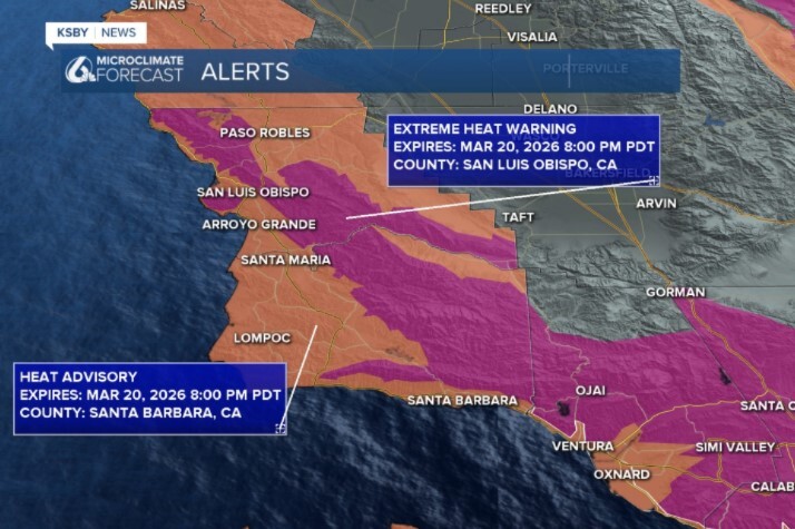
All of this heat is concerning and has prompted an extreme heat warning for the highest elevations across the region, as well as a heat advisory for the remainder of the Central Coast. ALL communities are under heat alerts through 8 p.m. Friday.
This week, the high pressure will just stick around and increase temperatures through the week.

Here is a look at the extended forecast.
I have shaded all temperatures on the 7-day forecast that, if reached, will set new record high temperatures for the region. As you can see below...there is a lot of red.


By the end of the week and into the weekend, the high pressure will have moved east enough to allow some marine air back to the region. That will bring slightly cooler conditions into the weekend. Still well above normal but no longer record-breaking.
Into next week, high temps will still be the story, but thankfully, it will be more comfortable.
Have a wonderful day, Central Coast!
-Vivian
