

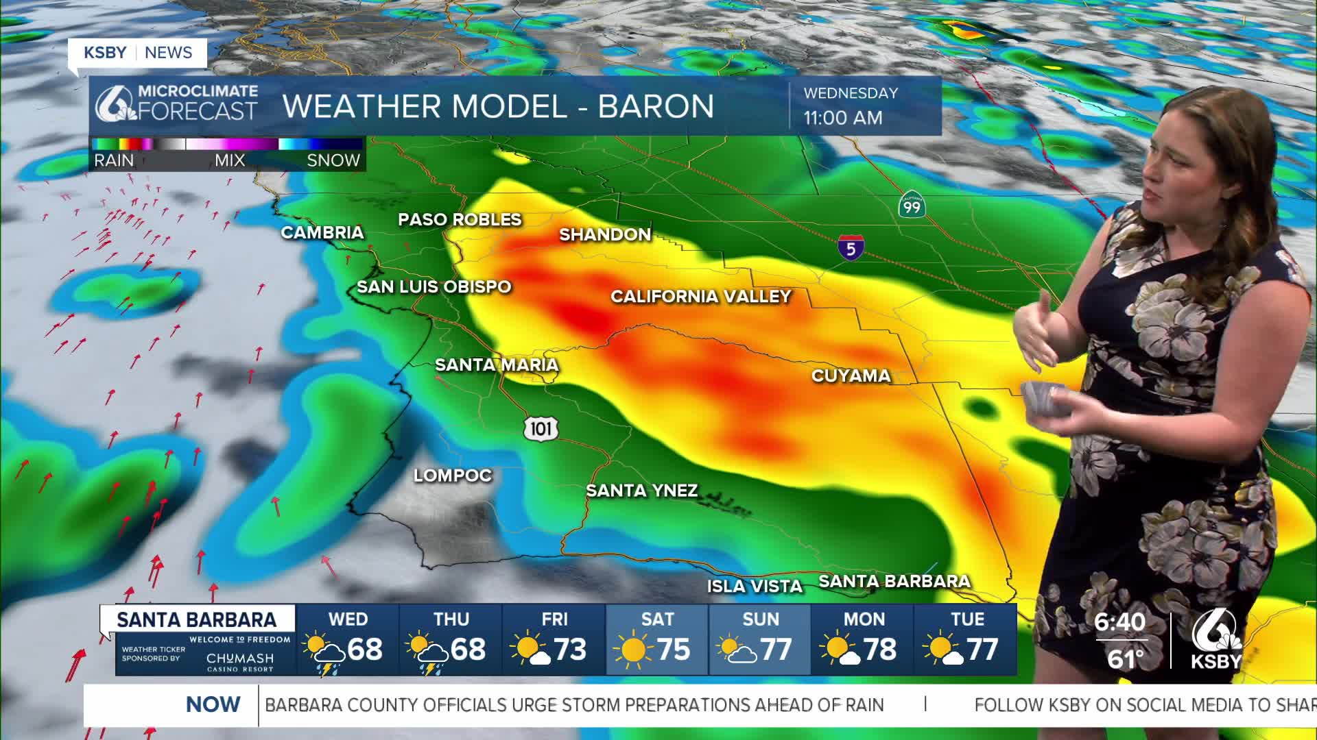


Good morning, Central Coast!
Rain is here! Before I dive into the forecast, here are a few links I find helpful to have on hand.
- Interactive Radar
- CHP Incident Dashboard
- PG&E Outage Map
- SLOCAL Edison Outage Map
- Rainfall accumulation map
I will update this article throughout the day with additional information. Check back in for updates!
Rainfall has begun across the region, with showers starting along the Gaviota coastline and moving north through the morning.
This is our first major (over 0.25") system for the region since May 28th. In the time since that system, a lot of oil has accumulated on roadways. Within the first hours of this storm, roads will be very slick. Take caution.
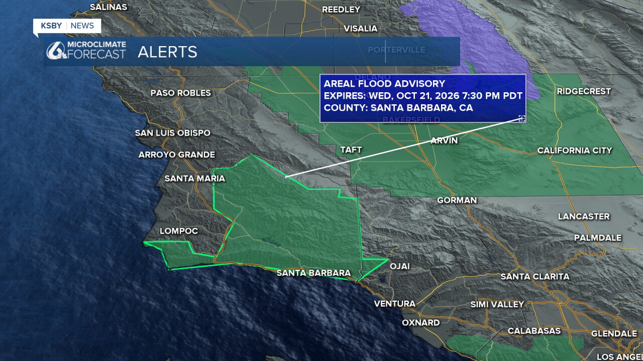
There is concern for flooding from this system, especially for our South Coast. An Areal Flood Advisory is in place for the South Coast and interiors of Santa Barbara County through 7:30 p.m. Wednesday. There is also a Flood Watch in place for the same area through 4 p.m. Thursday.
Timing out what we can expect. Through the early morning hours, rain will spread out from the south and bring some bands of heavy rain to the south coast.
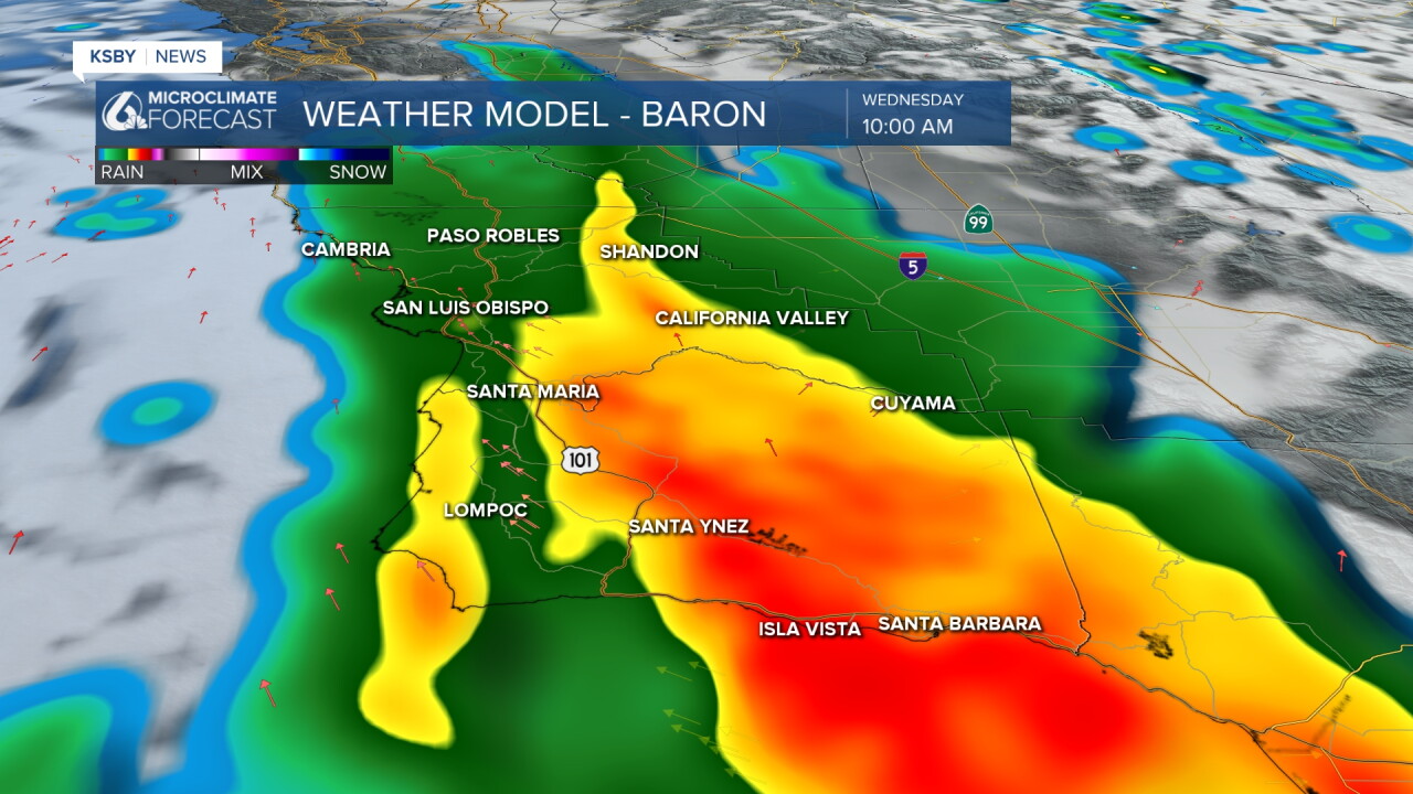
This will bring some of the flood risks as heavy rain lasts for a while on the south coast. Through the morning, we will see this core of the rain move north. By noon, the band of heaviest rain will reach the interior valleys.
There is a small break in the rain for the afternoon between the two low-pressure systems. This evening into the night though, another band of heavy rain is expected. This is where another chance for thunderstorms moves in. Take caution within this band as well.
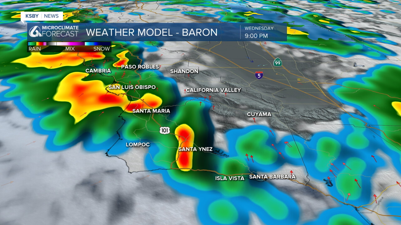
Once that second band moves though the storm will shift significantly and leave us with some scattered light showers through Thursday and even into very early Friday morning.
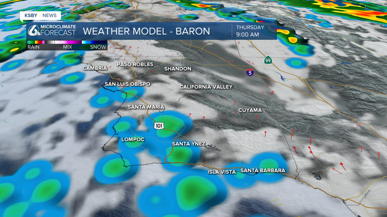
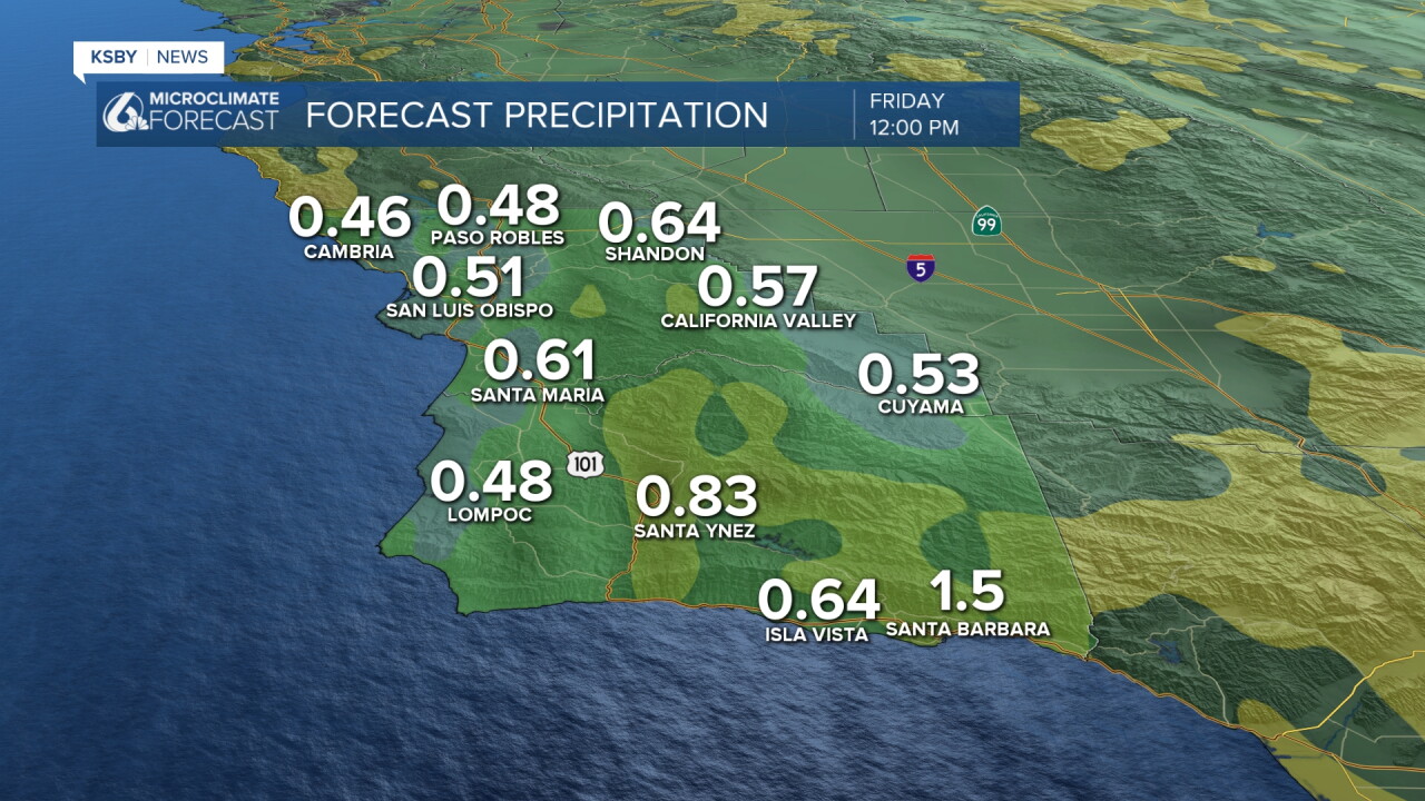
Accumulation-wise, we can expect over an inch on the south coast, with half to three-quarters of an inch expected for our coastal valleys through the end of the storm.
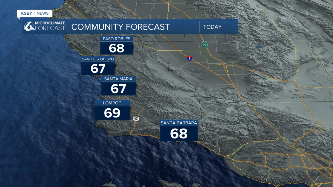
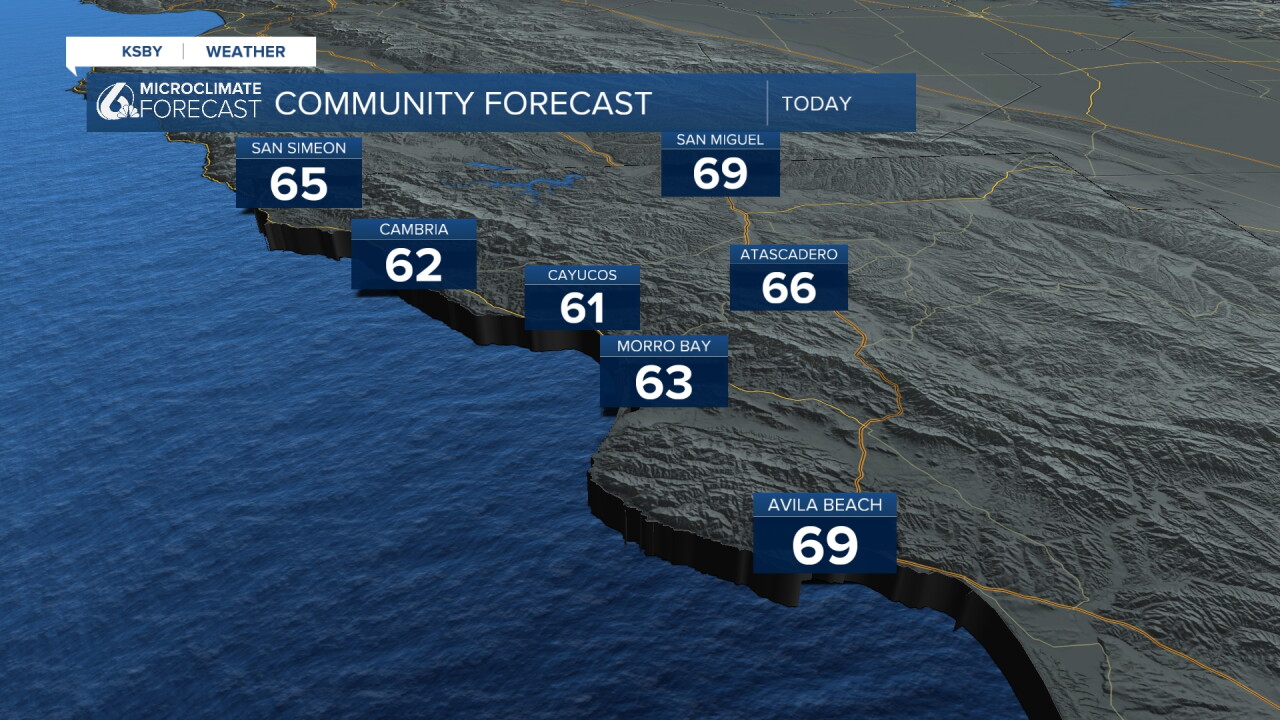
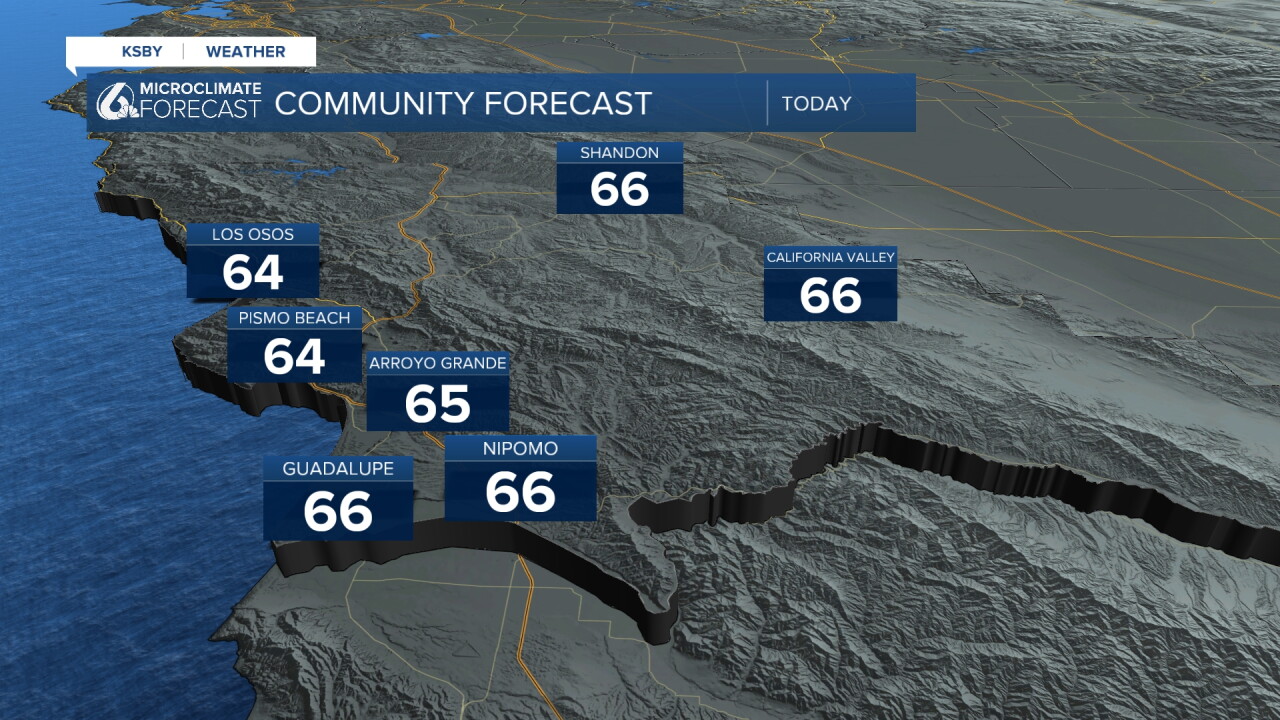
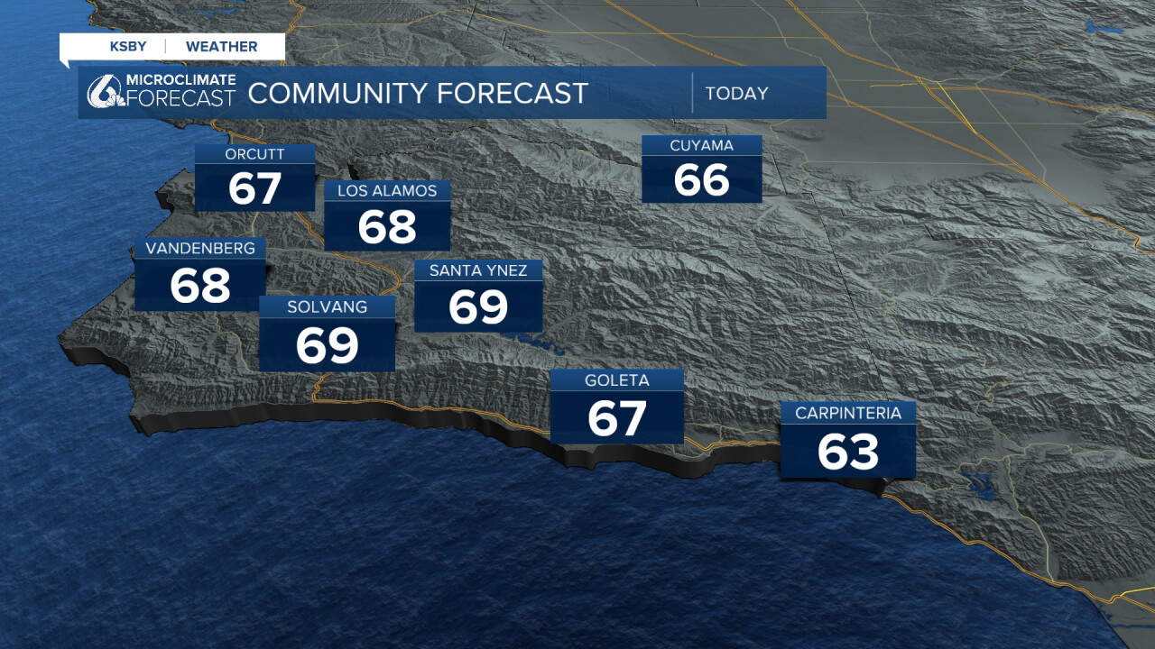
Temperatures today will be nothing special; high temps will be in the upper 60s for the region. Here is a look!
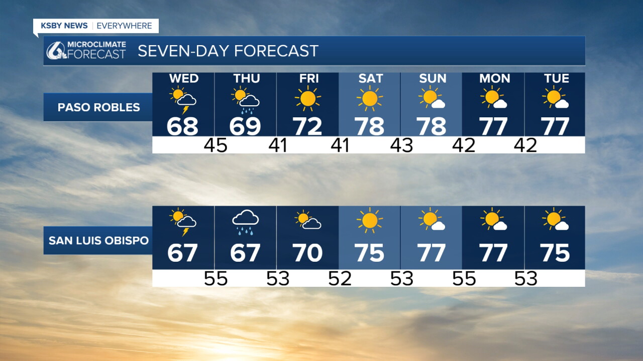
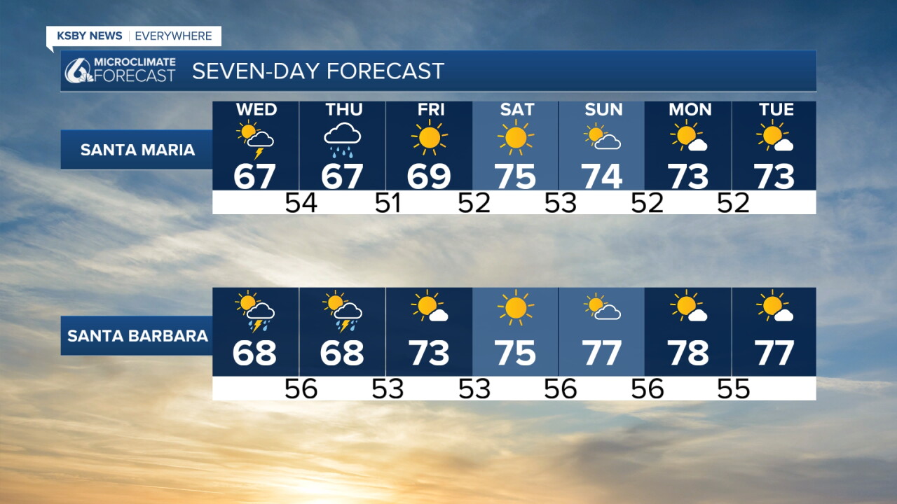
Looking farther afield. Once the storms clear by Friday morning, we will see temps warming slightly with highs in the 70s across the region for the weekend and into next week. It will be a great weekend for all of the fall themed events across the Central Coast!
Have a great day, Central Coast! Stay weather-aware and take caution as this storm moves through.
-Vivian
