

Good morning, Central Coast!
It was a downright soggy weekend as a mess of systems pushed through the region. The south coast picked up over 11 inches of rain and most other spots were measuring several inches of rain. We aren't done yet though. To kick off Monday morning a strong cold front is pressing into the region and bringing heavy rain and strong winds.
Before I dive in to the forecast, here are a few links that I find helpful to have on hand through a storm.

Thanks to this cold front we have a few alerts in place. Starting off with a wind advisory, in place for most of the region (except for the SB County south coast) in place through noon. Gusts up to 50 mph are possible as the cold front moves overhead.
Next is a flooding advisory in place for all of our coastal valleys and western beaches through 9:15 a.m. Monday morning. Flooding is possible due to the ongoing heavy rain paired with the excessive rainfall from this weekend. Low lying and poor drainage areas could see some localized flooding. Don't drive into standing water, it may be deeper than it appears.
There is also a hig surf advisory in place for all of our western beaches from 2 p.m. Monday afternoon through 10 a.m. Tuesday. Breaking waves 7 to 11 ft with localizes sets to 13 ft asre possible with rip current risk as well. Staying on the topic of our waters, it is always a good idea to stay out of the waters for three days after a storm to avoid contaminants in runoff.
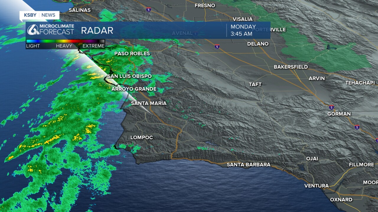
Here is what the radar looked like as of 3:45 a.m. through the morning it will move south and bring heavy rainfall.
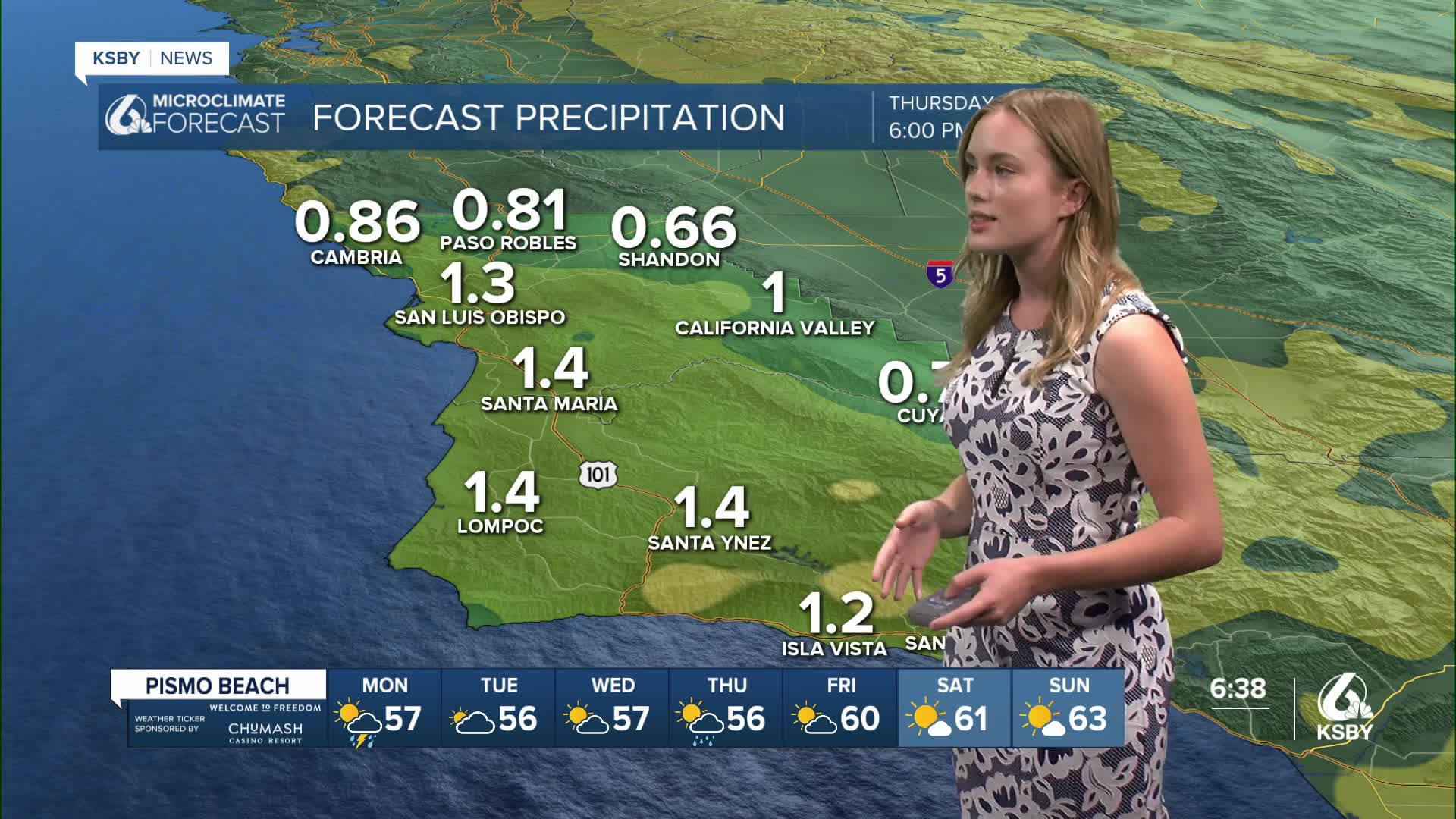
As the cold front moves in we can expect heavy rain, most spots can expect over an inch more rain with over an 1.5" falling along the south coast by the end of today. Most of that will fall in a few small bands but lingering showers are expected through Monday.
We can also expect temps to be on the cool side, most spots will be within a degree or two of 60.
Keep an eye out for a break in the rain that's expected by Tuesday. The interiors and south coast is set to see cloudy, but drier skies by this evening while the western beaches and coastal valleys get a little more rain before a two day break in the rain.

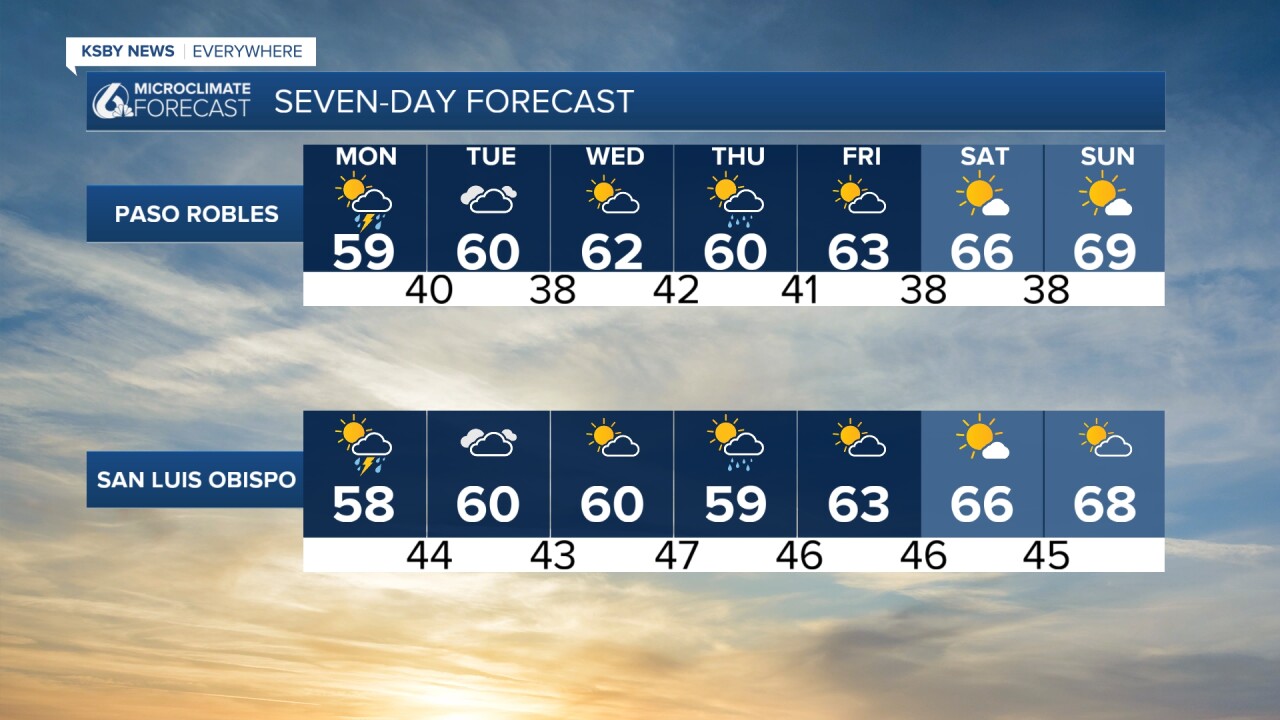
A slight bump in temperatures is on the way for Tuesday and Wednesday but the rain is set to make a brief comeback on Thursday across the Central Coast. This will come in the form of a cold front pressing in from the north. Thankfully it will be shorter lived that what we saw this weekend, and will give way to clearing skies and warmer weather into the weekend.
As always, make sure you are taking extra time today and Thursday to get where you're going. Stay safe, stay dry and have an amazing Monday!
