

Happy Monday, Central Coast!
The storm that I have been chatting about for a full week is finally here!
Before I dive into the forecast, here are a few links that I find helpful to have on hand during these storms.
As the evening goes on, I will update this story with updates. Check back for the latest information overnight.
——— Update 6:24 a.m. from Izzy Romero ———
Flash flood warning is cancelled for southwestern Santa Barbara County. The heavy rain has ended. Please continue to heed the remaining road closures.
——— Update 6:00 a.m. from Izzy Romero ———
Severe thunderstorm watch has been canceled for the cities of Goleta, Lompoc, Santa Barbara, and Santa Maria.
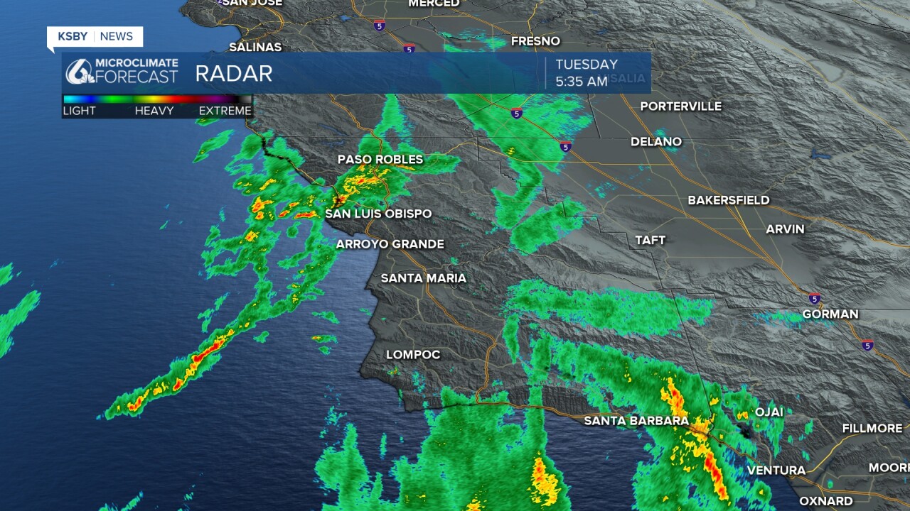
——— Update 5:35 a.m. from Izzy Romero ———
Another severe thunderstorm warning has been issued for central Santa Barbara County through 6:15 a.m. Traveling 7 miles north of Summerland, or 8 miles northeast of Montecito, moving northeast at 15 mph. Expect gusts up to 50 mph.
——— Update 3:20 a.m. from Meteorologist Vivian Rennie ———
Another flash flood warning has been issued due to the line of strong storms passing through the region. This time it is for most of South Central Santa Barbara County, including the Lake Fire burn scar. Flash flooding of small creeks and streams as well as urban areas, highways and poor drainage areas. This will stay in effect through 8 a.m.

——— Update 3 a.m. from Meteorologist Vivian Rennie ———
A severe thunderstorm warning has been issued for the south central portion of Santa Barbara County, including Buellton, Solvang, Santa Ynez, Isla Vista, Goleta, the Santa Barbara Airport, Lake Cachuma and Gaviota State Park. This is in place through 4:30 a.m.
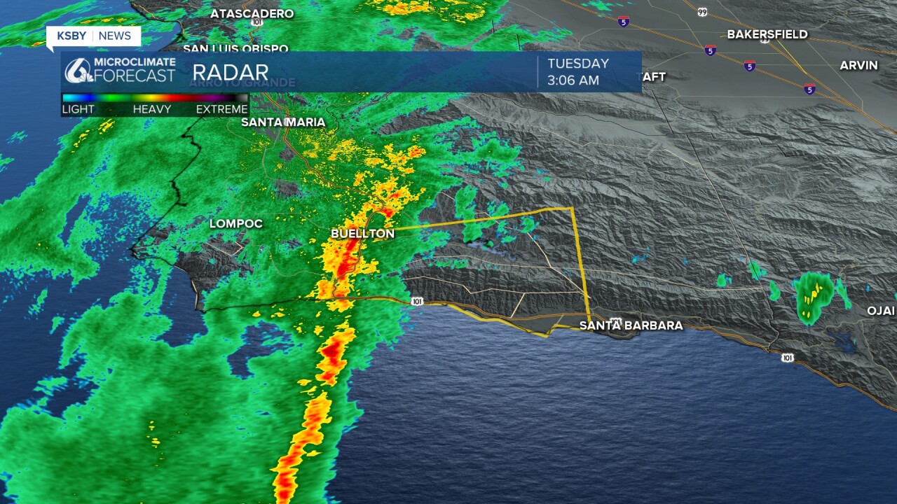
Strong winds up to 60 mph, heavy rain, and the chance for a brief weak tornado is possible. Stay aware as the storm pushes northeast moving at 10 mph.
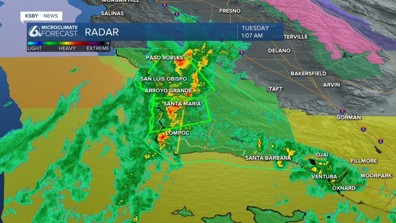
——— Update 1 a.m. ———
A flash flood warning has been issued for much of North Western Santa Barbara County. This will remain in place through 5 a.m. for communities including Santa Maria, Lompoc, Vandenberg, Orcutt, and Guadalupe. Heavy rain up to 0.4" in 15 minutes have been recorded. This is enough to cause flash flooding as the night goes on. This is likely in small creeks, streams, poor drainage and urban areas. Rock and mud slides can't be ruled out.

This is from the storm that is currently under a severe thunderstorm warning (see below update).
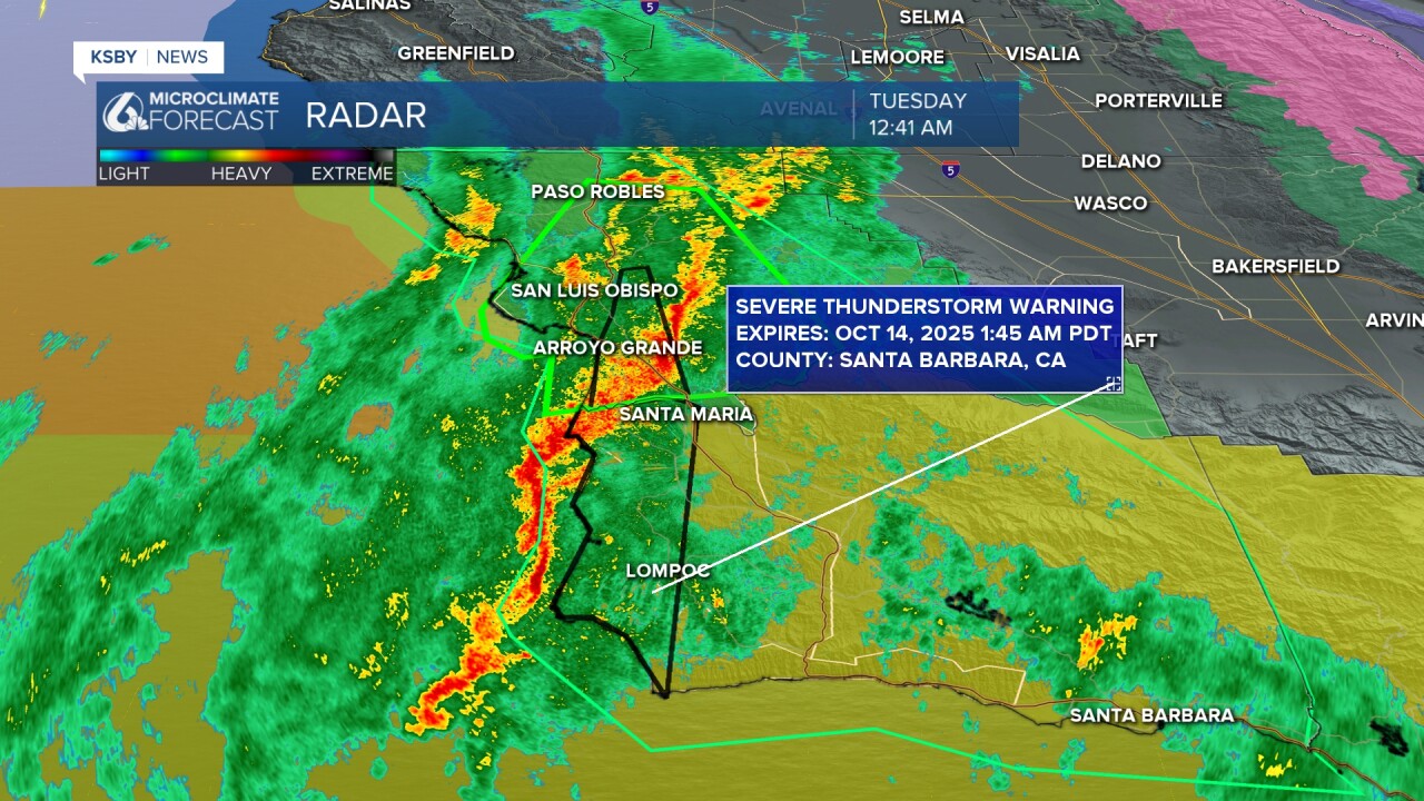
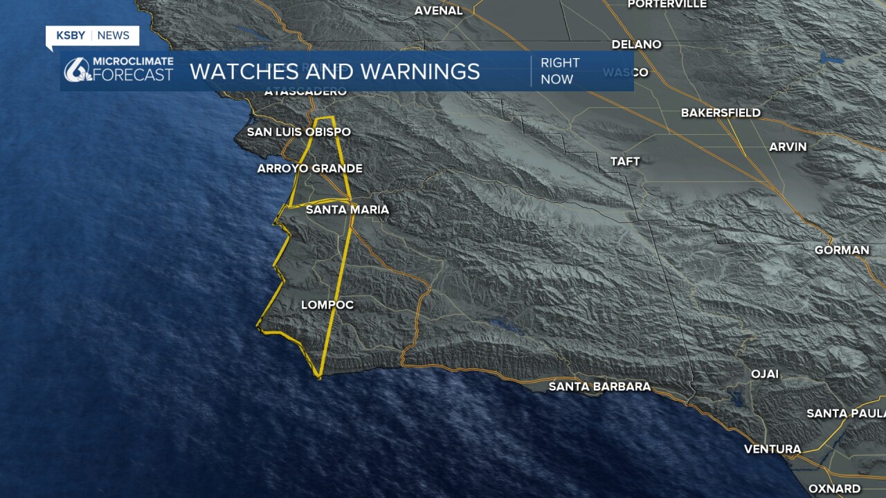
——— Update 12:45 a.m. ———
A severe thunderstorm warning has been issued for northwestern Santa Barbara County through 1:45 a.m. This includes Santa Maria, Lompoc, Vandenberg, Orcutt, Guadalupe, Vandenberg Village and Mission Hills.
60 mph wind gusts and heavy rain is expected. Damage to trees, roofs and siding is expected.
Remain alert for a possible weak isolated tornado.
Here is a look at the warning without the radar overlay.
——— Update 11:15 p.m. ———
The National Weather Service has issued a tornado warning for parts of San Luis Obispo County, including Cayucos, Morro Bay and Pismo Beach through 12:15 a.m.
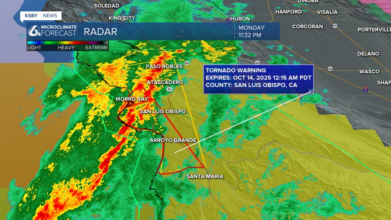
Get to an interior room in your home as the storm passes.
——— Update 10:30 p.m. ———
⚠️New Alerts⚠️
The cold front has arrived, and with it, new alerts and hazards.

The north coast has a strong storm moving through (I circled it in blue), prompting concern for winds up to 50 mph as well as flooding and the chance for a brief weak tornado. This line of storms will pass south overnight and is expected to bring these same concerns to the rest of the region.
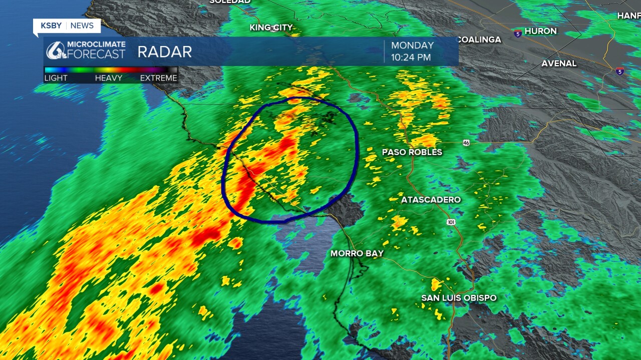
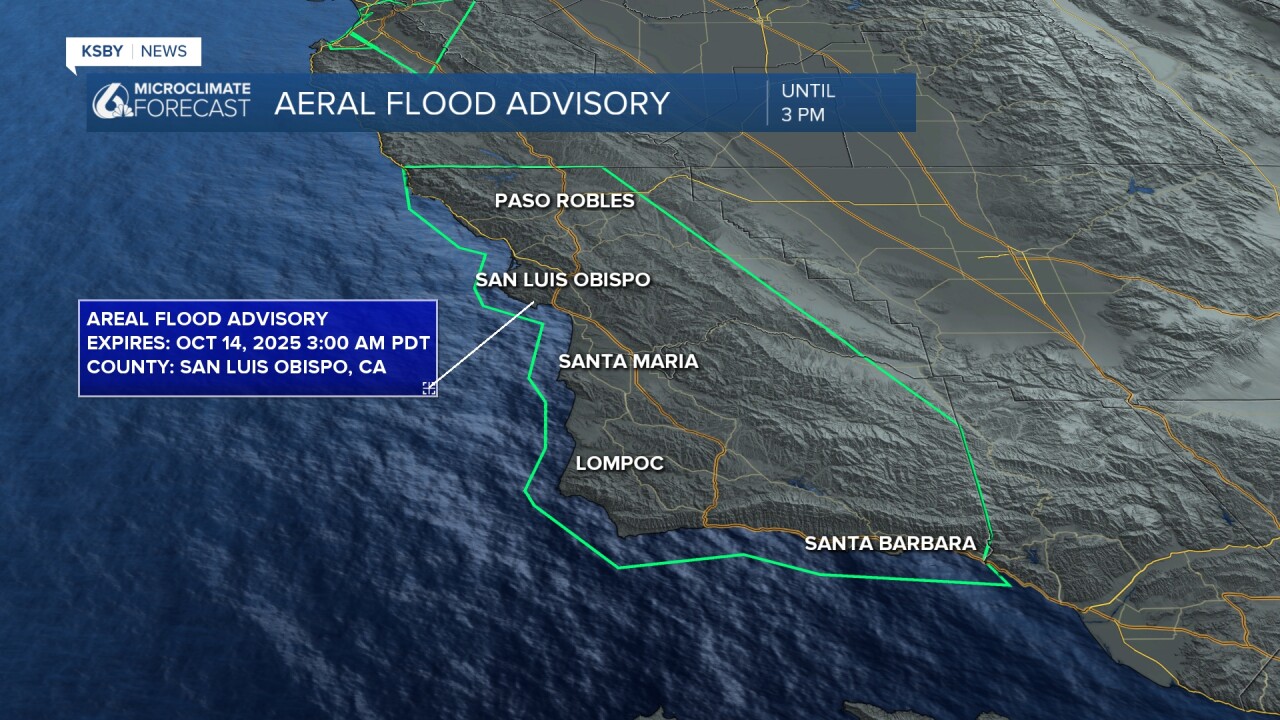
Additionally, all of the Central Coast is now under a Flood Advisory (the area in the green polygon) through 3 a.m. Minor flooding in low-lying and poor-drainage areas and water on roadways is expected.
Stay off the roads if possible.
———Storm Update 9:30 p.m. from Meteorologist Vivian Rennie ———
——— Original Article ———
Most of today was mild with clouds slowly increasing through the day. These clouds are the leading edge of our storm. Here is what is looks like on a satellite.

That cold-core low-pressure system is going to press south tonight and bring us some heavy rain. While it brings the rain, it will also drop temperatures and bring strong winds.
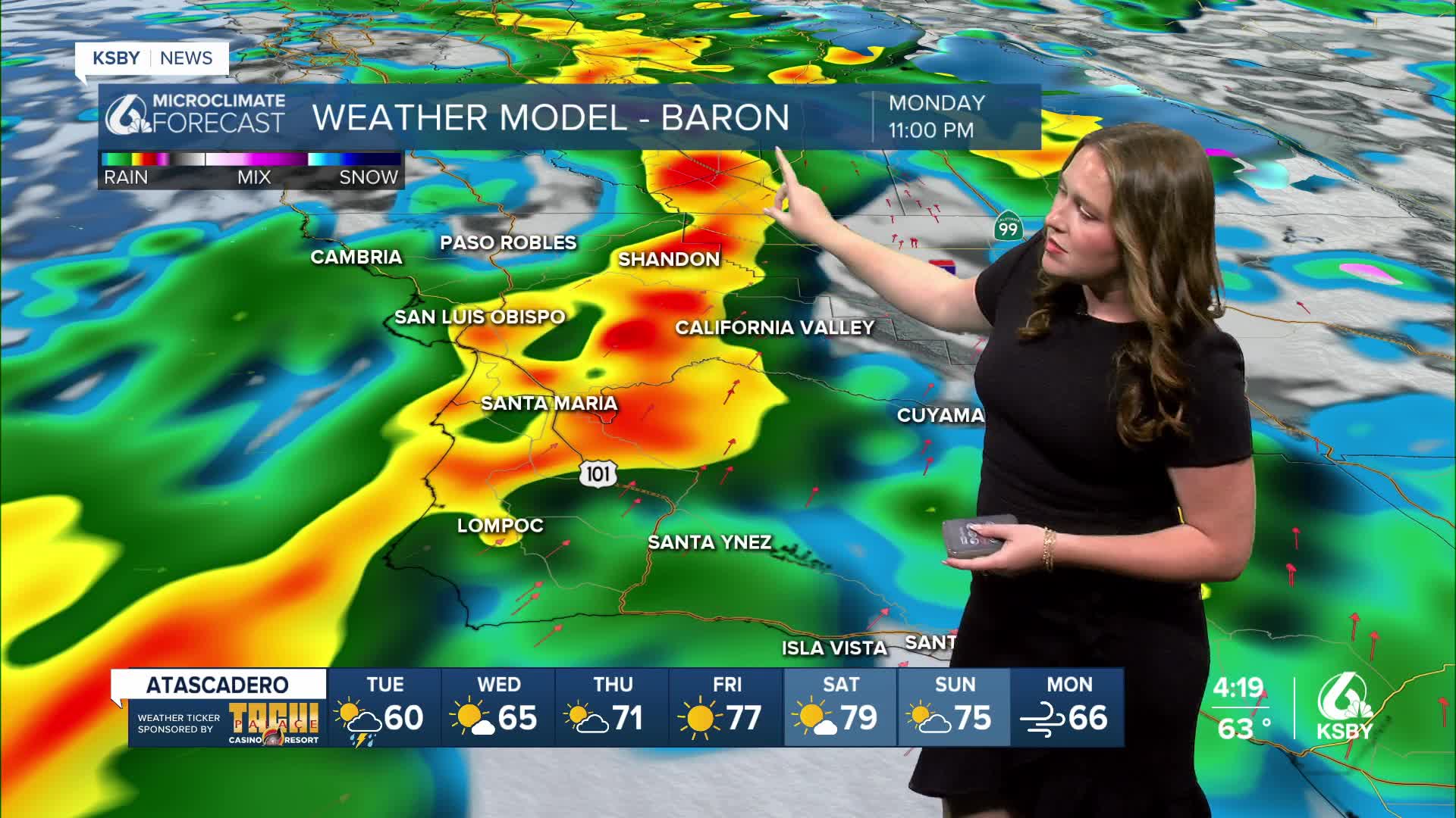
Timing out the system, we will start with light patchy rain on Monday afternoon, starting along the SLO county north coast and pushing southeast overnight. For the evening commute, some pockets of heavy rain will begin. Take it slow on the roads, especially during the first 15 minutes of rainfall.

Late tonight into early Tuesday the actual cold front will arrive and bring a band of heavy rain and stronger winds. This will be the "worst of it" with rain rates up to 0.5" an hour. This is also the core of when flooding is possible. Avoid driving overnight if you can.

Within the heaviest band of rain, there is the potential for some severe activity. Thunderstorms are possible and there is a small chance for a weak isolated tornado. I will keep a close eye on this chance, but it is not particularly likely.

Once the core front passes through, the storm will shift a little bit and bring patchy showers through the morning on Tuesday. These storms will become more widespread as the day goes on, eventually becoming isolated by the afternoon.
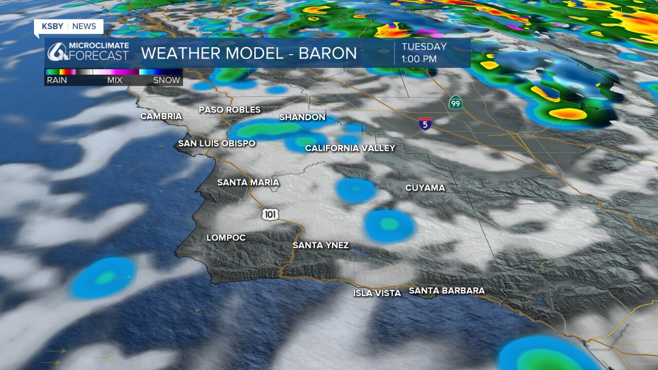
Expect rain totals to average about an inch. High elevation peaks and ridges in the Santa Lucia mountains and the Los Padres National Forrest are looking at the highest rain totals.

Alerts
- A flood watch has been issued for the areas around recent burn scars in San Luis Obispo and Santa Barbara counties. From this evening through Tuesday afternoon, there is the potential for brief heavy rainfall over local burn scars that may trigger hazardous and damaging flooding and debris flows. Flooding may also occur in poor drainage and urban areas. Low-water crossings may be flooded.

- A wind advisory is in place for a similar region. Gusts overnight may reach up to 50 mph with sustained winds around 25 mph. With the rain and with leaves still on trees, I expect some blown over trees as well as power outages.

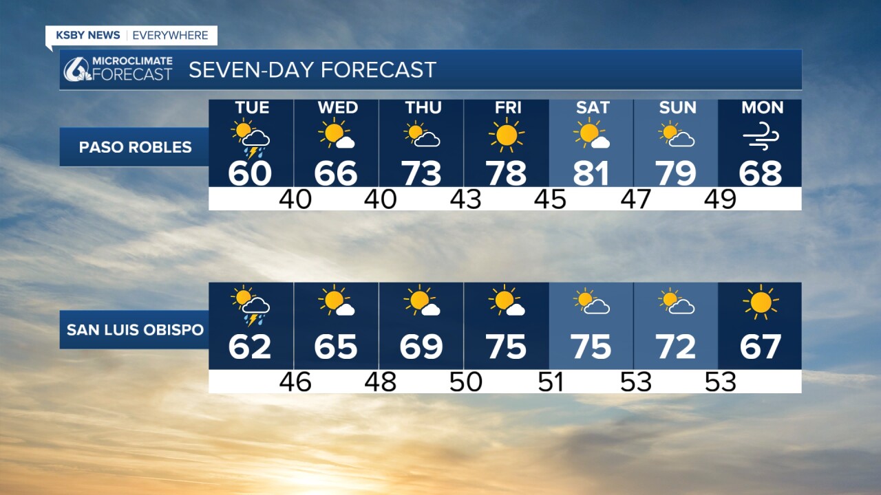
Following the storm, temperatures will be on the cooler side and will take a while to recover fully. Here is a look at the temps for Tuesday.

Thankfully, sunshine will return quickly with highs climbing into the weekend.
Here is a look at our 7-day forecast!

Have a great evening, Central Coast! I will update the top of this article with the latest information overnight.
-Vivian
