

Happy Wednesday morning, Central Coast!
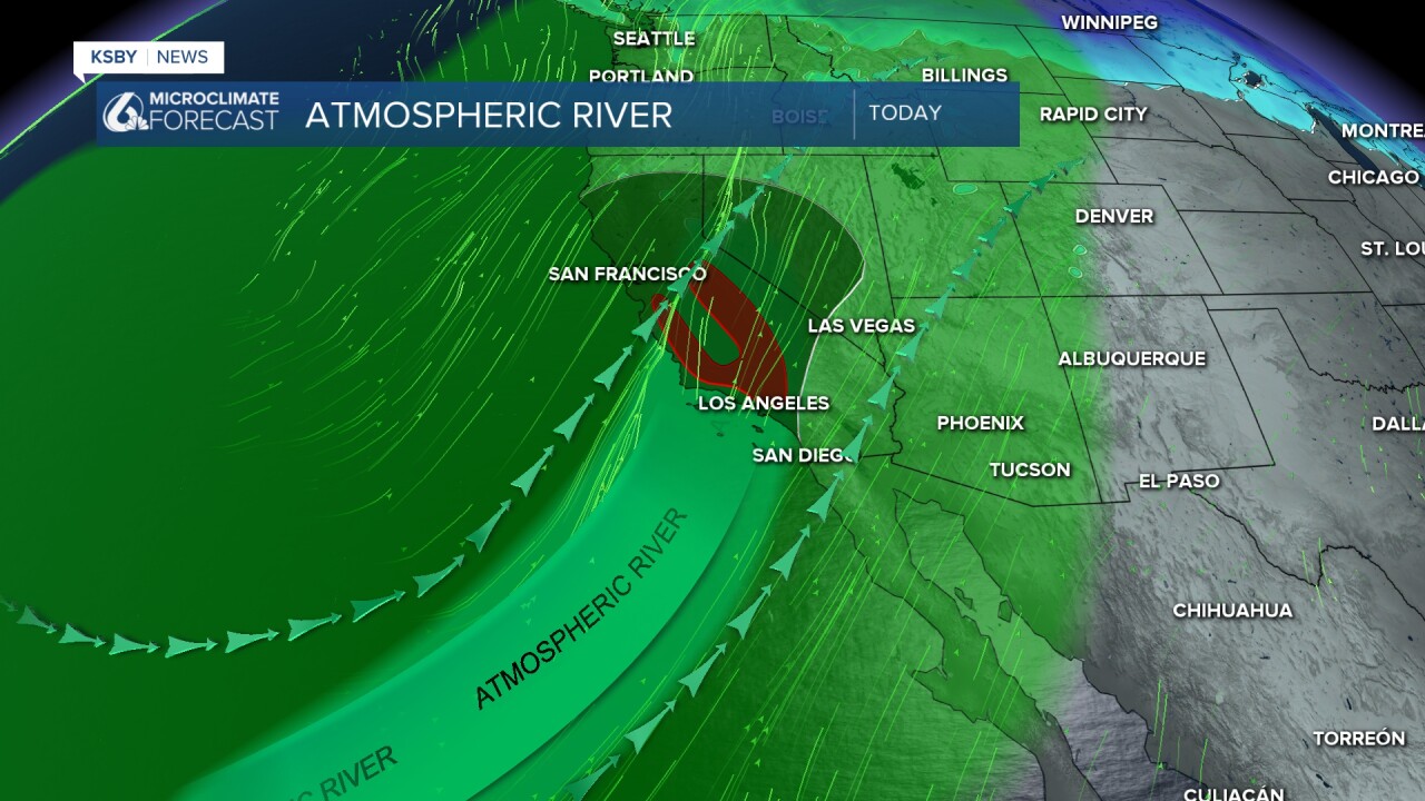
Late Tuesday night the strong atmospheric river that we have been tracking arrived. Overnight heavy rain has caused significant concern prompting flash flood warnings. Before I get into the details, here are a few links I find helpful to have on hand.
- Radar
- PG&E Outage Map
- SoCal Edison Outage Map
- Interactive Rain Totals Map
- CHP Incident Information Page
In storms like this, it is best to have multiple ways to receive storm updates. I recommend our KSBY Microclimate Weather App. It will automatically send a notification if severe weather alerts are in place.
——— 9:15 a.m. update from Meteorologist Vivian Rennie——-
All three flash flood warnings in place in southern Santa Barbara County have been extended until Noon.

You can see the next band of heavy rain just to our south. That will arrive and bring much more rain to the south coast over the next few hours. I have attached a snapshot of the rain totals we have received so far in this area.

Additionally, there are reports of flooding across the region. This has closed highway 1 near Orcutt between Solomon Rd. and Black Rd. Until further notice.
In #SantaBarbara County: Highway 1 near Orcutt is closed in both directions due to flooding between Solomon Rd. and Black Rd. No estimate for reopening. Please remember to adjust your driving for weather conditions, slow down, and maintain space between vehicles in front of you. pic.twitter.com/w6YoHPWd9r
— Caltrans Central Coast (District 5) (@CaltransD5) December 24, 2025
——— Original Article———
Starting with the flash flood warnings. There are three warnings in place for Santa Barbara County due to the risk for flash flooding caused by all that heavy rain overnight.
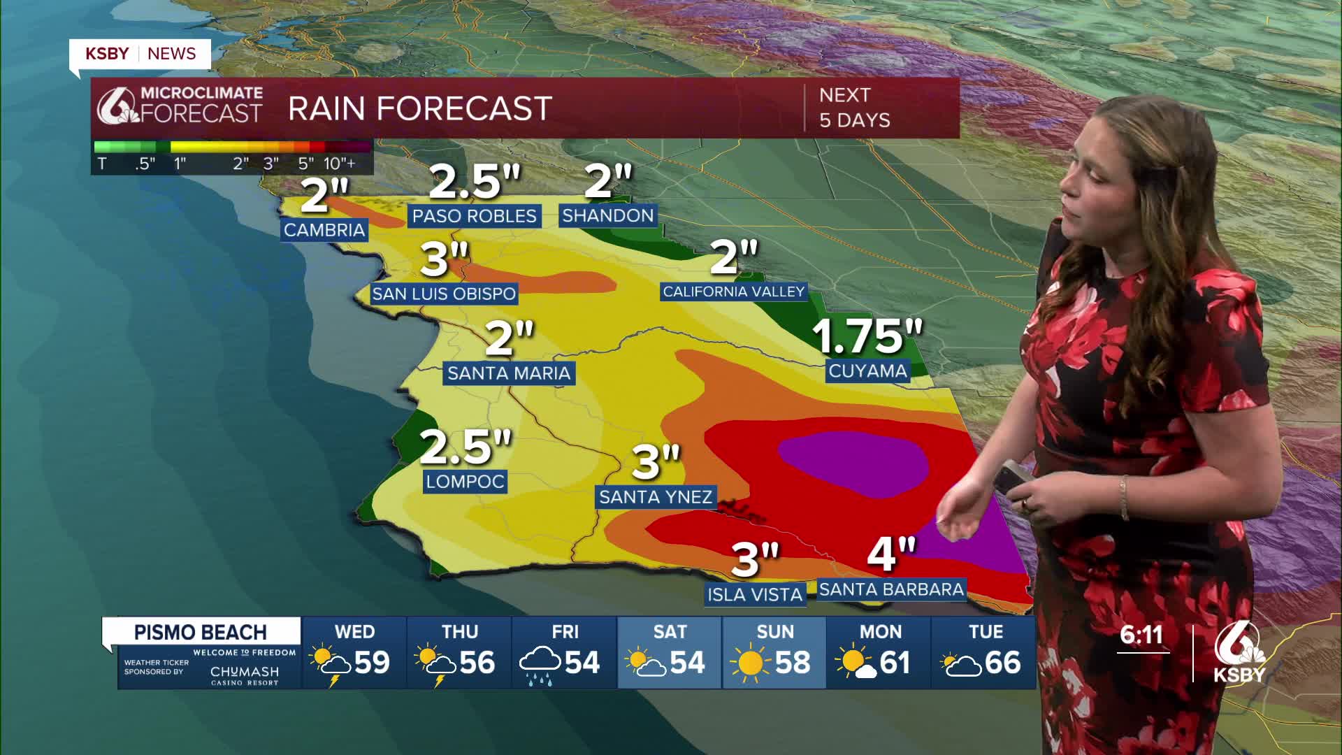
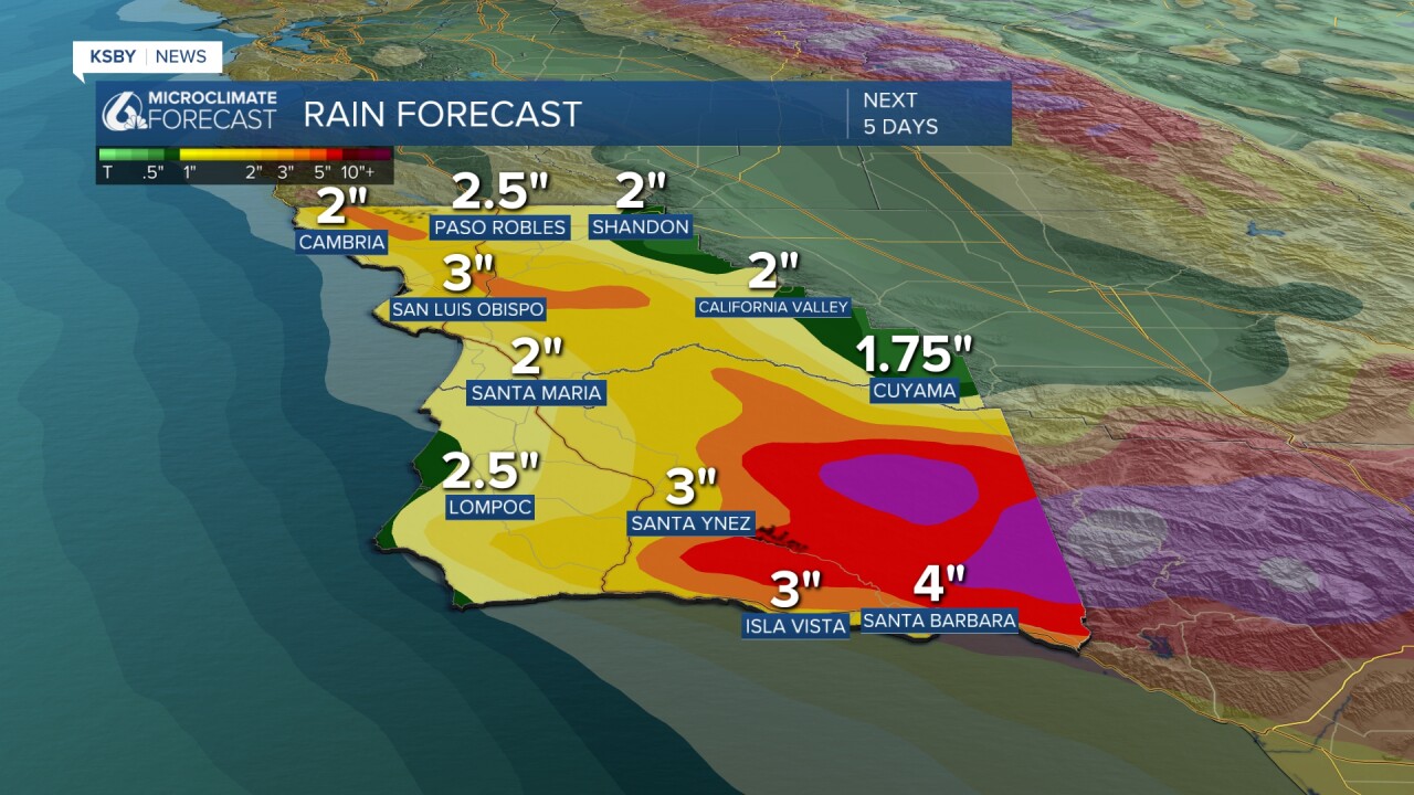
Between 1.5" and 5.5" of rain has already fallen in these areas, with several more inches expected this morning.

Let's dive into the details! The strong atmospheric river that we have been tracking moved onshore overnight and will continue to bring significant rain for the next few days.
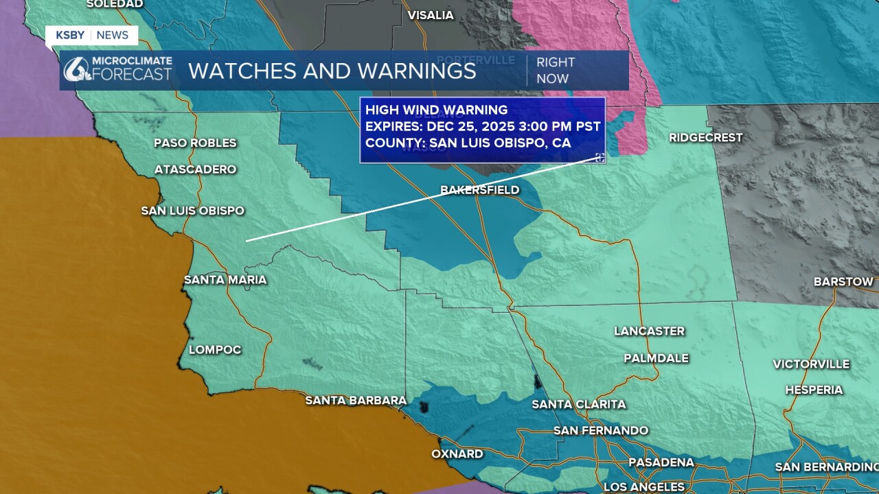
Along with heavy rain the winds are still a concern. South/southeast winds 30-50 mph with damaging wind gusts up to 70 mph are expected. The high wind warning is in place from noon Tuesday until 3 p.m. Friday.
The heavy rain is causing active concern for flooding and rock/mudslides.

That danger has put us in the moderate risk (4/5 on the scale) for excessive and problematic rainfall for the South Coast.

Additionally, there is enough rotation (vorticity) in our atmosphere with these storms to create the risk for severe weather. Today and Christmas Day will all have a small chance for weak tornadoes as well as water/land spouts. That risk is small but not out of the question.

Additionally, this storm is riling up our seas. There is a surf advisory in place for all of our beaches through 11 a.m. Saturday. Large breaking waves 10-15 ft and dangerous rip current risk are expected.

By later on this morning, the initial front will have passed, but the storm is still far from over. The storm on Wednesday, Thursday, and Friday will all be messy with significant rain and more winds, severe weather threats, and potential flooding.
Here is a look at how much rain we have left in the system.
Here is what all of that looks like on your 7-day forecast!


I hope everyone has a happy and safe Christmas Eve! Stay weather aware, Central Coast!
-Vivian
