

Good morning, Central Coast!
As we head into Thursday morning, the heavy rain is back. A cold front is pushing through the region and bringing more heavy rain and potential flooding to the region.
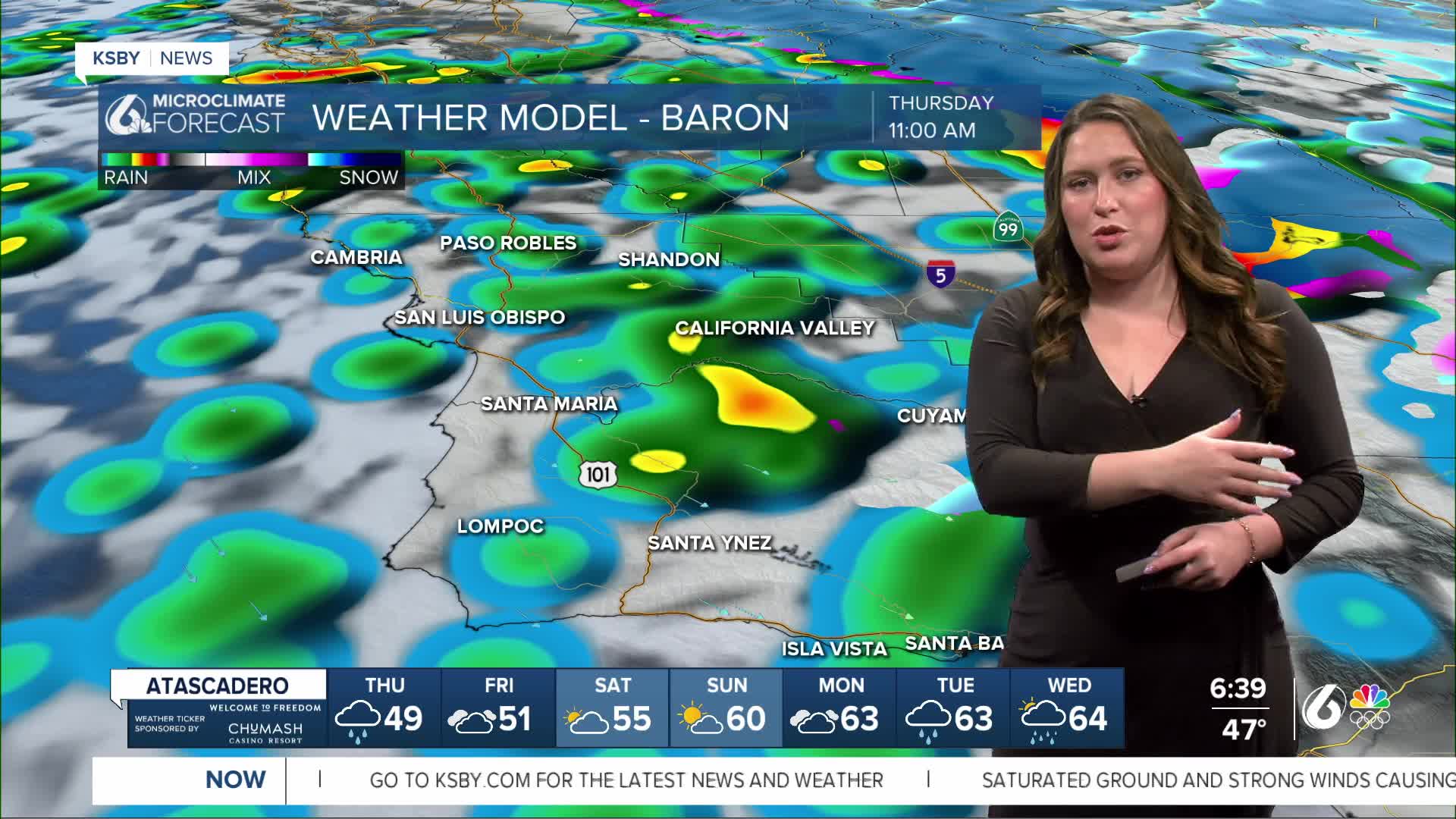
Here is a look at your interactive radar.

As the morning progresses, the cold front will continue to push south and bring heavy rain to all communities through the morning. The heaviest rain will be right along the front and will move through quite quickly. While it crosses your community, please try to stay off the roads.
A Flood Advisory has been issued for much of the region (from San Luis Obispo to Lompoc) through 9:15 a.m. this morning. Localized small stream and urban flooding is expected.

Similar conditions are expected for the south coast as the front passes through. Even once the rain stops, we can expect ongoing ponding on roadways and saturated soil tables.
Once it pushes south of the region into the mid-morning hours, we will see a shift to a separate portion of the storm. Scattered showers will be widespread through the afternoon into the evening.
They will become fewer and farther between as the day goes on. Tonight for the Lunar New Year celebration in San Luis Obispo, this evening there will still be rain chances, although it will not be a washout.
Temps today will be cool once again. Highs in the 50s.

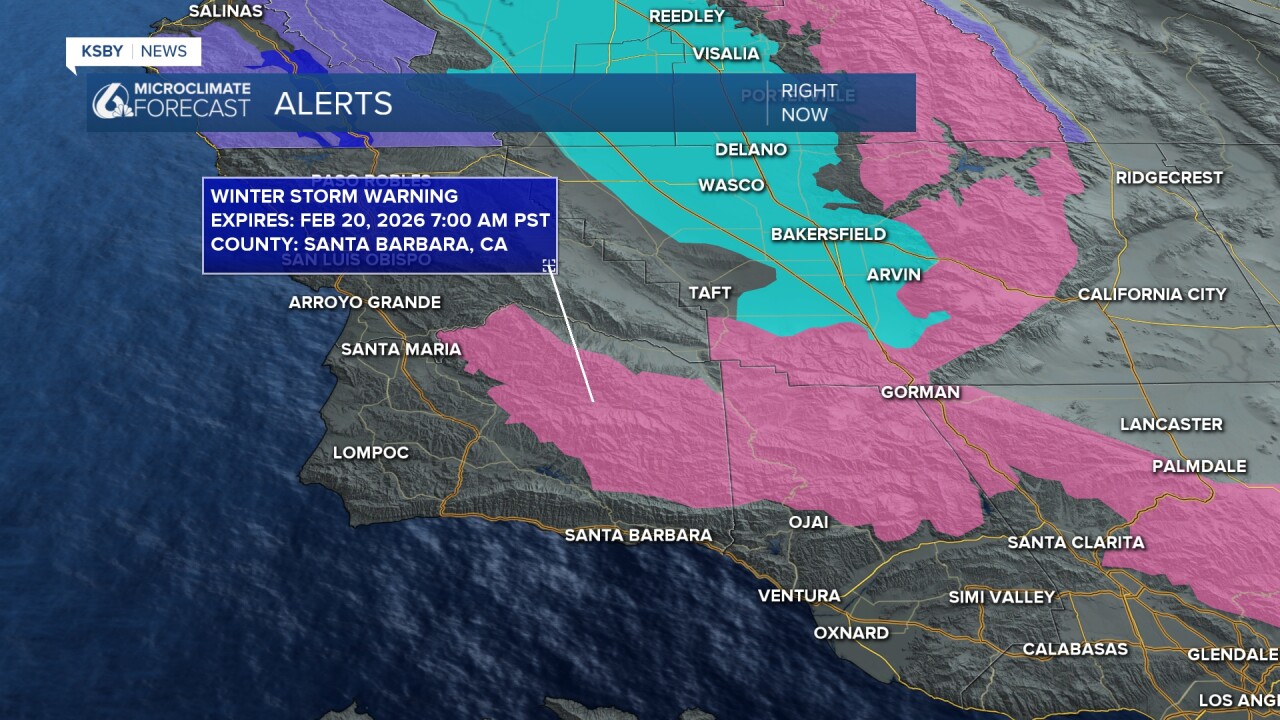
Winds will once again be gusty up to 40 mph on the coast and in the valleys, but in the mountains, gusts of 50 to 65 mph are possible. This has prompted several alerts.

There are also concerns for accumulating snowfall, due to this there is a winter storm warning in place through 7 a.m. Friday.
Finally, there is a high surf advisory in place through 10 p.m. Friday. That being said, even when that expires, it is best to avoid the ocean for at least three days after a major storm. Runoff into the water may be hazardous.

Rainfall totals are forecast to range from a quarter to a half inch for most coasts and valleys, and most of it falling within the thin band of rain this morning, with up to an inch in the mountains
Friday looks dry but very cool. Depending on how quickly skies clear and winds diminish overnight, some valley locations could see morning frost or even freezing temperatures.
Saturday is shaping up to be the nicest day of next week. A weak ridge will bring mostly sunny skies, dry conditions, and a warming trend. Highs should be reaching the 60s.


Another Gulf of Alaska system will drop into the Pacific Northwest on Sunday, bringing renewed chances of rain to the Central Coast. Forecast models vary quite a bit, so rain chances remain from Sunday through Tuesday. At this point, it does not look like a prolonged or especially impactful rain event like we just went through.
Stay tuned for updates as the forecast becomes clearer.
Have a wonderful day and stay safe, Central Coast!
-Vivian
