

Good morning, Central Coast!
It is a soggy start to the day. Grab that umbrella or raincoat before heading out the door.
Here is a look at your Interactive Radar!
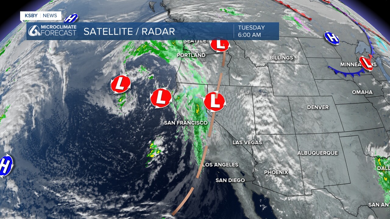
Early this morning, the core cold front pushed across the region. Heavy rain and some localized ponding were recorded, but the good news is that conditions are already improving.
Here is what the radar looked like around 5:30 Tuesday morning as the heaviest rain moved through.

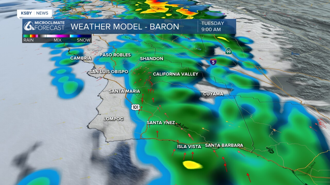
Over the mid morning hours, rain will still be the story, but the core cold front is decaying and will fall apart fast. Here is what 9 a.m. will look like.
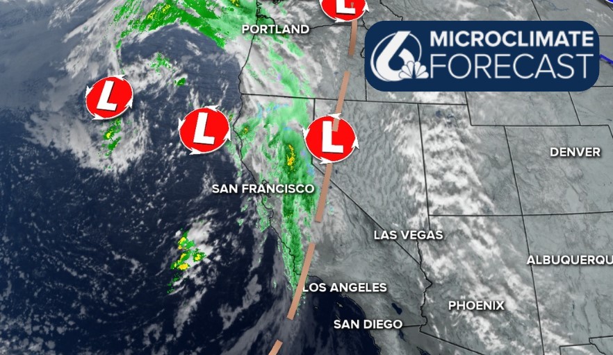
Looking at this storm with a wider lens, it is a bit complicated. The core cold front that is bringing us the heavy rainfall this morning will push east. Wrap-around moisture will build in and bring a mixed bag of conditions for the rest of the day.
Most of the showers will be light, but there is a small chance for thunderstorms
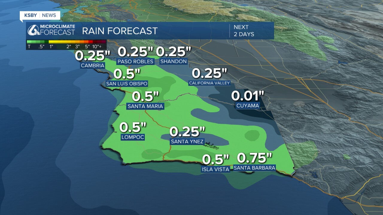
Here is a look at the rainfall totals so far!
In terms of continued accumulation, we can expect up to a half inch more rain from the system. The vast majority of that will come from the core cold front, but still, the ongoing showers this afternoon will bring more accumulations.
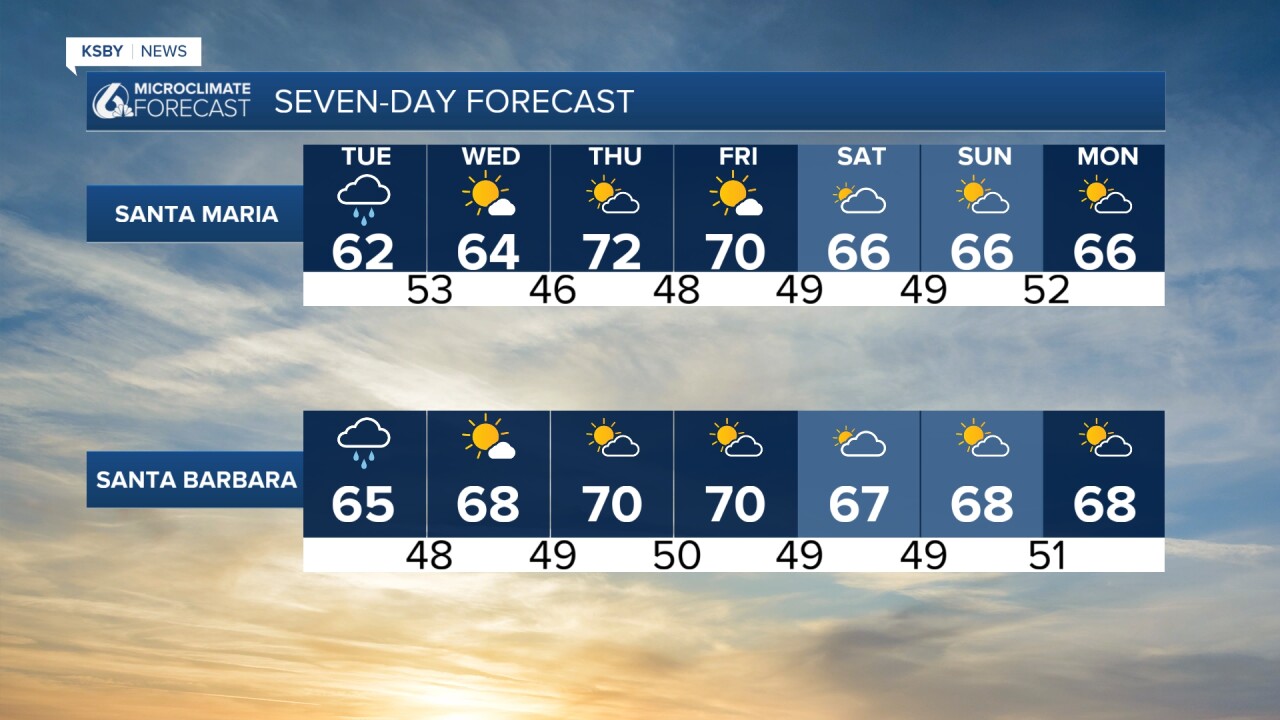
The cold front is bringing rain, but also, just like the name says, cooler air. Temps today will take a tumble and stay in the low 60s for most communities.

Wednesday will be on the cooler side with clouds in the morning, but sunshine is eager to move back in. Sunny skies and warming temps are the story for the remainder of the week.
The weekend will bring a slight decrease in afternoon temperatures, but still mostly sunny skies will bring great conditions.

Have a great day, Central Coast!
-Vivian
