



Good morning, Central Coast!
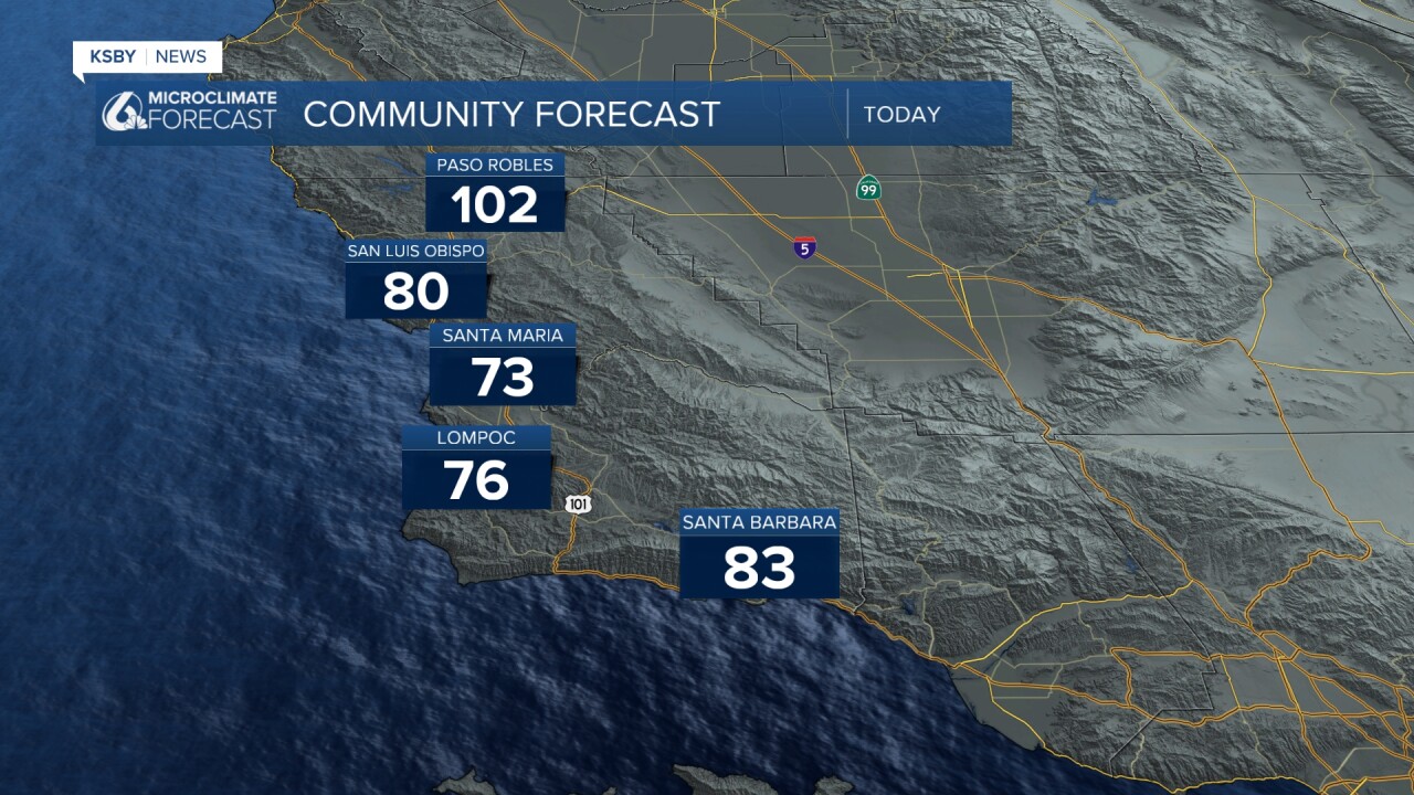
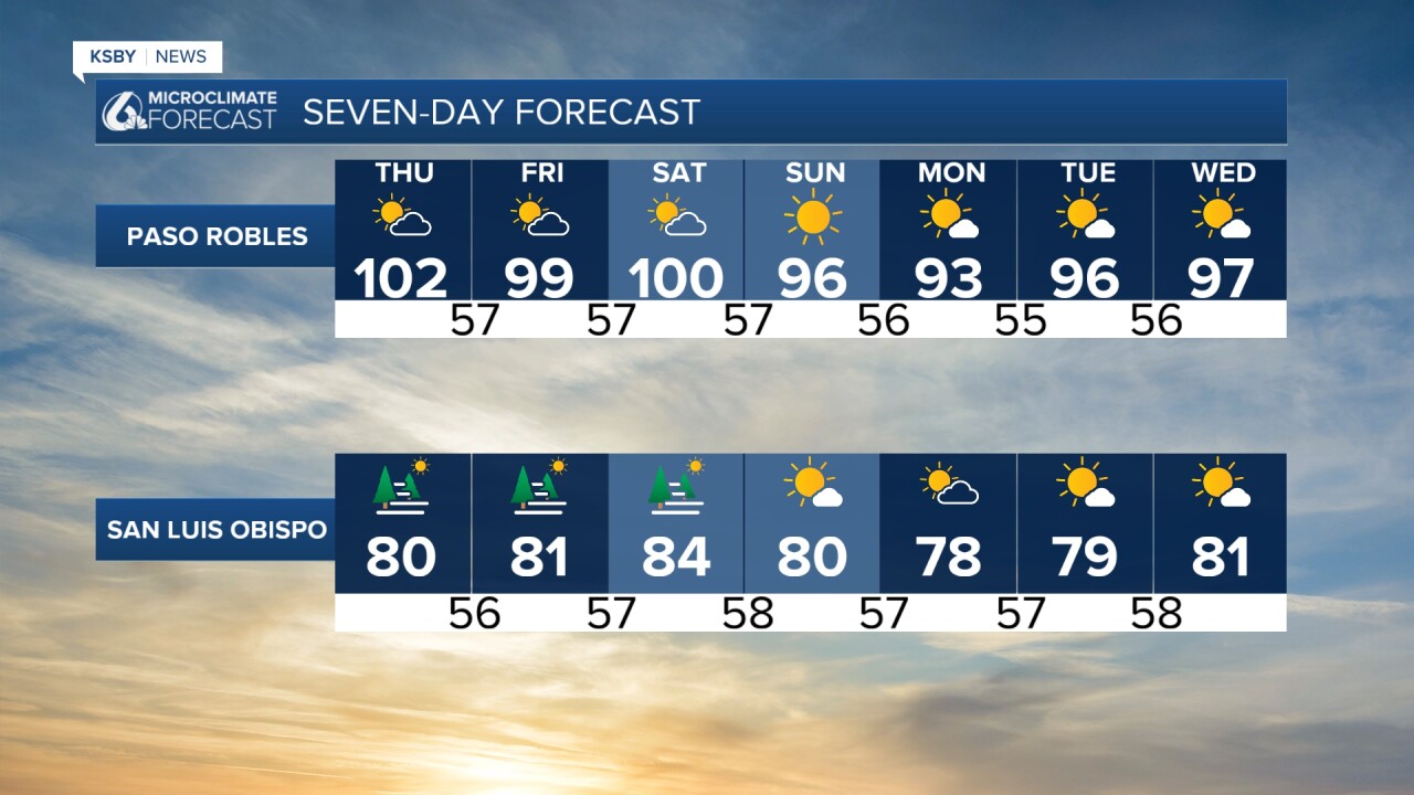
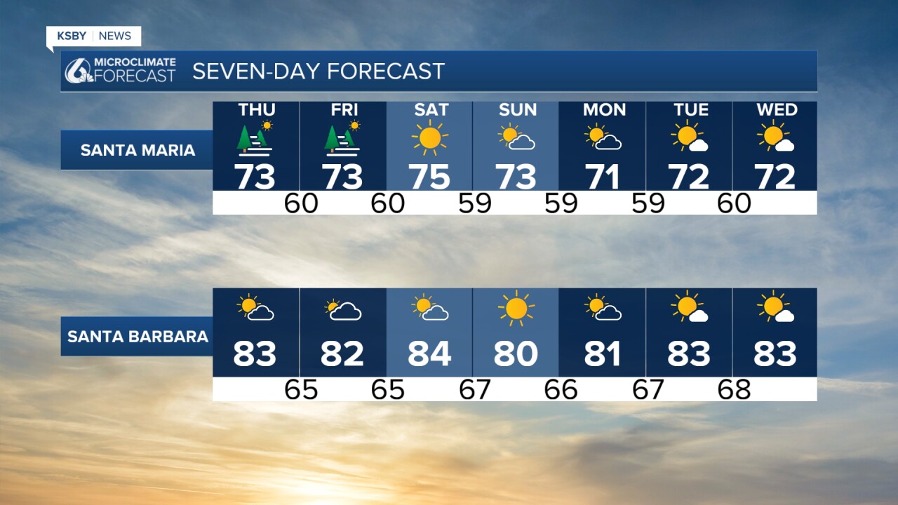
The last few days have been hot across the region, with heat upwards of 100° in the interior valleys and cooler but still warm conditions for our coastal valleys.
Today we can expect more of the same, with dense fog starting off the morning for communities with low elevations. All coastal valleys will start with clouds and some pockets of dense fog.
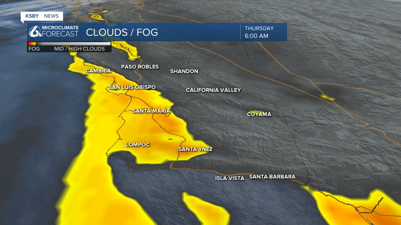
That cloud cover will recede by mid-morning and make for a great day! Here is a look at the temps we can expect today!
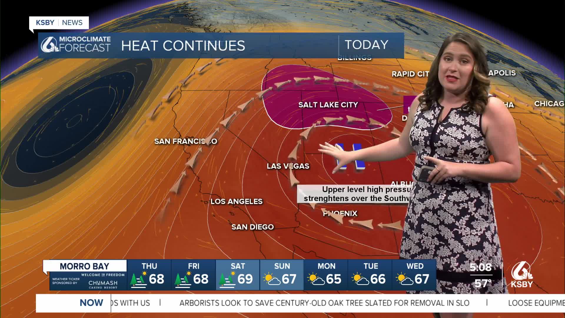
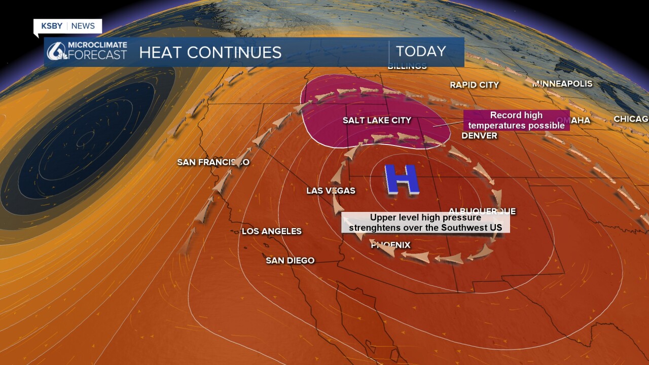
The heat for our interiors is coming from a large upper-level high-pressure system that is continuing to strengthen in the west. Record high temperatures are expected through the Rockies.
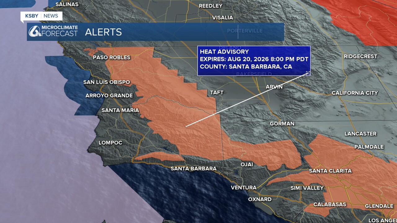
A high heat advisory is still in place for our interior valleys through 8 p.m. tonight.
For us, we are just on the edge of this system; over the next few days, we will see the high move east and be replaced by a small low-pressure trough. Thankfully, that will drop temps a few degrees each day into the early portion of next week.
Here is what all of that looks like on the 7 day forecast!
Have a wonderful day, Central Coast!
-Vivian
