



Good morning, Central Coast!
It is a foggy one with some visibility falling to less than a half mile. Take it slow on the roads.
As we kick off our Tuesday morning there is a lot of energy in the atmosphere. Two strong storms are spinning in the eastern Pacific, while not directly impacting us they are bringing some higher waves and rip current risk to the region. Here is a look at the wave heights as of Tuesday morning.
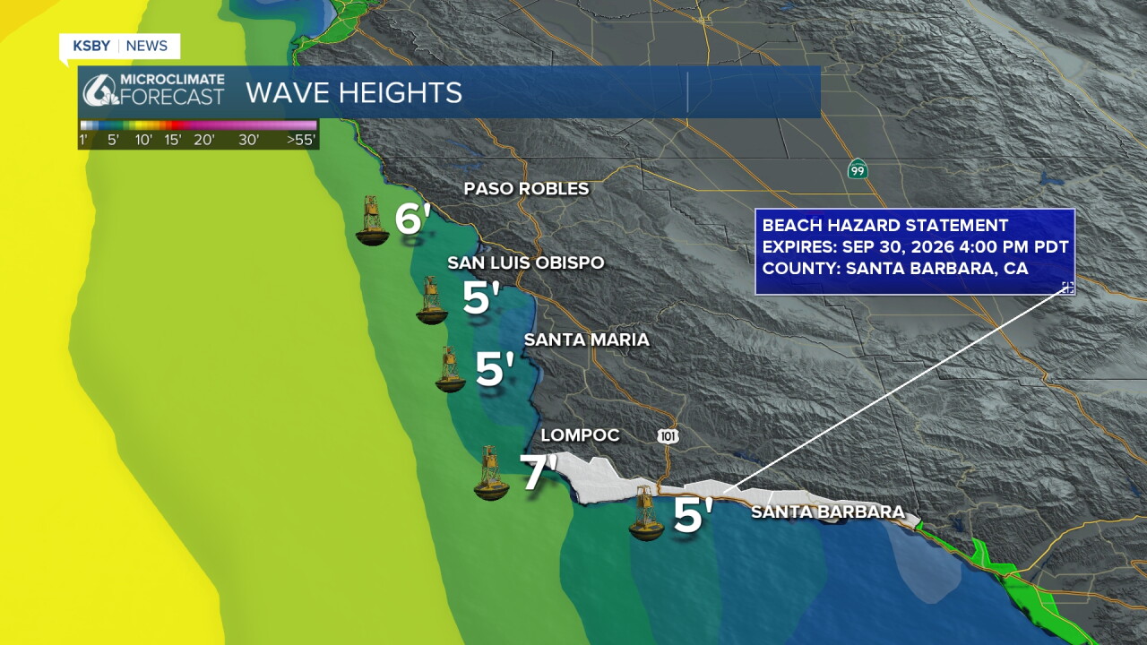
Along the Santa Barbara County south coast there is a beach hazard statement in place through Wednesday afternoon. Rip current risks are increased and with higher waves as well be cautious in the water.
There is a high pressure system in place to our west and it is pushing towards us. That will warm us up into the extended forecast. It will also help to limit marine influence into the weekend.
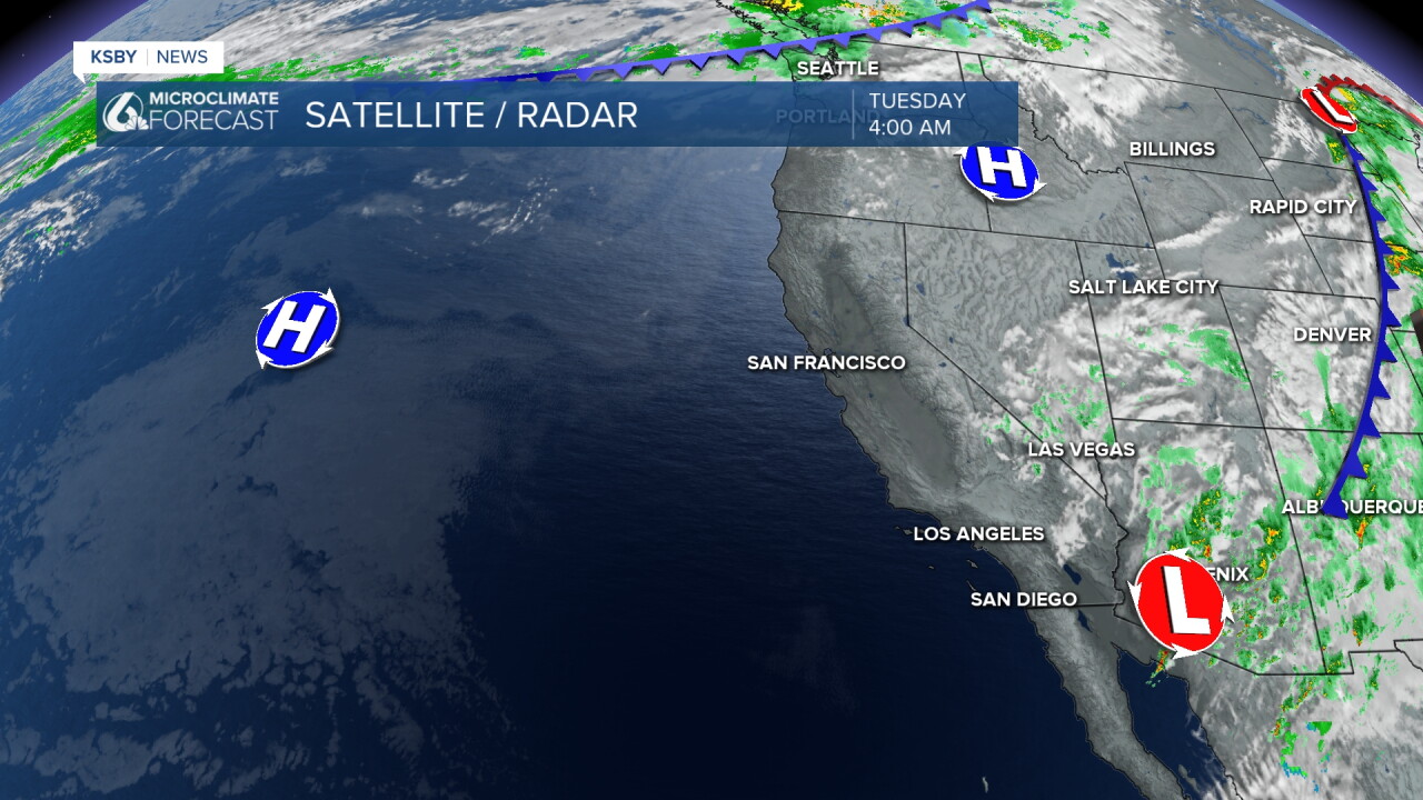
With that high pressure moving slightly closer we kick off the warming trend today!
Temps today have ticked up slightly bringing highs into the low 90s. Coastal valleys will be in the low 80s, beaches in the upper 70s. Here is a look at temps across the region.
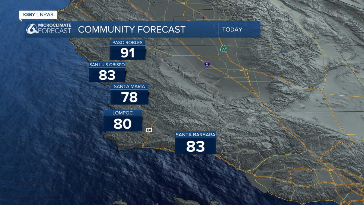
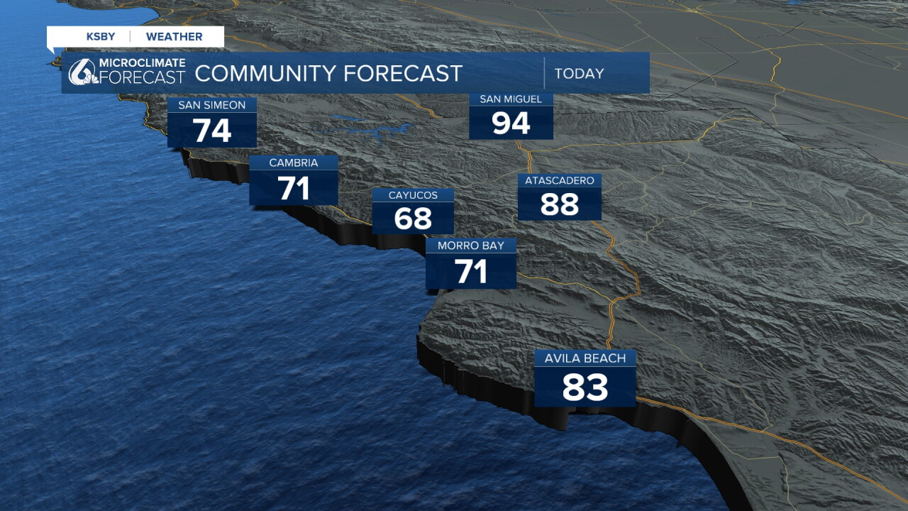
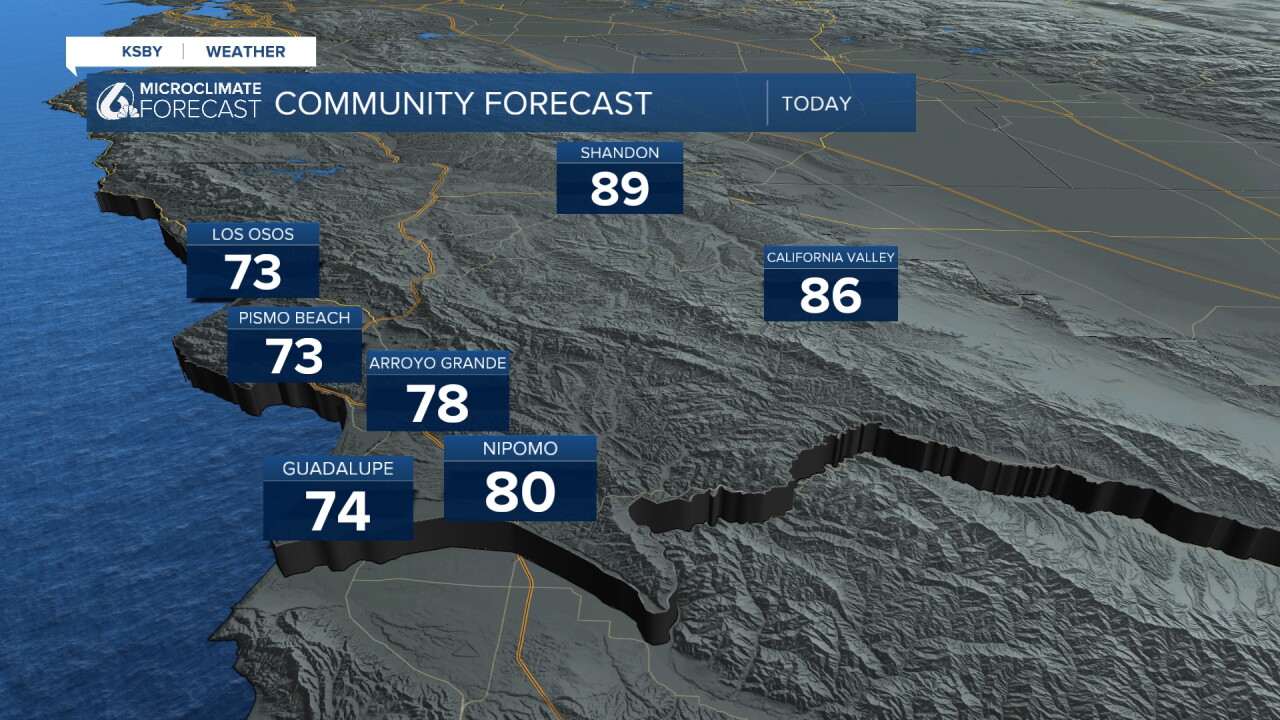
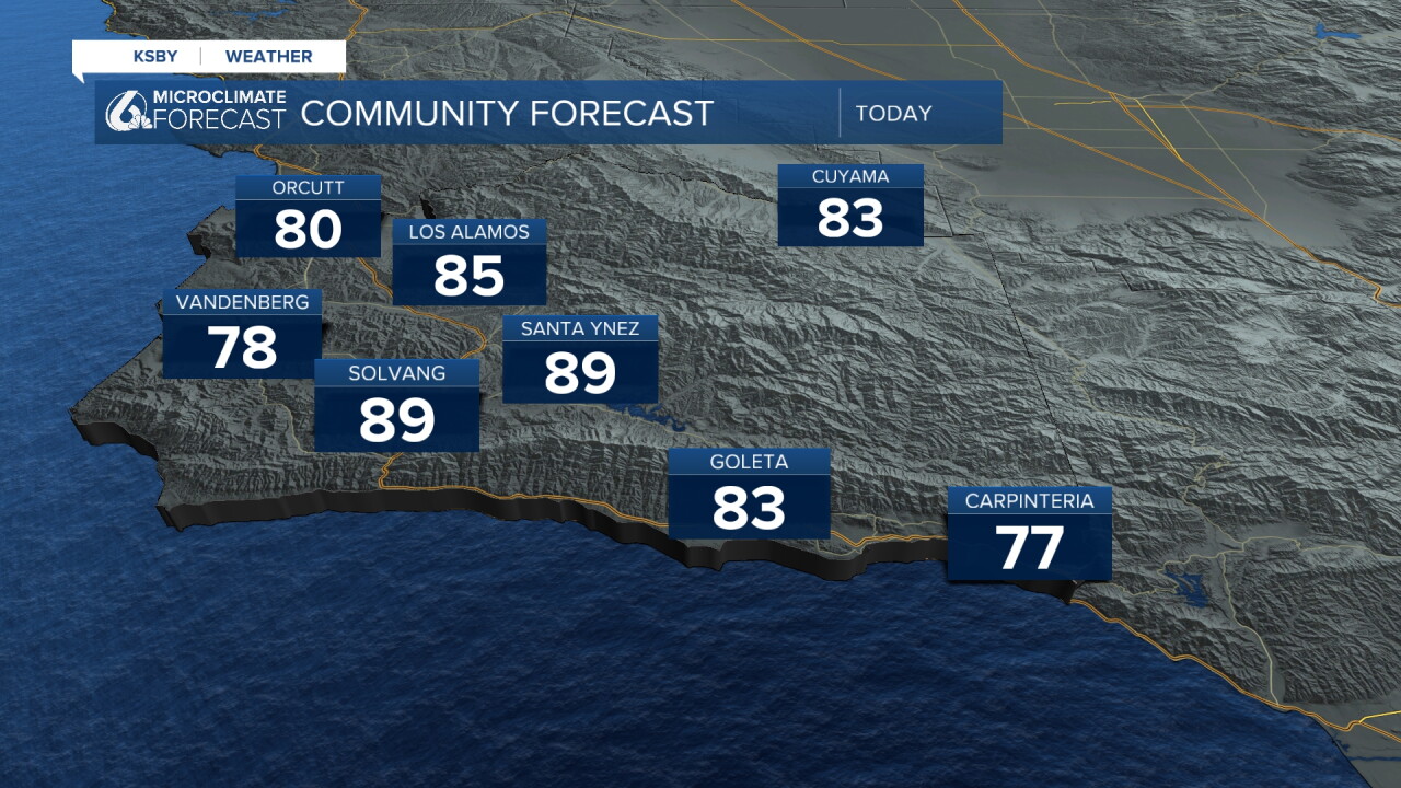
The heating trend will increase substantially into the weekend when upper 90s are expected for the interiors.
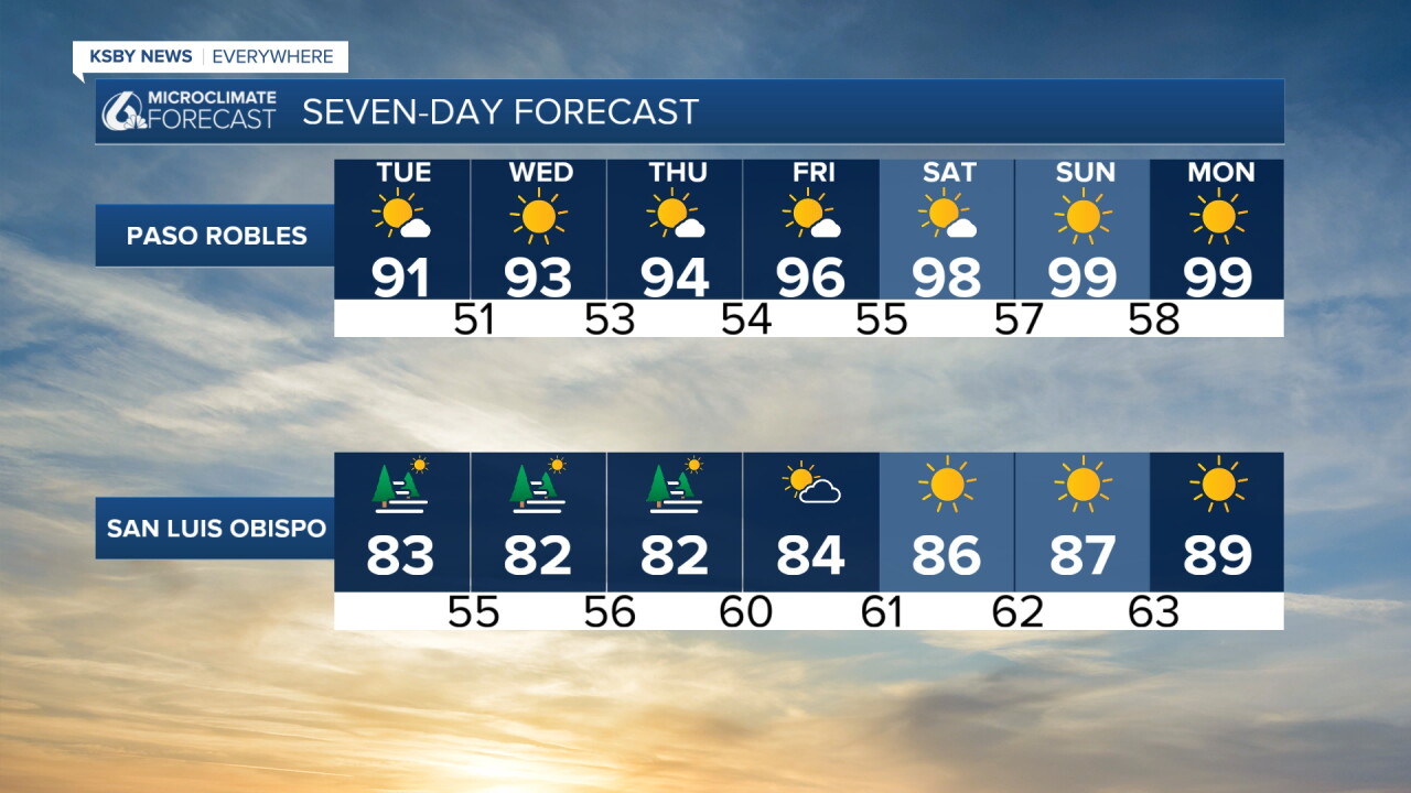
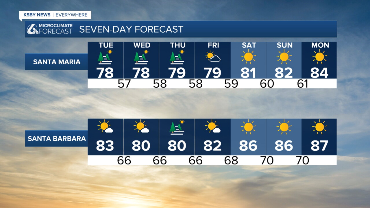
Here is what that all looks like on the 7 day forecast!
Have a wonderful day, Central Coast!
-Vivian
