



Good morning, Central Coast!
To kick off our Wednesday morning there are a few localized pockets of fog in the Santa Ynez and Santa Maria valleys. That cloud cover will clear quickly to a beautiful and sunny day.
We have some lingering concern by our beaches where a swell is passing up to our north. Localized sets up to 8 ft are possible.
Our south coast is still under a Beach Hazard Statement for rip current and slight tidal overflow risk through 5 p.m. Wednesday evening.
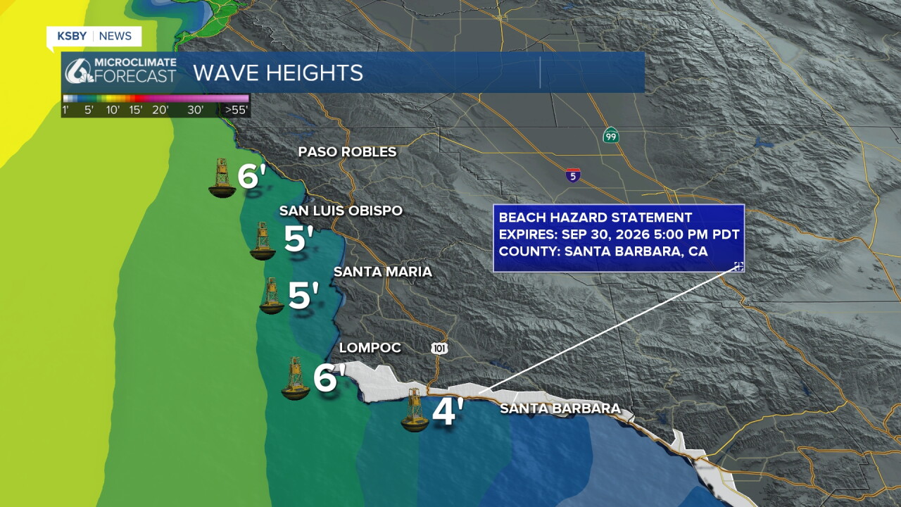
For the rest of the week waves will calm but it won't last soon. A swell associated with Hurricane Rachel will arrive by the weekend. It shouldn't be too much of a concern but it is something I am watching.
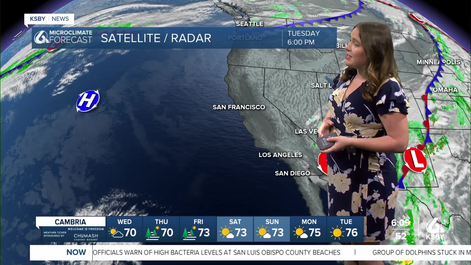
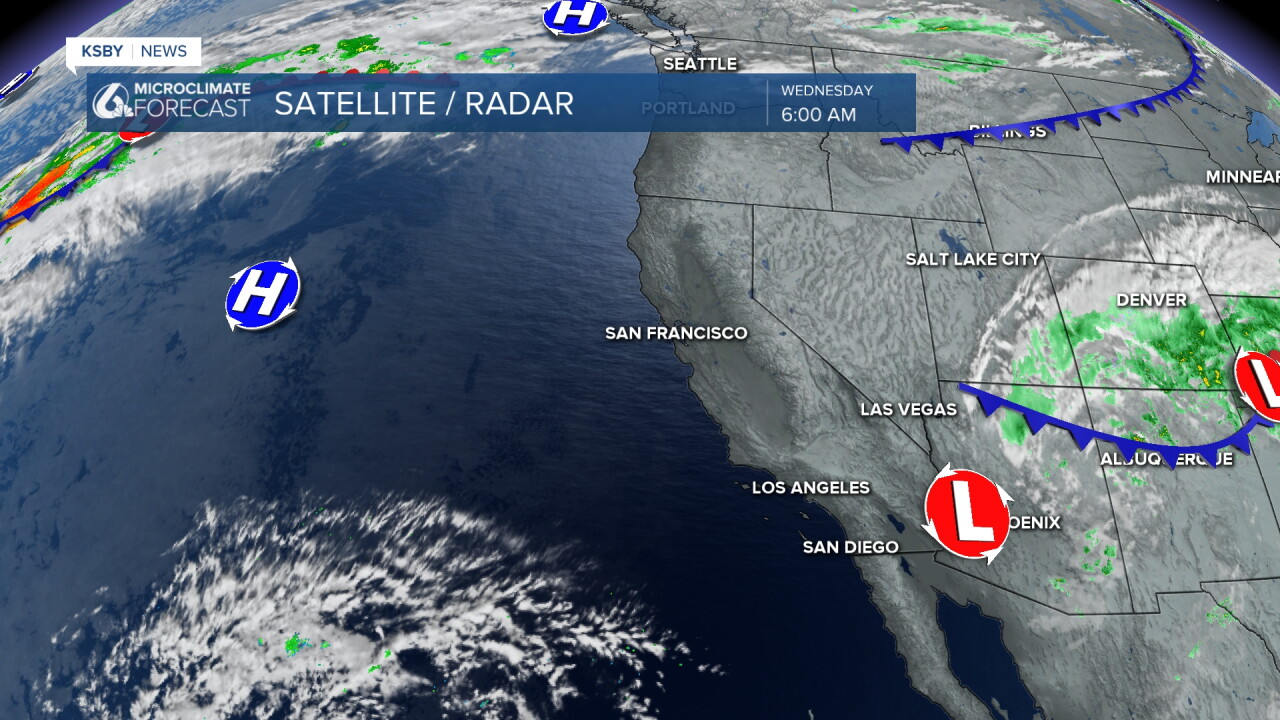
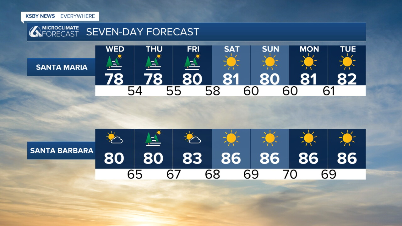
The bigger impact for the Central Coast this week is a high pressure system that is inching closer. As it reaches us offshore winds and sunshine will be the story.
Here is a look at the temperatures we can expect for today.
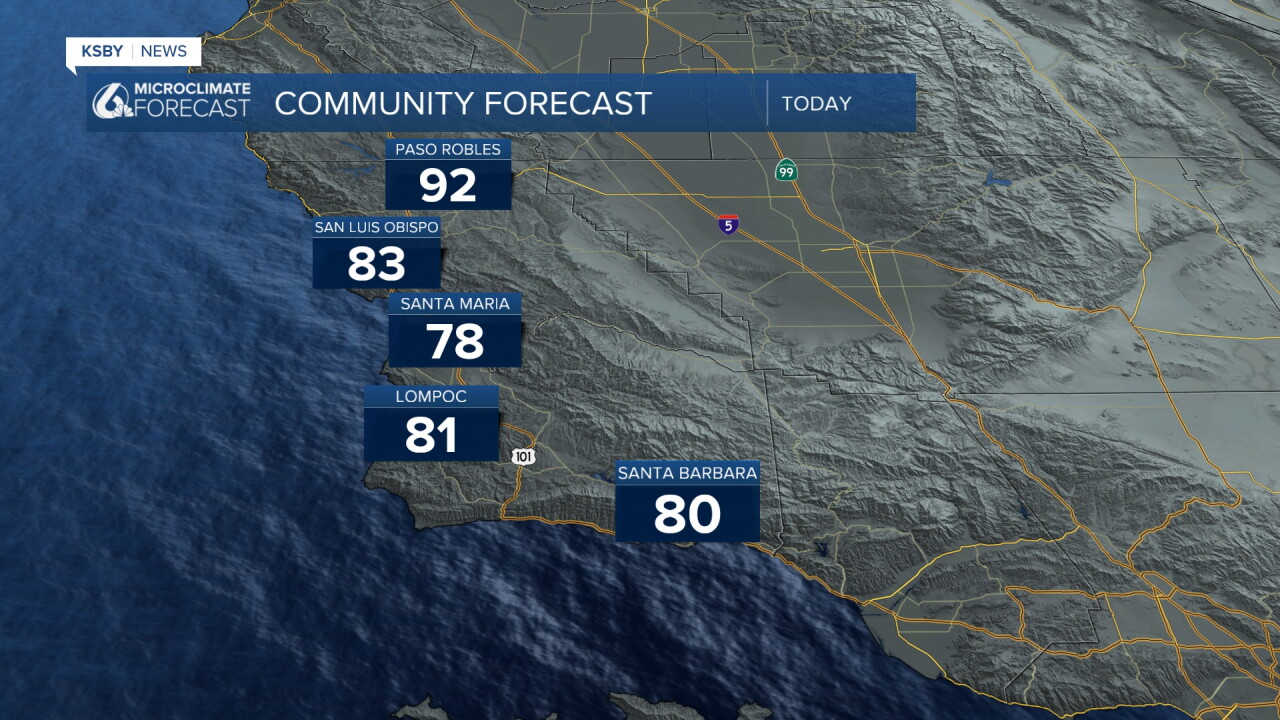
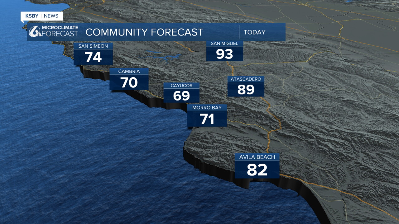
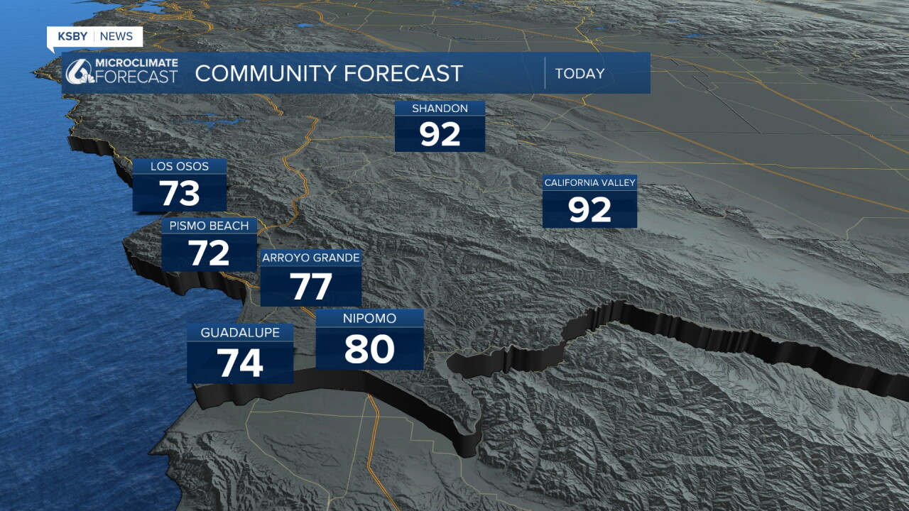
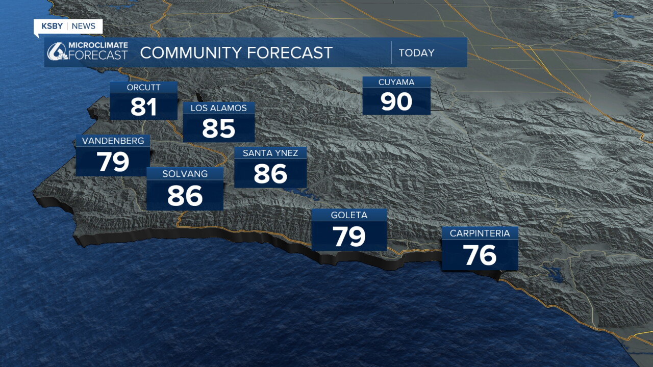
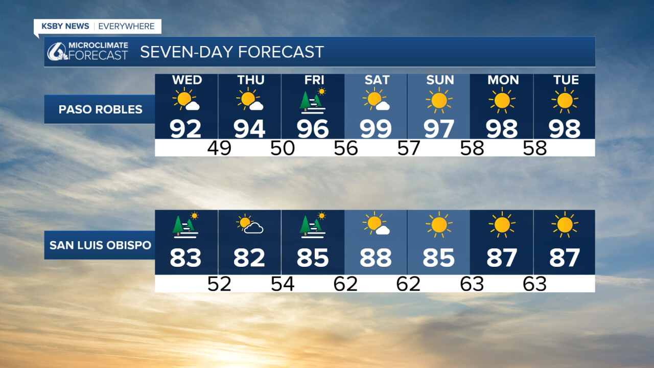
That heating will bring temperatures up to near triple digit highs for the weekend and into next week.
Here is what that all looks like on the seven day forecast.
Have a wonderful day, Central Coast!
-Vivian
