



Good morning, Central Coast, and happy Monday!
Grab that umbrella and raincoat it is a soggy one out there. Before I dive in here is a link to the interactive radar!
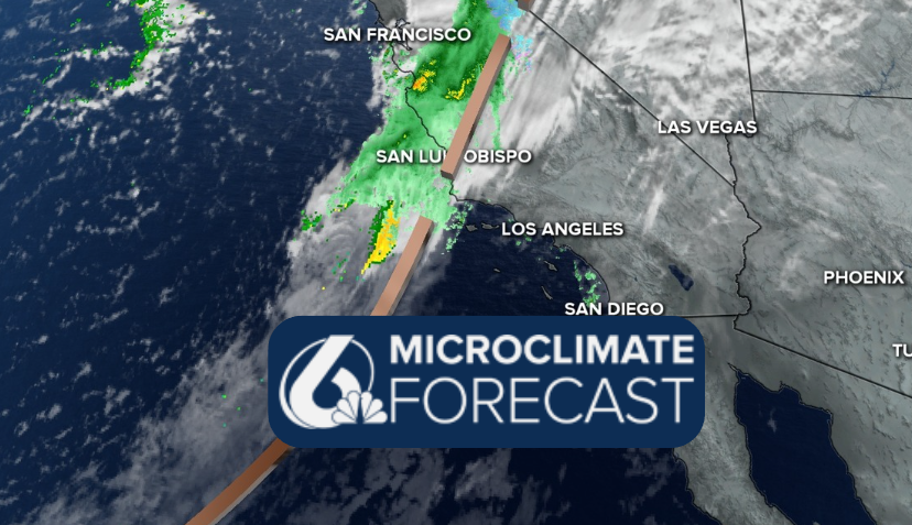
A band of moderate rainfall moved in overnight and is progressing southeast through the day. This isn't too heavy but something that will be noticeable as we kick off the week.
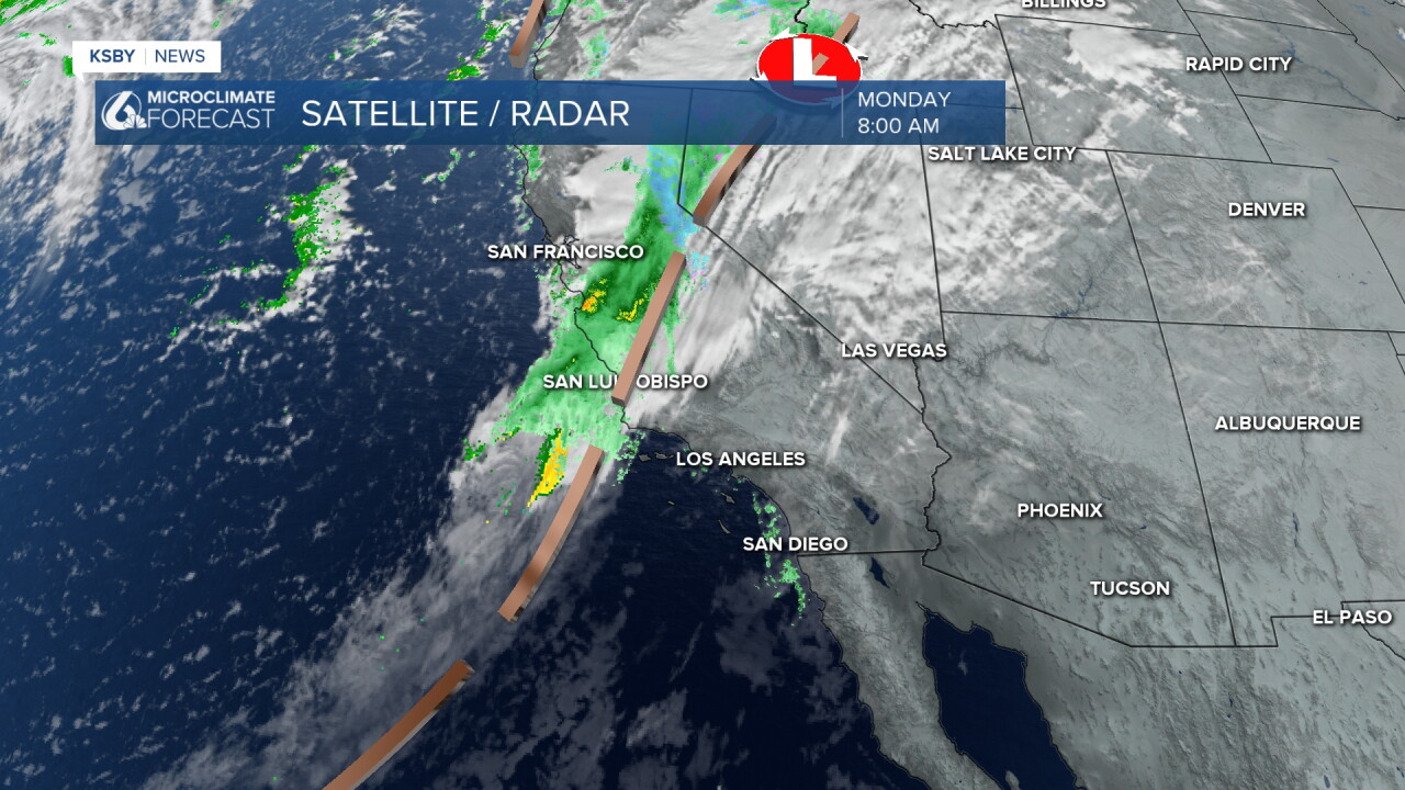
As the day continues it will be a soggy one with showers slowly clearing into the late afternoon.
As it pushes south it will loose much of its structure. By the time the south coast is reached there won't be much left.
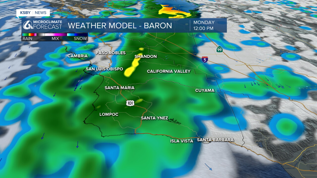
Accumulation-wise, this will be less than half an inch in most spots.
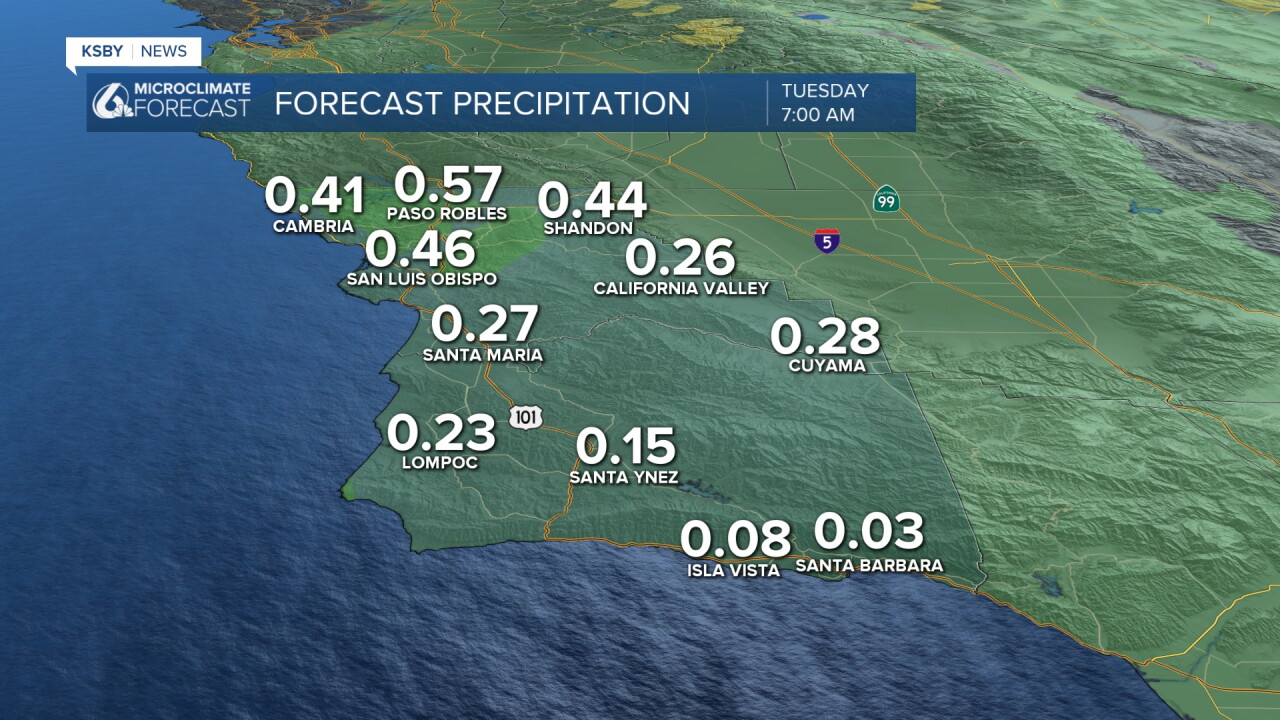
Tuesday will be a break, although imperfect. Some slight showers are possible but won't amount to much.
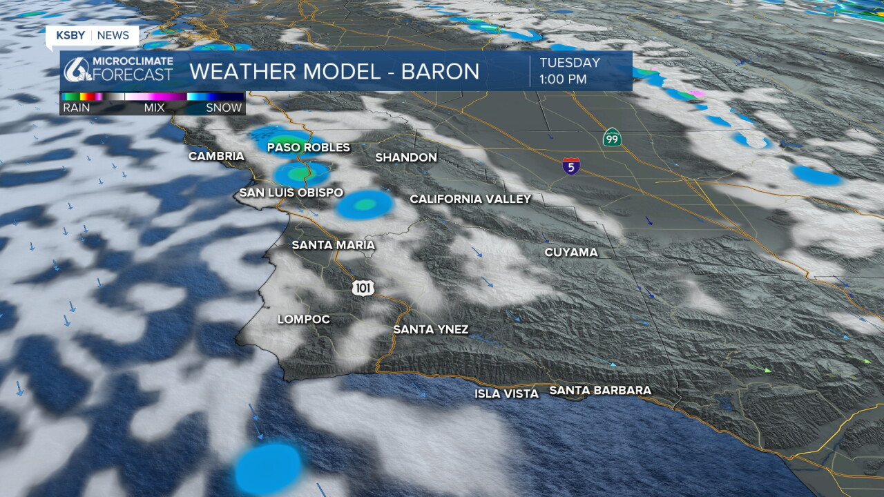
The greater concern is Wednesday when a much stronger storm pushes in. Thunderstorms are expected with localized very heavy rain. That brings flooding risk and potential driving hazards starting Wednesday around lunchtime and continuing into Thursday as more pockets of heavy rain move in.
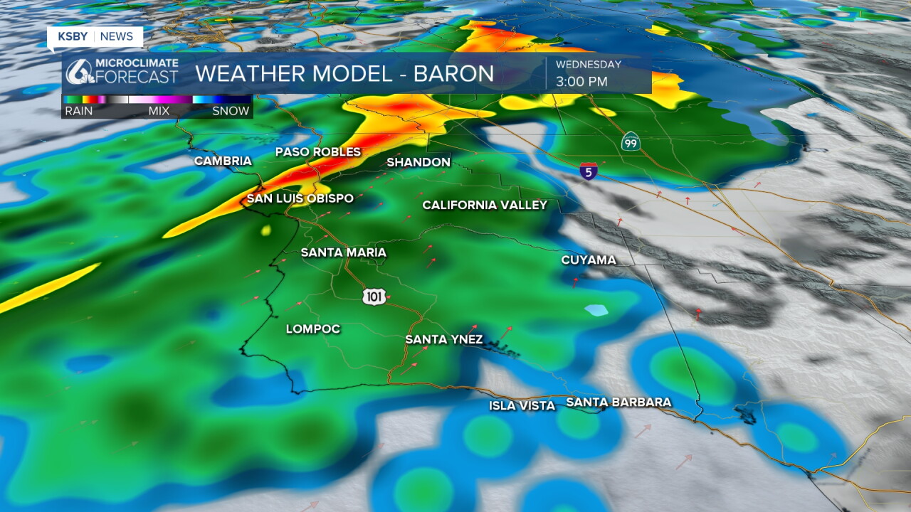
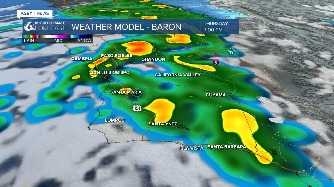
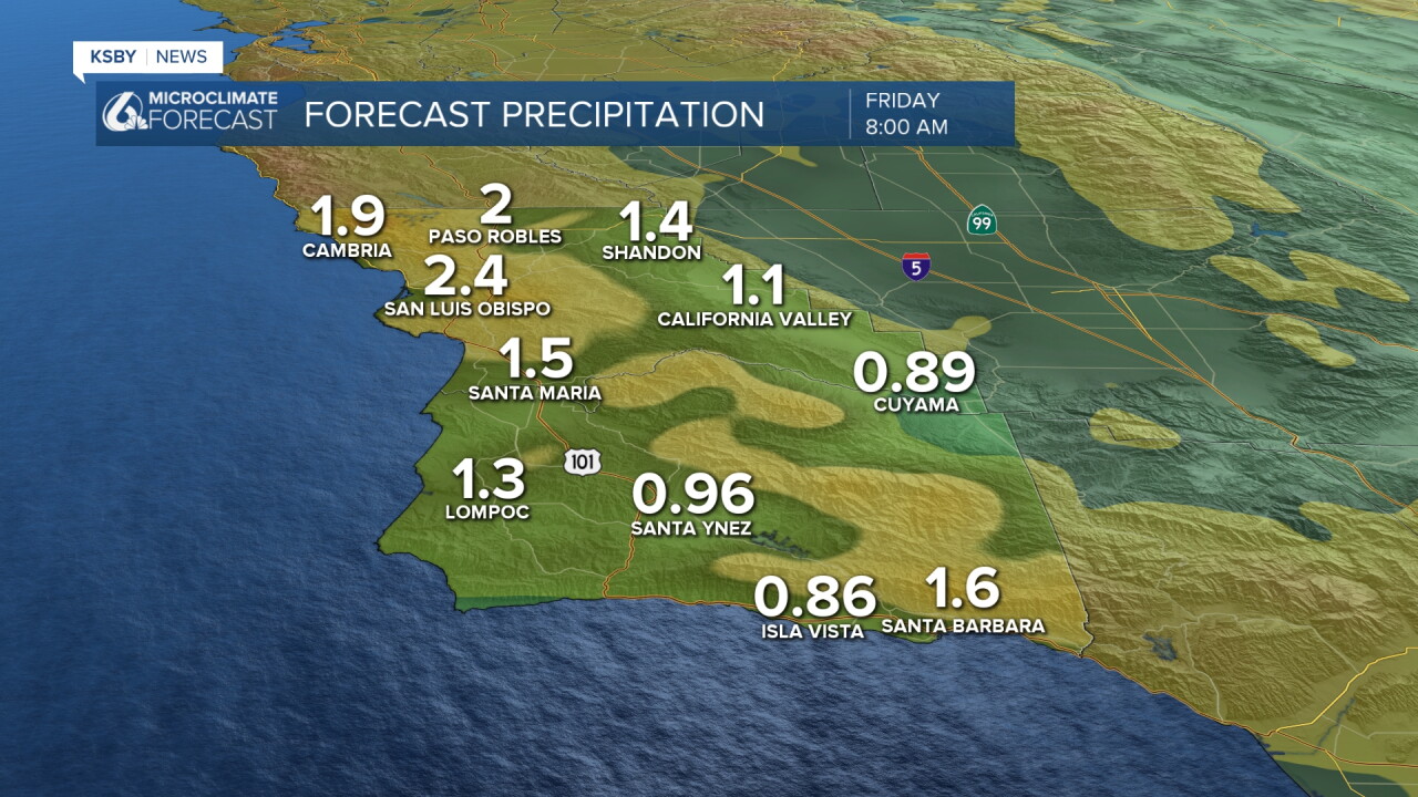
Accumulation-wise, that storm will be a bigger one, with several inches of rainfall possible. Peaks will see the highest totals, with up to 3 inches possible locally; many spots will pick up 1.5 inches.
Beaches remain a concern today, with many alerts in place. Here is a look!
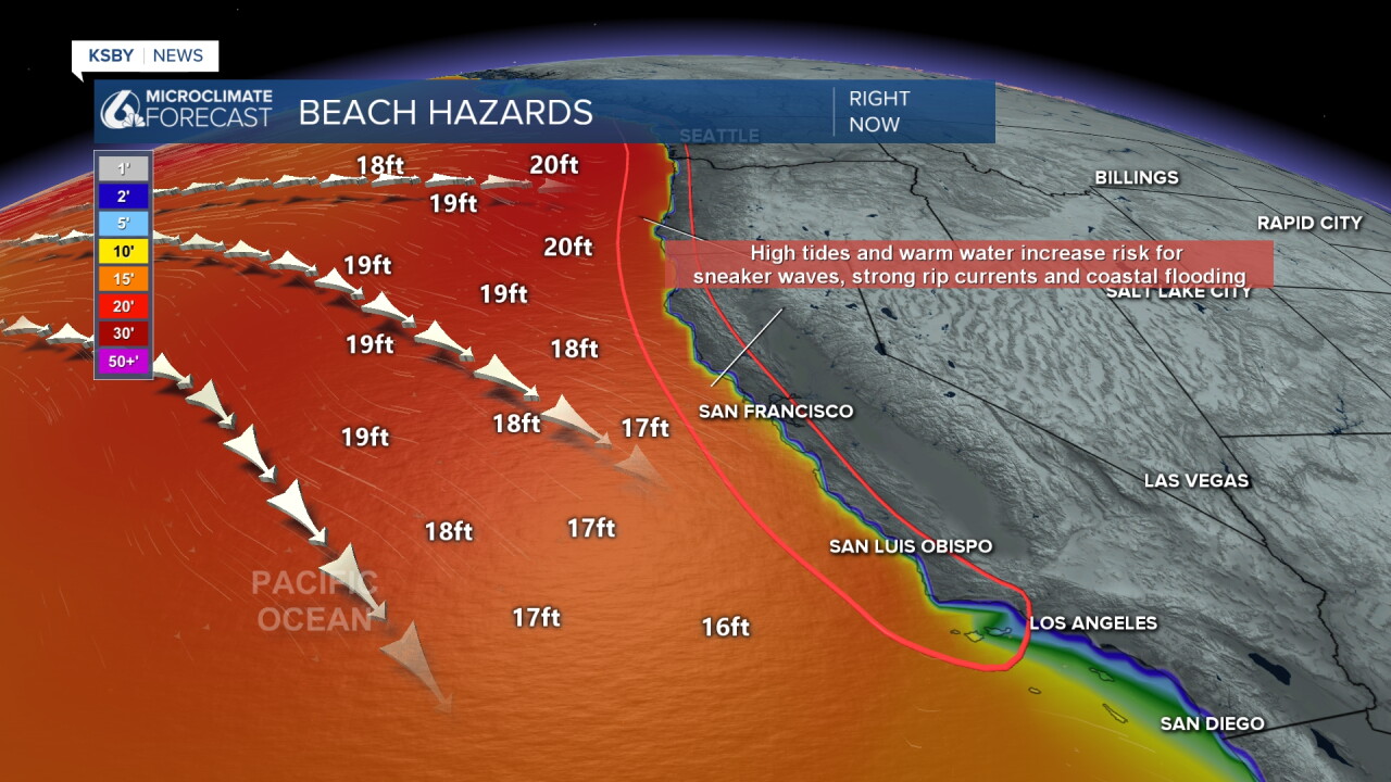
Western beaches are under a High Surf Advisory through Tuesday at 3 p.m. The advisory may be extended through Wednesday, with another round of larger surf expected Thursday into Friday
- Breaking waves of 10 to 15 feet, increasing to 15 to 18 feet, with localized sets reaching 20 feet.
- Dangerous rip currents, significant beach hazards and an increased risk of ocean drowning.
- Large waves could wash people off rocks and jetties, cause beach erosion and capsize small boats near shore.
There is also a Coastal Flood Advisory in place for the western beaches through 9 p.m. this evening (Monday)
- Coastal flooding is expected in vulnerable low-lying areas, especially around high tide.
- Areas at risk: Beach parking lots, bike paths and harbor walkways.
- Additional concerns: Moderate beach erosion and isolated property damage are possible.
- Safety: Avoid flooded areas and never drive through water of unknown depth.
For the south coast, there is a Beach Hazard Statement in place through Tuesday at 3 p.m., although this may also be extended through later this week as more waves move in.
- Breaking waves of 4 to 6 feet, with locally larger sets possible along west-facing beaches.
- Dangerous rip currents and hazardous swimming and surfing conditions.
- Waves could wash people off beaches and rocks or capsize small boats near shore. Minor tidal overflow is possible during high tides.
Now that the headlines are out of the way, here is a look at the nuts and bolts of the forecast.
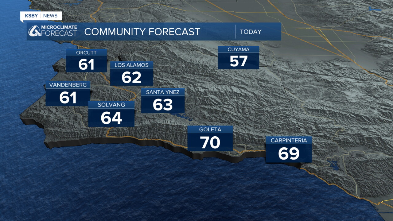
Temperatures stay cool today with highs in the low 60s and upper 50s for most. The South Coast may reach 70 today as the rain takes longer to reach them.
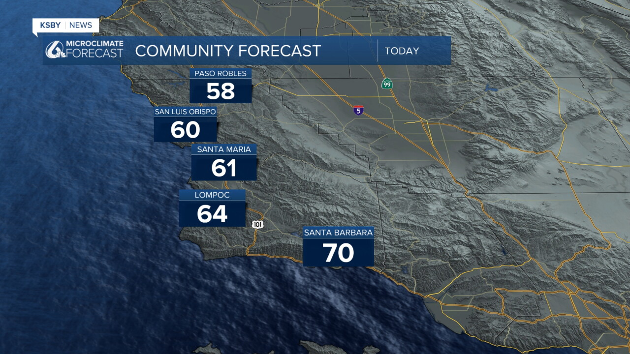
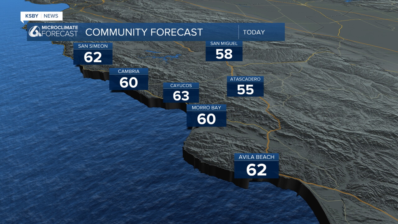
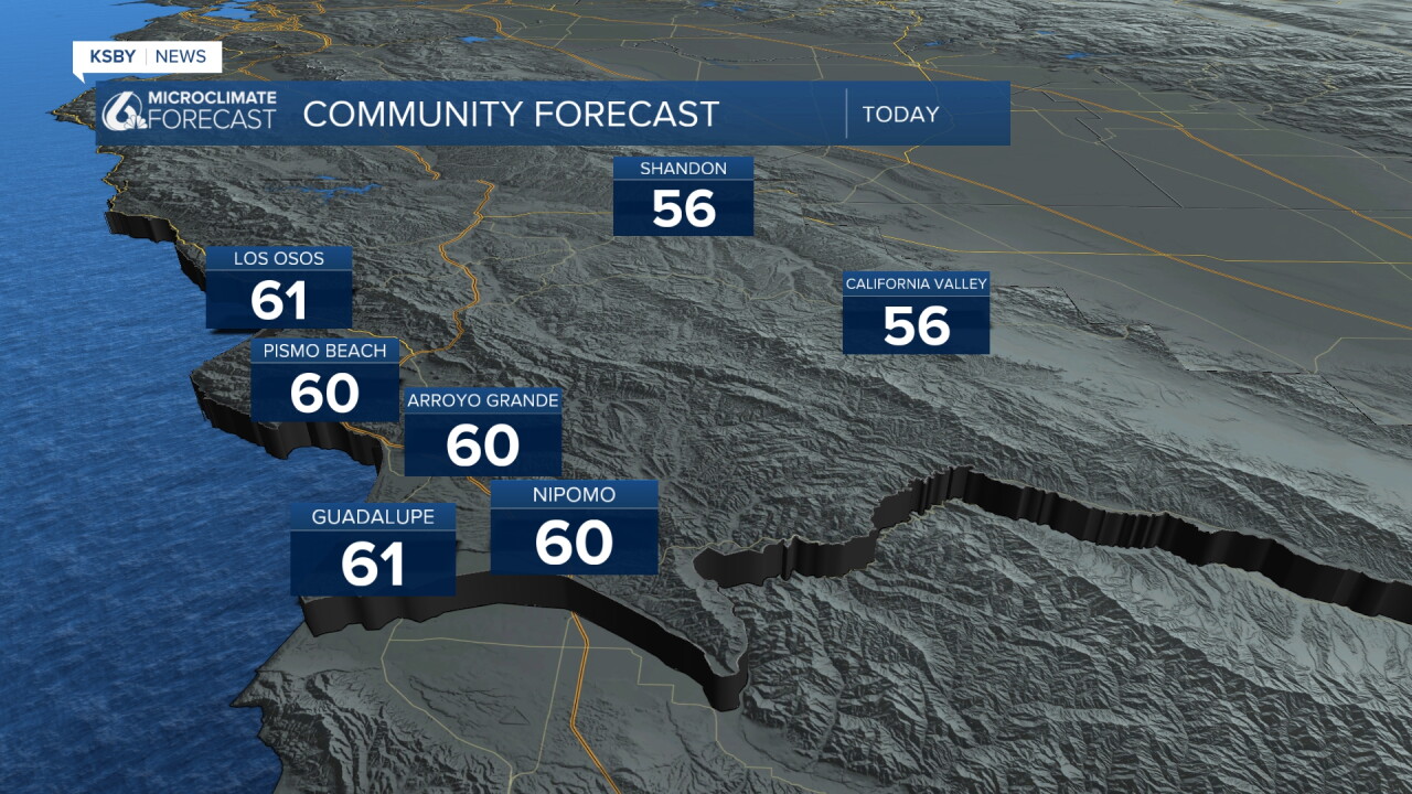
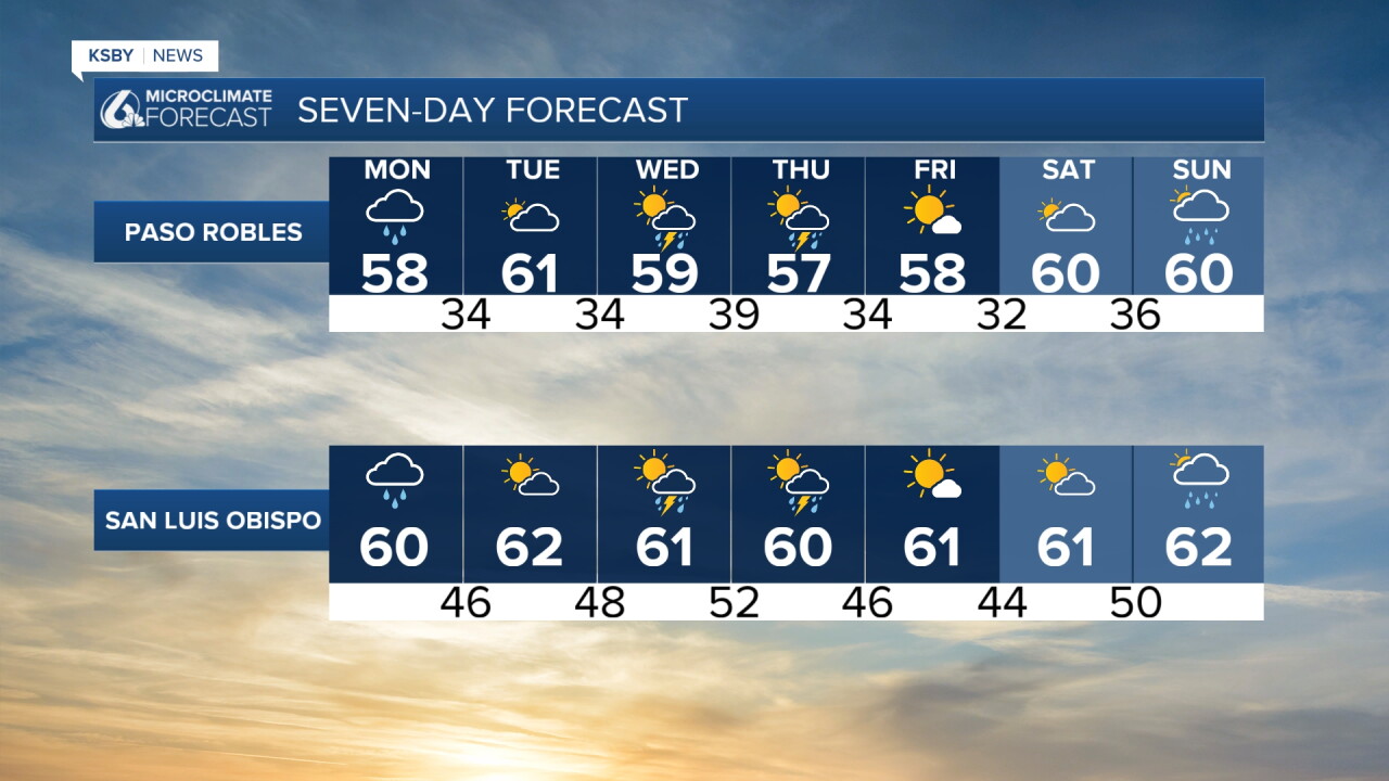
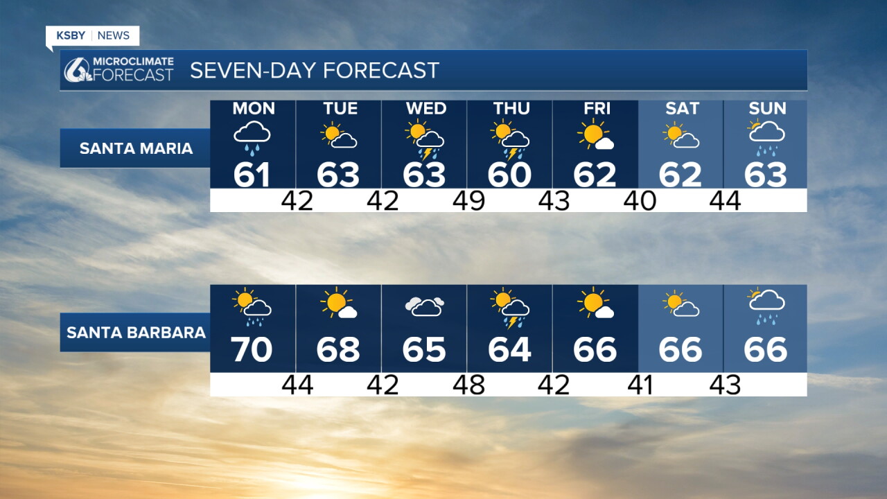
Looking into the 7-day forecast, rain is expected Monday, Tuesday, Wednesday, and Sunday. Temperatures will stay cool through the week.
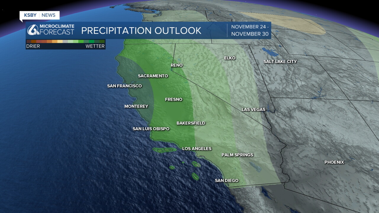
Into the farther extended forecast, we can expect the more active pattern to continue through the end of November. That does mean we expect more activity during the Thanksgiving travel period, although it is still too early to nail anything down.
Have a great day, Central Coast!
-Vivian
