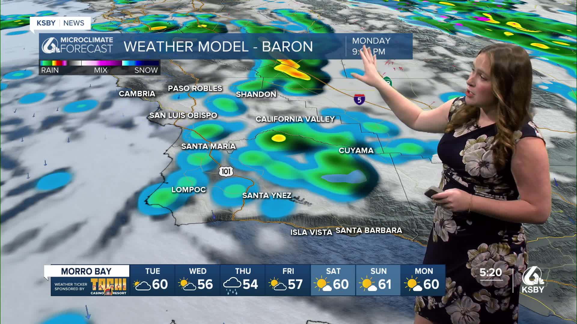


Happy Monday, Central Coast! We made it to the end of a very soggy weekend where the Central Coast picked up inches of rain and faced flooding, damaging winds, and low visibilities.
That is where I want to start (I will get to the forecast in just a moment).
Here is a look at the rainfall accumulations across the Central Coast from Thursday afternoon through Monday evening.


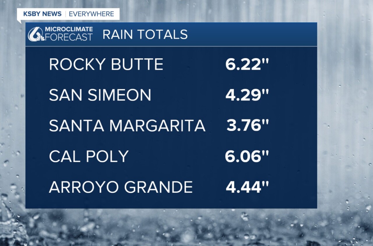
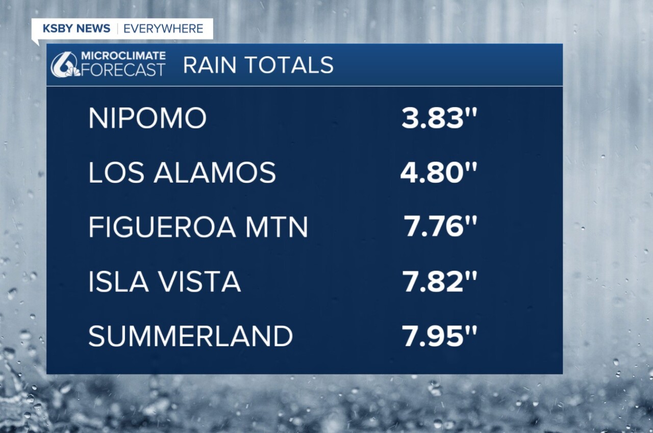
For some context, this marks the wettest start to a water year (Oct 1-Sept 30) on record. Santa Barbara County has experienced one of the wettest starts to a water year on record through November. The Countywide percentage of "Normal-to-Date" and "Normal Water-Year" rainfall is currently at ~460% and 44%, respectively.
Water-year 2026 eclipsed water-year 1983 as the wettest start on record in the City of Santa Barbara over the past 127 years, with WY 1983 also one of the wettest years on record in Santa Barbara County.
Okay, now back to the forecast.
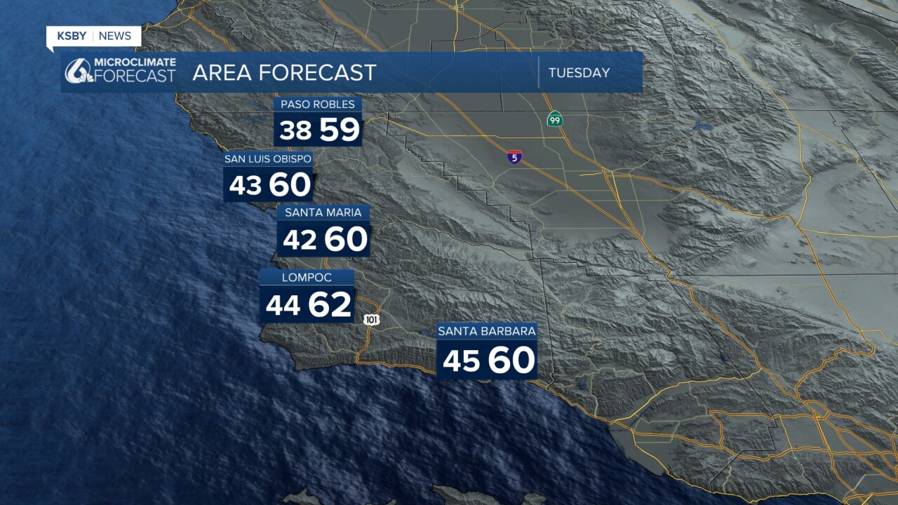
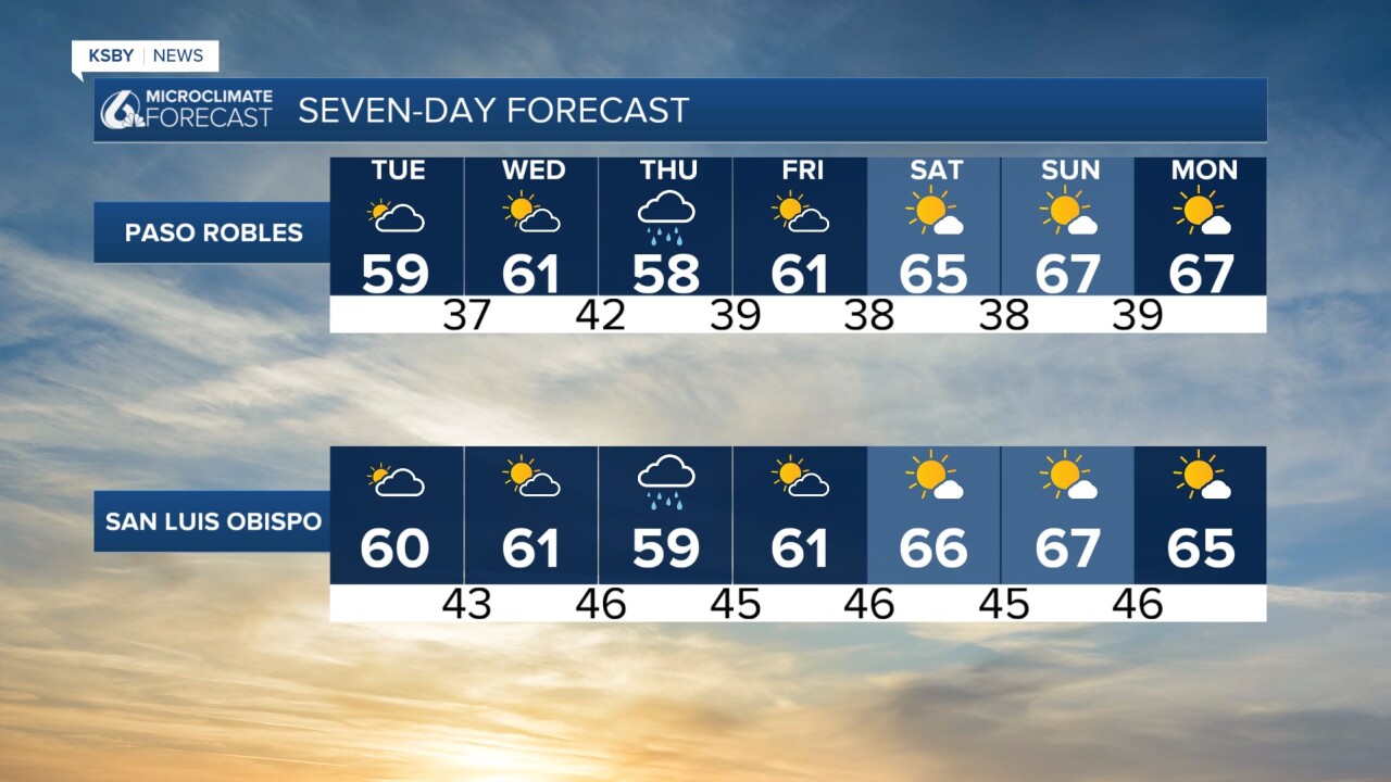
Tuesday will be quite a nice day with clearing skies. There is still the chance of some scattered showers, mainly for the south coast, but it will be much clearer than the weekend.

Temps will be low still, within a degree or two of 60 for all communities.
Into Thursday morning, another cold front will reach the Central Coast.

This will bring more rain to all of the region. Thankfully, this will not be too much of a system, though; accumulations will be between a quarter and a half inch.

Once that system clears out, we will start a modest warming trend. This will pair with mostly sunny skies, making for a welcome change from the soggy weekend we just had.
Here is what that looks like on our 7-day forecast!

Have a wonderful week, Central Coast!
-Vivian
