



Good morning, Central Coast!
As we kick off our Wednesday morning, the whole forecast centers around a lingering low-pressure system that is sitting just to our north.
This is the same low pressure that brought us some light drizzle yesterday.
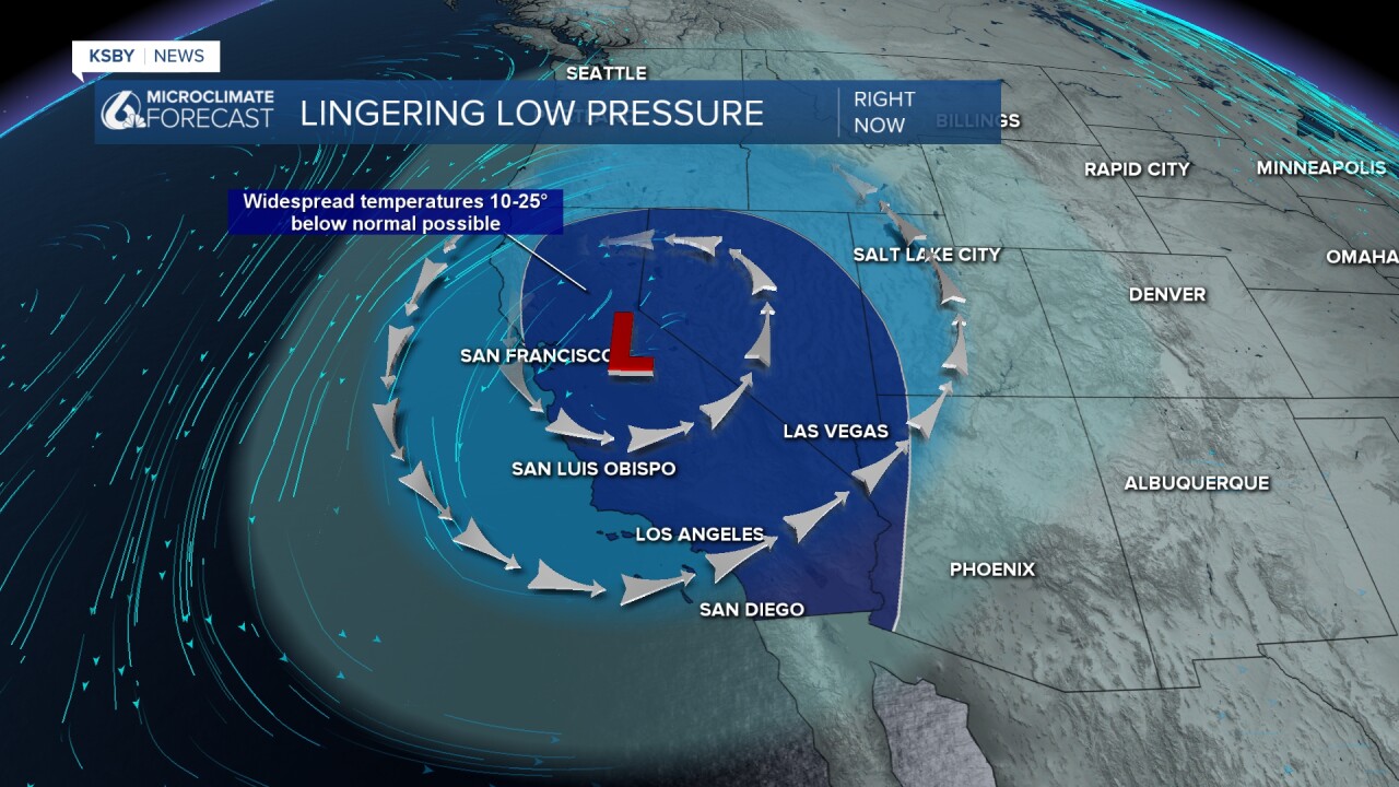
The first impact of the low pressure you are likely to notice is the cooler weather. Temps 10-25 degrees below normal for this time of the year are expected across the West Coast.
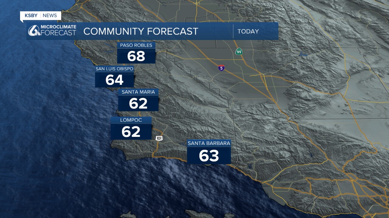
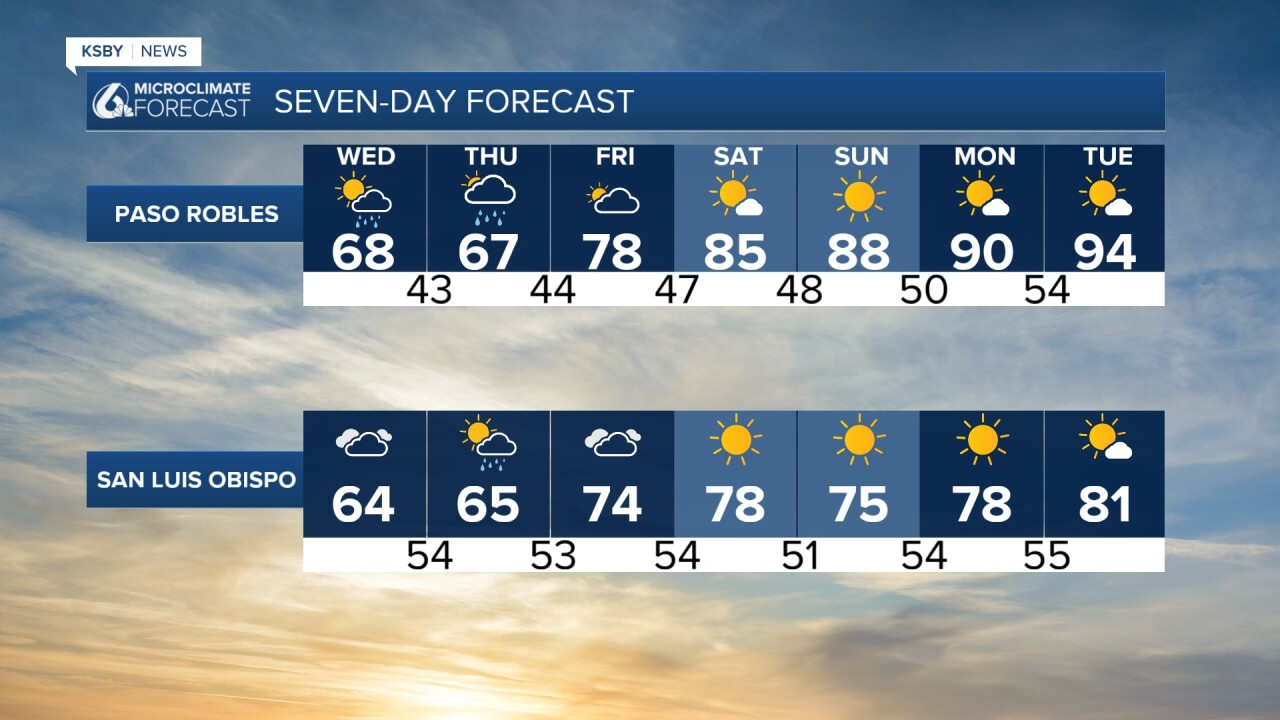
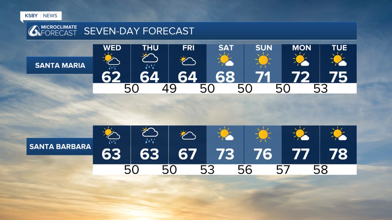
Our temps today are also on the cool side, with highs in the mid to low 60s.
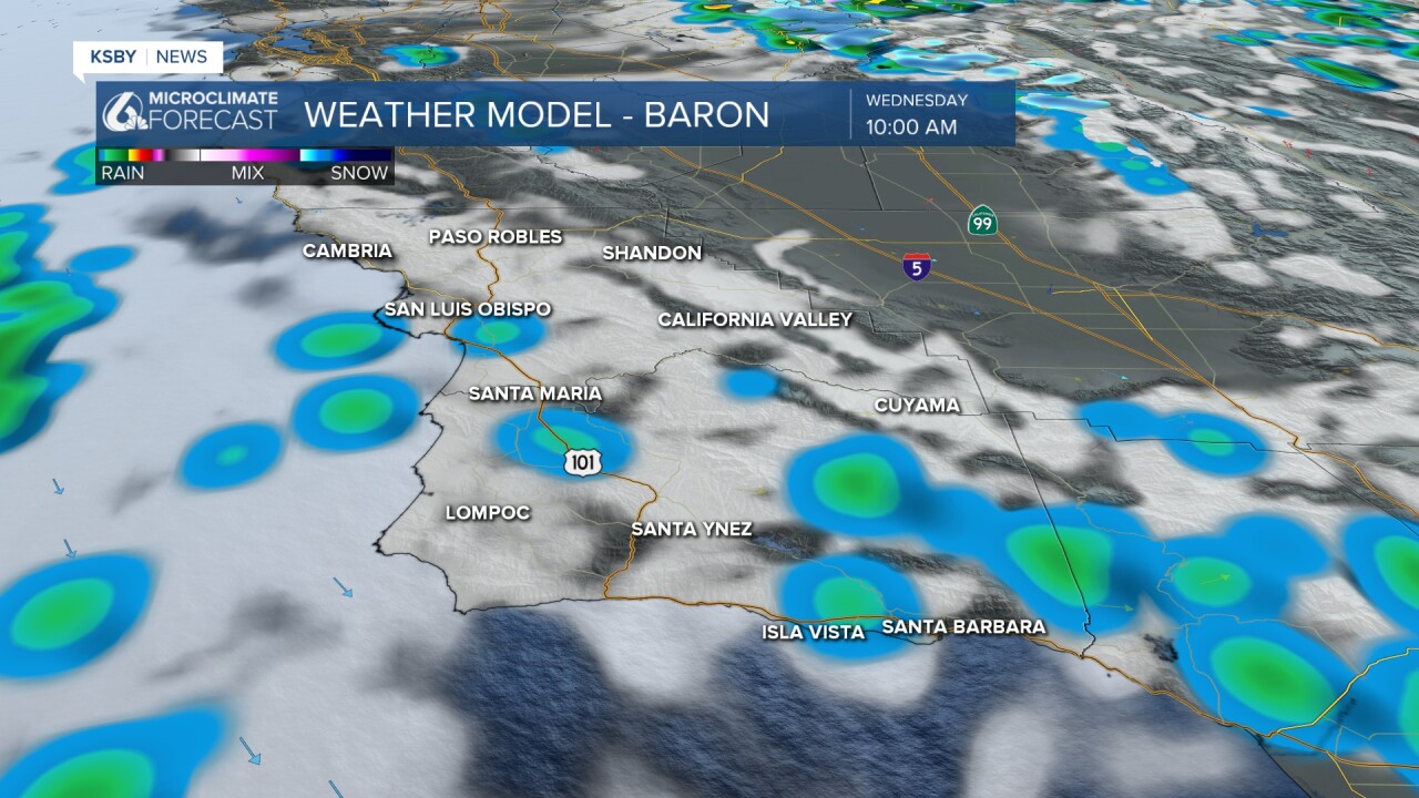
Cloud cover will be patchy, but where clouds move through, there is the chance for some light rain. It is going to be minimal, but with off-and-on chances throughout the day, it may accumulate to a few hundredths of an inch.
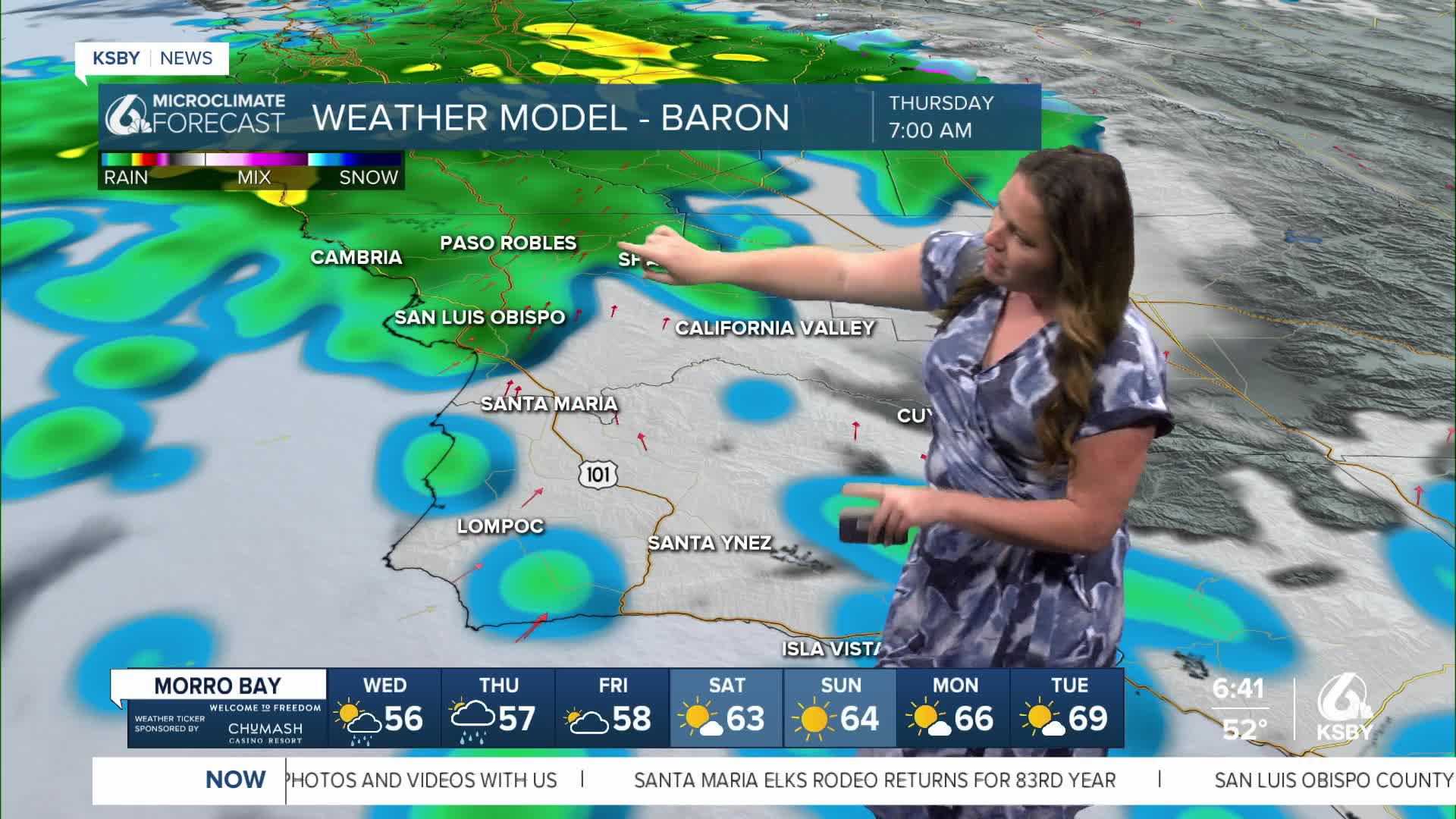
Thursday morning, the rain will move in with slightly higher accumulations expected.
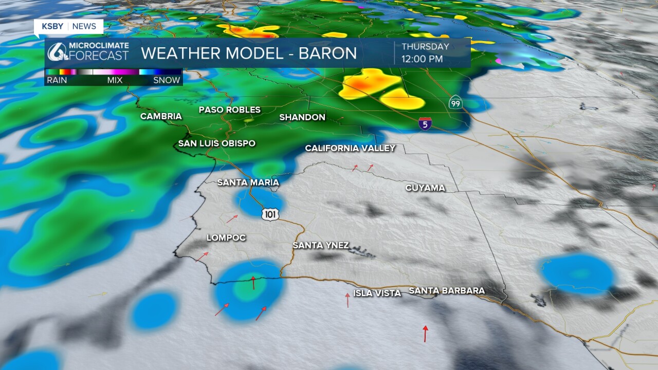
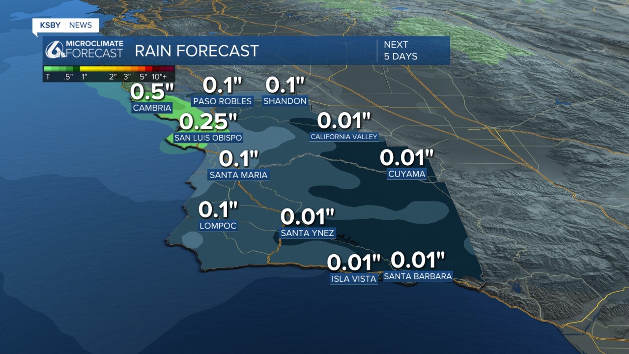
The lion's share will fall in the Santa Lucia's and along the SLO County North Coast. Up to a half inch is possible, although most spots will just be hundredths of an inch.
With the cooler weather and the rain, we can expect high winds, up to 45 mph, and strong waves.
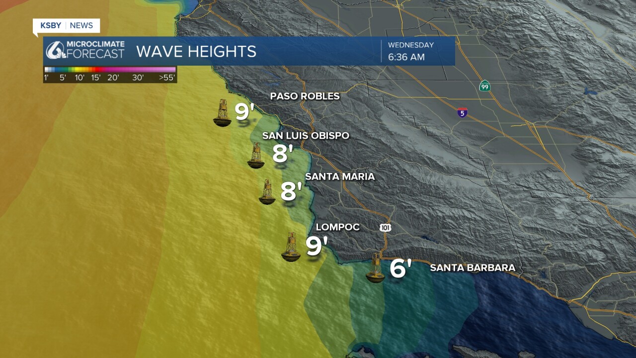
8-12 ft sets and dangerous rip current is expected. Here is a look at the waves on Wednesday morning. They will peak mid-afternoon.
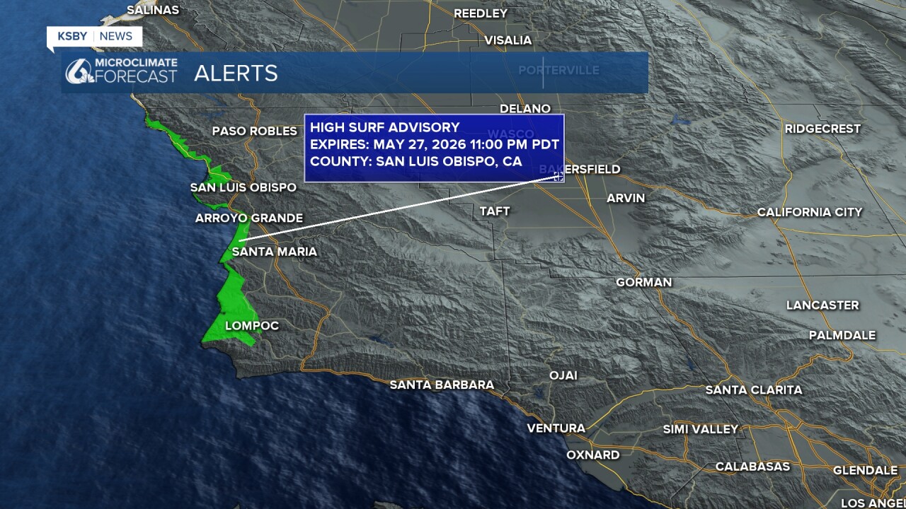
The waves have prompted a high surf advisory for our western beaches through 11 p.m Wednesday night.
Friday skies will clear, and over the weekend warmer weather will move in with a high-pressure system.
Here is what that looks like on the 7-day forecast!
Have a great day, Central Coast!
-Vivian
