



Good morning, Central Coast!
Finally, some relief is on the way! After weeks of above-normal heat, we're starting a significant cooling trend that will bring the most comfortable weather we've seen in quite some time across San Luis Obispo and Santa Barbara counties.
The big story is the pattern change as the ridge of high pressure that's been baking California all month finally starts to weaken. At the same time, strong onshore flow is developing, bringing back that familiar marine layer we've been missing.
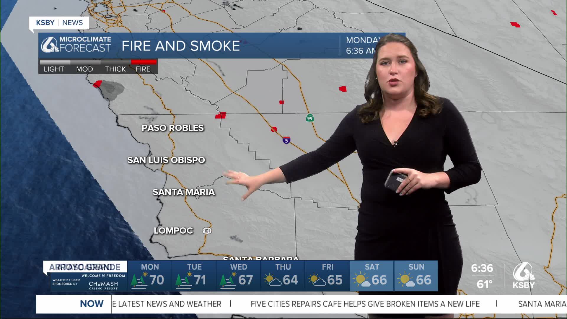
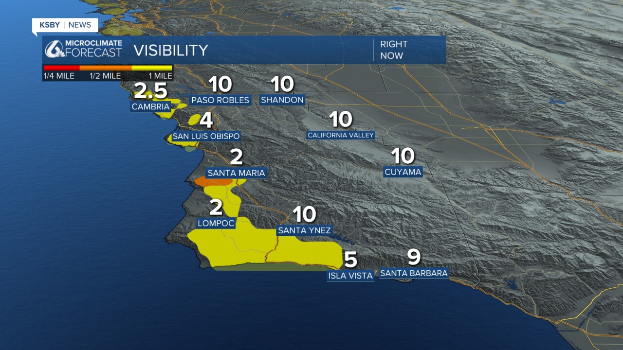
To kick off the morning, we will see some fog and low-lying cloud cover. The good news is that it isn't impacting the commute too severely.
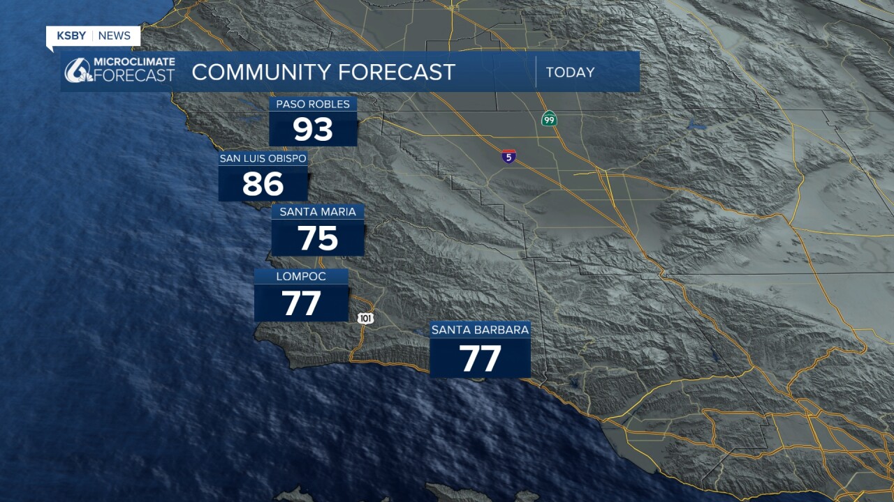
Today's highs will see some substantial cooling, with highs in the interiors falling up to 8 degrees. Coastal valleys will also see a drop in the temps, although not quite as dramatic. Here are the high temps for today.
Sunday night, all of the heat alerts that have been in place were allowed to expire, and later today the alerts for heat in the Central Valley will also fall.
The only alert in place right now is for our south coast, where a Coastal Flood Advisory is in effect for beaches south of Point Conception from 6 p.m. today through Wednesday night due to high astronomical tides reaching up to 7.5 feet.

Here is what all of that looks like on the 7 day forecast.

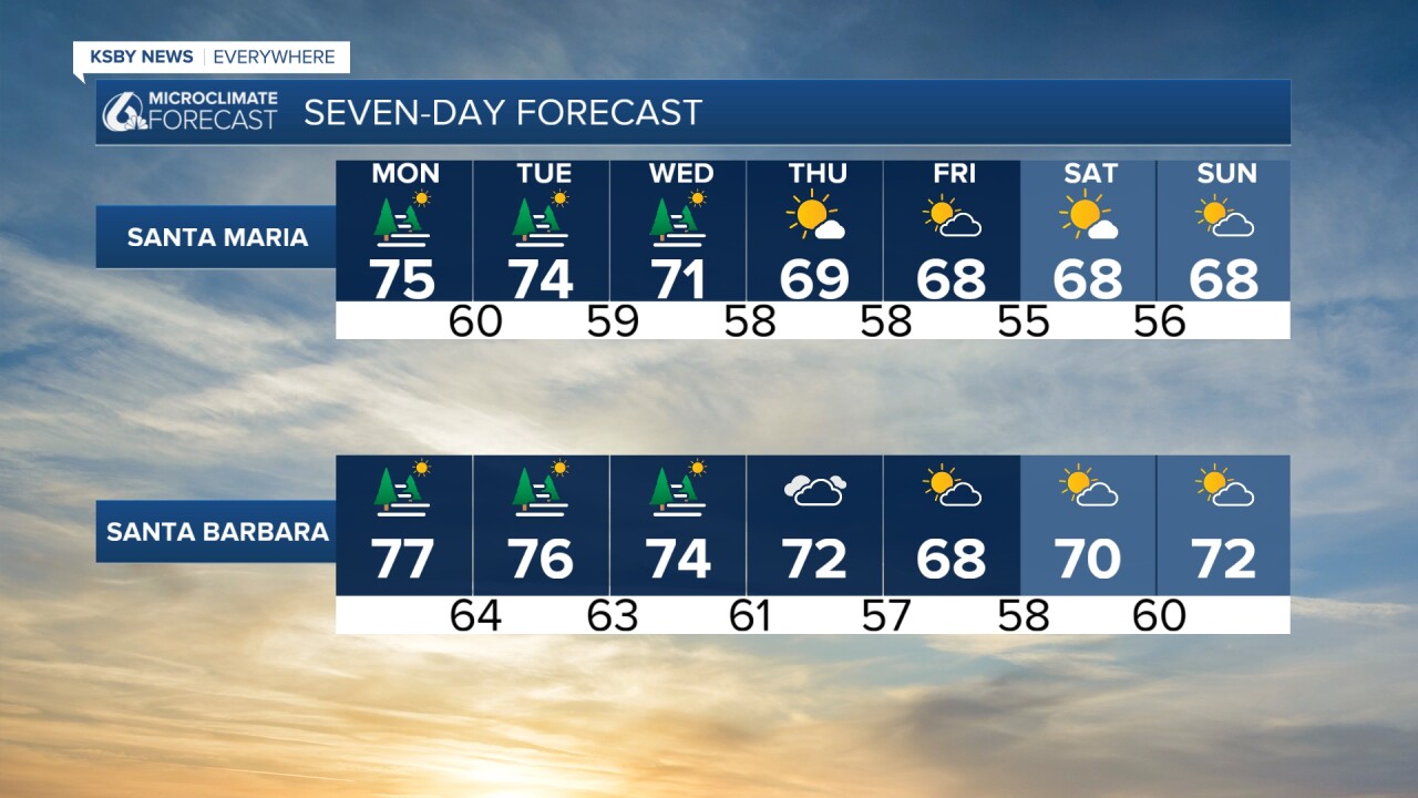
Bottom line: This is the break we've all been waiting for! Embrace the marine layer - it's bringing us the coolest, most comfortable weather in weeks.
Welcome back, marine layer, we've missed you!
-Vivian
