

Good morning, Central Coast!
This week is going to be a soggy one and likely to set records for the wettest Christmas week on record throughout much of the state. I'll get into all the details a little further into this article, but here is a quick glance at what you need to know going into the week!
- Temps cool slightly on Monday, but the week starts off mainly dry
- Atmospheric river to impact the region from Tuesday through Saturday
- Inches of rain are expected
- Flood watches are already in place
Starting off with what we can expect today. On the whole, we are starting off with a relatively quiet day (followed by all the action for the rest of the week).
The biggest concern today is dense fog in place for most of our coastal valley and inland communities. Take it slow on the roads where visibility may fall.

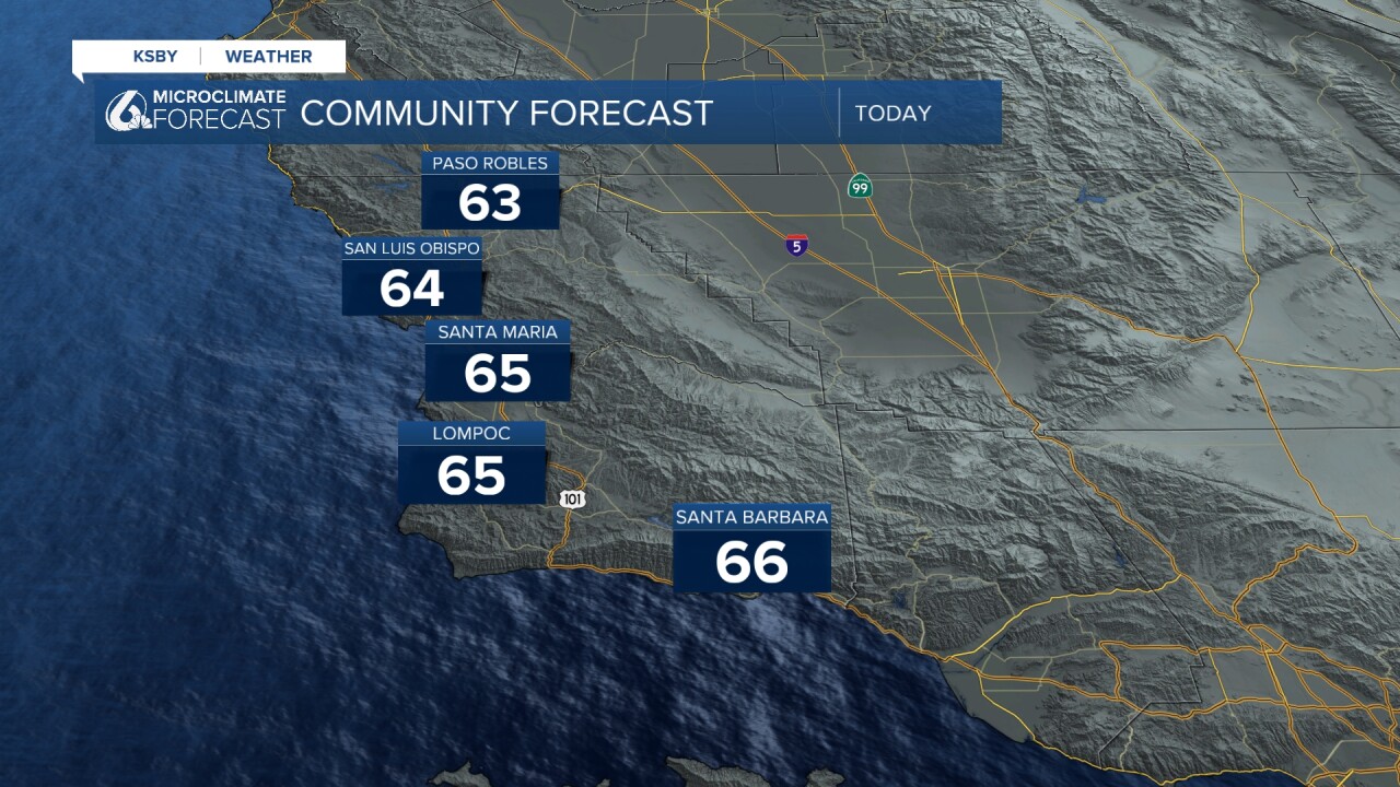
Temps are very mild to start off, mostly in the mid 50s with high 40s inland.

We will warm up a little bit into the daytime hours with most spots right around normal for this time of the year. Mid 60s are expected for all with some sunshine mixed into the bands of clouds coming off the system to our north.
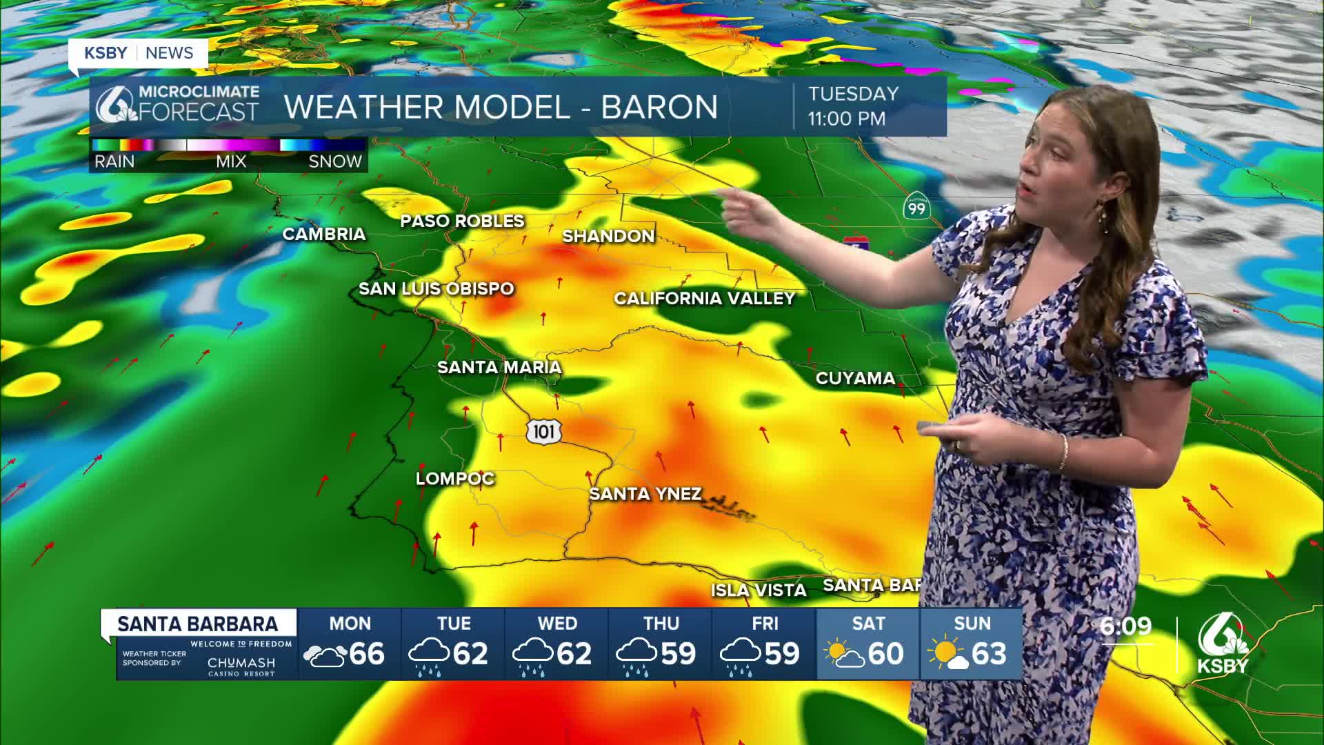
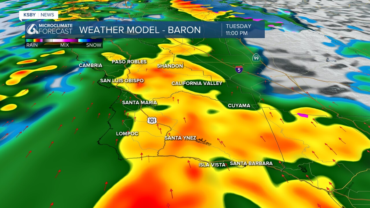
Turning to the big weather headline, our incoming storm. The large-scale atmospheric river is currently bringing heavy rain to the Bay Area and Northern California.

The core low pressure will start to rotate today and by tomorrow morning a few small scattered showers will reach us. They will start off mild but by the evening Tuesday heavy bands of rain will be upon us.
The worst of the storm is expected overnight Tuesday into Wednesday. That time frame will also bring the strongest winds.
Into Wednesday morning we will see some relief but showers will still stick around through Wednesday into Thursday morning.

More rain is expected Friday and into Saturday.
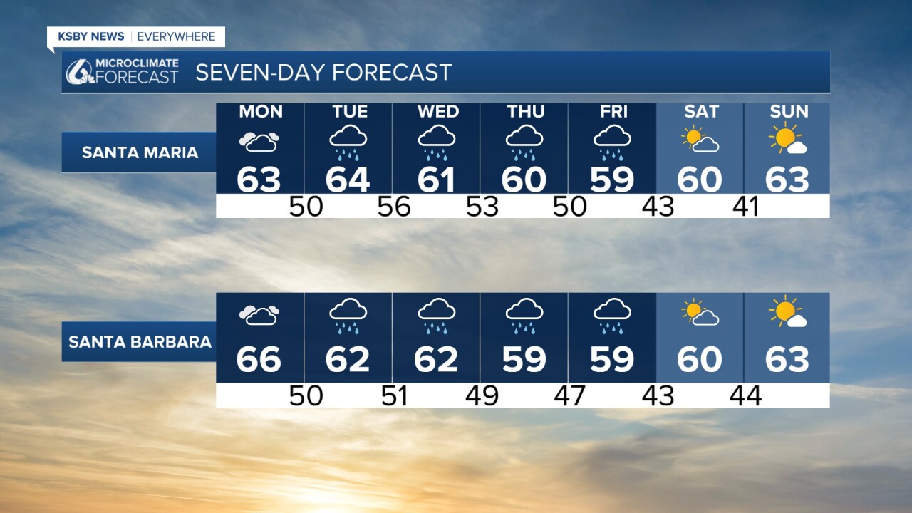
All of those days of heavy rain will combine to massive rain totals. Here is a look at what we can expect over the next 7 days.

That amount of rain is expected to cause flooding across the region. There is a flood watch in place through 10 p.m. Wednesday for the whole region.

One additional concern with the storm this week are strong winds. Here is a look at the timeline of the winds for Morro Bay for the first half of the week.
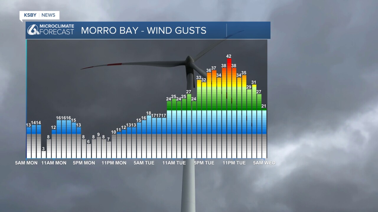
Those winds will be widespread and have prompted a high wind watch for the whole region. 50 mph winds are expected with strong, sustained winds as well. This watch is in place through 3 p.m. on Thursday.
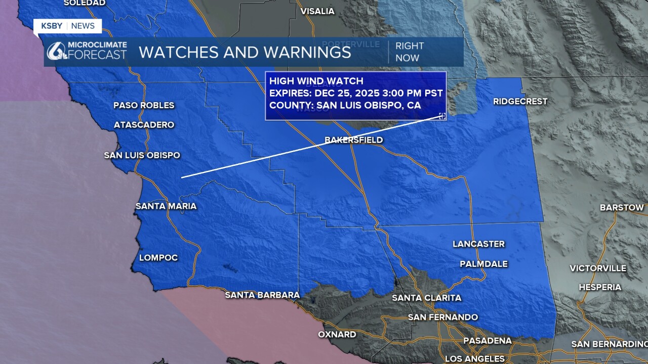
As the strong winds get closer I do expect the watch to upgrade to a wind warning for the duration of the storm.
I really like this infographic from the National Weather Service showing the impacts for our region over the week.

Here is what all of that looks like on your 7 day forecast!

I will be keeping a very close eye on the storm as we head through this week. Be sure to stay weather aware! Have a wonderful day and a great week ahead, Central Coast!
-Vivian
