

Good morning, Central Coast!
The weekend was beautiful across the region, with morning clouds giving in to afternoon sunshine. Highs were right around normal for this time of the year.
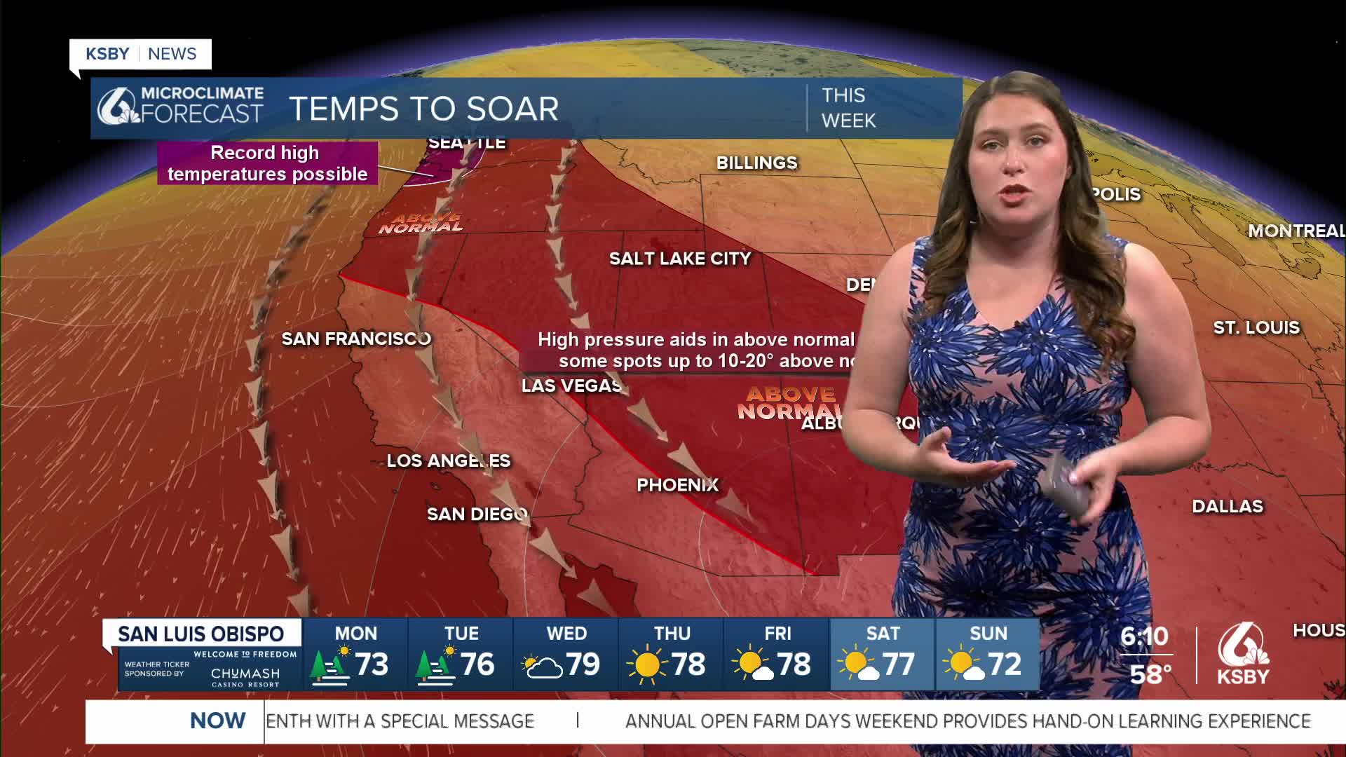
As we head into the week, temps will be the main story. Winds will push south and bring with them the heat. The Pacific Northwest will reach record highs, and the whole west will be under a broad ridge of high pressure.

This will help to limit the marine layer as well as the morning fog. Heat will be slow to build, though today's highs will only climb by a few degrees. Here is what we can expect.

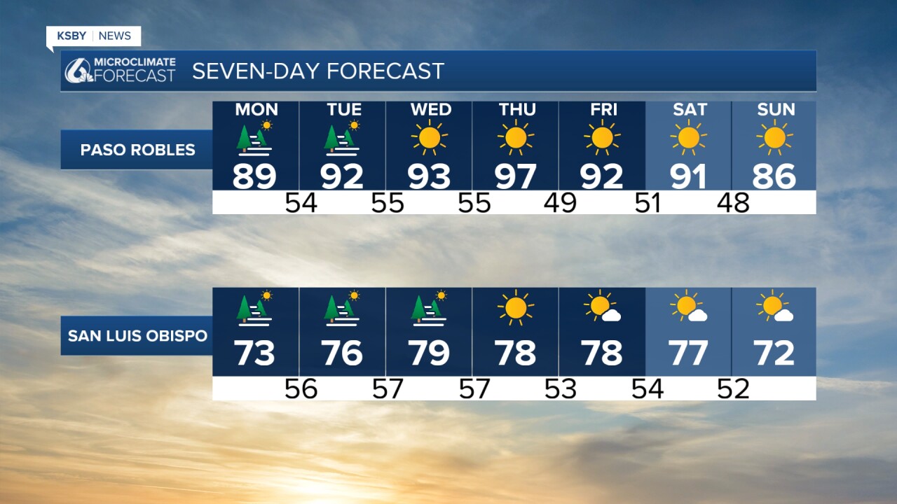
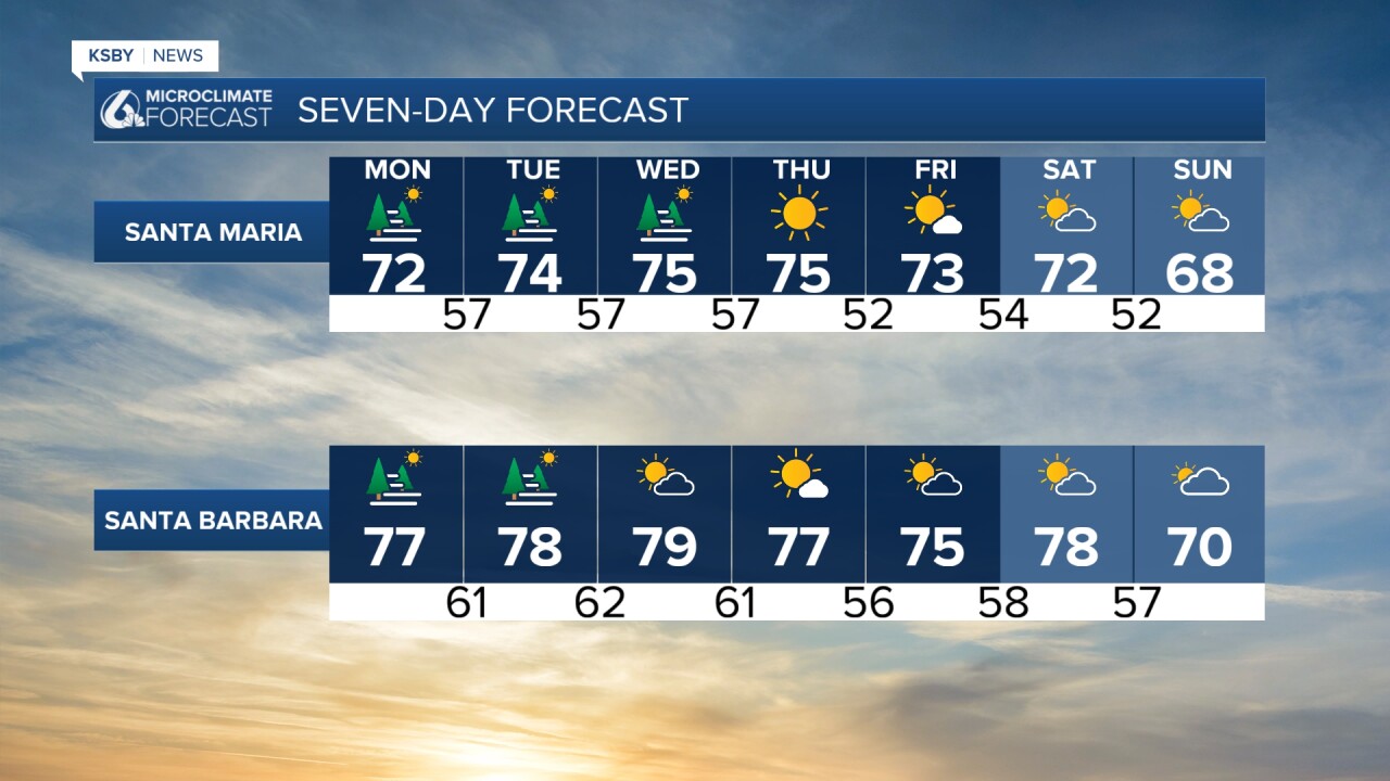
Day after day, we will see the warmer weather build in. Morning fog and cloud cover will give way to sunshine each afternoon, and highs (for the interior valleys) will jump. Upper 90s are expected on Thursday for the hottest day of the week.
Into next weekend, the ridge will start to break down and temperatures will start to fall back towards normal or this time of the year.
Have a wonderful day, Central Coast!
-Vivian
