


Good morning, Central Coast!
As we kick off our Thursday morning, skies are sunny with a few mid-level clouds mixed in. There is some high-level smoke from the Plaskett Fire, but not too much of an issue.
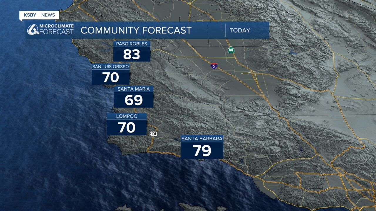
Today's highs will be a degree or two above yesterday's, with very comfortable conditions across the region. Here is a look at those temps.
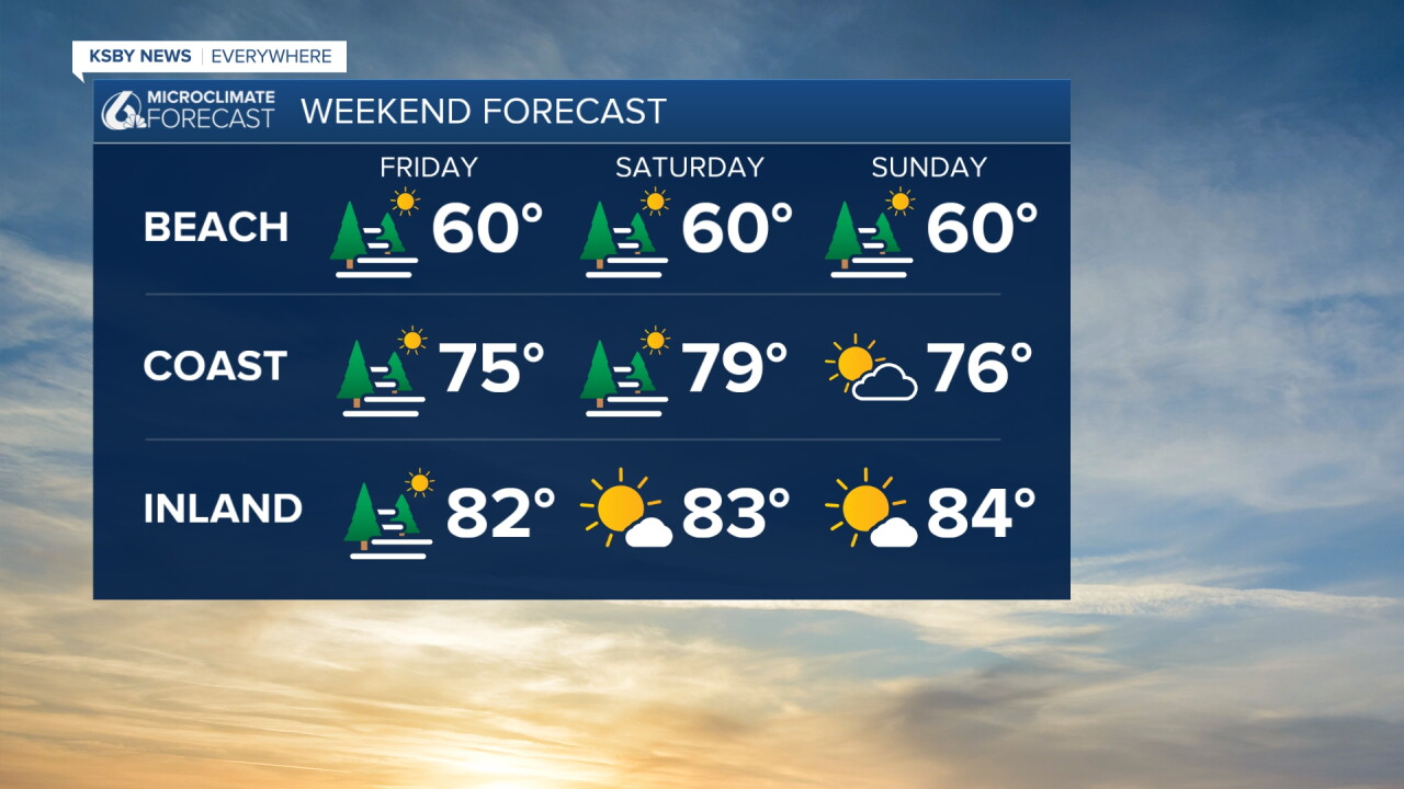
Into the weekend, we will see very similar conditions, with high temps a few degrees below normal for this time of the year. Morning clouds will give way to afternoon sunshine each day. Here is a look at that forecast!
Into the weekend, there are a few wrinkles thanks to a very active Pacific region. There are three named storms in the Pacific right now, with Hurricane Marie causing the bulk of the concern.
This will NOT make a direct hit to us. The storm will continue its path out to the Central Pacific. What it will do, though, is bring more humidity and higher waves to the region. It may also bring a raindrop or two late Saturday as a far outer band of clouds pushes through the region. No need to worry or pay too close attention to it, though. Impacts are almost nonexistent.
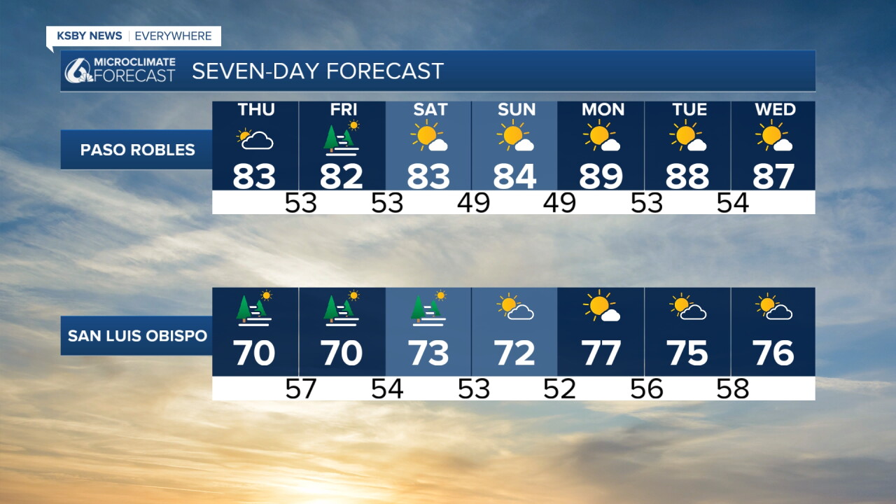
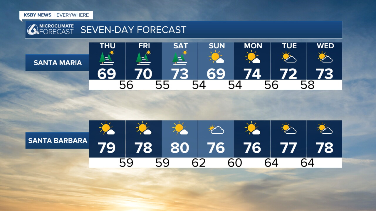
Here is a look at all of that on the 7-day forecast!
Have a wonderful day, Central Coast!
-Vivian
