


Good morning, Central Coast!
After a rainy, though mild, Monday, we have a bit of a break in the rain with cool temps for our Tuesday.
There is some dense fog in the southern Salinas River Valley, with visibility falling to less than a quarter of a mile. This has prompted a Dense Fog Advisory for the Paso Robles region through 9 a.m.
Some strong winds are also in place for the Gaviota Coastline this morning. There is a High Wind Advisory in place through 9 a.m.
On top of all of that, it is a cold one, with many locations in the 30s this morning. Grab that extra layer on the way out the door.
Even this afternoon, highs will stay on the cool side. Here is a look at what you can expect.
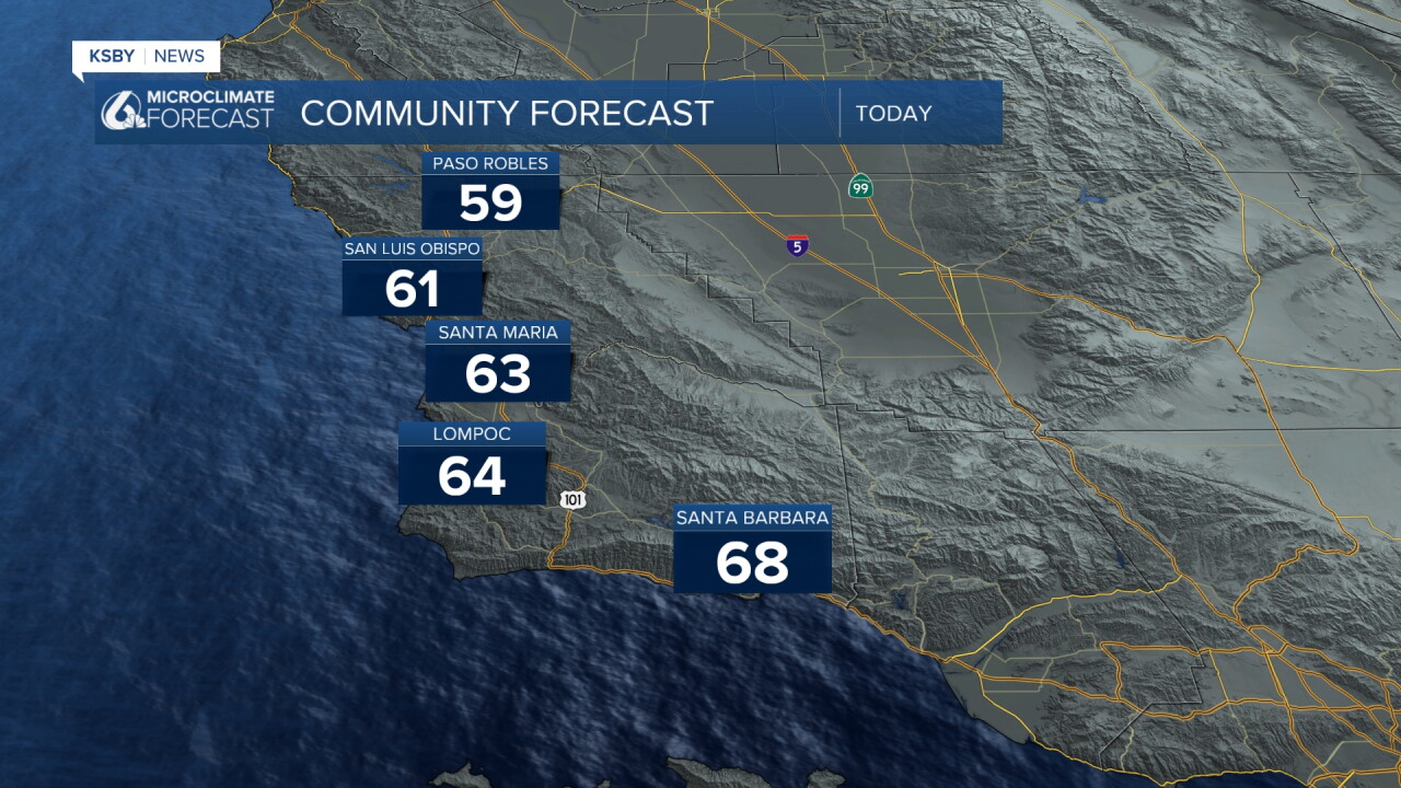
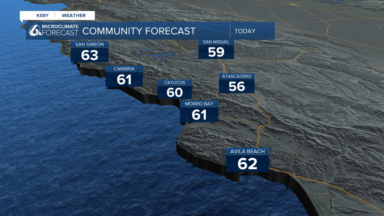
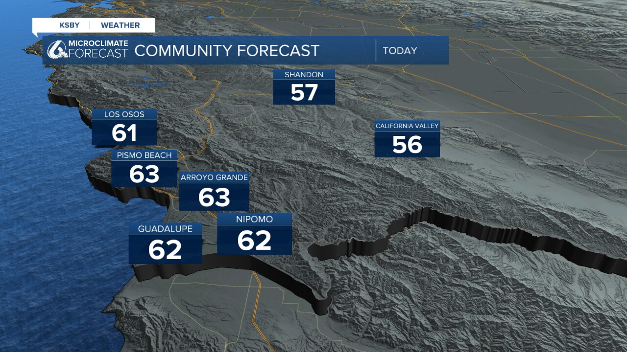
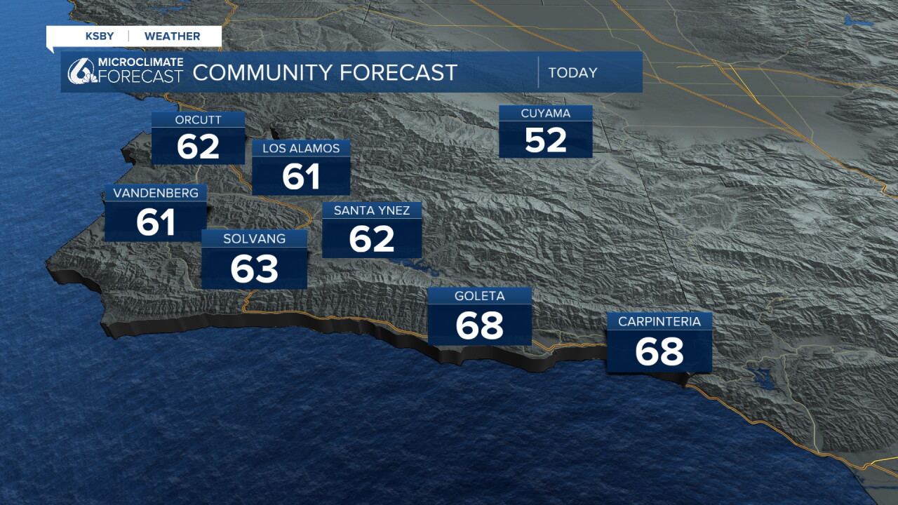
Some very isolated showers are still possible for today, but for the most part won't be impactful.
The greater concern is Wednesday when a much stronger storm pushes in. Thunderstorms are expected with localized very heavy rain. That brings flooding risk and potential driving hazards starting Wednesday evening and continuing into Thursday as more pockets of heavy rain move in. The vast majority of the rain and the hazards will be late Wednesday into the overnight hours.
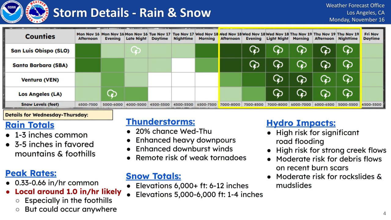
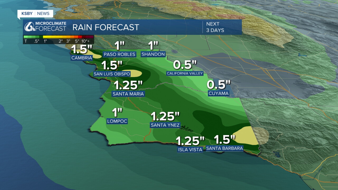
Accumulation-wise, that storm will be a bigger one, with several inches of rainfall possible. Peaks will see the highest totals, with up to 3 inches possible locally; many spots will pick up 1.5 inches.
Beaches remain a concern today and into the larger storm, with many alerts extended to include Wednesday. Here is a look!
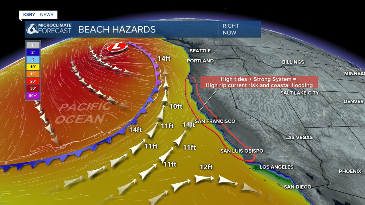
All of our beaches are under a High Surf Advisory through Wednesday at 4 a.m. The advisory may be extended through Friday as another round reaches us.
- Breaking waves of 10 to 15 feet, increasing to 15 to 18 feet, with localized sets reaching 20 feet.
- Dangerous rip currents, significant beach hazards, and an increased risk of ocean drowning.
- Large waves could wash people off rocks and jetties, cause beach erosion, and capsize small boats near shore.
Looking into the 7-day forecast, another storm is possible on Sunday; this will be smaller but still something we are monitoring.
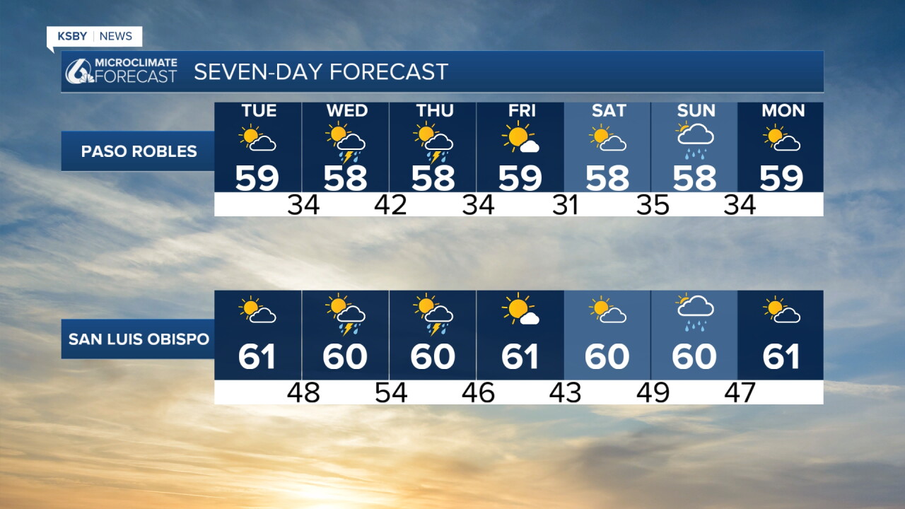
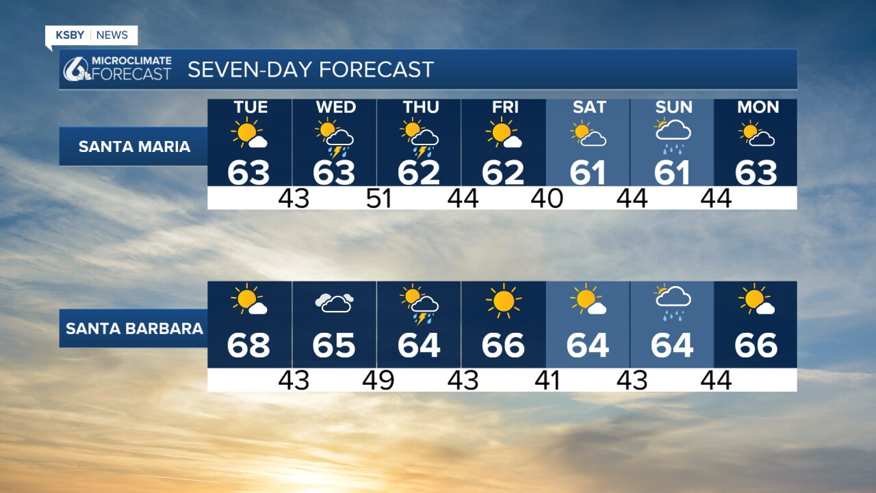
Into the farther extended forecast, we can expect the more active pattern to continue through the end of November. That does mean we expect more activity during the Thanksgiving travel period, although it is still too early to nail anything down.
Have a great day, Central Coast!
-Vivian
