

Happy Tuesday, Central Coast!
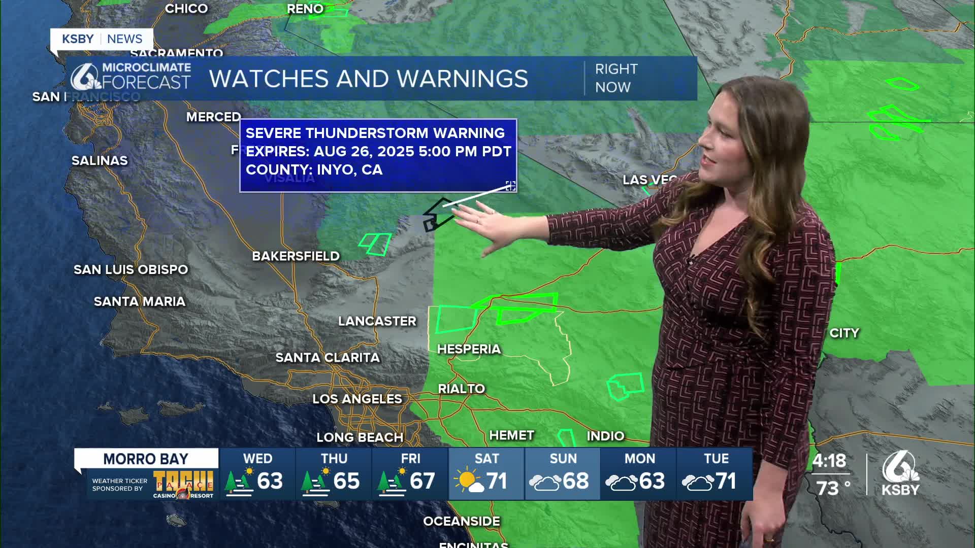
Today was a little bit of an interesting weather day across the Central Coast. While we saw no storms, if you looked East from the region there is a good chance you were able to peak towering thunderheads from storms almost 150 miles away. Here is what they looked like from the KSBY News Studios!

Here is what they looked like on radar, a long way away for sure.

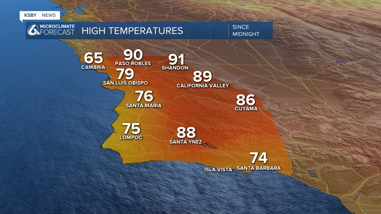
Tuesday brought mostly sunny skies and temperatures around normal for this time of the year.
That noticeable cooling trend was aided by fog along the coastal valleys and beaches, alongside winds pushing cooler air onshore. Tuesday evening those winds picked up in northern SLO county. Here is a look at those speeds.

Wednesday will start off with another round of fog for the beaches and coastal valleys, although that will clear quickly, and we are in store for another round of near normal temps.

Into Labor day weekend, temps will rise once again and make for a warm and sunny holiday across the region. Thankfully, this warm-up is not as substantial as recent heat waves, we will stay well below warning level criteria.


Also, into the weekend, I am keeping an eye on the tropics. Tropical Storm Juliette i moving north parallel to Baja California. It will lose strength well before reaching us, but brings the potential of slightly heightened surf into the weekend. Not a particularly large problem, but something to be aware of.

Have a wonderful evening, Central Coast!
-Vivian
