


Good morning, Central Coast!
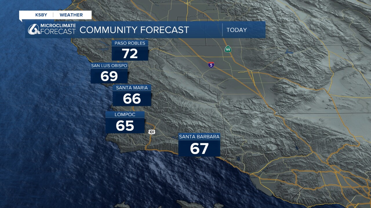
As you kick off the morning, we have another day of cooler temps and overhead cloud cover.
Some dense fog this morning is limiting visibility in the Paso Robles area. That is mainly due to winds from the north bringing in cloud cover that is getting trapped behind the Cuesta Ridge. That will clear out quickly, and we will see a cloudy morning and partly cloudy afternoon with temps similar to Monday.
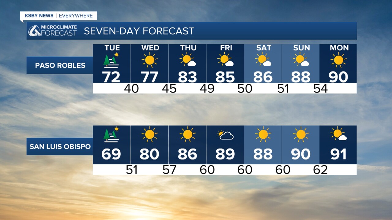
Starting Wednesday a ridge of high pressure will build in and replace the lingering low that brought us the cooler temps today. That will start the offshore winds, abundant sunshine and hot temps.

Those hot temps will stick around for the extended forecast with widespread highs in the 90s by the weekend.

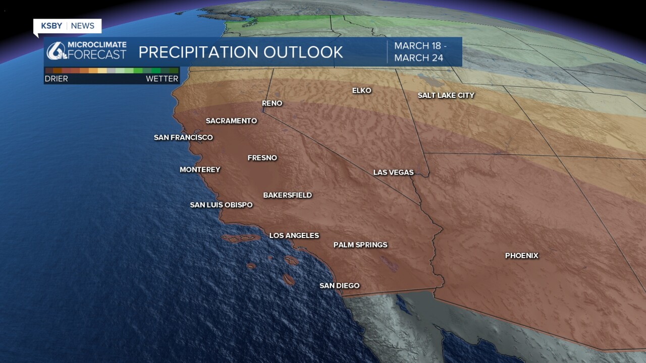
Even past the 7-day forecast the ridge of high pressure, hot weather, and dry conditions will continue. Here is a look at what we can expect from Next Tuesday through March 24th.

Have a wonderful day, Central Coast!
-Vivian
