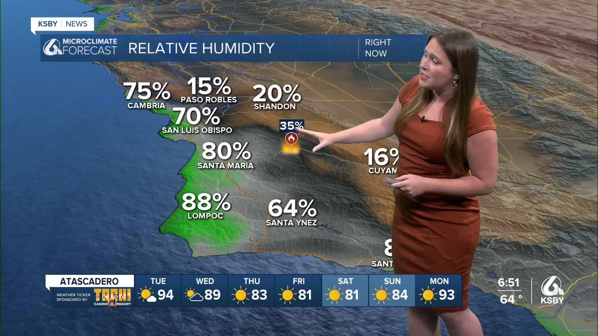


Monday started the week with hot temps and continued fire weather conditions across the region. There is good news though, a low-pressure trough is on the way and will bring cooler weather and a more humid airmass to the region by later this week.
Before I dive into the forecast, I want to take a moment to update information on the Gifford Fire.
As of Monday afternoon, the Gifford Fire has burned 120,779 acres and is sitting at 33% containment. For the latest updates on the Gifford Fire, click here.
Here are a couple of links on Air Quality Information for San Luis Obispo and Santa Barbara counties:
Air Quality Information San Luis Obispo County
Air Quality Information Santa Barbara County
Residents in San Luis Obispo County can check whether their property is included in evacuations by visiting this link.
For information on evacuation orders and warnings in Santa Barbara County, click here.
Highway 166 also remains closed between Highway 101 and New Cuyama with no estimated time for reopening.
Let's dive back into the forecast!
High pressure has increased heat across the region, temps are hot enough to cause some concern. There is a heat advisory in place until 9 p.m. Tuesday for the interiors of Santa Barbara County.
Additionally, there is a wind advisory in place for the Gaviota Coastline for this evening (expiring at 3 a.m. Tuesday morning). That is a typical Sundowner Wind event with gusts up to 30 mph.

Winds also continue to be a concern for the rest of the region. Gusts up to 25 mph will once again be in place Tuesday, plus overnight wind gusts at peaks near the Gifford fire are expectd to continue overnight.
Tuesday will bring a slight warming trend to the region. That will bring temps farther into the triple digits for interiors, upper 70s and low 80s elsewhere.
Turning to the extended forecast, the pattern is set to change. An upper-level trough of low pressure is headed to the West Coast, which will shift winds and bring much cooler marine air to our communities. The transition will be on the slow side, though, upper 90s will still be the story Thursday in Paso Robles, low 90s by Friday and the weekend will feature temps in the 80s. That dramatic cooldown will also be felt in our coastal valleys and beaches. Most coastal valleys will be in the low 70s by Saturday.


Stay informed and aware of the ongoing heat and Gifford Fire updates.
-Vivian
