



Good morning, Central Coast!
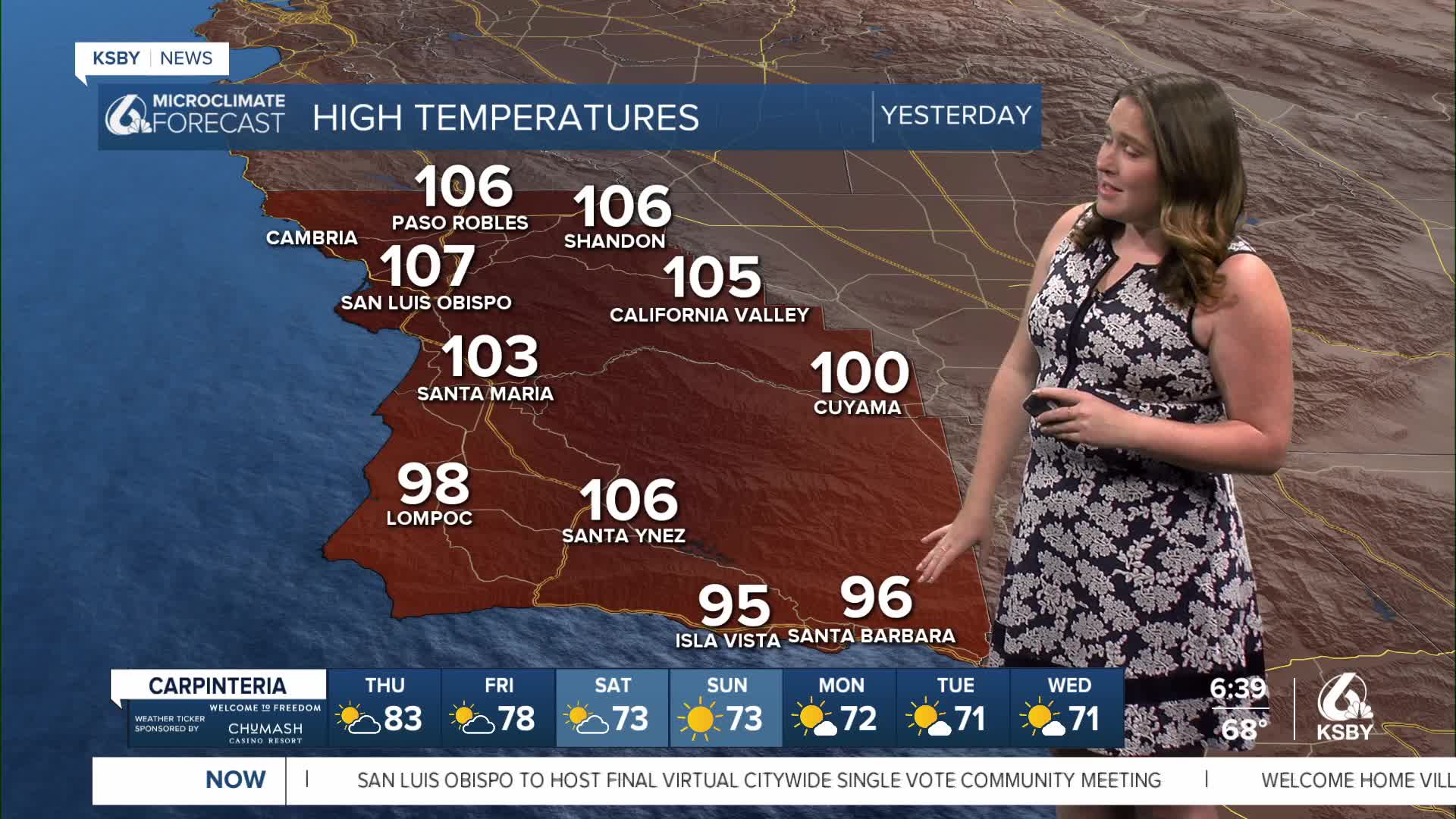
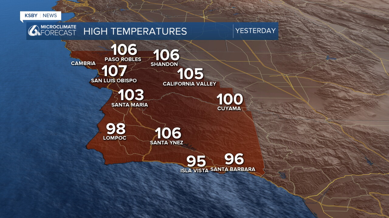
Yesterday was a record breaking hot day across the region. Thank you to all the viewers who sent me the high temps you recorded yesterday! Looking at all of them together it is clear that this is a heat event we won't be forgetting any time soon. Here is a look at those high temps.
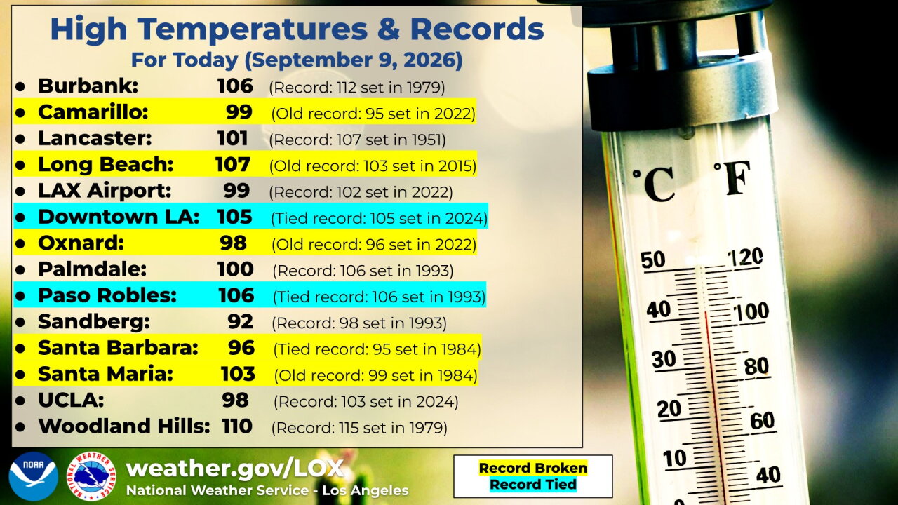
Many of those temps are new daily temp records for September 9th. Here are some of the records that fell across the region.
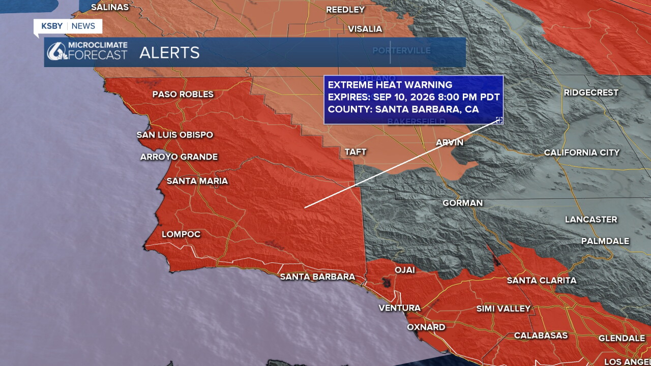
Today will be another hot one. Extreme heat warnings are still in place through 8 p.m. Thursday.
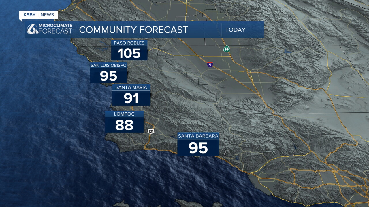
Highs will still soar into the triple digits in Paso Robles and other interior valleys. Thankfully coasts will see temps a bit cooler than yesterdays dramatics. Highs in the 70s (even down to the coasts) are still expected but without as much offshore support the temps will not be quite as high. Here is a look.
Combine those temps with the higher humidity, sunny skies, and lack of overnight cooling heat stress is a concern for sensitive groups across the region.
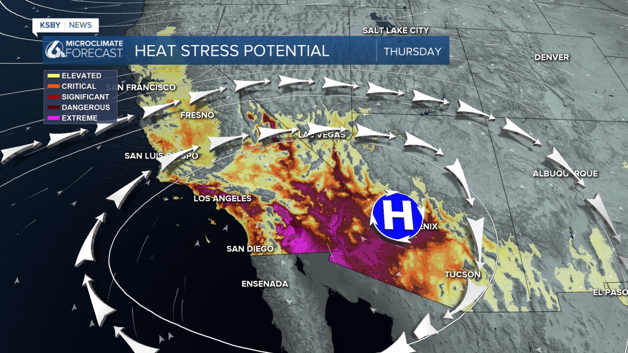
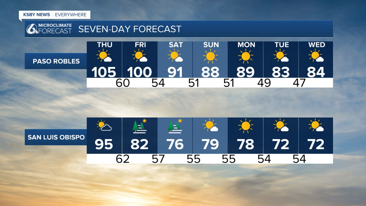
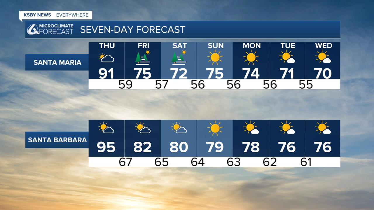
That core of high pressure will push east tonight and bring onshore winds to the surface. That shift in winds will usher in a much cooler pattern. This weekend temps will fall below normal for this time of the year. For the first half of next week that change will perpetuate more for a mild pattern.
Here is a look at that cooldown on your 7 day forecast!
Stay cool, Central Coast!
-Viv
