

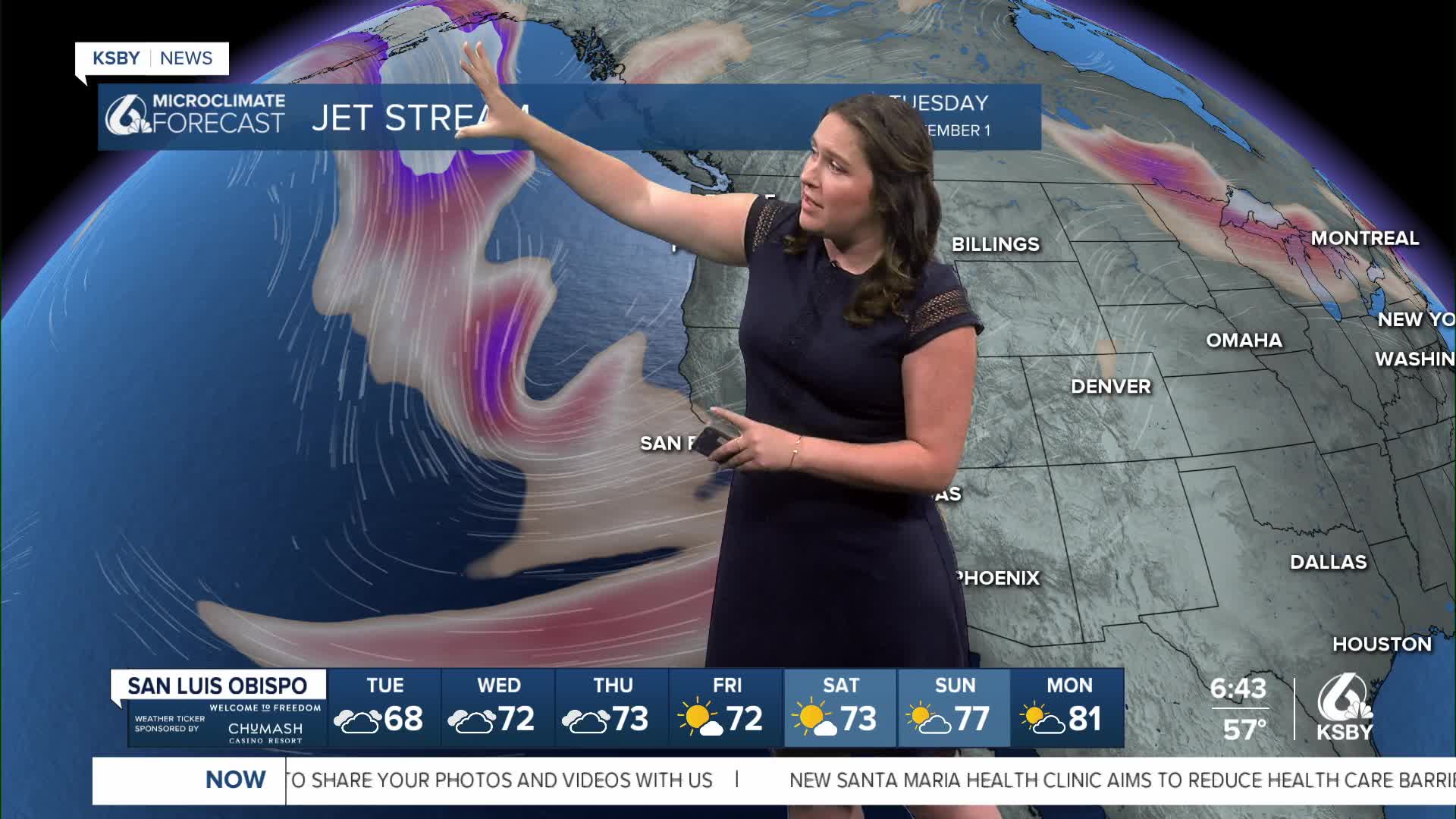


Good morning, Central Coast!
To kick off the morning, air quality is significantly improved as onshore winds banish smoke from the Timber and Plaskett Fires in Big Sur.
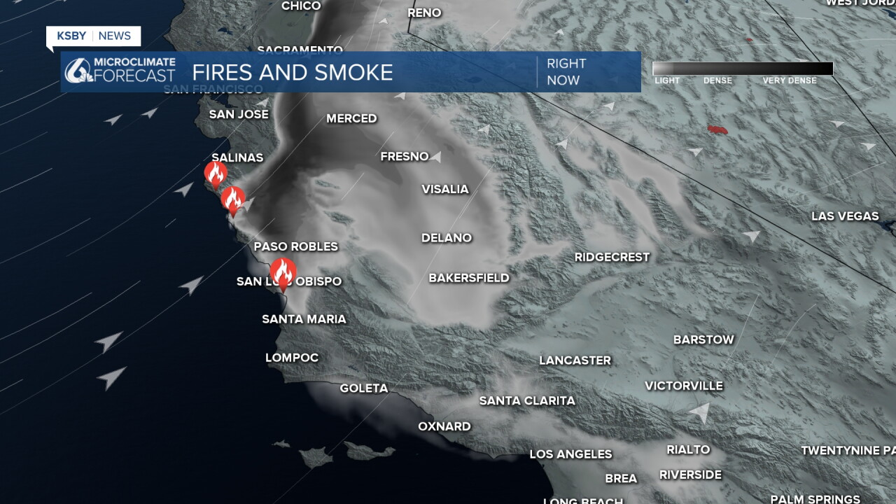
Clear skies are expected today; that being said, tomorrow morning smoke is likely to move back in for another round of air quality concerns.
Temps today are still well below normal for this time of the year as a trough of low pressure pushes cool dense marine air into all of our communities.
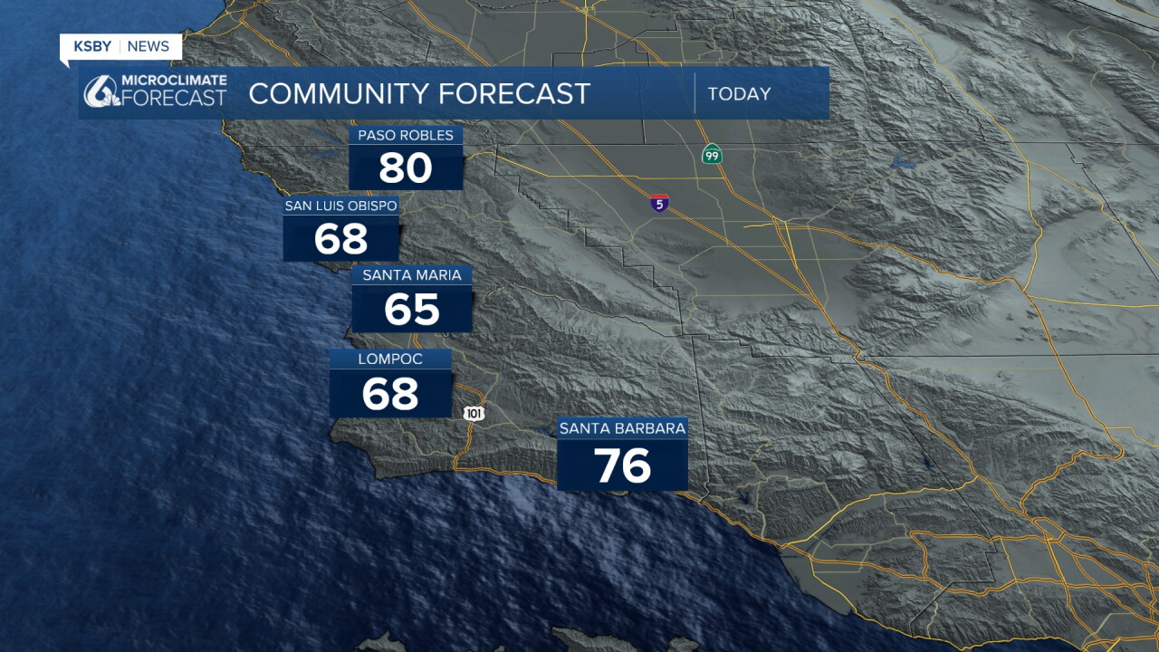
For some context the typical daytime high for Paso Robles is 94 degrees for September 1st.
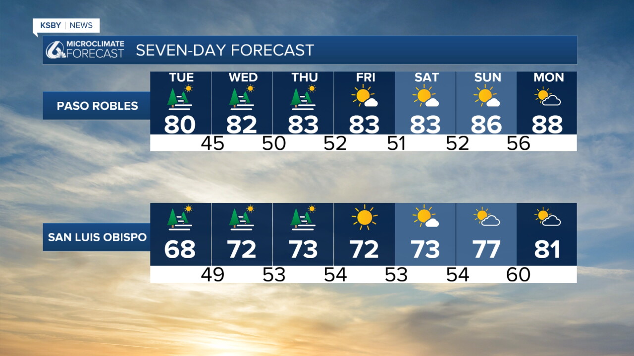
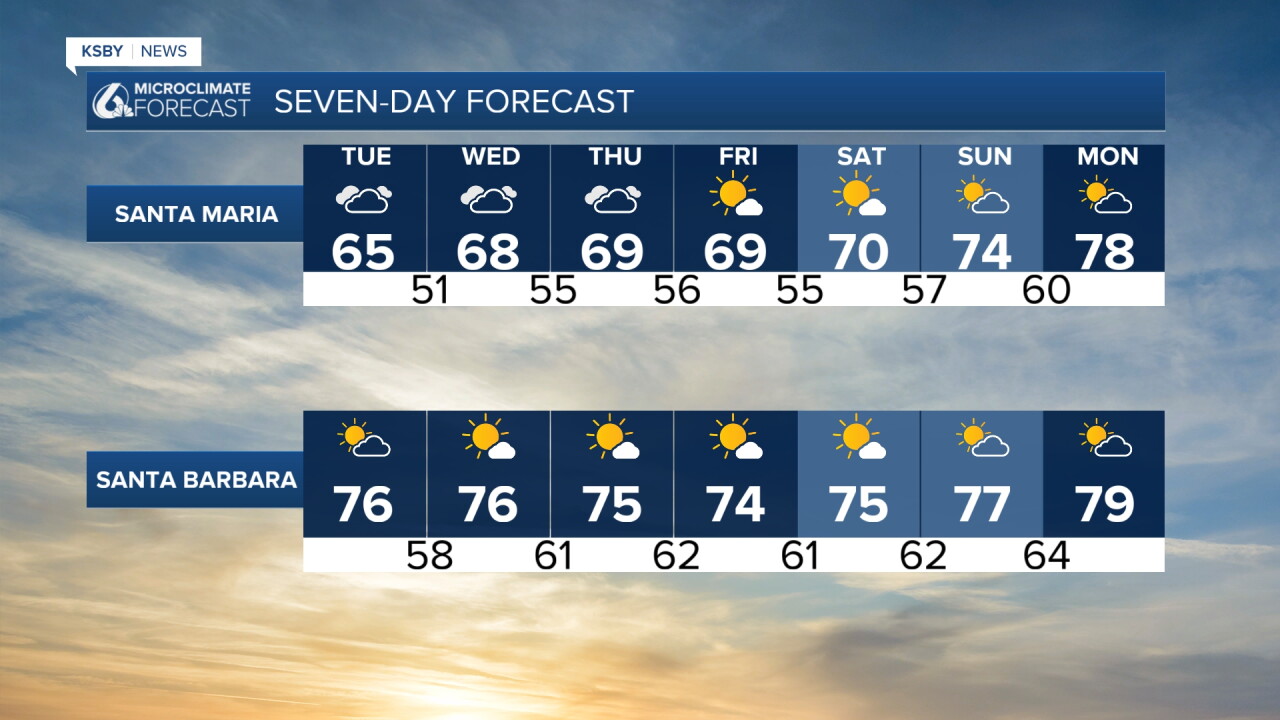
Over the next few days little will change, cool temps will stick around with very little change. Some warming is expected for the weekend.
Turning now to the big talker...
There's a lot of buzz online about the holiday weekend turning active. It's complicated and very unlikely, but here's what you need to know.
There's now an official storm to watch. Tropical Storm Maria is sitting southwest of Mexico. Most models (and the National Hurricane Center) take the storm off our shores with this track.
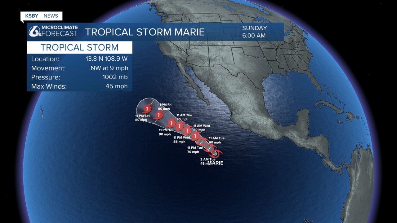
One model (the GFS) takes it north and draws tropical moisture into far Southern California in the 7-8 day range. Most likely scenario: it curves offshore and SoCal just gets a few more waves and some added humidity. The scenario making headlines is the one where the storm center pushes north, which could mean meaningful rain for the LA Basin.
Here's the thing: NWS Los Angeles/Oxnard itself says the GFS is creating "quite a bit of excitement," but no other major model agrees, not even the AI version of the GFS. NWS San Diego says fewer than 5% of their ensemble members even support this. So this is very much an outlier, not a forecast.
(Also, if you're seeing big surf and rip currents already, that's Hurricane Karina, a totally separate Cat 4 storm way out in the Pacific. Not related to this story.)
I'll keep watching and update you if more models start agreeing, but for now, it's one fun-to-watch model run, not something to build weekend plans around.
Bottom line, there is little change through the next few days ahead of a larger warm up into next week. Here is that 7 day forecast!
Have a wonderful day, Central Coast!
-Vivian
