


Happy Wednesday, Central Coast!
We have another night of low temperatures for the interior valleys. Lows may drop towards 28 degrees. That has prompted another night of Freeze warnings as well as a frost advisory. Both are in place through 8 a.m. Thursday morning.

There is a lot of action along our coasts over the next few days. Starting off with waves. We are in the last few hours of a High Surf Advisory. It is in place through 3 a.m. Thursday as a long-period swell will bring large breaking waves 8 to 12 feet with a dangerous rip current to our western beaches.
Additionally, all beaches are under a Beach Hazard Statement though 11 a.m. Saturday, thanks to another round of King tides associated with the full moon. Small-scale tidal inundation is possible from the 4th to the 6th due to the tides.

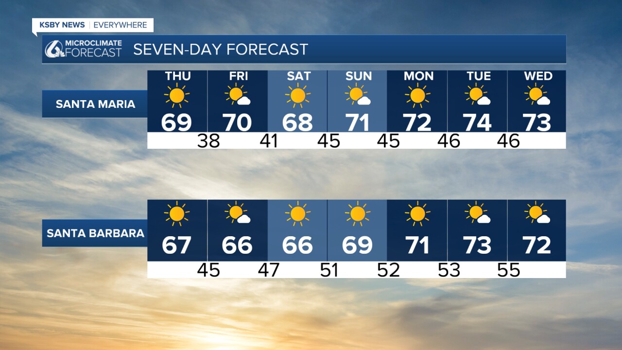
Temperatures tomorrow will climb slightly but on the whole will be near to today's highs.

Into the weekend, a high-pressure system will settle in. That will allow temps to climb. We can expect abundant sunshine and high temps climbing into the 70s for most spots. This will also help to warm up the overnight temps. Lows will stay above freezing through the weekend.
Here is a look at all of that on the 7-day forecast!

Have a wonderful evening and a great rest of the week, Central Coast!
-Vivian
