

——— Update: 1 p.m. ———
A winter weather advisory has been issued for the interiors of Eastern Santa Barbara County from 9 p.m. Saturday through 11 a.m. Monday morning. As the storm moves over the cold high peaks, wet snow is expected with winds gusting as high as 40 mph.

———Original Article———
Happy Friday, Central Coast!
Before I get started, here is your Interactive Radar. Plus, here is a look at the interactive rain totals.
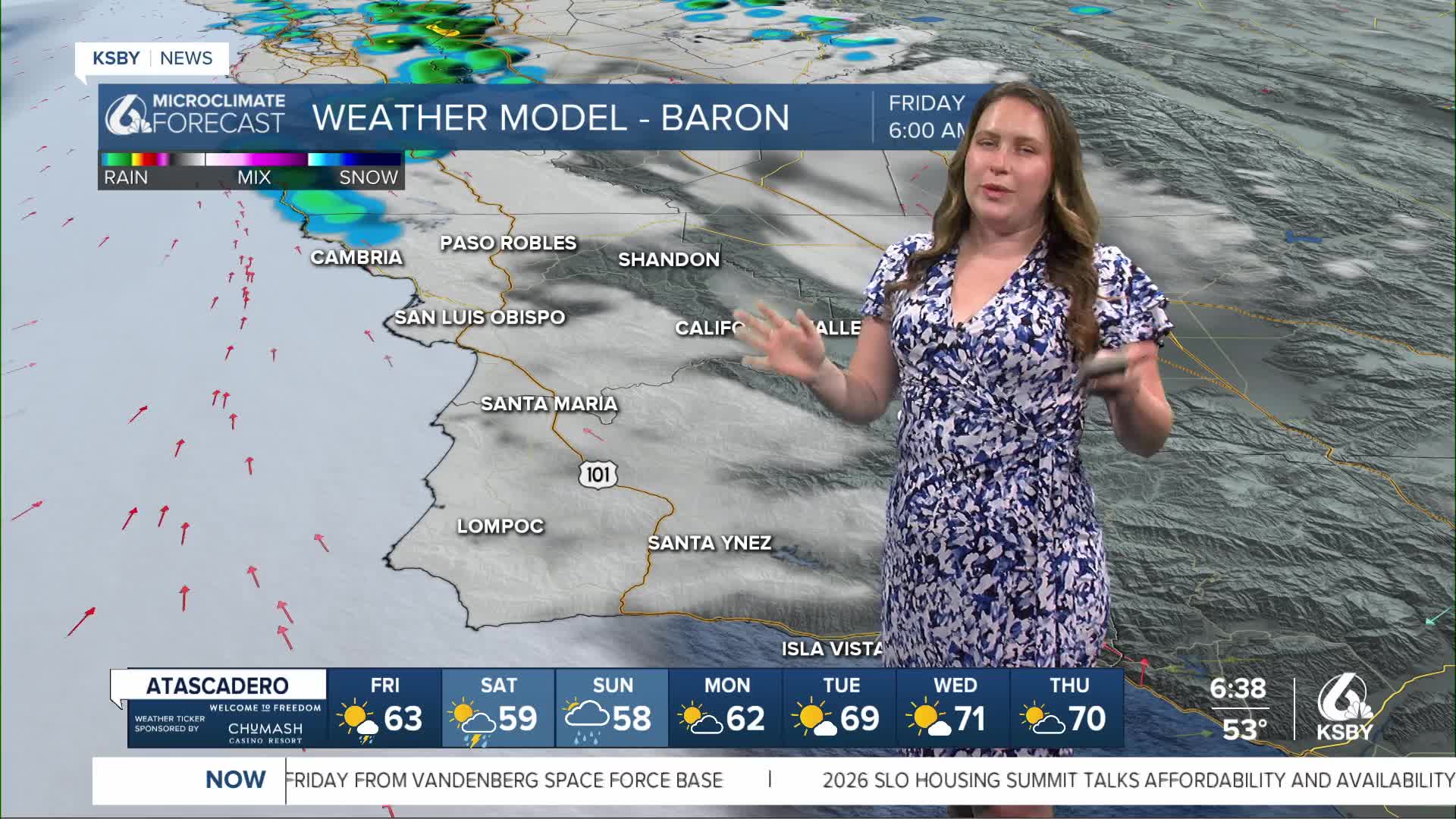
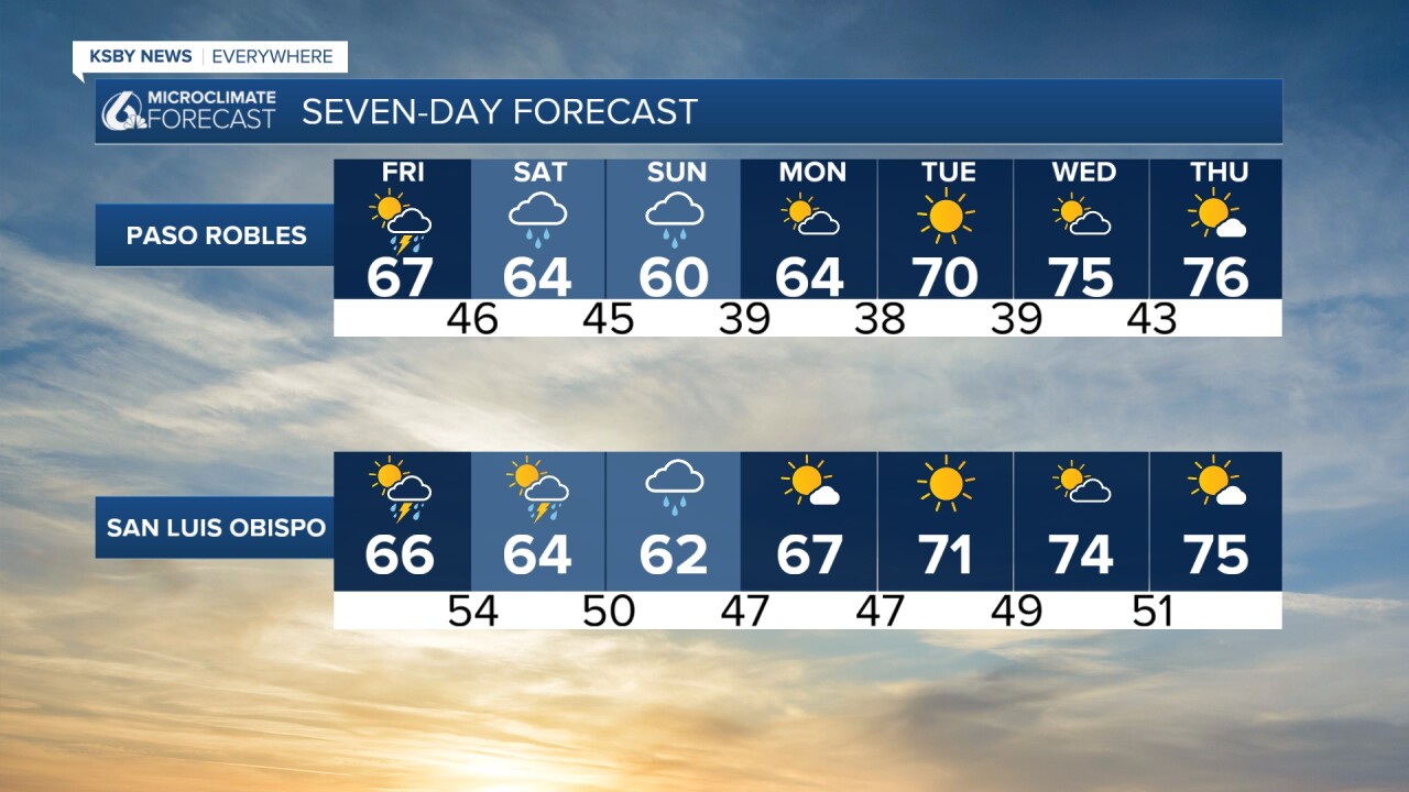
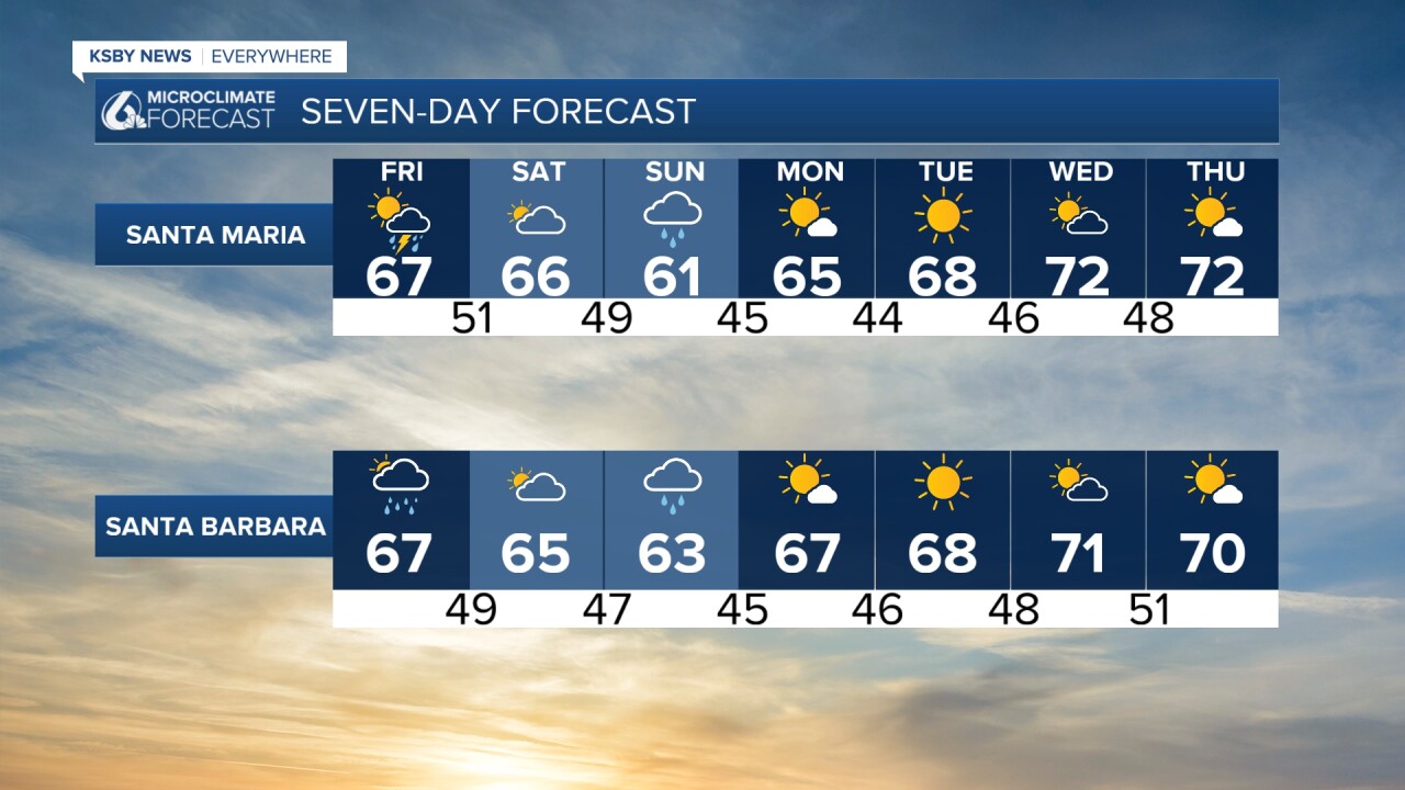
The rain we have been talking about all week is nearly here. The first few light scattered showers will begin by mid-morning and become more widespread through the day.
The showers will begin light and become more widespread through the daytime hours on Friday and Saturday. While most of the storms will be mild. There is some small severe weather risk of significant winds, heavier, downpours, and potential hail all the way through the system.
For those headed the Poly Royal Rodeo Friday night, luck might just be on your side! Storms will continue this afternoon, but look like they will take a little break this evening. It won't be perfectly dry, but on the whole, it looks to be a bit milder than today.
Saturday morning will once again feature cloud cover and accumulating rainfall very similar to Friday. The big difference is Saturday night.
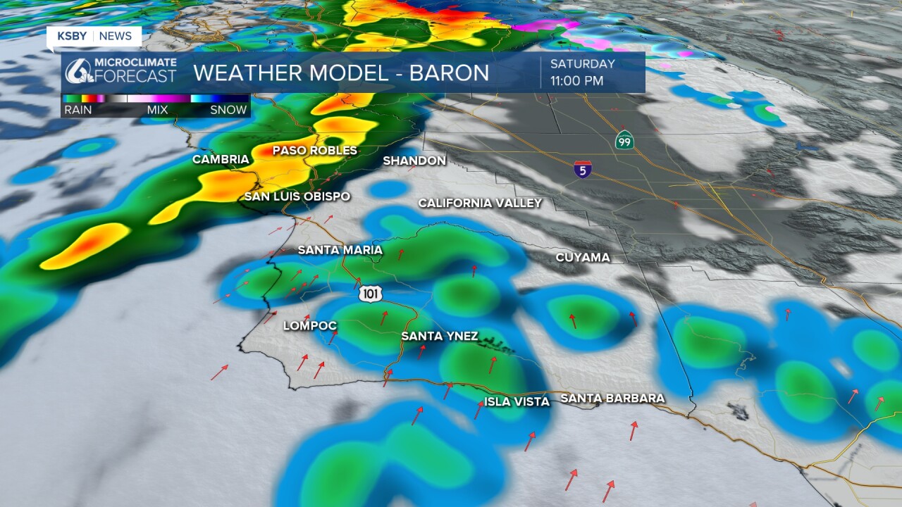
Saturday night a second cold front will reach the region and bring us the greatest chance for severe weather. Thankfully, recent model runs show it getting here a little bit later than initially anticipated. That is good news for the Poly Royal festivities Saturday night, as most of the storms will pass through after that has ended. Penny-sized hail, heavier downpours, and strong winds are expected. The chance is minimal, but there is the possibility for a severe thunderstorm warning as the front pushes through.
Sunday will be a mixed bag as the storm leaves, but still showers are possible through early Monday morning.
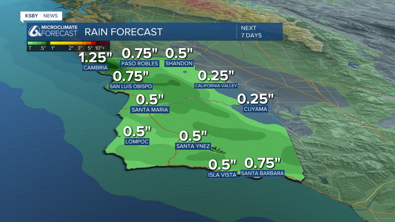
All said and done, half to three-quarters of an inch of rain is expected across the board.
Temps today will be wholly unremarkable. Cooler with highs around 68 degrees.

This weekend will be far from a washout, but it is best to keep an umbrella handy.
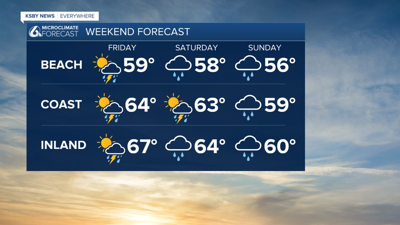
Here is all of that on a 7 day forecast.
Have a wonderful day, Central Coast!
-Vivian
