

Rain is here!
Through the evening hours, I will add updates on the storm to this story. Check back for the latest! Before I dive in, here are a few links to have on hand.
Update 10:30 p.m.
The first round of storms has passed (I have taken all the expired alerts out of this article), we are now just waiting on the main event!
Overnight, the bulk of the system will pass through and bring the chance for a rumble of thunder (or two) across the region. Thankfully for drivers, this means that the accumulated oil will have washed off the roads ahead of the morning commute.
That being said rain will still be falling across the region during the commute and into the rest of Thursday, and some showers are even possible on Friday. Here is a quick look at the timeline as the storm progresses. Long story short, off and on rain is expected.

With how much rain some communities picked up from the short-lived storms today, I am upping my rain accumulation forecast by a little. Here is my map for the high end of what our communities will receive. It is not going to be this consistent and widespread, but the trend is there for the highest totals we can expect.

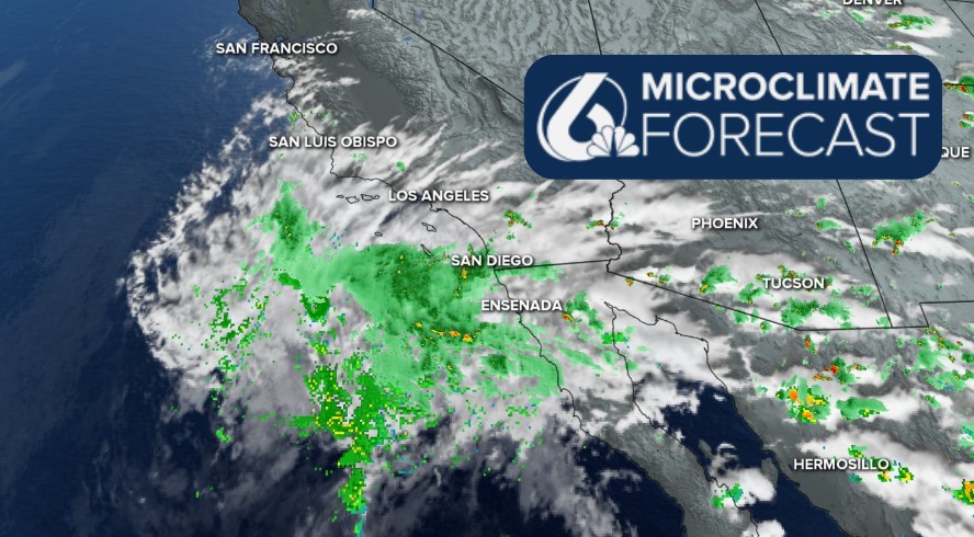
Overall setup and general forecast.
The remnants of Tropical Storm Mario are here and are bringing some pockets of heavy rain to the Central Coast tonight and much more rain over the next few days.
Here is what the storm looks like in its entirety.

Starting early this afternoon, the leading line of storms pushed through. These storms were small in scale but packed a punch. Winds up to 50 mph and localized downpours warranted short-lived special weather statements for impacted communities. On the broader scale, there are Flood Watches in place for all interiors of Santa Barbara and San Luis Obispo Counties through Friday morning. This is an alert for localized flooding chances where the small-scale storms set up, particularly for poor drainage spots.

Into the evening the small storms will give way to weaker, broader scale bands of rain. By commute hour Thursday morning we can expect rain over much of the region.

Be aware of slick roads as the accumulated oil washes off.
Through the day Thursday and into the evening, scattered storms will continue to make for a messy radar and more accumulations across the board.

Into Friday, the storms will become fewer and farther between, but small chances of storms will last into early Saturday morning.
All said and done the storm will bring vastly differing totals depending on location. Interior valleys will pick up the most with some spots expected to be up to an inch, beaches will see the least with some only seeing a few hundredths. Here is one model that shows the variability. I think this one is a little weak but shows the general trend well.

Back to the 'nuts and bolts' of a forecast. Temps tomorrow will be much cooler than the earlier half of the week. Low 80s for the interior valleys, mid 70s for coastal valleys, upper 60s for the beaches.

Into the next 7 days, a small ridge of high pressure will warm temps for the latter half of the weekend, bringing temps back to the seasonal normals. That will not last long, though, cooler weather and a small chance for rain move in for the second half of next week.


Be sure to stay aware, Central Coast!
