



Good morning, Central Coast!
Grab that umbrella or raincoat; rain is here! Before I dive in, here are a few links I like to keep handy when rain is falling!
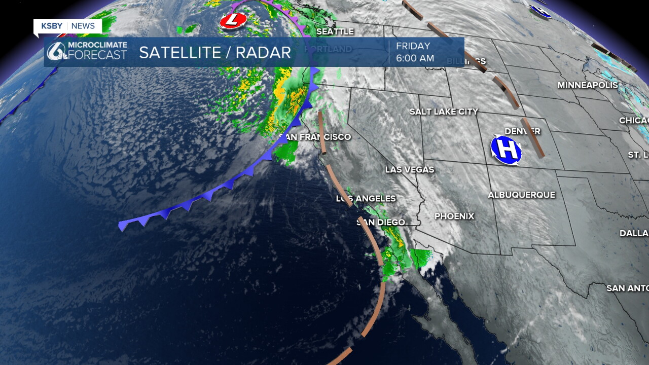
Starting off this morning, showers pushed in from the south and brought some rainfall. While most was light and mild, a few bands of rainfall prompted alerts. Including a flood advisory for Carpinteria and Summerland. Those have expired but still something to be aware of.
Through the mid-morning, we have an imperfect "break" in the rain as the first front pushes east and before the main cold front reaches us.
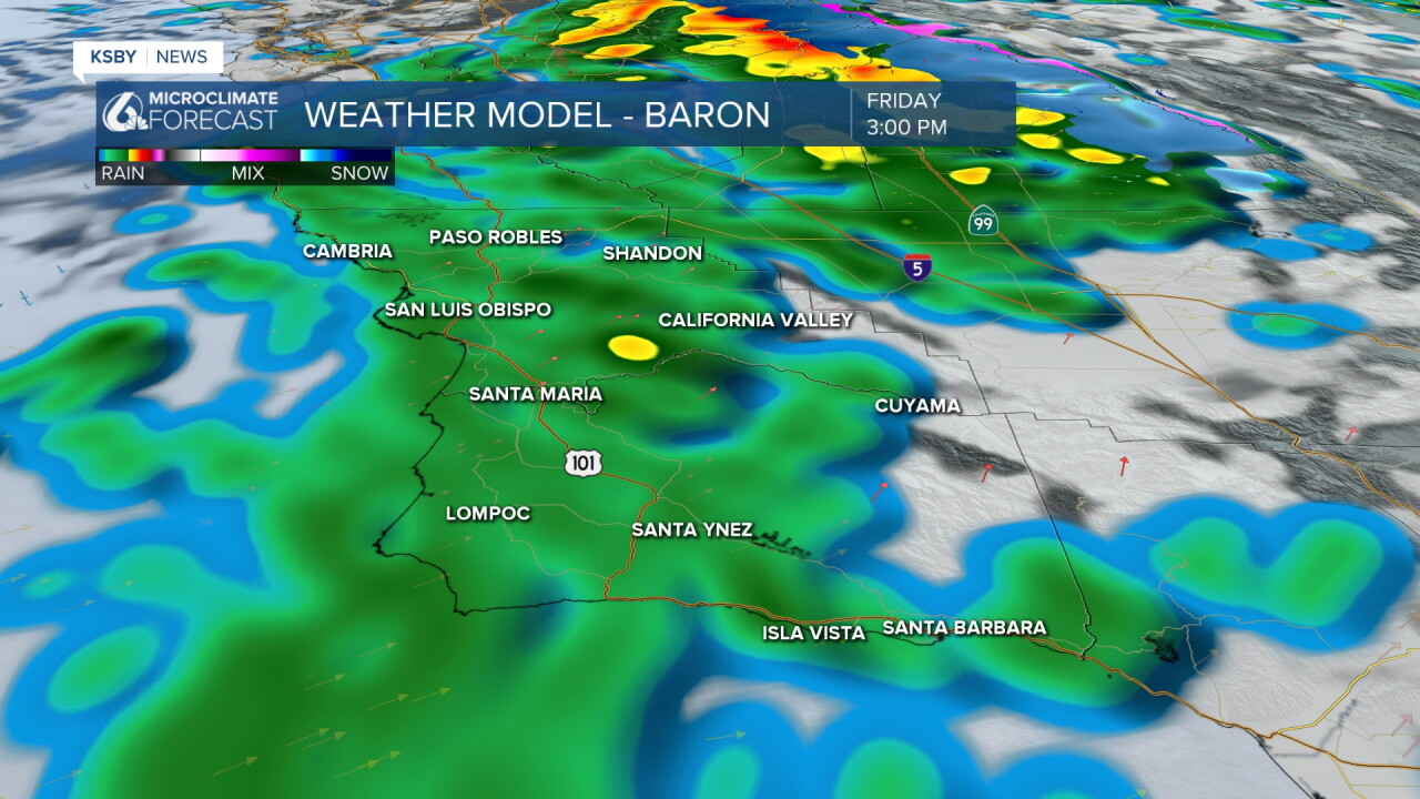
Once the cold front arrives, a band of heavier rain moves in. This will start along the north coast by noon and slowly move south, while it loses energy. By the evening, most of the region will see rain accumulating.
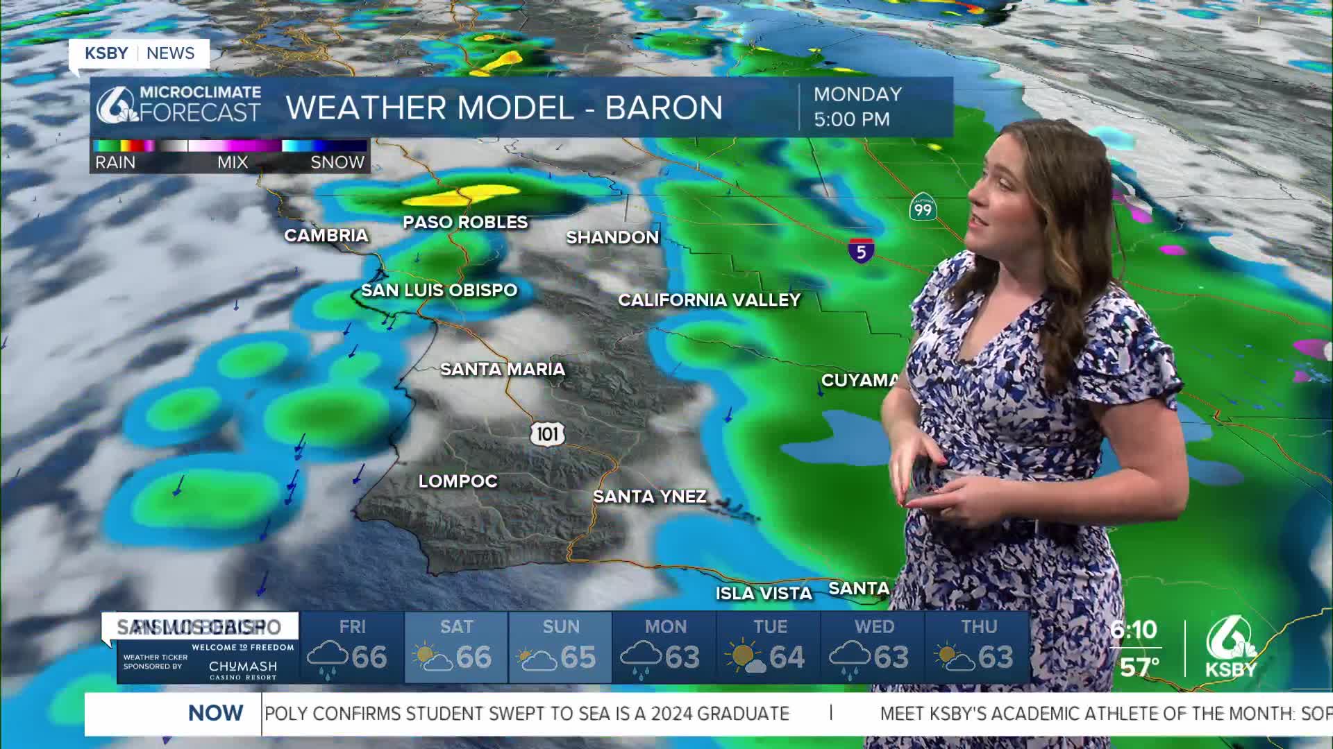
Once the cold front moves out, we will see a bit of a break in the rain chances with a cooler and cloudy weekend across the region. That is great news for weekend events while we enjoy the pause in rain chances. That being said, it won't last long. Another rain system will move in on Monday, with another quarter of an inch of rain expected.
On Wednesday, we have yet another rain chance expected, with a band of heavy rain expected.
Accumulations will be minimal overall, with less than a half inch of rain for today's system.
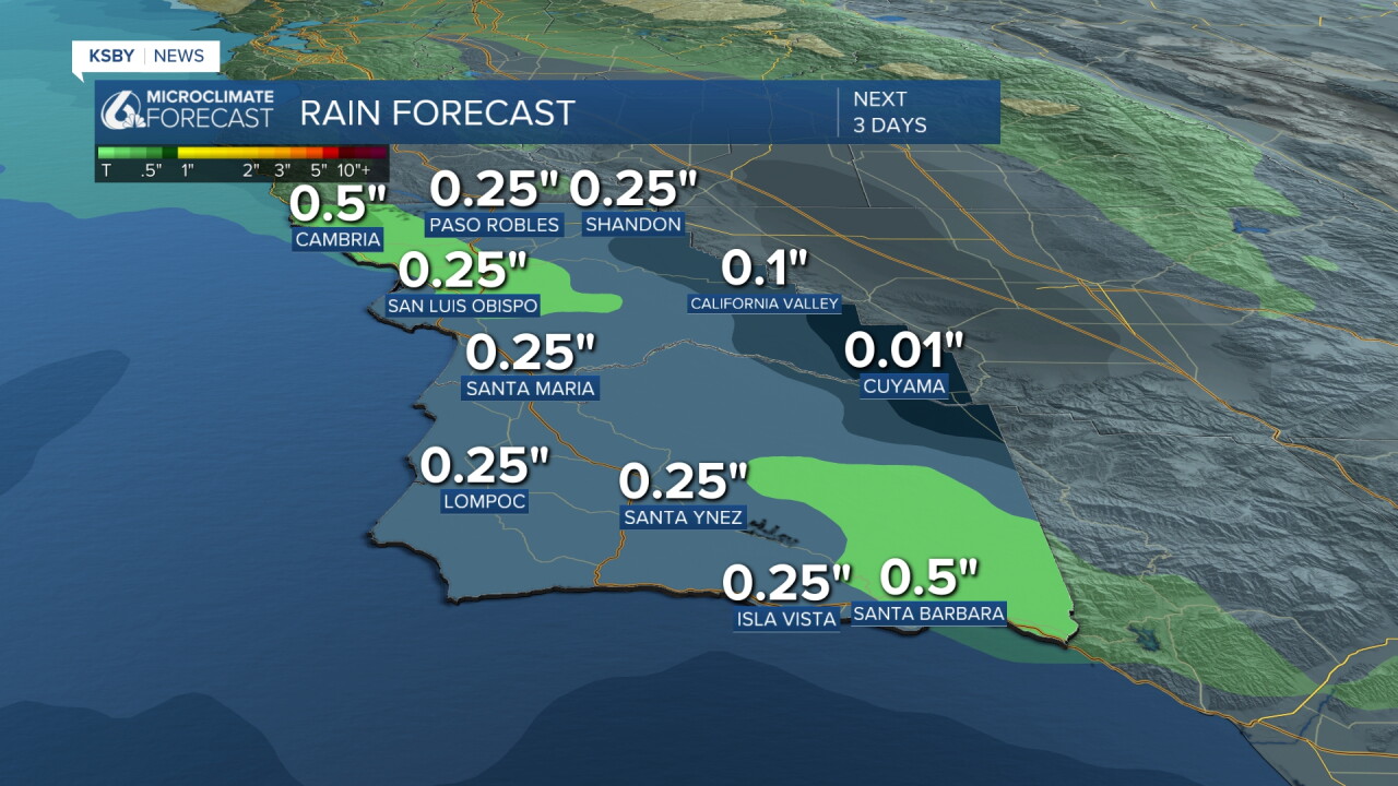
All three rain chances together will add up to an inch to an inch and a half total. Not a huge amount overall, but it will help keep the hills green!
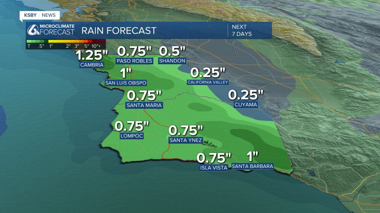
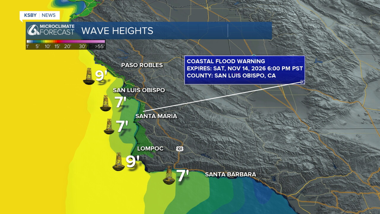
While most of our communities deal with rain, the beaches are also dealing with tricky ocean conditions.
We have a Coastal Flood Warning with significant coastal flooding expected and a High Surf Warning for large breaking waves 18 to 25 feet! Areas that may see the most significant impacts will be west- and northwest-facing beaches, with widespread flooding likely at Oceano Dunes. Breaking waves may impact the Cayucos and Pismo Beach piers as well as the Morro Bay Harbor entrance. We also have a beach hazard statement for the southcoast through the weekend.
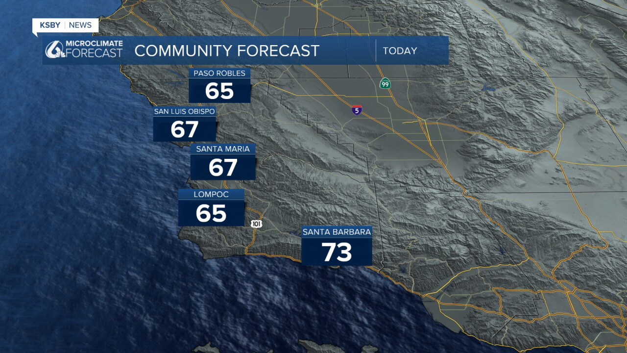
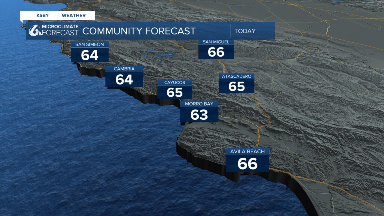
Back to the nuts-and-bolts of the forecast here are the high temps we can expect today.
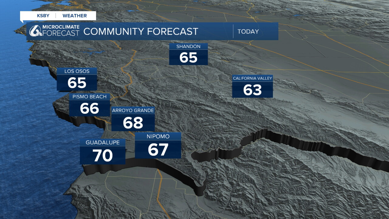
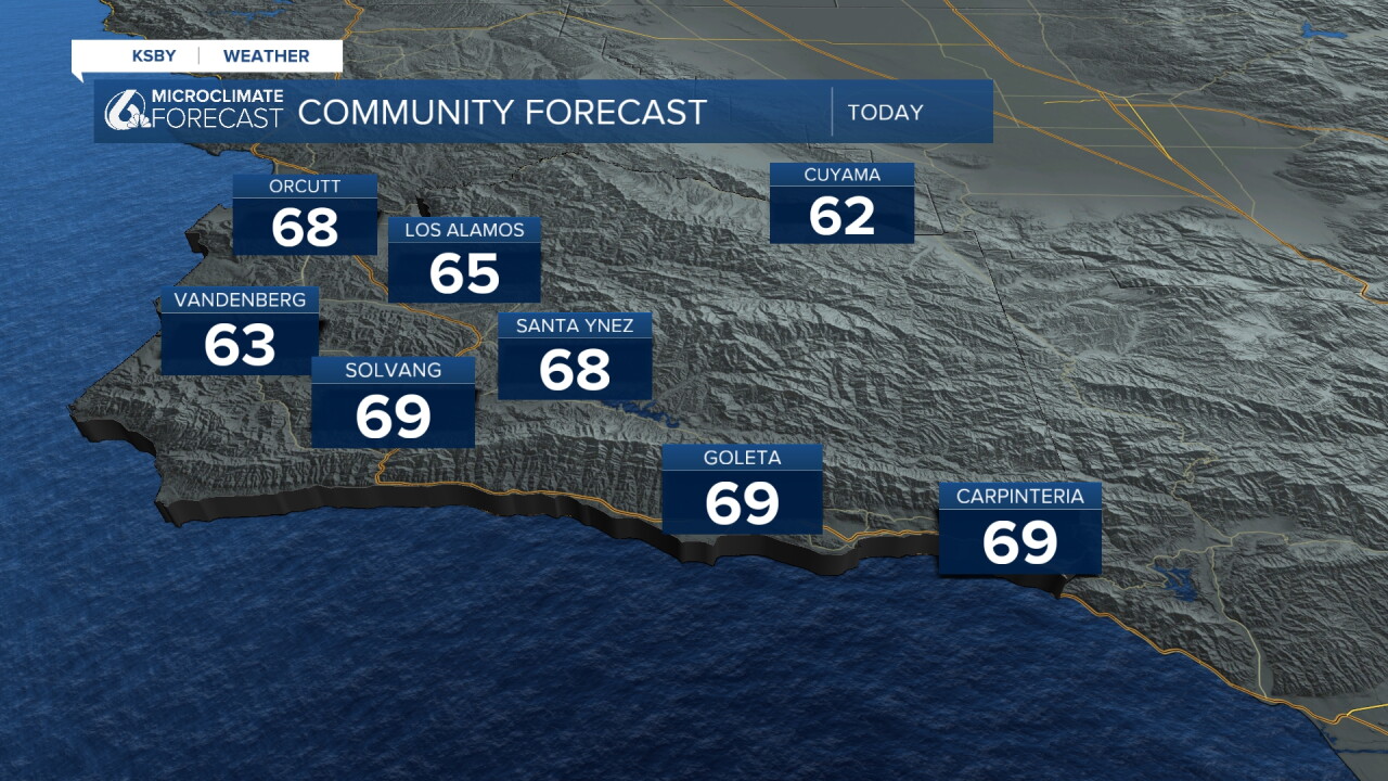
Here is what that all looks like on the 7-day forecast!
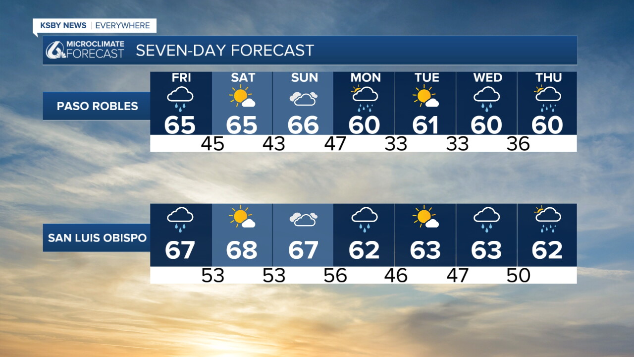
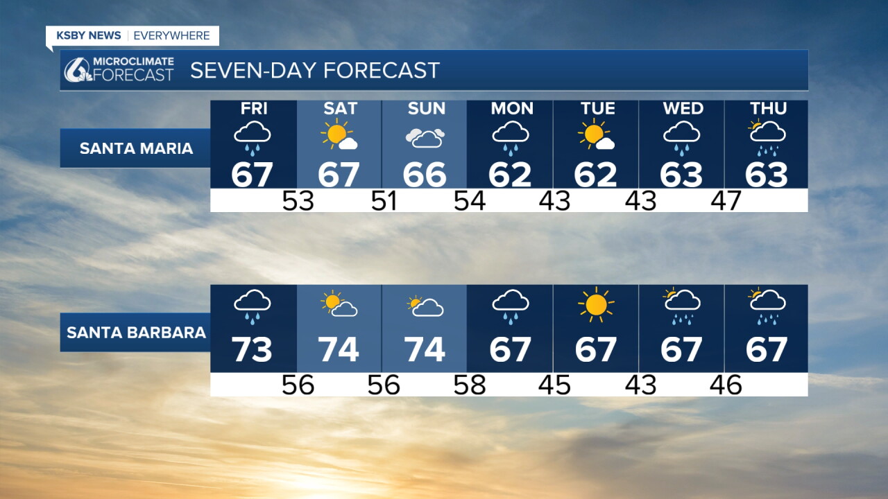
Even into the second half of the month and towards the Thanksgiving travel rush, we will stay in a more active pattern across the region.
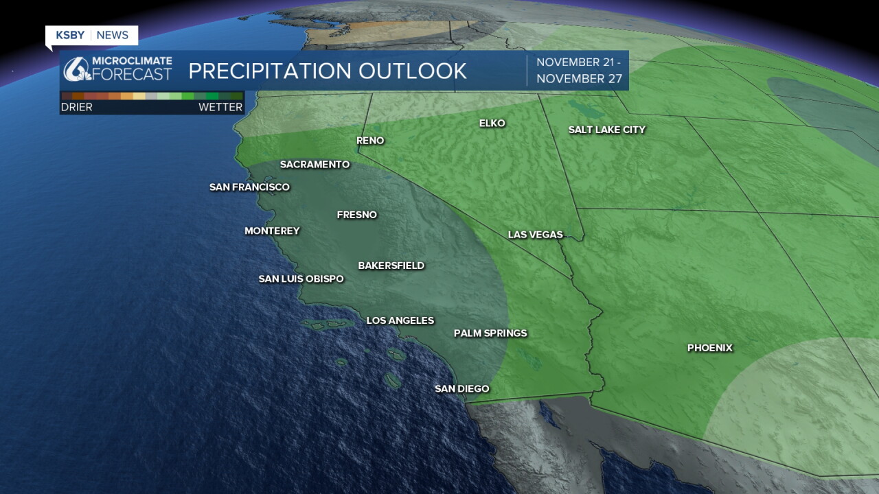
Have a great day and a wonderful weekend, Central Coast! Be sure to stay weather-aware and drive carefully on the roads as rain moves through.
-Vivian
