

Happy Tuesday, Central Coast!
Today was a classic "microclimate" day across the region. Interior valleys saw temperatures climb into the mid-90s while many western beach communities stayed in the low 60s (thanks marine layer)

Wednesday morning will start off with more fog and cool temps with interiors clearing out quickly while beaches stay foggy. Here are the high temps we can expect on Wednesday afternoon.

Wednesday afternoon will also bring the first impacts of our weather headline... rain.
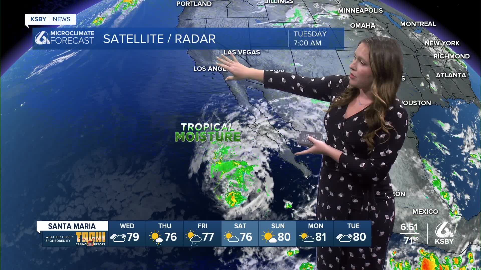
Remnants of Tropical Storm Mario have been moving north and will move into California on Wednesday morning, reaching us by the afternoon. This storm will bring rain to the whole region, amounts will be highly local and span a few days.

Before I dive into the nitty-gritty of the forecast, I have a quick disclaimer. While forecasting for this storm, there are a few factors that could drastically change accumulations.
Firstly, interior valleys have a very dry air mass in place, which means that at first, much of the rain falling will evaporate before hitting the surface. That will drop accumulation totals and will increase the chance of dry thunderstorms. With the current very dry ground cover, I would not be surprised if small brush fires start due to these lightning strikes.
The second tricky aspect of the forecast is due to the tropical nature of the storm. If the core low pressure stays offshore, rain totals will stay on the low side, but if it pushes onshore, we could pick up a more substantial soaking rain across the region. Good news, though, even the more robust rainfall amounts are likely to stay well below debris flow criteria for the Madre Fire and Gifford Fire burn scars.
Every weather model is handling these challenges differently, leading to mass model disagreement and wildly differing forecasts. Despite the differences that you may be noticing depending on your weather source, the bottom line is all the same. Rain is on the way; be aware of dangers within the changing forecast.
Now that all that is out of the way, here is my forecast for you.
Starting Wednesday afternoon, clouds will cover the Central Coast, and winds will shift and begin to push rain in from the south. There may be an isolated shower here or there on Wednesday, but this will not be too substantial. This first impulse does have a little instability in it. Non-zero thunderstorm chances are in the mix but that is limited.
Overnight into Thursday morning, the rain will arrive in earnest and bring widespread light rain to the region. Many communities will see their first accumulating rain during the Thursday morning commute. Be aware of slick roads as the accumulated oil washes off.

Through Thursday and much of Friday, trailing remnants of the storm will move through, bringing some messy days, although accumulations will be limited.

On the whole, the rain will be light, but there is expected to be a few pockets of thunderstorms where heavy local rain is expected. Most of the region will see less than a quarter inch of rain, the lightest amounts look to be along the SLO County north coast. The interiors of Santa Barbara County are looking to see the highest totals near a half inch.

I really like the way the risk is shown on this graphic from the National Weather Service LA Office.

Into the weekend, a small high-pressure system will build in and clear out skies and bring lots of sunshine to the region as well as a small warm-up.
Here is what that looks like on the 7-day forecast.


For the 8-14 day extended forecast, it looks like the more active pattern is on the way with the potential for a glancing rain chance next week.

Have a wonderful evening!
-Vivian
