

Tuesday shaped up to be a cloudy and cool day for our beaches with some sunshine for the interiors.
Tonight, fog and cloud cover are once again in store; take caution tomorrow morning for the commute as visibility may fall.
The headlines of the forecast are a bit varied, with rain, waves, and tides causing concern. Let's start with rain.
A large system is pushing onshore in the PacNW tonight, and that storm has a trailing cold front that will just clip the Central Coast Wednesday afternoon.

Rain will start in our farthest NW communities by late morning and will spread to the south. This rain will be light on the whole, and as it pushes south, it will fall apart quickly.

Accumulation-wise wise NW SLO county will pick up the most rain with up to a quarter of an inch. The farther inland or south you get though, totals will diminish to just hundreths of an inch.

It isn't much rain but will hopefully help the hills to green up!
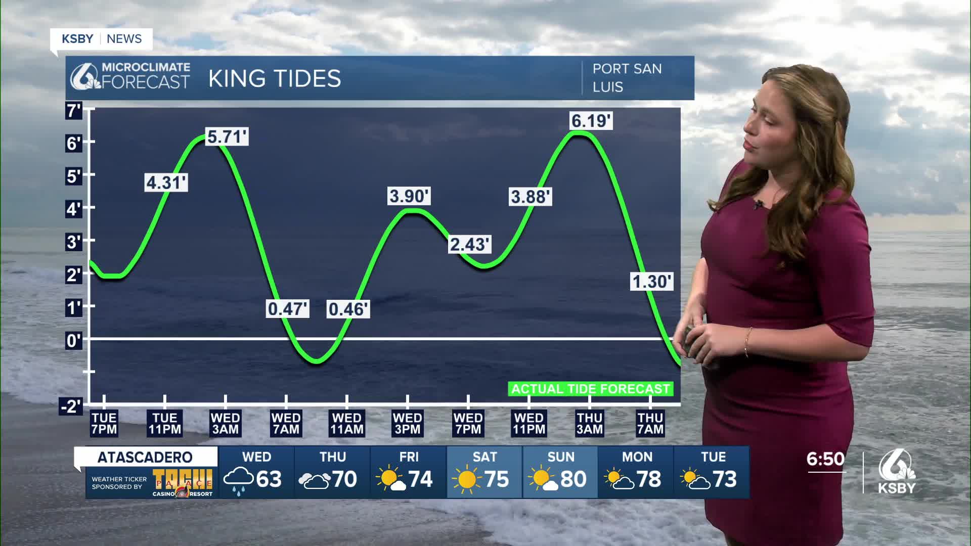
Now shifting gears to our coastal hazards.
King tides are pairing up with a long-period swell for our western beaches. Here is a look at the alerts in place through Friday.

King tides will bring us the best chance for small-scale coastal inundation, particularly at flood-prone spots.

Here is a look at the temps Wednesday will bring us.

Once the cold front pushes East our skies will clear and we will warm up into the weekend. Sunny skies will also return.


Have a great night and stay weather aware through Wednesday!
-Vivian
