

Friday gave some relief from Thursday's heavy rain. Don't get comfortable, though; much more rain is on the way through the extended forecast.
Before I dive in, here are a few links that I find helpful to have on hand through a storm.
I will be updating this article throughout the night with any new information.
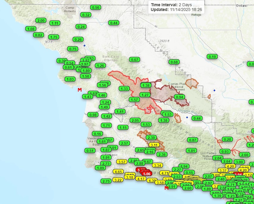
Friday brought some sunshine and wonderful conditions across the region, a stark difference from the inches of rain that the cold front pushed through on Thursday night. Here is a look at some of the totals as of 6 p.m. Friday night.
All of that rain was from the initial cold front, right now that is bringing heavy rain to Southern California.

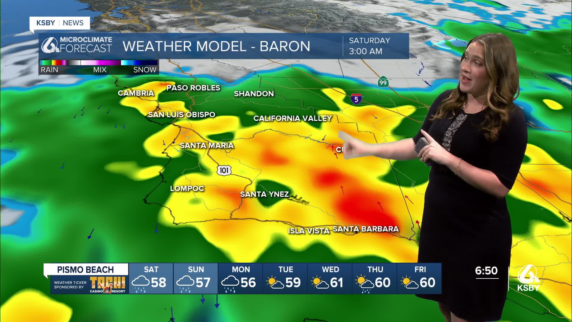
Tonight, the storm will begin to rotate as the cut-off low (along the cold front) begins to be pushed north. For us, that means rain will build back in tonight. This will start with a few showers and become more widespread towards midnight.
Into the very early morning hours, that core low pressure will reach us. Heavy rain and some thunderstorms will bring limited visibility. Flooding is expected for the south coast and at poor drainage spots.
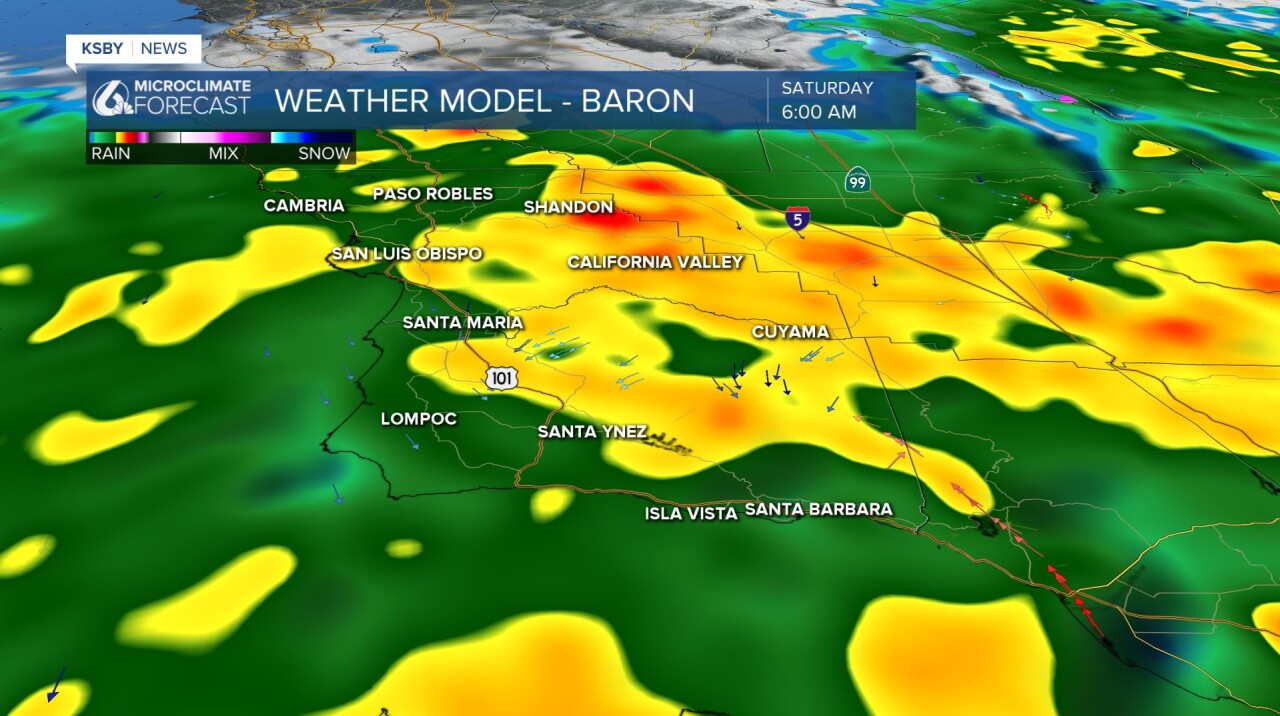
Through the day, the rain will continue as the low pressure slowly moves north. The evening will bring a brief break, but even that won't last long. The continued rotation of the storm will bring back rain into Saturday night, continuing into Sunday morning.
Sunday will be another imperfect break with a few small showers moving through, but thankfully nothing much for the morning hours when the City to the Sea Half Marathon will take place.
The break will be short-lived; another cold front will reach us Sunday night into Monday morning.
All said and done with all those storms combined will bring the potential for a LOT of rain.
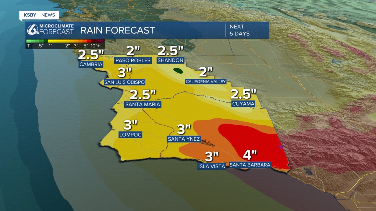
Thankfully, that is a long time for all the rain to fall; thankfully, most of it will absorb into the soil and not cause too many issues. I am still watching localized flooding, though. That risk is why there is a flooding watch in place for most of Santa Barbara County through 10 p.m. Saturday.
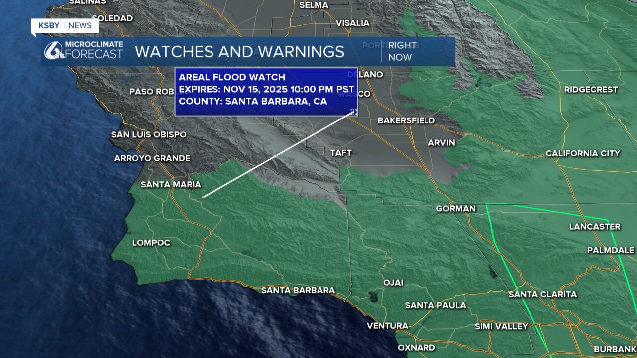
There is also a high surf advisory in place for the western beaches and a beach hazard statement in place for the south coast. Both through 3 p.m. Saturday.

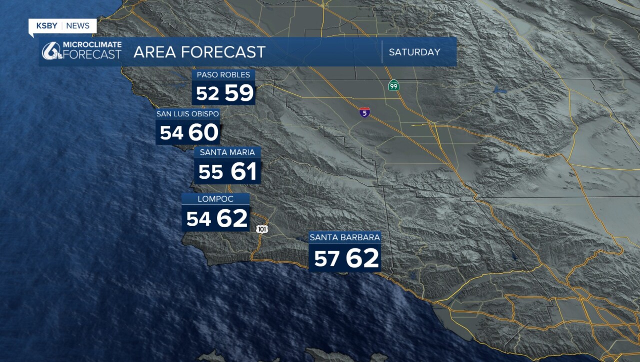
Throwing in the typical forecast elements now. Here are Saturday's temps!
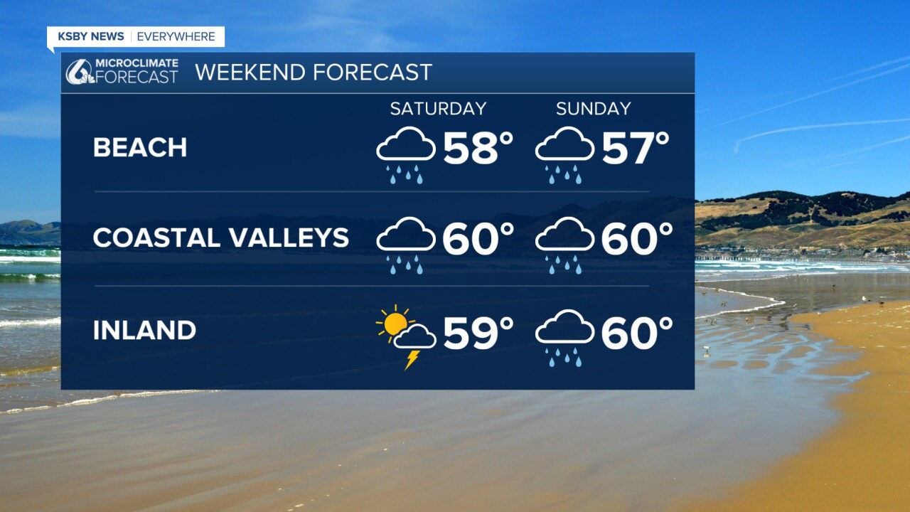
Here is your weekend forecast.
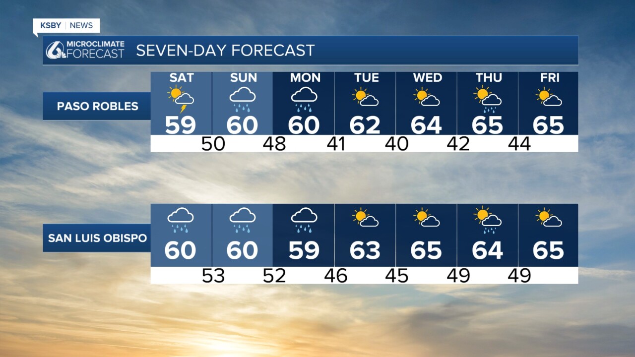
And here are the 7-day forecasts.

Stay weather aware through the weekend and into next week as the storm continues.
-Vivian
