

Good morning, Central Coast!
Before I dive into the forecast, here are a few links I find helpful to have on hand.
Tuesday night brought heavy rain to the region as well as several severe thunderstorm warnings. This morning we are seeing a few scattered showers that will continue through the morning hours. Good news, though, we have a little break in the rain this afternoon and into the region.
Today, the continued winds from the north will keep cool temps in the region. Interior valleys will stay in the 40s, while much of the region will only be in the 50s.

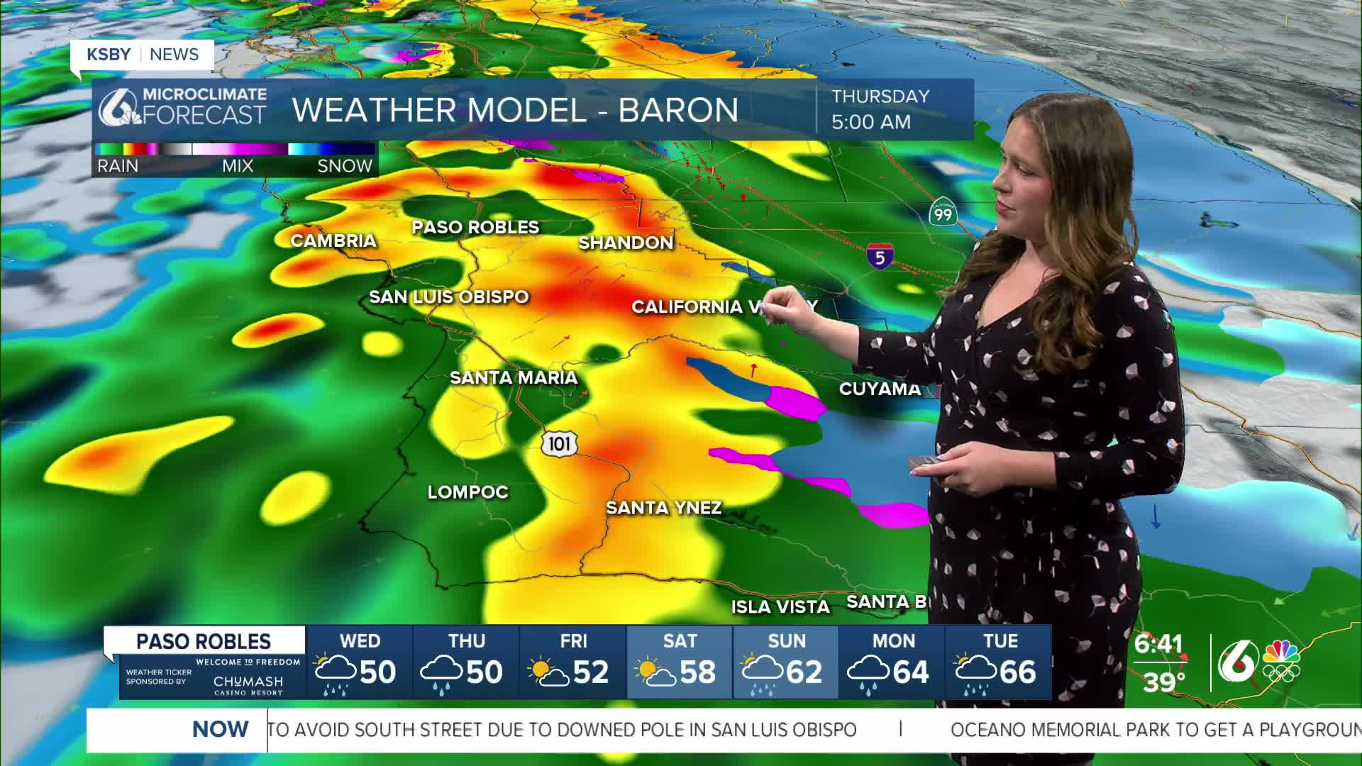
Early Thursday morning, another cold front will reach us and bring a round of heavy rain into the region. Strong winds and the potential for a few more severe cells are expected.

Here is an estimation on what the radar will look like at 5 a.m. Thursday morning.
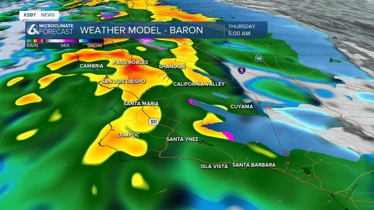
As far as accumulation goes, there is the potential for up to another inch of rain for the region. Due to the scattered showers expected, these will not be consistant but one thing to be aware of is the potential for more rain on top of the already saturated ground.

There are still quite a few alerts in place due to the ongoing rain.

Interiors of Santa Barbara County are under a winter storm warning through Thursday. There are some lingering wind alerts for the south coast, and all beaches have additional surf energy.
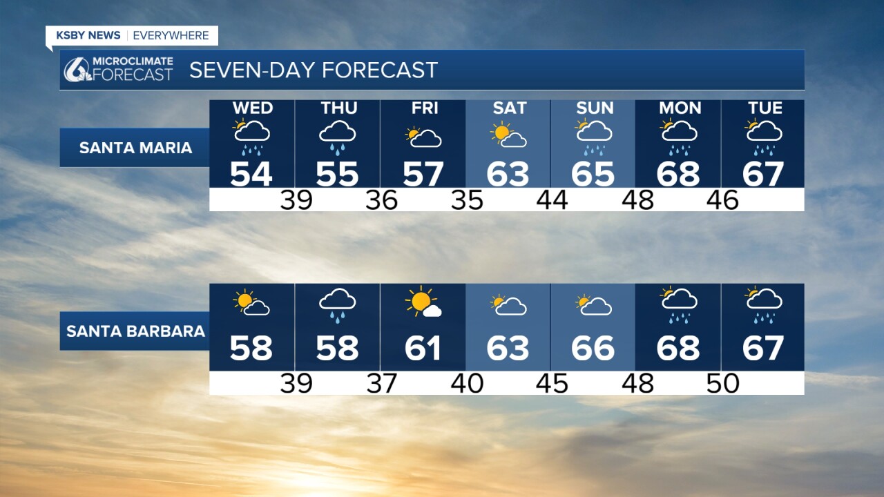
If you have been missing the sunshine, there is some good news for you. Once the storm clears out Thursday afternoon, we will see a break in the rain for a few days as a weak high-pressure system works to clear us out. Enjoy it though, it won't last!
Early next week, another storm will move into the region, bringing us the chance for more heavy rain on Sunday, Monday, and Tuesday.

Even into the extended forecast, it looks to stay on the active side across the West Coast. Here is a look at the 8-14 day precipitation outlook.

Have a wonderful day, Central Coast!
-Vivian
