

Good morning, Central Coast!
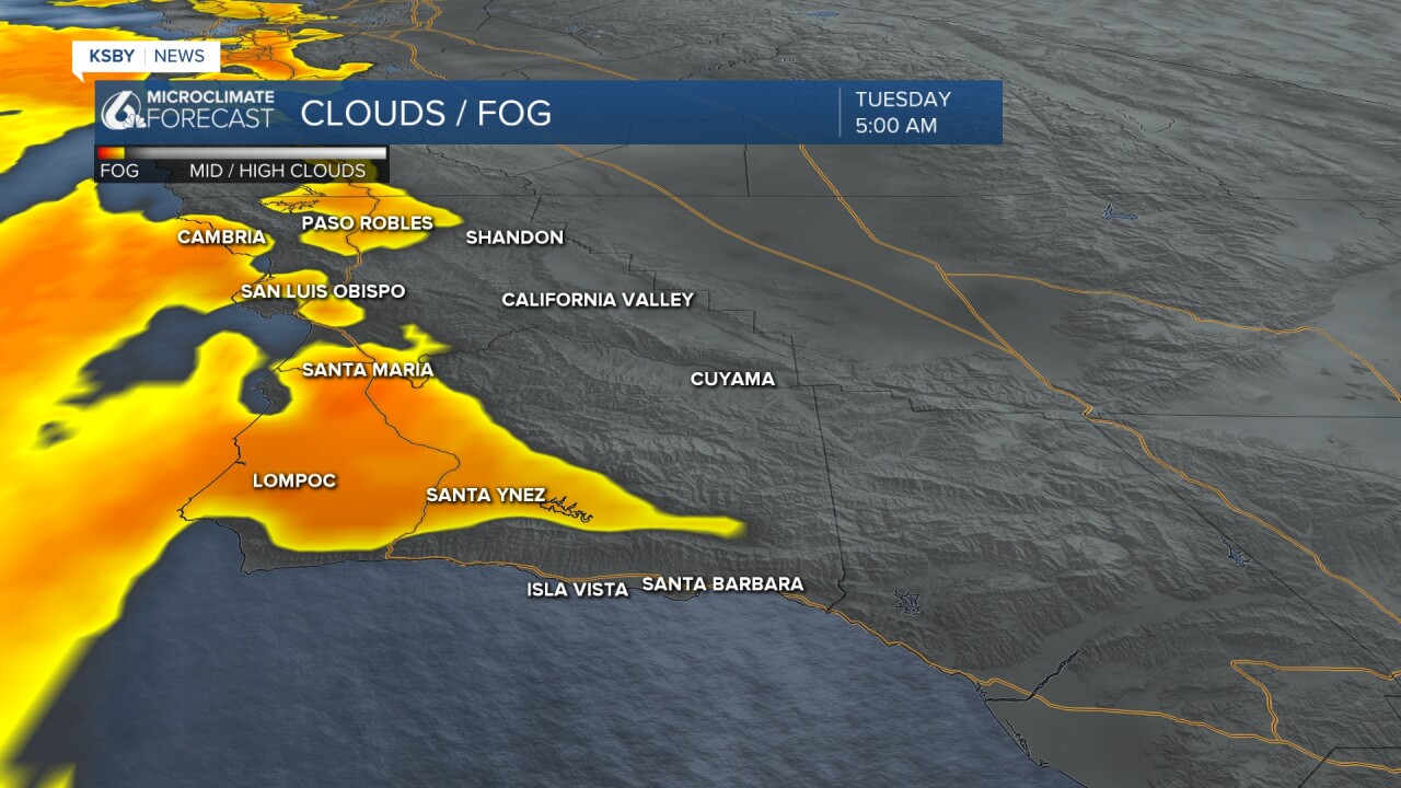
It is a cloudy one as we kick off the morning. No major areas of fog, similar to Monday morning you won't need the sunglasses for a few more hours.
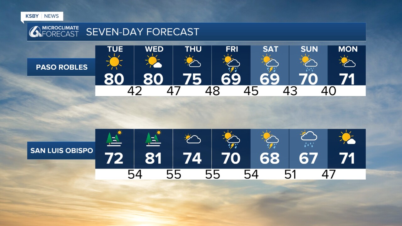
This afternoon will feature clearing skies and mild temps. They are a bit warmer than Monday but that change is only a few additional degrees.

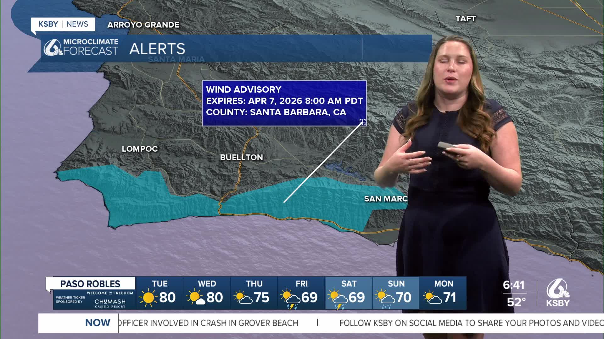
Starting Today, a high-pressure system will move into the region and bring sunny skies and warmth. A large portion of the warm-up will come from offshore winds and compressional heating. Those winds (and temps) will peak on Wednesday. I expect a wind advisory to be issued for these winds.

Looking into the end of the week, we have a big change on the way. There is a low-pressure system moving towards the west coast that will bring us cooler weather, cloud cover, and most importantly... rain.
Measurable rainfall is expected Thursday night through Saturday morning. Most of that will be mild, but because of conditions in the upper atmosphere, there is a chance for convection within this storm. For us, that means the chance for some thunderstorms on Friday.
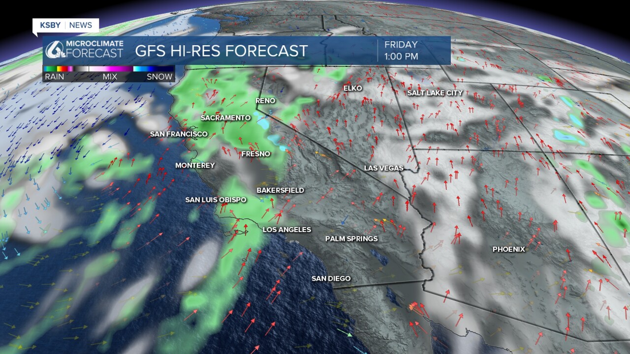
Chances for heavy rain and hail will be included in these thunderstorms. They aren't expected to be widespread, but still possible across our communities.
This system is a long way out so the timing and intensity will change. What is important for our communities to know this morning is that there is rain and potential thunderstorms in the forecast.
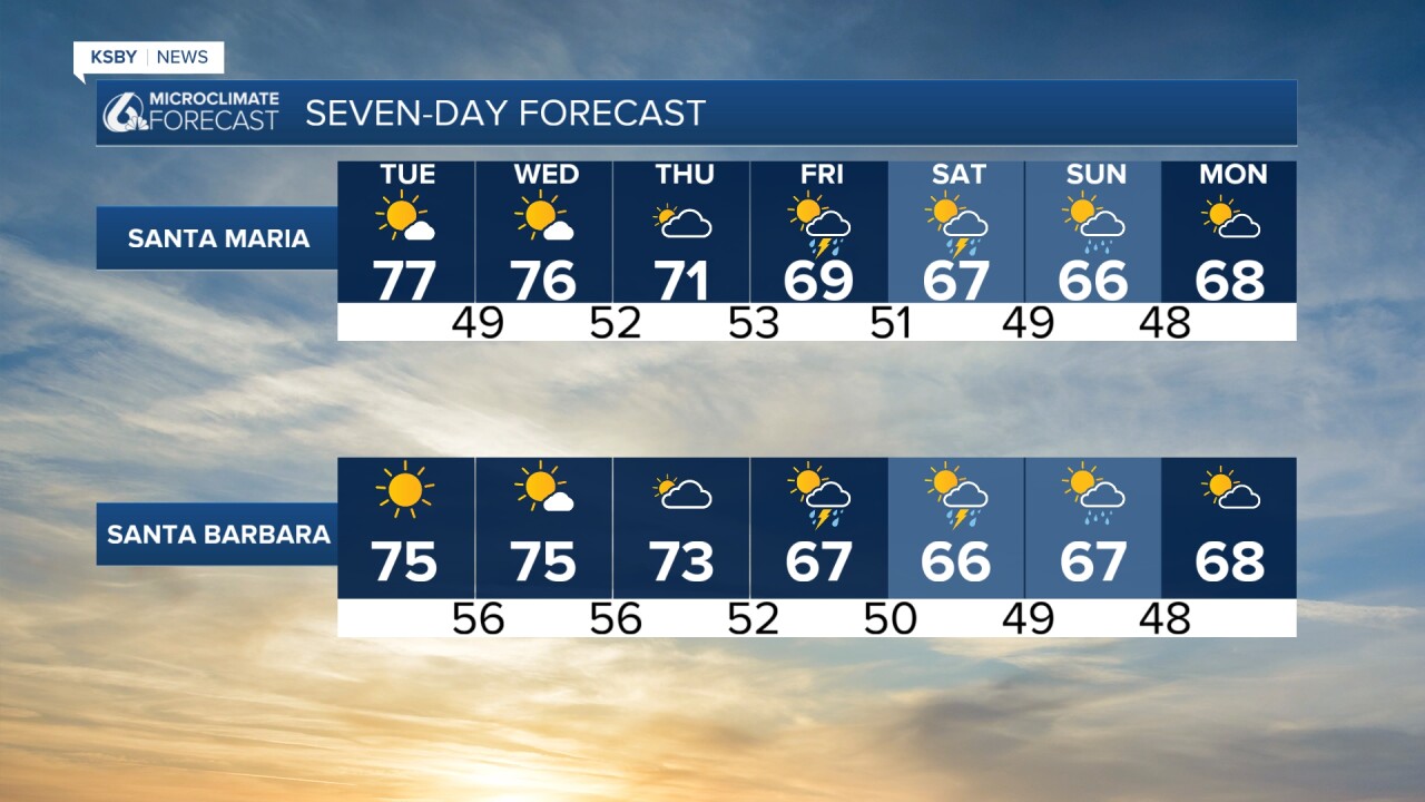
Here is what all of that looks like on the 7-day forecast!
I'll be keeping a close eye on the system as it gets closer and will bring you the updates as the system gets closer.
Have a wonderful week, Central Coast!
-Vivian
