

Tuesday brought mild weather to the region with clear skies and temps right around normal for this time of the year. There was one small change, though, active weather to our East.
Storms kicked up late Monday night into Tuesday morning, and some viewers even captured images of the lightning associated with the storms. For the most part, the only impact today was visible clouds surrounding the storms.
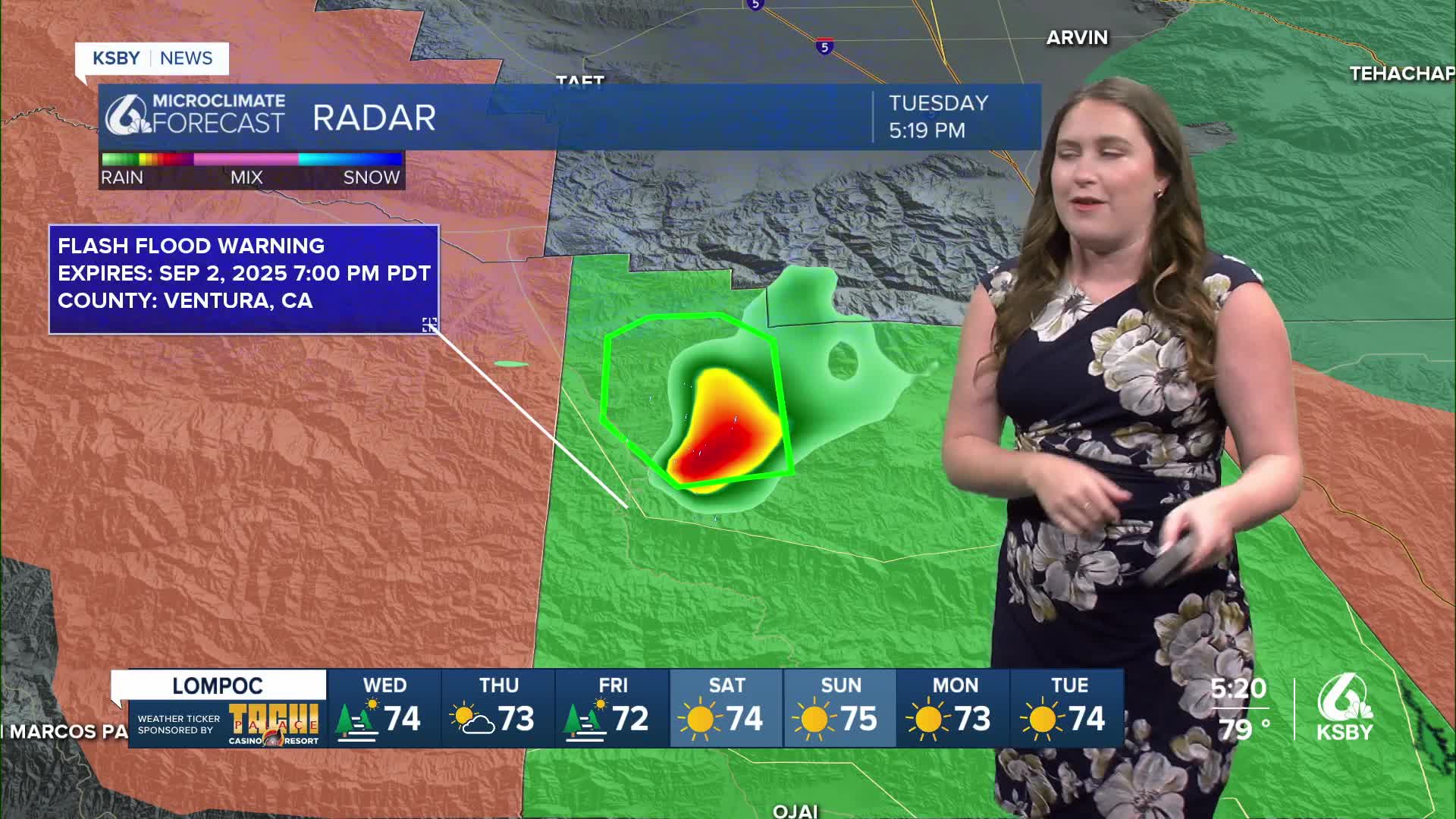
That being said I was closely monitoring a storm just to the east of us in Ventura County.

That storm brought strong winds, localized heavy rain, and penny-sized hail to the interiors of Ventura County. Because of these concerns, a severe thunderstorm warning was issued as well as a flash flood warning. Both have expired at this point.
Severe Thunderstorm Warning including Ventura County, CA until 5:15 PM PDT pic.twitter.com/iMqXIDs6V5
— NWS Los Angeles (@NWSLosAngeles) September 2, 2025
Another interesting addition to the forecast is Tropical Storm Lorena. Overnight, it strengthened into the tropical storm category. It is expected to become a hurricane tomorrow before falling apart over the weekend. It will not impact us much, but I would not be surprised if some outer bands reached southern California.

Tomorrow, temps will bounce back slightly with another run at the upper 90s, but on the whole, temps will still be a degree or two below the heat from earlier this week.

By the end of the week, cooler air will move in from the West and will cool temps down across the region. Near normal highs (90s for interiors, 70s for coasts, 60s for beaches) will return into the weekend.
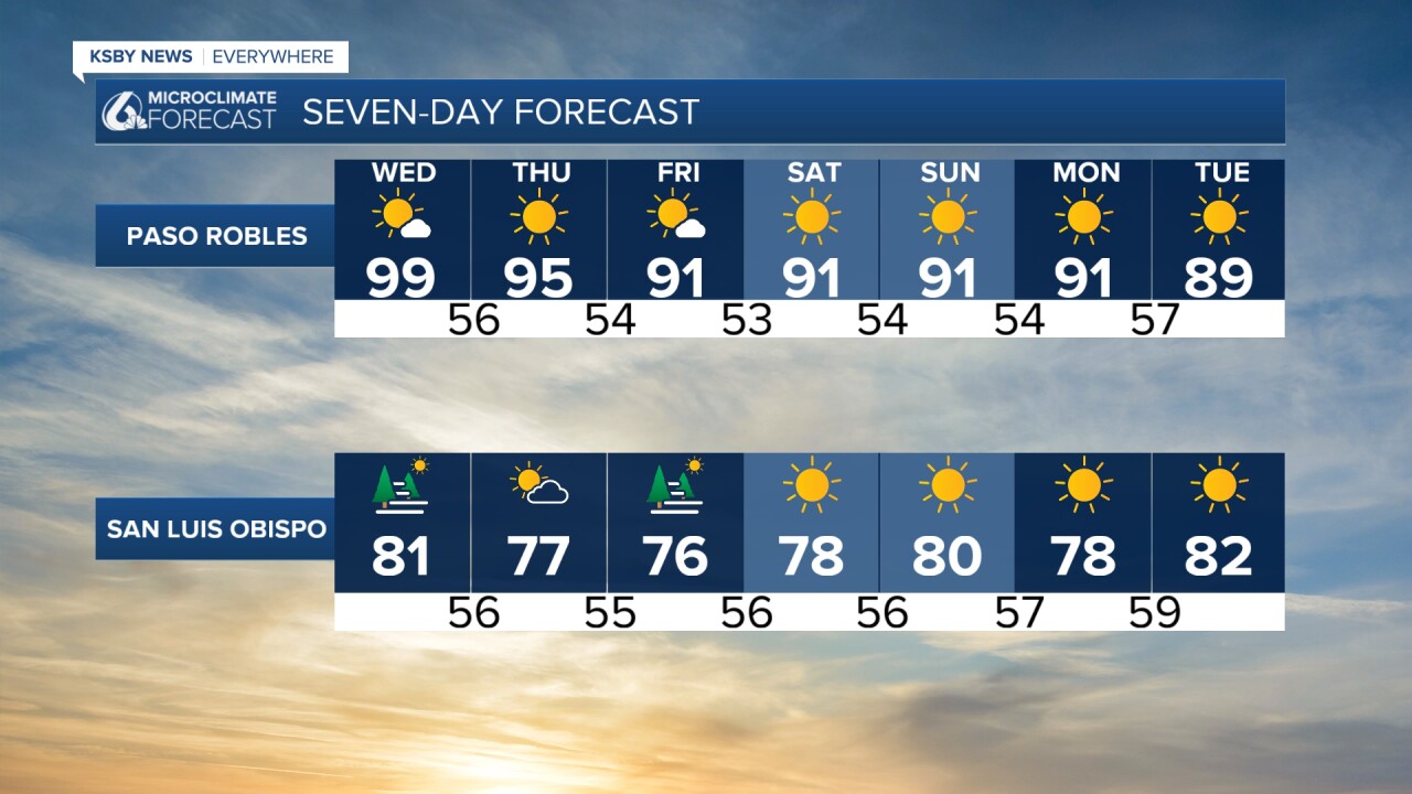

This pattern looks to hold into the further extended forecast. No major concerns here!
Have a great rest of your evening, Central Coast!
-Vivian
