

Good morning, Central Coast!
The massive storm that we have been preparing for has arrived. Before I dive into the forecast, here are a few links I find helpful to have on hand.
——— 8:10 a.m. Update———
A Severe Thunderstorm Warning has been issued for all of western Santa Barbara County through 9:30 a.m. as a strong line of storms pushes through the region.

The line of storms is moving east at 40 mph and is bringing 60 mph wind gusts and penny-sized hail. At this point, a small weak tornado cannot be ruled out. Heavy rain is also expected to bring flooding to the region.
Communities impacted include Santa Maria (impacts expected in about 15 minutes), Vandenberg, Lompoc, Santa Ynez, Solvang, Orcutt, Los Alamos, Buellton, Guadalupe, and Sisquoc.
———8 a.m. Update———
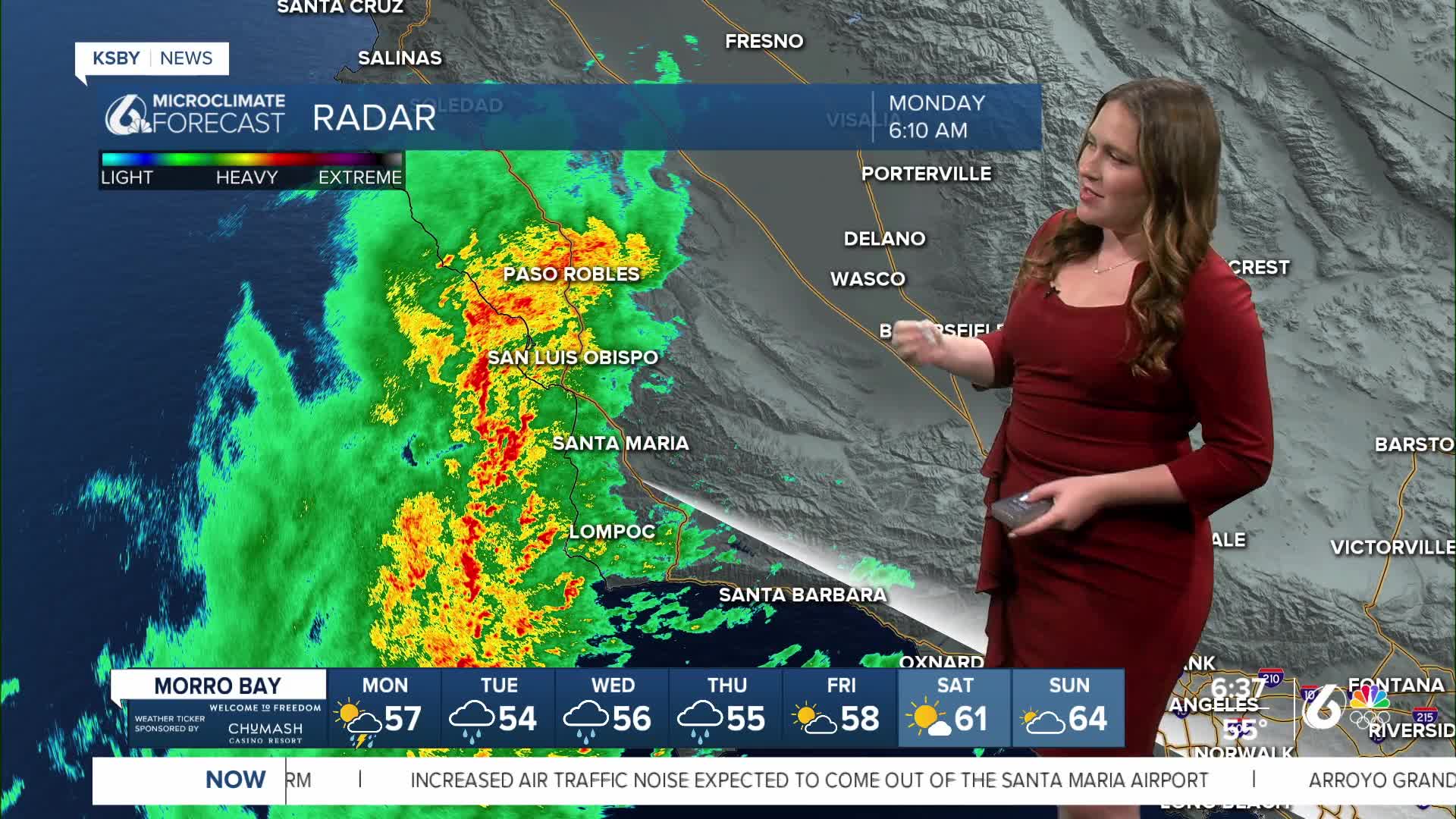
The severe thunderstorm below has expired but the line of strong storms is continuing to progress across the region. There are flood advisories in effect for all but the farthest interior valleys of the Central Coast!

———6:45 a.m. Update———
A severe thunderstorm warning has been issued for much of coastal and interior San Luis Obispo County through 7:15 a.m. Heavy rain, wind gusts up to 65 mph, and the potential for developing weak tornadoes are possible. If in this area, stay inside and weather aware.

——— Original Article——-
This system will be impactful as a massive region of low pressure pushes east, moving directly over the Central Coast.
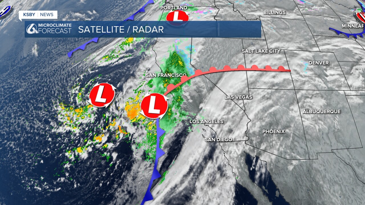
Through the next few hours, the core of the storm will move east. By 9 a.m., most of the region will have heavy rain falling and strong winds.
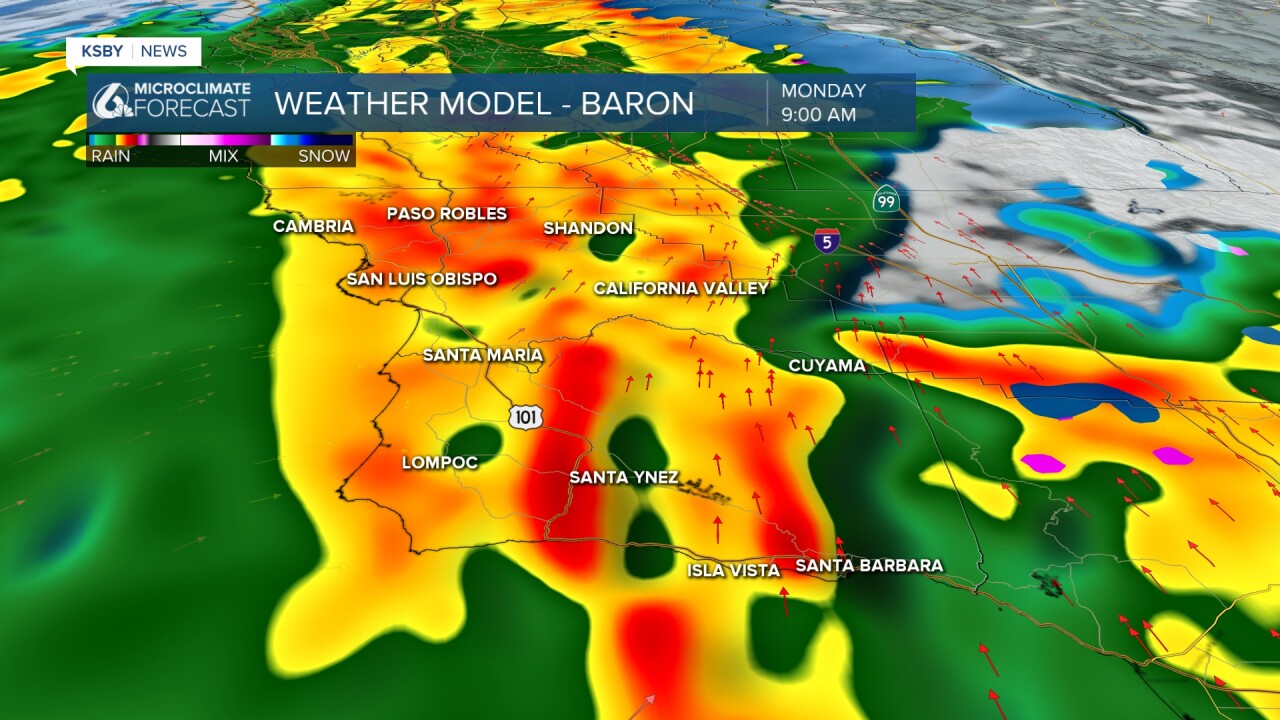
Into the afternoon, we can expect the rain to break up a little bit, but scattered showers will continue into the evening.
The cold front will pass through the region early Morning. As it moves through heavy rain will cause some small-scale flooding. Due to this, there is a flood advisory in effect for almost all of San Luis Obispo County through 11:15 a.m.

There is also a flood watch in effect for our south coast through the day.
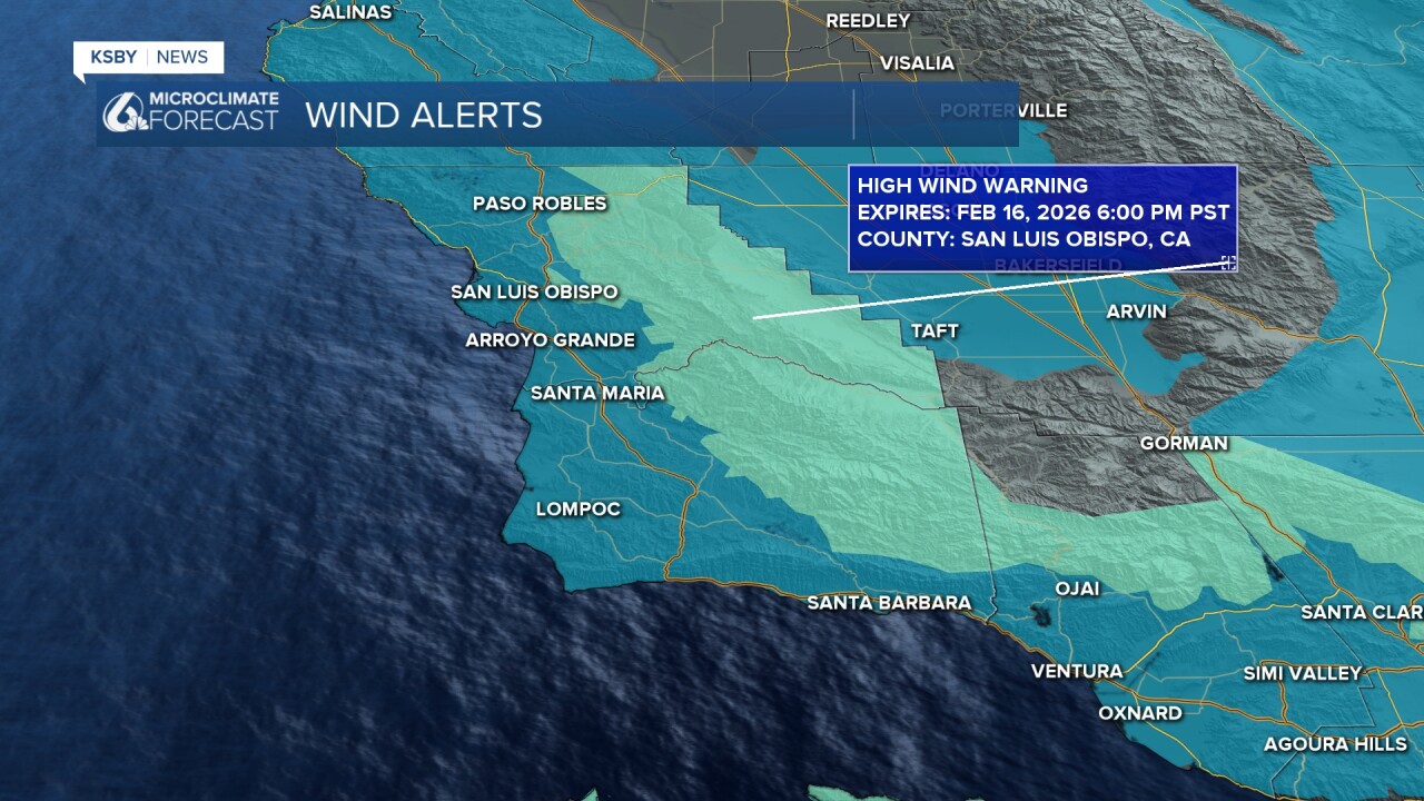
Outside of the rain, winds are a big concern this morning. Here are the winds as of 5:30 Monday morning.
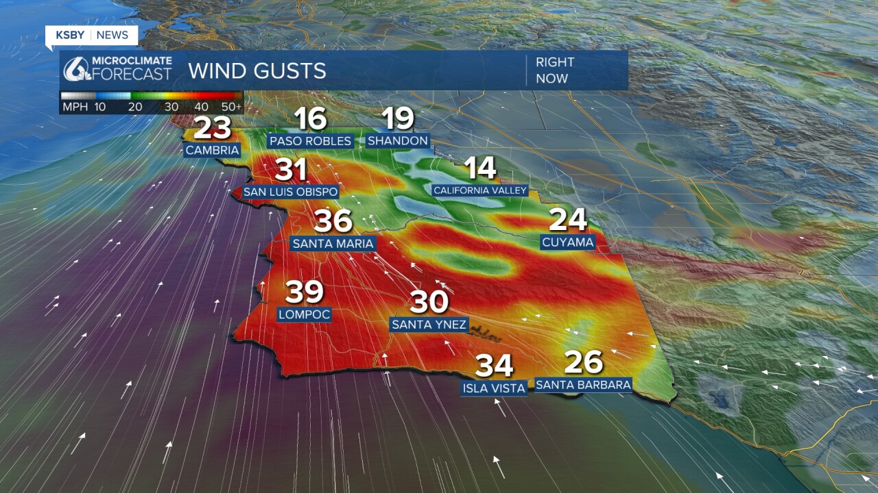
Due to the winds, there are a few alerts in place. A high wind warning is in place for the interior valleys through 6 p.m. Monday. The rest of the region is under a wind advisory. also in place through this evening.
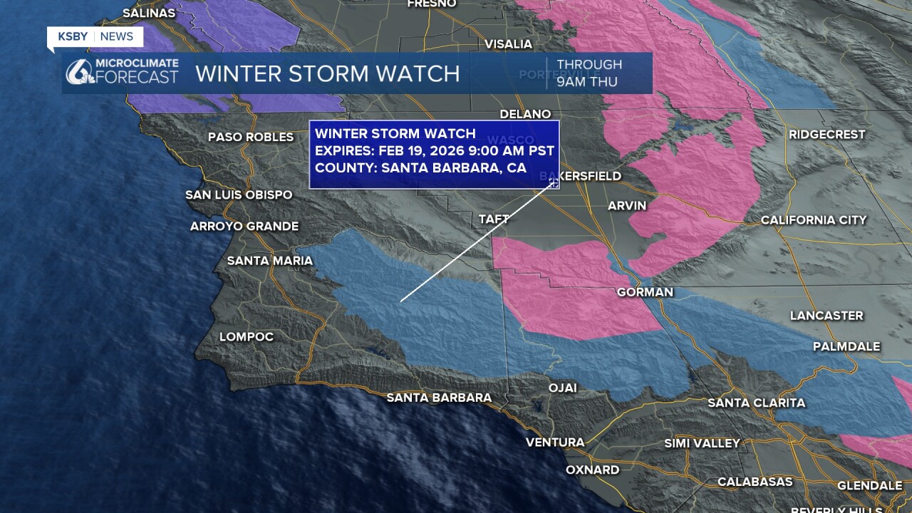
Starting Tuesday morning, we will start to see another system reach us. This time with cooler air.
Heavy rainfall is expected for the afternoon hours with snow levels falling to around 2,000 ft into the evening. That will bring some snowfall accumulations for the peaks of the Los Padres National Forrest. A Winter Storm Watch is in effect through 9 a.m. Thursday.
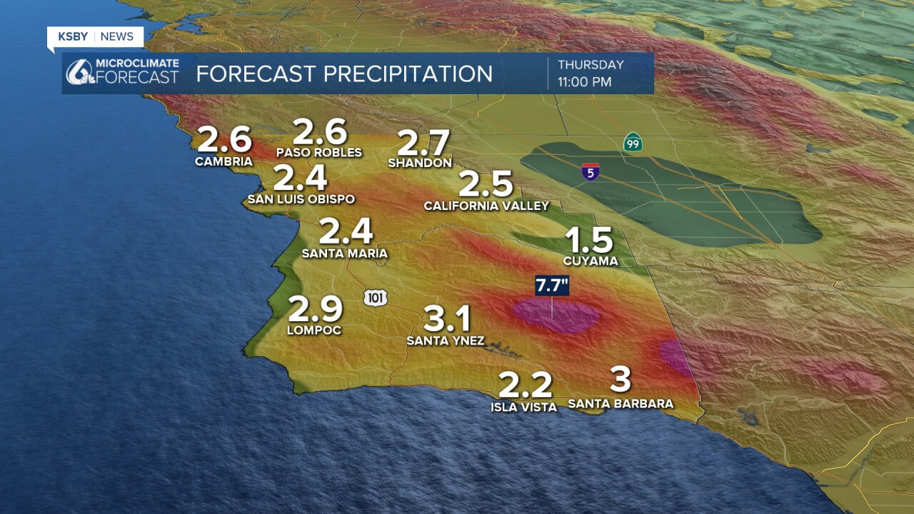
As far as rainfall accumulations go, we can expect inches of rain. Most spots will pick up between 2.5 and 3 inches of rain with significantly more expected at the highest peaks. Some spots in the Los Padres National Forrest can expect over 6 inches of rain.
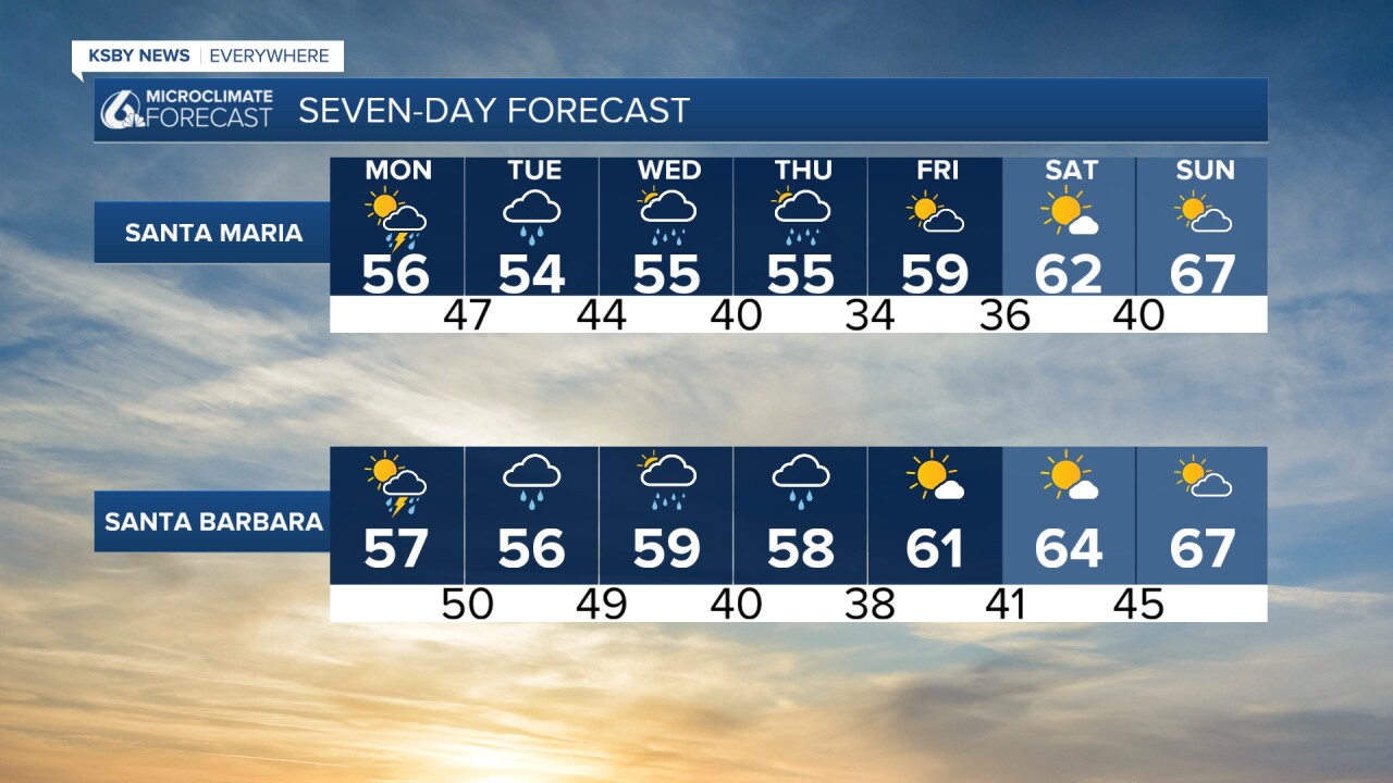
By Thursday morning, skies will start to clear, and we will begin to see better weather. Temps will warm slightly, and we will finally see sunshine by the weekend.
I know that is a ton of information. Here is what it looks like, boiled down onto your 7-day forecast.

Have a wonderful day, Central Coast! Stay weather aware through the week.
-Vivian
