

Good morning, Central Coast!
Before I dive into the forecast, here are a few links I find helpful to have on hand.
Yesterday was a soggy one with heavy rainfall and even some severe impacts across the region. We are far from done with the rain though here is what we can expect.
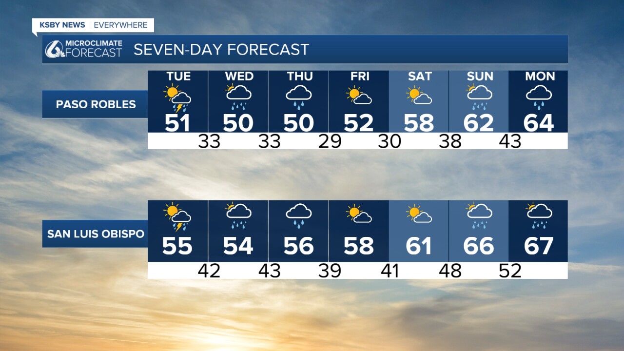
To start off Tuesday morning a few scattered showers are bringing pockets of rain to the region but most are staying mild and a lot calmer than early Monday morning. That being said, make sure to grab that umbrella or rain coat today.
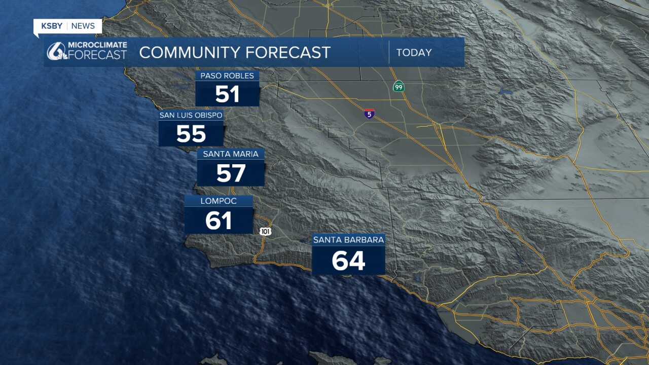
Temps today will stay on the cool side with highs in the 50s and low 60s.
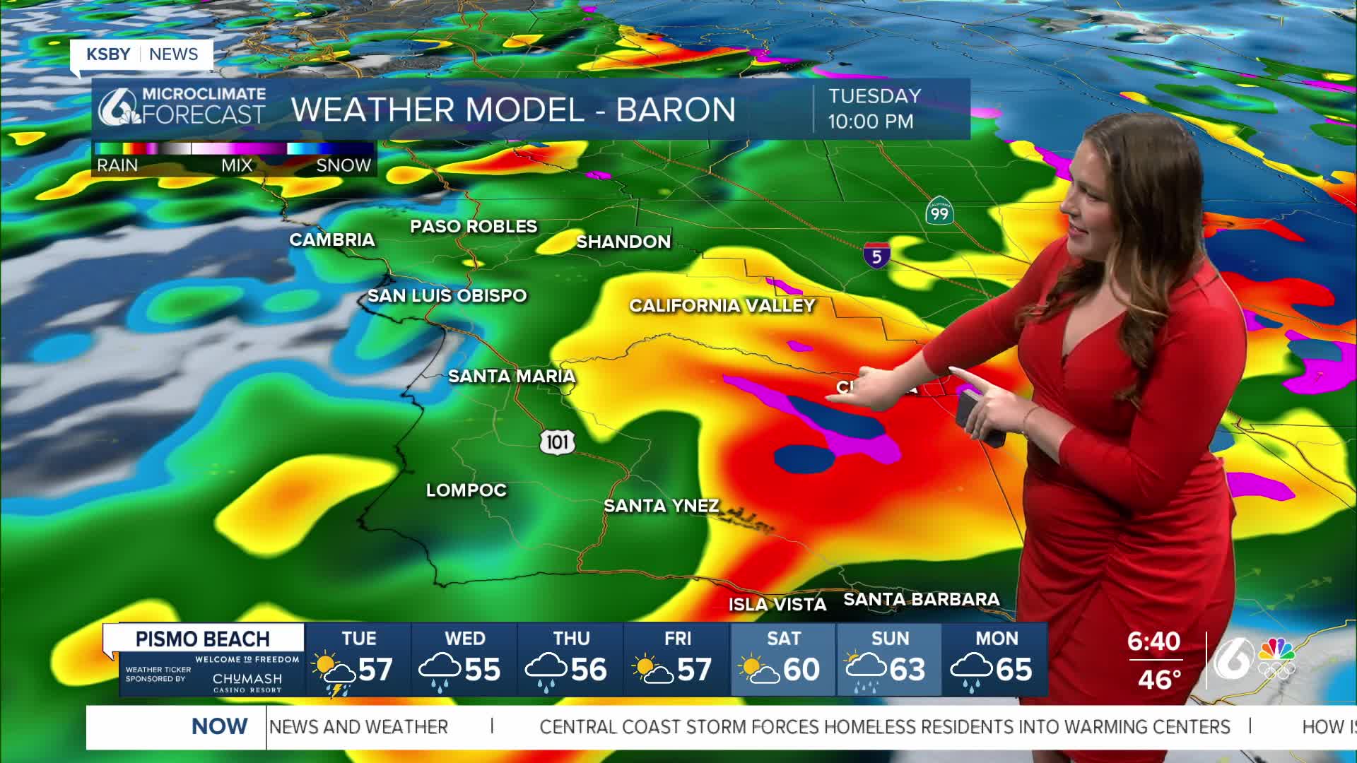
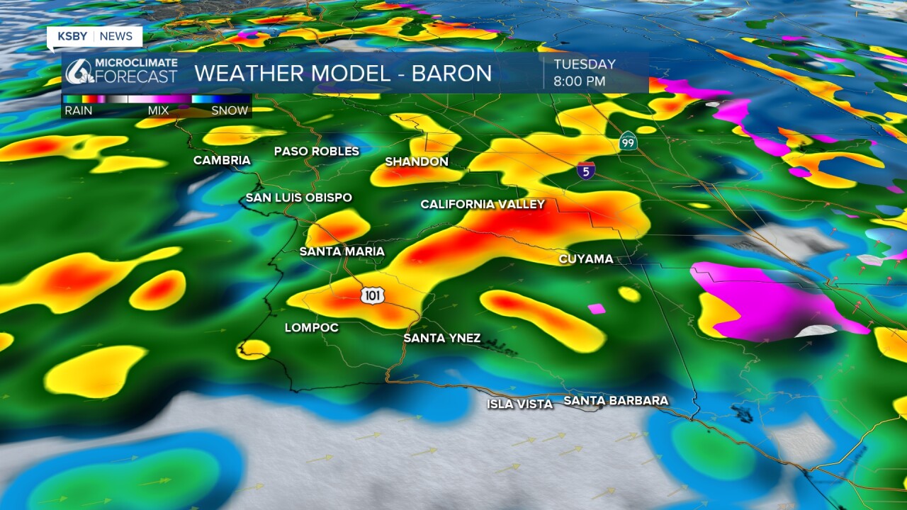
By the evening, heavy rain will begin again as a cold front reaches the region. The most impact will be in the evening into late-night hours.
Wednesday will be another imperfect break ahead of even more heavy rain.
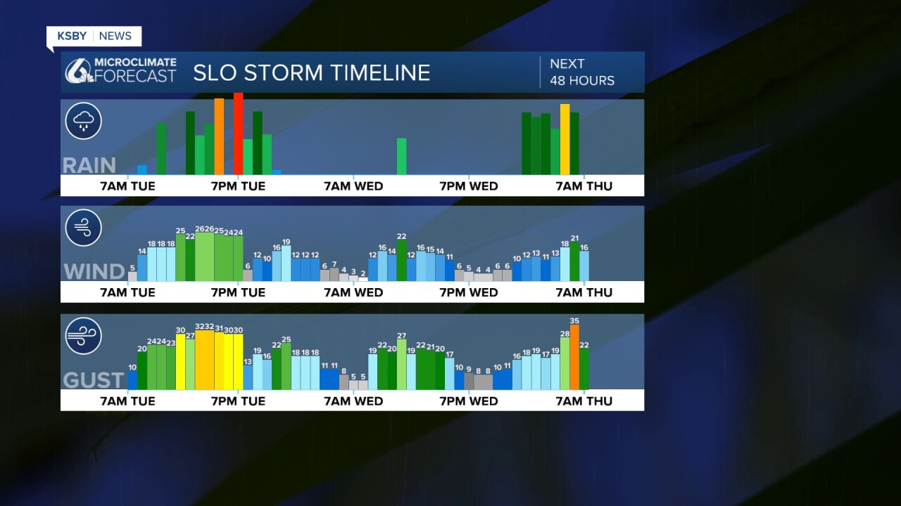
The next band will arrive early Thursday morning, likely making for a soggy commute. Within this band of rain, we can expect some gusty winds once again.

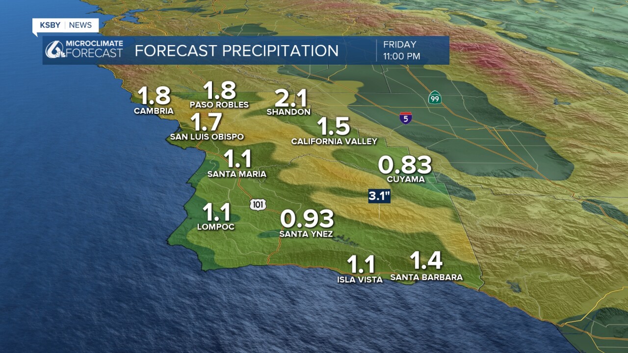
Accumulation wise 0.75" to 1" of rain is expected. Thursday morning another 0.5" of rain is expected. Add that up here are the totals for the region.
There will be some sunshine possible Friday and Saturday, before yet another system that will arrive Sunday into Monday.

Have a wonderful day, Central Coast! Stay weather aware!
-Vivian
