

Good morning, Central Coast!
As we kick off the morning, interior valleys are facing cloud cover and some fog, while most of the region is enjoying sunshine.
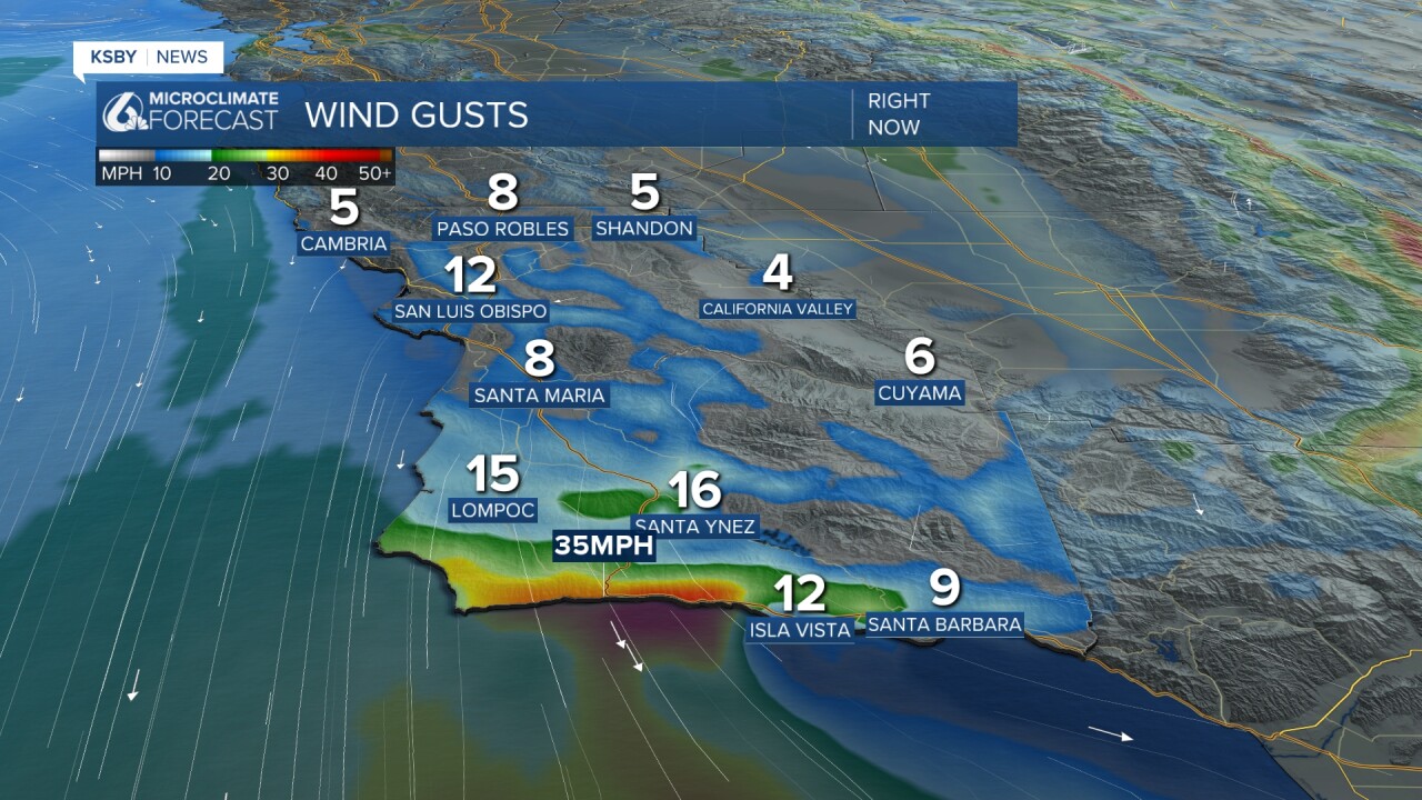
Sundowner winds are lingering along the south coast with gusts up to 45 mph this morning along the Gaviota Coastline. Here is a look at the winds.
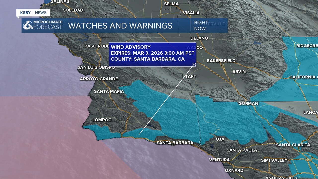
Tonight we can expect similar winds, thanks to that a wind advisory is in place for the southcoast through 3 a.m. Tuesday morning.
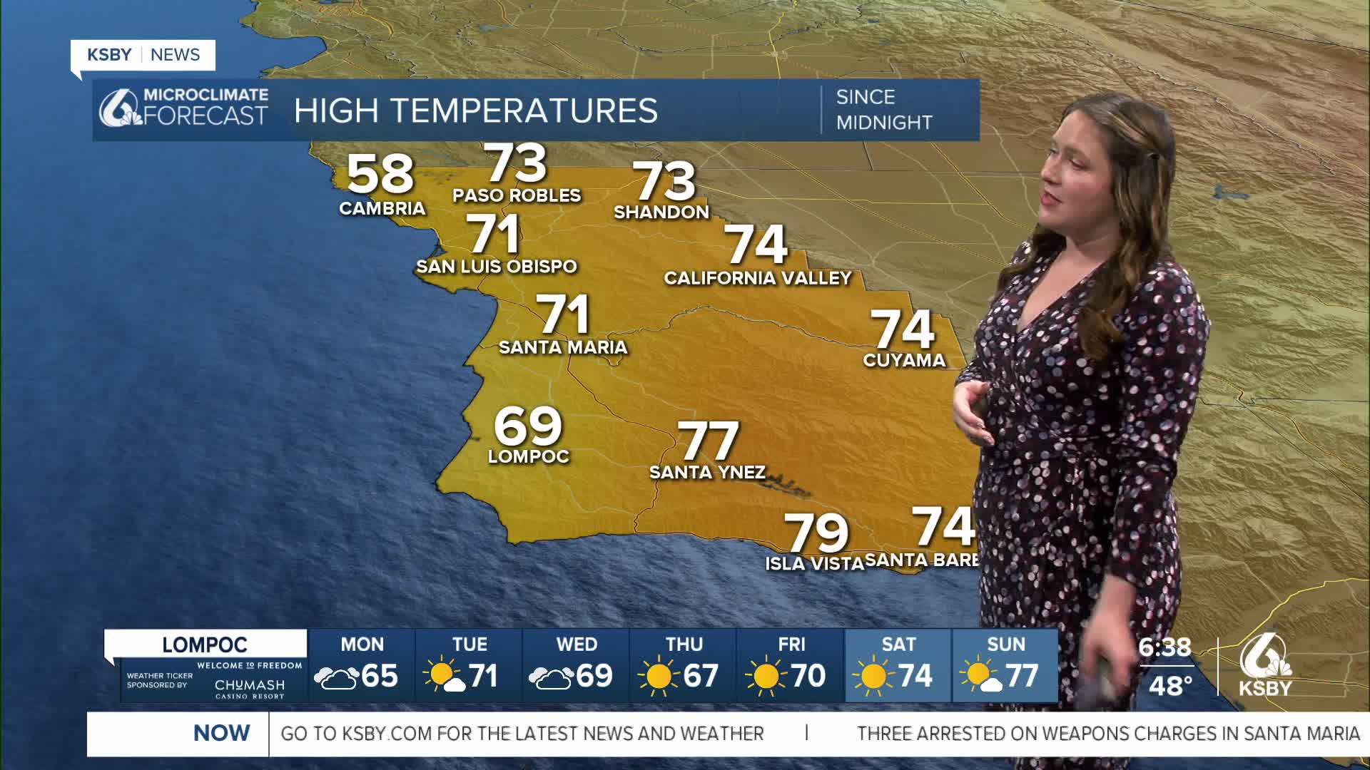
Today temps will fall slightly as compared to the weekend, but they will still be very mild and slightly above normal for this time of the year.

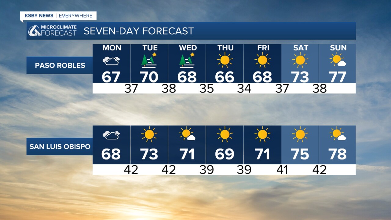
Tuesday and Wednesday will also bring some fog and low clouds to the interior valleys. Temps will be slightly warmer than today, but not too substantially.
Late this week, a high-pressure ridge will build in and raise those temperatures. Next weekend, we will once again see the upper 70s and the potential for some low 80s.
Here is what all of that looks like on your 7-day forecast!

Even into the further extended forecast, we can expect more sunshine and warmer than average temperatures across the region through the first half of March.
Have a wonderful day, and a great week ahead, Central Coast!
-Vivian
