
Good morning, Central Coast!
It is a soggy start to our Wednesday as overnight rain brought significant accumulations. Before I dive into the forecast, here are a few links I like to have on hand on rainy days.
Overnight, heavy rain moved in within the patchy storms that continued into this morning. Most of the rainfall that is left from this first system will be patchy at best but still chances for rain continue through much of the day.

As far as accumulations go, about a tenth of an inch of rain is expected for the showers continuing today. That is on top of the over an inch of rain that fell overnight for many of our communities.
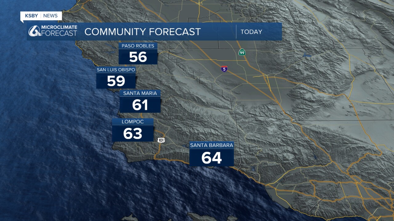
Temperatures are cool as well, with highs in the low 60s and upper 50s across our region.
One additional hazard to keep in mind is for our beaches. There is still a high surf advisory in place through the day. Additionally, it is best to avoid runoff from this storm in the ocean for the next few days. Runoff, especially after the dry month we have seen, may be hazardous.

Into Thursday morning, a few small showers are still possible but clearing skies will be the story. A small warm-up will accompany the clear days.
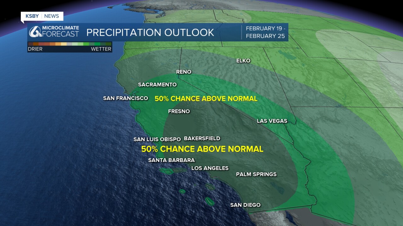
To close out the weekend a large system will reach the region and bring several days of rain. This will be a larger-scale system and likely bring inches of rain to the region.
Here is what all of that looks like on the 7-day forecast.


Even after the late-week storm, we are expecting an active pattern for the latter half of the month with a few more rain chances expected.
Have a wonderful day, Central Coast!
-Vivian
