



Good morning, Central Coast!
As we kick off our Wednesday morning, fog is the story! There is a thick layer of marine fog across most of our western beaches and coastal valleys.
Take it slow on the roads where the visibility is low.
Despite the morning fog, temps are still set to soar across the region as the high pressure sticks around. This means another day of scorching heat!
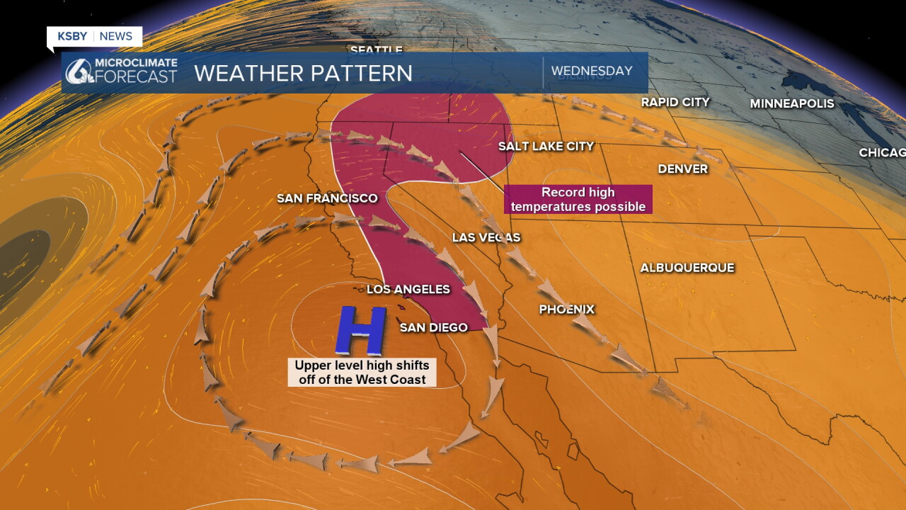
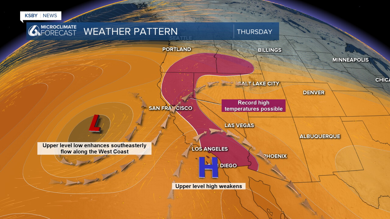
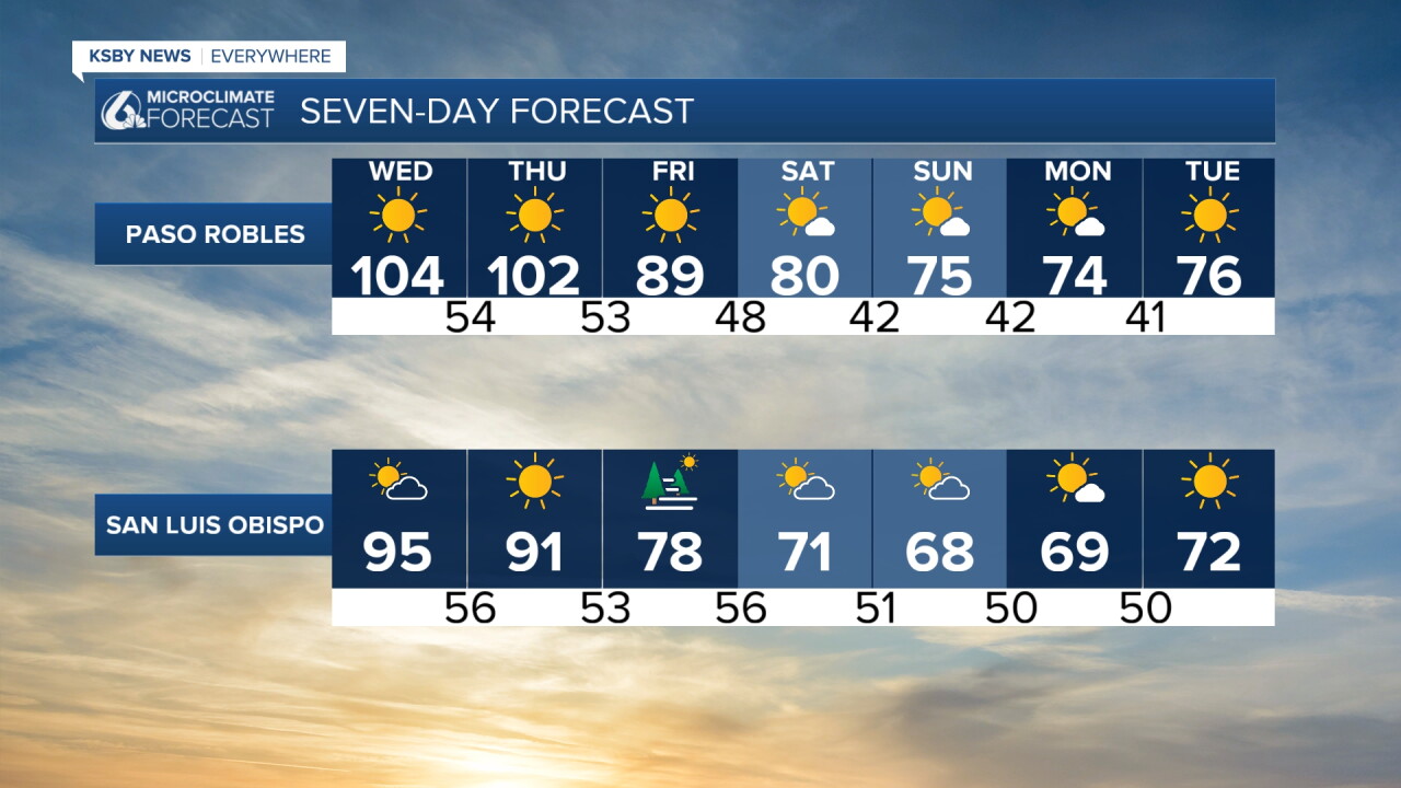
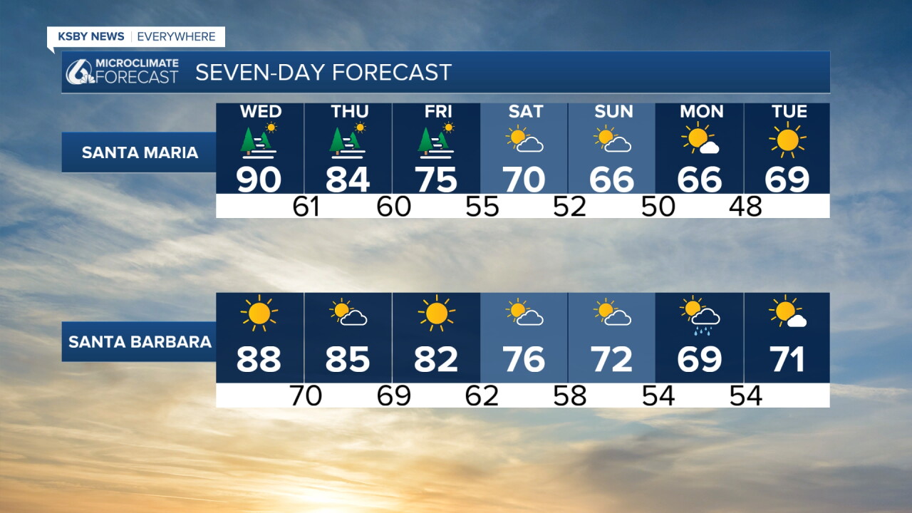
The good news is that we have a low-pressure system on the way that will shift the conditions dramatically. Thursday night, the low will move in and drop temperatures starting Friday, and much more noticeably for the weekend.
Not only will the temps fall, but we can also expect a small chance for rain Sunday and into Monday. These showers will be minimal but are still something to be aware of.
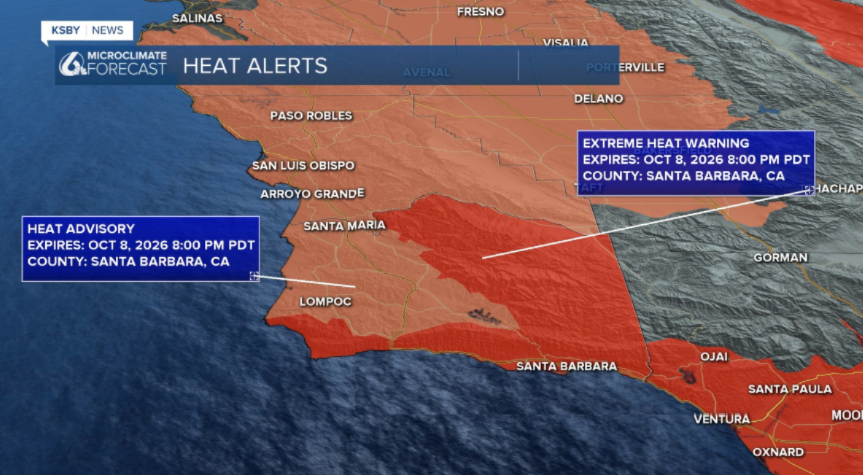
We are still under that heat, though. There is still an Extreme Heat Warning as well as a Heat Advisory in place for the Central Coast. Both of these alerts are set to expire Thursday night.
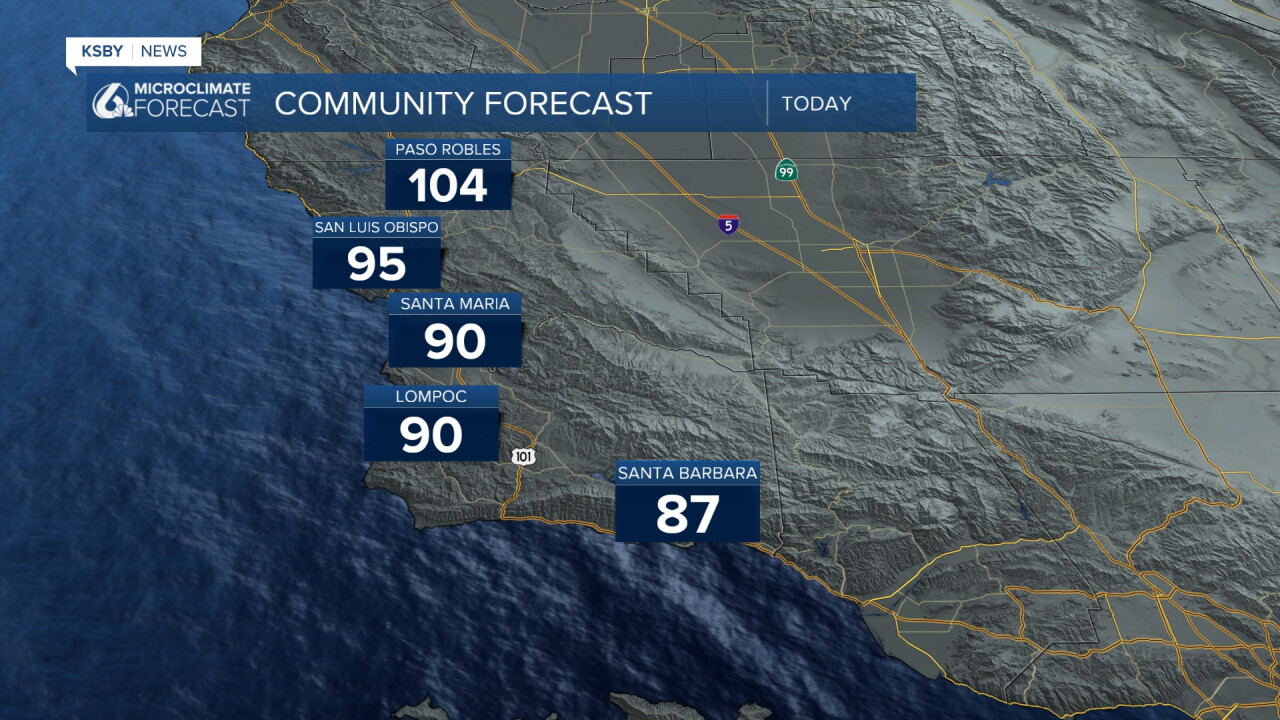
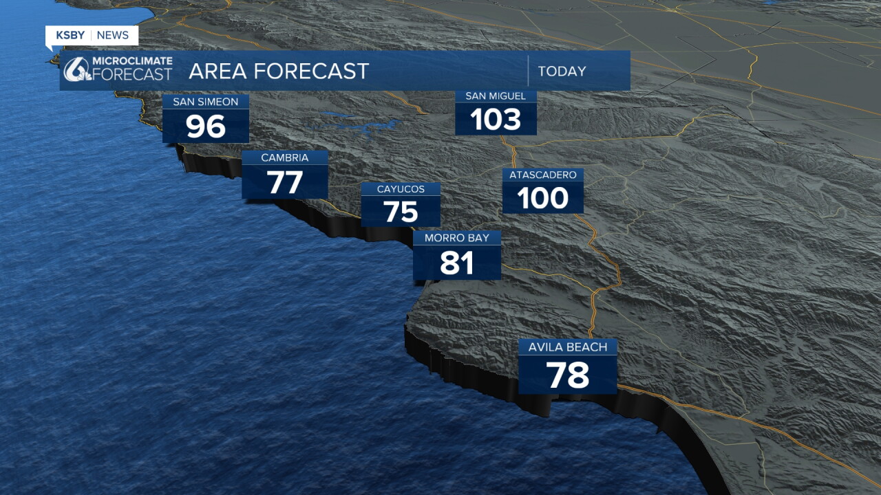
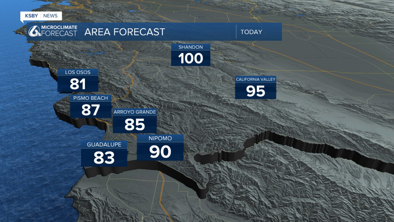
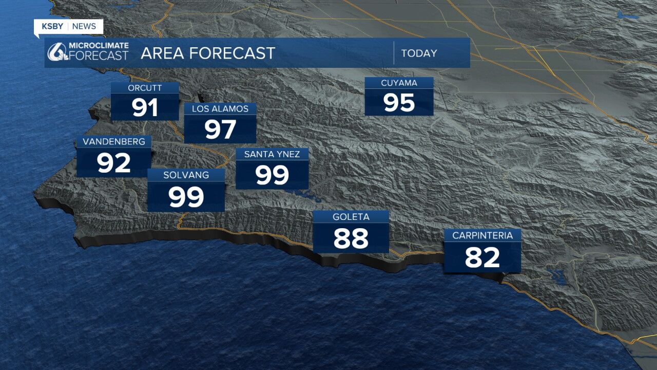
Here is a look at the temperatures we can expect Wednesday throughout the region.
Thankfully, the cooldown is nearly here. This is what we can expect on your 7 day forecast!
7-da
Have a wonderful day, Central Coast!
-Vivian
